My first thru-hike!*

(*not true. I just wanted an attention-grabbing headline.)

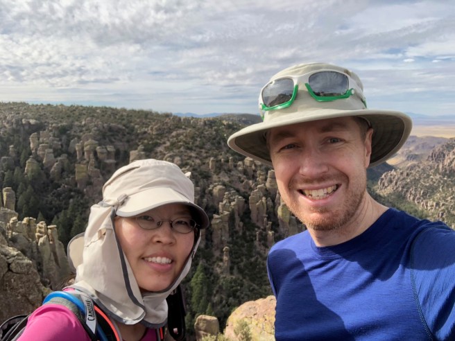
Yesterday, my S(elf)-A(ppointed)T(rainer) and I completed a hike we’ve been wanting to do for a while: South Mountain’s National Trail. Over the past few months, we have been slowly tackling the peaks around the Phoenix valley and have kept the National Trail on our radar for when the weather is cool and when our legs have been trained up a bit more. My SAT asked his work friend, Matt, to join us for this adventure, to which he agreed. (For the record, Matt told my SAT that he wasn’t in great hiking shape. Cool! I thought I’d be able to keep up with him at least, or maybe even make him feel inadequate by hiking faster than him. Well, Matt lied. He’s in plenty good hiking shape. Lying isn’t cool, Matt.)

The National Trail is 13.71 miles long (22 km) and gains 2,611 feet (796 m) in elevation. In an effort to be environmentally-conscious, we hiked to the trailhead from our house, adding 3.25 bonus miles. Yay us! However, since we were only doing the trail end-to-end and did NOT want to do a round-trip hike (that would be about 35 miles of pain), we had to drop off a car at the end….which was not being environmentally-conscious. Boo on us. Anyway, we knew our limitations, so about an hour before Matt was to arrive at our place, my SAT and I drove both our vehicles to the end point, then drove back home together in one vehicle.

The weather was great for a lower elevation hike (trailhead sits at around 1400 feet): it was cool (high of 14C / low 50s F) and partly cloudy with 0% chance of precipitation (true, even though I did feel a few drops at one point).  [Note: a thru-hike is when one hikes a long-distance hike end-to-end within one hiking season. Examples of iconic thru-hikes include the Pacific Crest Trail (PCT), the Continental Divide Trail (CDT), and the Appalachian Trail (AT). Obviously, my use of the term “thru-hike” to describe what my party did today is for humorous purposes only!]

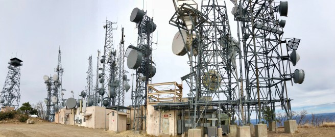
We started our hike on the east end, which is the more popular end. As we hiked west, we saw fewer people and mountain bikers (the National trail is also a popular mountain biking trail). However, we did see a horseback rider and his dog, which was unusual. Another surprising thing we saw was a summit register. Generally, summit registers are on peak summits for hikers to sign. Instead of marking an actual summit, the National Trail summit register marked the highest point on any trail in the park. The last surprising thing we saw as we were firmly on the west side of the park was a cholla cactus forest.


I’m happy with our day today for a number of reasons:

  • we got some more good hiking training in;
  • we got to do a hike “close to home;”
  • we didn’t have a huge drive to the trailhead (other than setting up the car shuttle);
  • we got to see the remote west side of South Mountain;
  • we got to hang out with Matt!; and
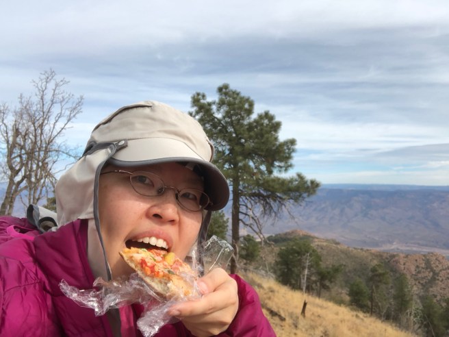
  • we got to eat a lot after the hike! (We went to a local Mexican restaurant to refuel and rehydrate.)

Stay tuned for more hiking adventures!


Read the directions first.

In our quest to hike the biggest peaks in and around the Phoenix valley, we decided to attempt Mazatzal (“Maz”) Peak, the highest point in central Arizona and the Mazatzal Mountain range. Maz measures 7903 ft / 2409m in elevation. My SAT’s (self-appointed trainer) GPS said that we hiked 12.4 miles / 20 km and gained 4185 ft / 1276 m. That GPS did not measure the large number of scratches, bruises, and overall pain we incurred during the hike. Let me explain…

When my SAT chose Maz Peak as our weekend challenge, he neglected to inform me or our friend Ian (our delightfully agreeable hiking buddy) that he did not read any of the multiple hike descriptions he found. Therefore, we all assumed that we would be hiking on a groomed trail and that we should be finished the hike by mid-afternoon. That was mistake #1.

We left Phoenix at 6:45am after picking Ian up and arrived at the trailhead at 8:17am (Maz Peak is near Payson, AZ). After organizing our stuff, we started the hike by 8:30am, choosing the “Y Bar” trail for the ascent portion of the hike. The trail was a bit chunky in sections, but was definitely a clear path. Views were pretty and we noticed A LOT of manzanita bushes along the way (this is foreshadowing…).

Around mile 4, we noticed that the trail just…vanished. My SAT checked his GPS (he downloaded a gpx track recorded by a previous hiker) and said that the route just goes…up. We looked up:

IMG_2170
The GPS said we were supposed to go up the red rock. My stomach just dropped.

At this point, we had a LOT of climbing to do. Most of the climbing was bushwhacking, or forcing one’s way through manzanita bushes and thorn bushes. We also had to climb up little cliffs, like this:

It was very slow going. Because none of us thought to bring an axe, the bushwhacking part was just plain annoying. Good thing we all wore long pants and shirts. After 5 hours, we reached the summit. I think I almost cried, and not because of the views.

Now that we made it to the top, how do we go back down? We all agreed that going down the way we came up was NOT a feasible option. That left us with going down “the other side.” So, we started our way slowly — the word of the day — making our way through the snow and rocks and those dratted bushes. Our goal was to hit the other trail (the Barnhardt) before sunset. We kept moving down the gully over boulders and pine logs, instead of staying on the ridge as the online instructions directed (this was mistake #2). Because we were descending in the gully, we ended up stopping at a couple of points because we were “cliffed out” (i.e. when you want to climb down a mountain, but find yourself on the top of a cliff and have to find another way down). After much tedious work, we finally FINALLY reached the Barnhardt trail after only 3 hours.

Because I did not want to be dramatic or anything, I did not indulge in my first reaction upon hitting the trail (i.e. kissing the ground). Being on a trail again felt amazing. Realizing that we had another 2+ hours to hike back to the car was not as amazing, but hey, we made it to the trail with about an hour of daylight left. This is what we saw in the waning light of day:

We finally made it back to the car at 7:17pm, which meant that we were “out there hiking” for almost 11 hours! (Of course, we weren’t moving the whole time, as we took some breaks to eat, check the GPS, or cry (internally).) We thought about going for a celebration dinner, i.e. “We made it out alive!” dinner, but decided to go for something fast and ended up grabbing some Chipotle when we got back to town.

Final note: during the drive back, I read the hike description that Ian and I thought SAT read. Turns out that after my SAT read the first paragraph, he thought “hey, that doesn’t sound too bad! Since we’ll be on trail the whole time, we’ll just wing it.” THAT WAS A BAD DECISION. The first paragraph of the hike description says this: “This is a loop hike beginning at the Barnhardt Trailhead. It takes the Barnhardt Trail to about the 4 mile point, freestyle your way to the top, then a fairly direct route down to the Y Bar Trail for the return.” If my SAT read the NEXT paragraph, he may not have been so cavalier about the hike, because the writer indicates that 1) the Maz Peak hike is the most difficult he’s done, 2) there is a lot of route finding and bushwhacking, and 3) his accompanying GPS route is “possibly not the best.” And that route was the one we used. Read the full hike description for yourself for more detail on how challenging the route is (we actually ended up doing the reverse of the hike description writer’s route).

Next time my SAT plans a hike, Ian and I are not going to agree to do it so readily.

New Year’s resolution: eat more junk food!

Before any of you comment on how unhealthy my resolution is, let me explain. I consider myself a healthy eater and primarily eat a vegetarian/vegan diet, i.e. no meat. Junk food is not a staple of my diet. However, I do let myself enjoy a treat or two after a big hike or bike ride, like a Coke or fries. Therefore, I figure as long as I engage in physical activity, I can eat junk food! This may be a resolution I can keep….

Today, my SAT (self-appointed trainer) and I hiked Arizona’s Mount Ord, which is the second-highest mountain in the Mazatal Mountain range (7128 ft / 2173 m). Some online accounts record the hiking distance to be 14 or 15 miles round-trip and the elevation gain to be anywhere between 3800–4720 ft (1158–1440 m). Our Garmin recorded the following statistics:

  • round-trip distance: 12.66 miles (20.4 km)
  • elevation gained: 3890 ft (1186 m)

Whatever the “true” statistics are, all I know is that my legs are sore. It’s an easy hike to follow, as you are on a jeep service road the entire time (the road is heavily eroded for the first 5 miles then comes to a junction with a newer, better quality service road for the rest of the way up to the top). However, all of the views along the entire trail/road are beautiful. (This was good, because the higher we hiked, the more we hurt….but the views were a pleasant distraction.) For instance:

At the summit, we saw a cluster of communication towers:

IMG_2110

And more amazing views, this time of the entire Phoenix valley:

We were pretty hungry when we reached the summit. Remember my resolution of eating more junk food? Here’s me eating some leftover pizza on the summit:

IMG_2102

On the way home, we went through a McDonald’s drive-thru so I could get some fries and a Coke. Both were consumed quickly. Overall, it was a successful day and we are excited to “bag” more peaks and eat more junk food!

A (potential) new tradition to ring in the new year

My S(elf)A(ppointed)T(rainer) and I spent the last weekend of 2017 camping and hiking in the beautiful Chiricahua National Monument. (Fun fact: according to a Jesuit priest named Juan Nentvig who lived in the mid 18th century, the name “Chiricahua” is an Opata word meaning wild turkey. Apparently, the Chiricahua mountain range was known for the wild turkeys who could be found there. However, by the mid 1900s, most of the turkeys were gone.) I don’t know why more people don’t know about this amazing place, but was sort of glad more people did not know about it because it was wonderful to have the place almost all to ourselves! The official webpage uses the phrase “a wonderland of rocks” to describe the landscape, and that phrase is very appropriate. We did 2 hikes, the “Natural Bridge” trail and the “Big Loop” trail (which was made up of several smaller loops). The first hike was lovely and features a pine forest and a small water-carved rock bridge at the end of the trail. The “Natural Bridge” trail is the least used trail, according to the official website, but the 4.8 mile/7.8 km hike is definitely worth doing, with its pretty woodland landscapes. However, the “Big Loop” is the hike that passes by all of the amazing rock formations. If you do the whole Big Loop, you will have hiked 9.5 miles/15.4 km and seen otherworldly rock landscapes. My words can’t do the scenery justice, so I’ll leave you with the following pictures:

We stayed in the Bonita campground (the only campground in the park). The campground has running water, flush toilets, and lots of wildlife! There are 4 different ecosystems that pass through Chiricahua National Monument, which means that there are a lot of different animals that call the area home, including deer, mountain lions, bears, skunks (all 4 North American varieties live in the Chiricahua National Monument), and birds. The area is a birdwatcher’s paradise (according to the official website, about 200 different bird species have been documented in the area). We enjoyed the numerous Mexican blue jays that hovered around our campsite, waiting for us to drop crumbs. I actually fed a Mexican jay from my hand!

IMG_4992

We ended our New Year’s weekend by watching the moon set and the sun rise. Happy New Year to all of you and get out and enjoy nature!

IMG_2068

(Me and my SAT say “Go play outside!”)