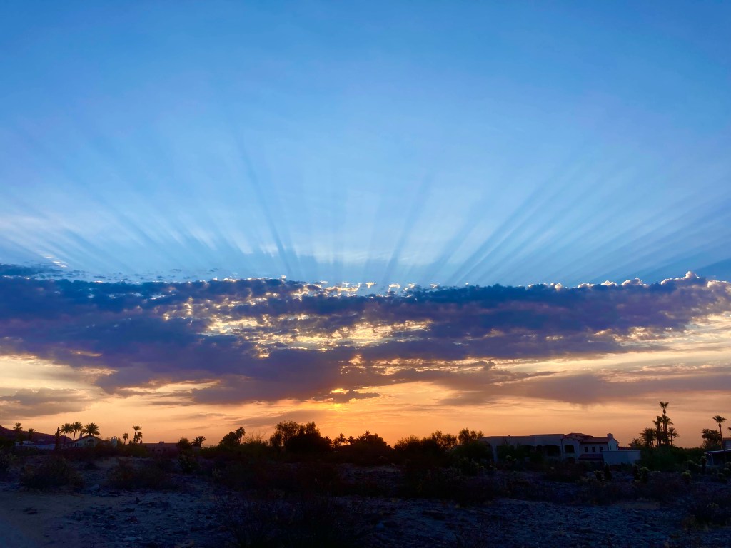
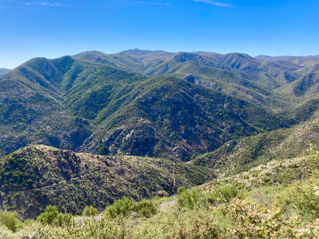
It’s mid-August, which means it’s STILL summer in Phoenix….which means “monsoon season,” which means hot and humid. July and August are the “monsoon” months and the Phoenix area usually gets most of the rain it gets for the year during these two months. I’m good with watering the desert; after all, the desert needs water too! Also, rain helps keep forest fires at bay, which is a very good thing. However, all this watery monsoony goodness means humidity and when you combine humidity with high heat….yuck. I’m still trying to get out and ride most mornings, but I’m not gonna lie….it’s really difficult to get up early and ride, when you know you’re going to be SOAKED at the end of the ride. And not because of rain. Because of sweat.
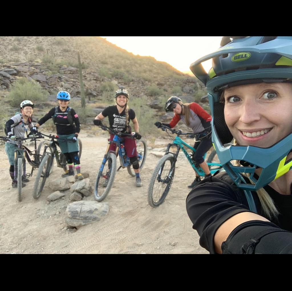
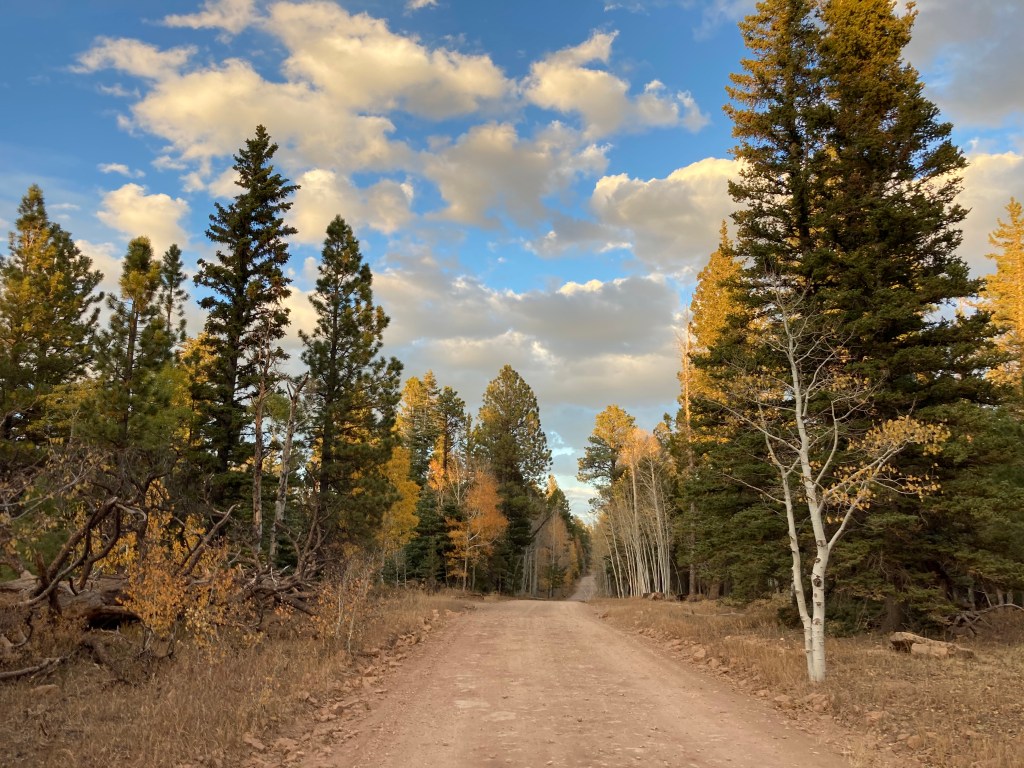
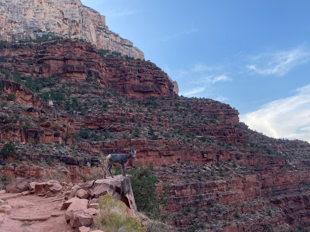
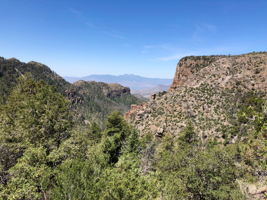
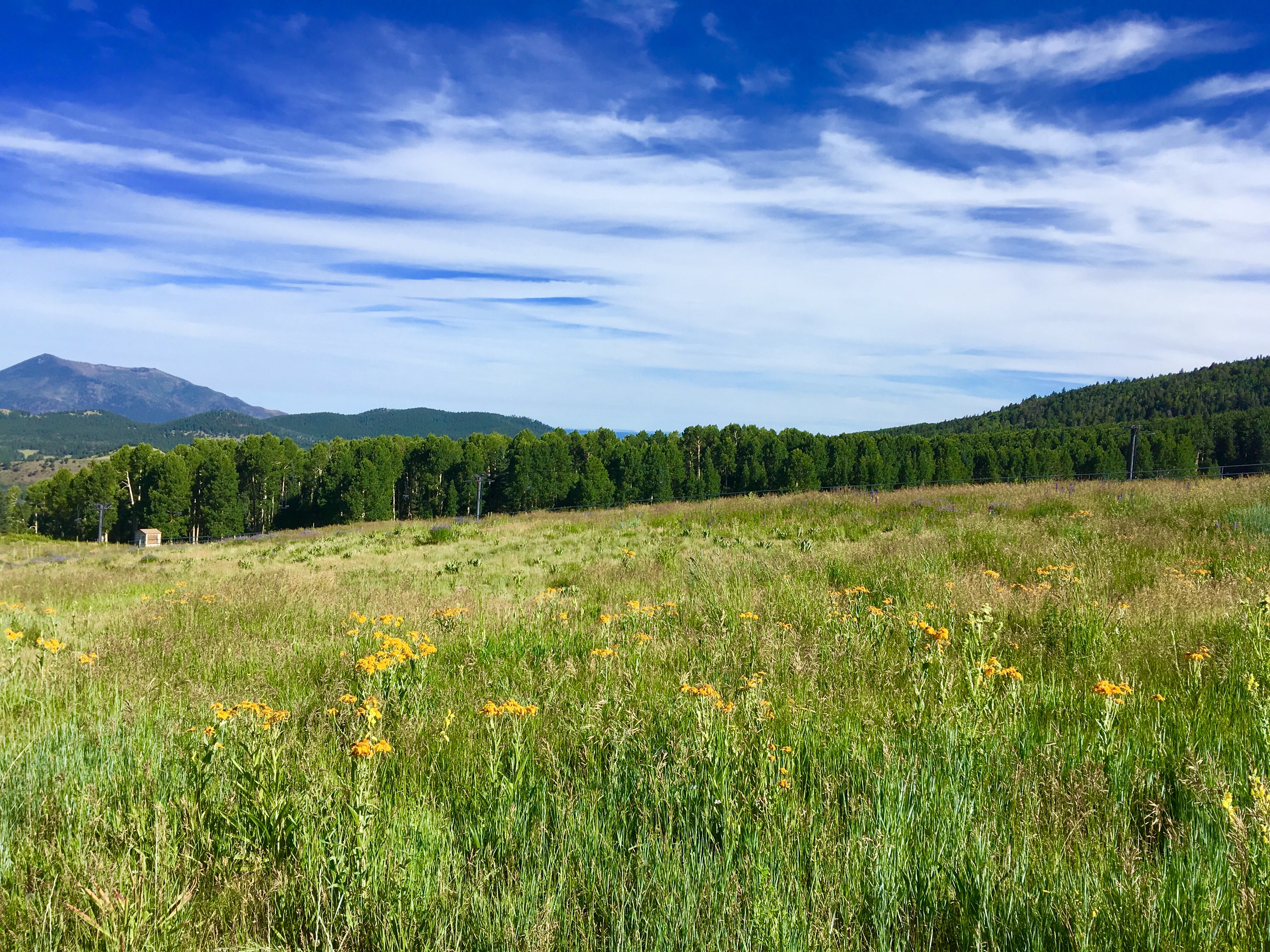
However, a couple of distractions have been helping to keep me on my bike. The first distraction is a little race coming up on August 21 called Bear Jaw Groove. This race is a homegrown event and takes place just outside Flagstaff. This is the 2nd year for the race and it’s fun to support a local event and be part of the event’s formative years. Bear Jaw is a 6 hour event during which solo riders, duos, and teams of four ride as many course laps as possible. The course is an 11 mile loop which starts and ends at the Arizona Nordic Village. One of the cool parts of the course is the “Aspen corridor,” which is a section that winds through an Aspen forest. I’m part of a 4 person ladies’ team and we’re all doing this race for fun and to get out of the Phoenix heat!
The other distraction is a monthly challenge issued by the Hawesaholics Babes Ride On (HBRO) Facebook group. I joined this group at the end of 2020 and have met a ton of ladies who ride. HBRO is a local group, so it’s easy to find someone to ride with. Each month, the HBRO founders post a monthly “clean this challenge,” which is basically a technical obstacle or more difficult trail to work on for that month. Those who take on the challenge are supposed to record a video of their attempts at “cleaning” (i.e., clearing, riding successfully) the challenge and the video with the most Facebook “likes” wins a prize. It’s a fun way to work towards a goal. The “clean this challenge” for August is not bike related; instead, it’s a fun little obstacle course at a local park (think of a very watered down American Ninja Warrior type of course with things like monkey bars and a “Spiderman” style net ladder). Participants are supposed to record and time their best attempt and the video with the most “likes” will win the prize (this month’s prize is an insulated mug).
As soon as I saw the August challenge, I thought it would be funny to put a spin on it. What if I got a few other ladies to do the challenge with me….but instead of attempting the obstacle course “normally,” we pretend it’s an obstacle course for a bike? I suggested the idea to a few friends and things took off from there. The result of all that brainstorming and video shooting is right here in this YouTube link: click me for a laugh.
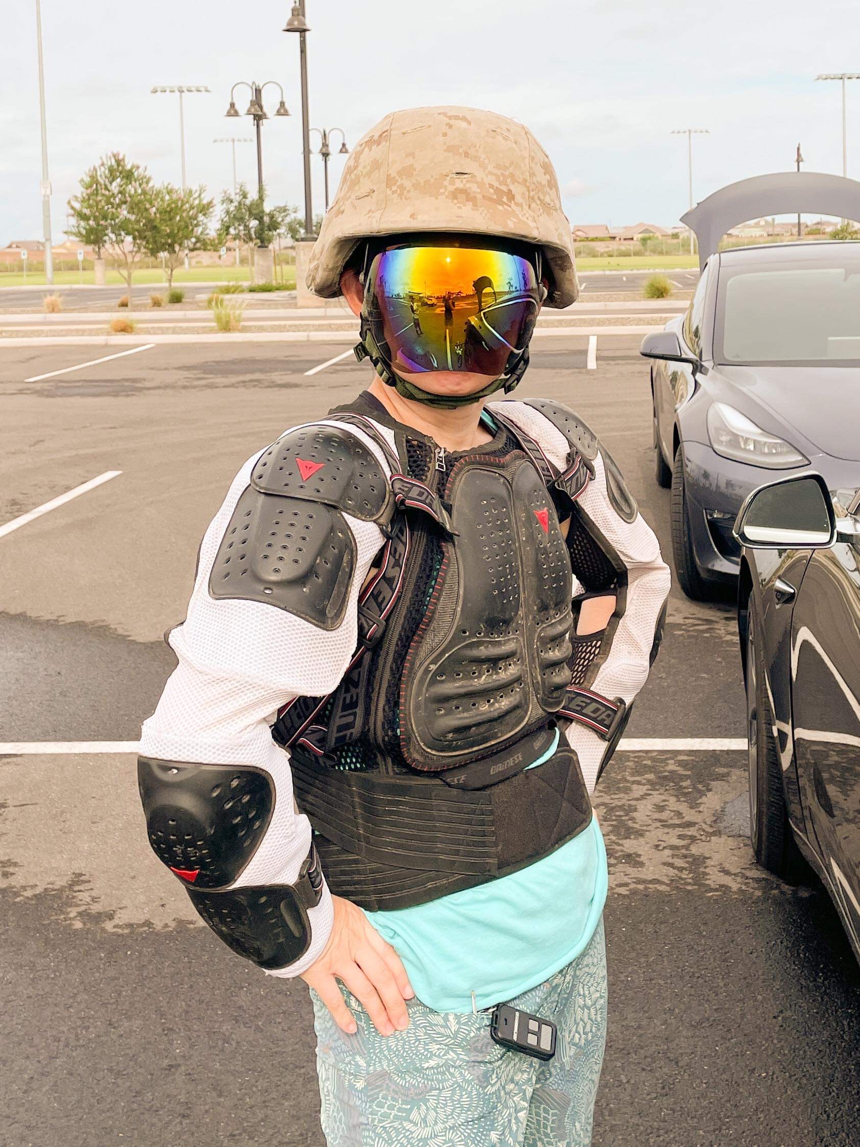
To give you an idea of the sheer ridiculousness of the video, here’s a picture of me in my protective gear (yes, it is a bit much for a playground obstacle course, but it served its purpose)! Let me know what you think!
(Ready to roll! I am wearing a Kevlar helmet, “facegoggles,” and downhill body armour. The helmet is bullet-resistant and weighs about 10 pounds. I was SO GLAD I didn’t have to wear that thing for very long. The “facegoggles” are more like a face shield and quite effective at keeping people at a distance. They’re not as breathable as regular face masks, though. Both the helmet and facegoggles were borrowed. The body armour is my SAT’s from his downhill mountain biking days. I think I look like a cross between GI Joe and a stormtrooper.)
This blog is way overdue for an update! Why haven’t I updated lately? Because I’ve been consistently riding my mountain bike. This is not a joke. Although I’ve had my mountain bike for 5 years, I barely rode it. I was seriously considering selling my bike in October 2020 because it was a waste to have a great bike and not ride it. (Also, due to the pandemic, it seemed like EVERYONE was spending time outside on bikes, which meant that bikes were in great demand. I figured that I could tap into that demand and get a pretty great price for my bike.) However, my SAT (self-appointed trainer, a.k.a., my husband) persuaded me to give mountain biking one more go and I agreed. I even signed up for a clinic….and that was the clincher. Not only did I learn some fundamental skills, I met some great women riders, who introduced me to a lot more women riders. Now, I have a community of women riders!
I wanted to blog about each of my mountain bike rides and trips that I’ve done this year, but because there are way too many rides and trips to document, I’m just going to bullet out the highlights of my mountain biking year thus far:
Set a mileage goal for 2021: 30 miles / week (i.e., 1,520 this year). As of June 26, 2021, I’ve ridden 927 miles (1,492 km)!
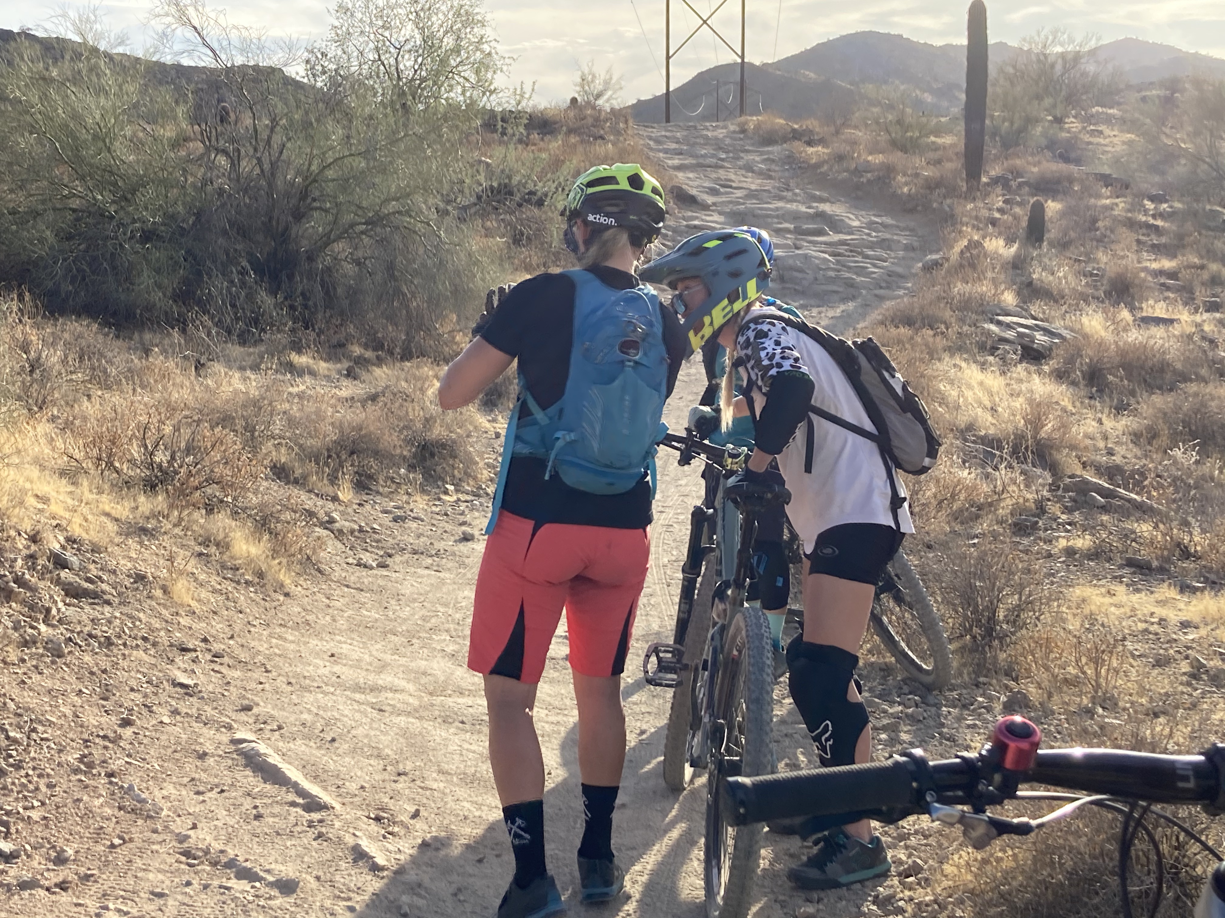
Gone on lots of group rides, both self-organized and via a few groups I’ve joined.
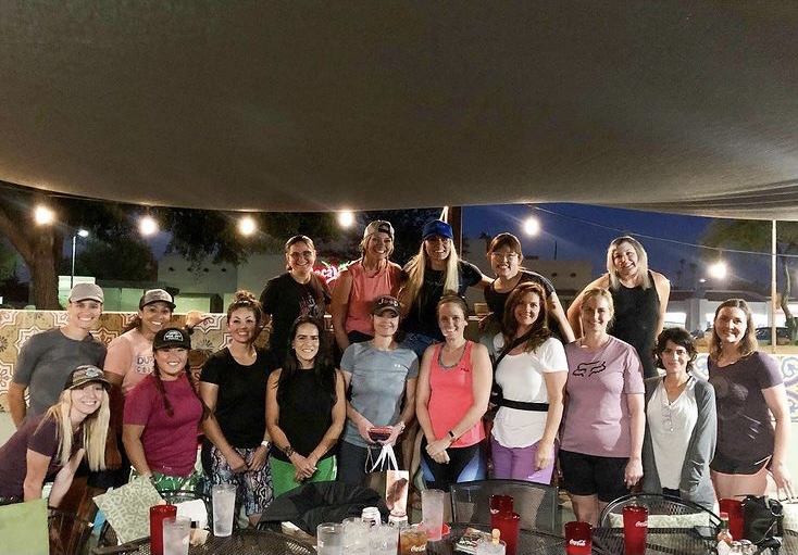
Met lots of lady shredders!
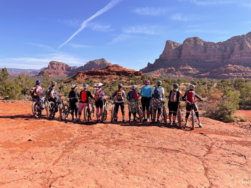
Trips taken include 3 Sedona trips, 2 Flagstaff trips, and numerous valley/local rides.
Successfully completed the Slaydies 30 day skills challenge, which means that I intentionally practiced mountain bike skills for at least 20 minutes a day for 30 consecutive days. Over the 30 days, I spent 28 hours and 27 minutes on my bike and rode 184.1 miles. That’s a lot of practice!
Took 2 bike skills clinics (cornering and downhill with PedalTherapy).
Accomplishments: I can actually lift my front wheel! I can also do baby level lifts and something resembling a back wheel lift. Additionally, I can now ride ALL of the Beverly Canyon downhill sections, the Javelina downhill, most of East Loop in both directions, and much of the Hawes trail system. I also rode a couple sections of the Black Canyon Trail for the first time in May and that was really fun.
Residual benefit: lost a few pounds. 😉
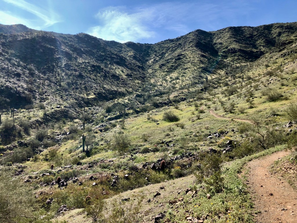
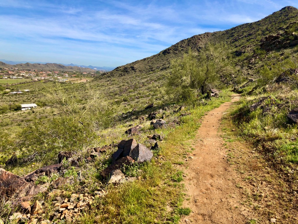
Goals for the rest of this year include exceeding my mileage goal and focusing on new trails at South Mountain to learn, such as Mormon and National (yikes). Right now, getting out to ride is a bit more challenging due to the heat here in Phoenix, but I’m managing to continue riding by getting up at 4:30am (this is not a joke). I cannot wait for fall.
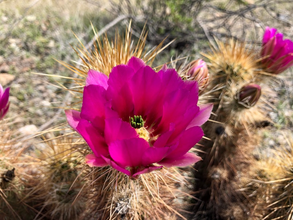
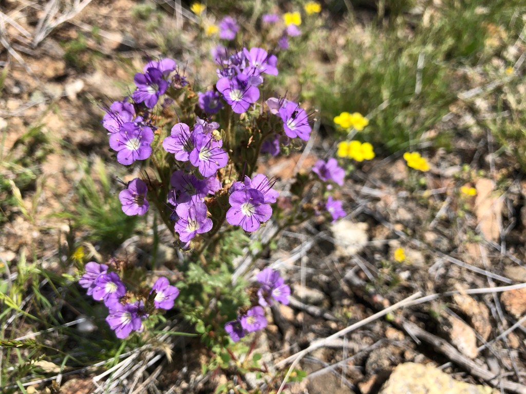
I’ll end this blog post with lots of pictures from all the riding I’ve done this year!
On top of the “Helipad” at South Mountain with Jodey and Jess.
Lovely view of the Sedona red rock on Valentine’s Day.
Rode with Lifan and Carl on Valentine’s Day in Sedona.
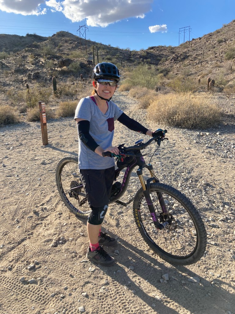
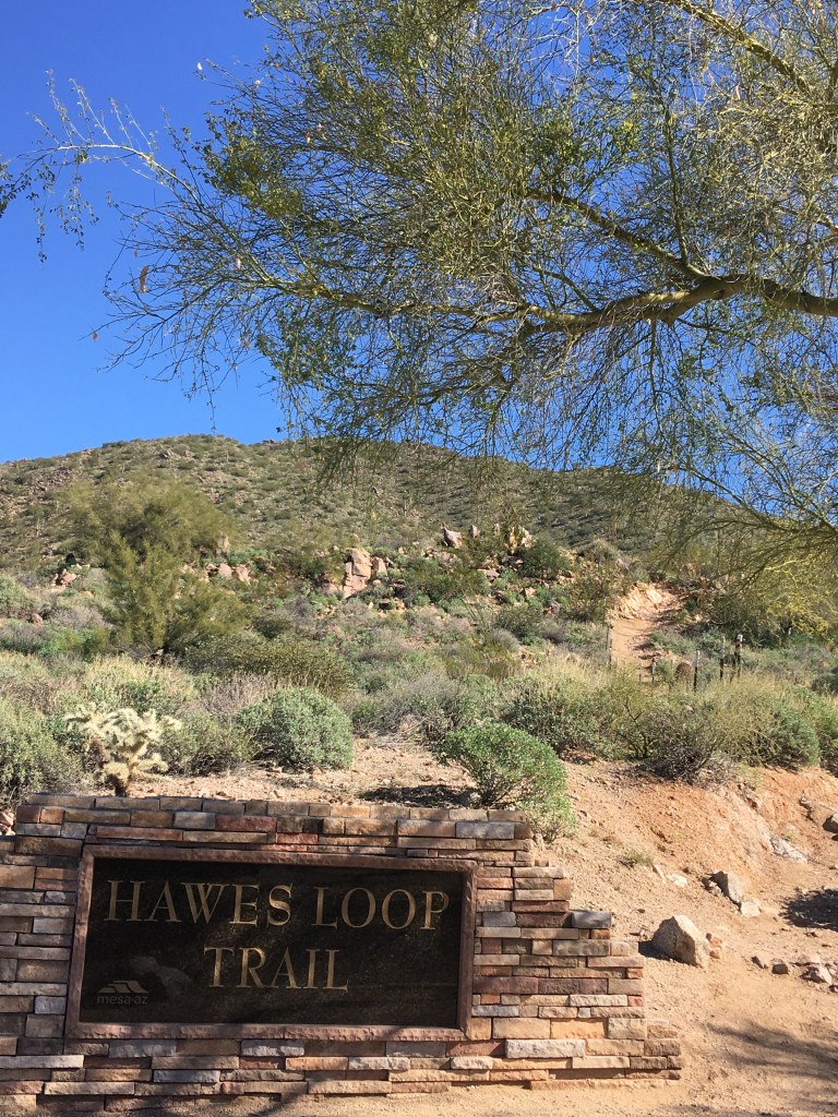
Riding some trails at Hawes in east Mesa on my birthday.
Another Sedona ride in mid-March.
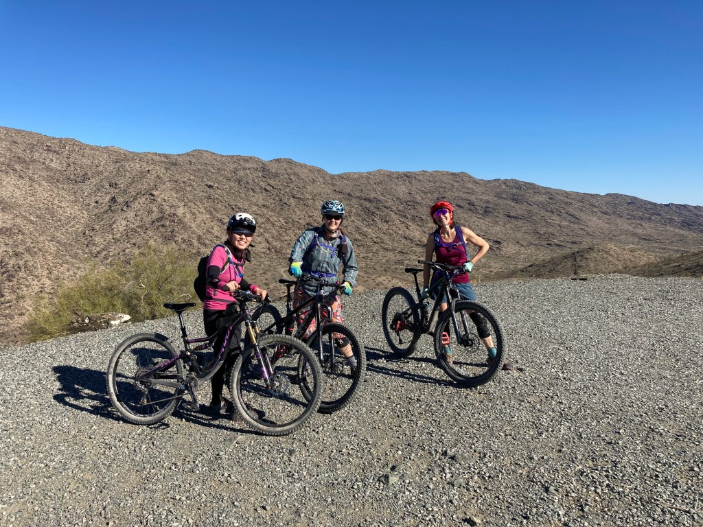
Sedona girls’ ride with Jodey, Vanessa, and Kara.
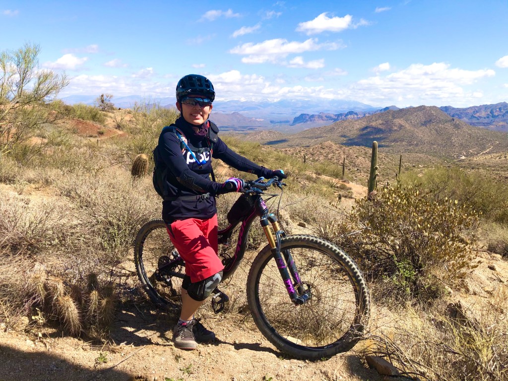
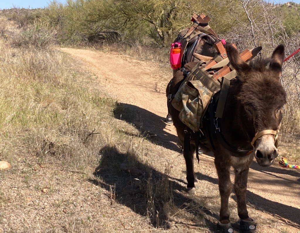
Saw burros on the trail at Browns Ranch!
Just after “cleaning,” i.e., successfully riding, the south side Beverly Canyon downhill. I focused on downhill skills for a week leading up to the PedalTherapy downhill skills bike clinic I took in April.
Getting the hang of what the proper downhill body position should feel like during the PedalTherapy downhill skills clinic in April.
Riding a portion of the Black Canyon Trail in May.
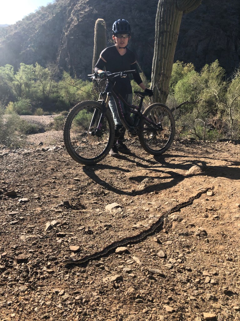
Barely saw this critter on the Black Canyon Trail!
All the ladies who completed the Slaydies 30 day challenge.
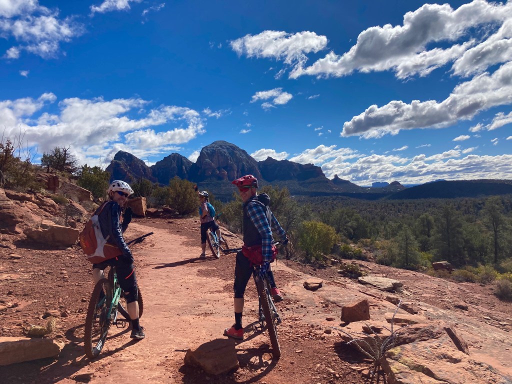
Girls’ ride in…Sedona! (It’s a great place to ride.)
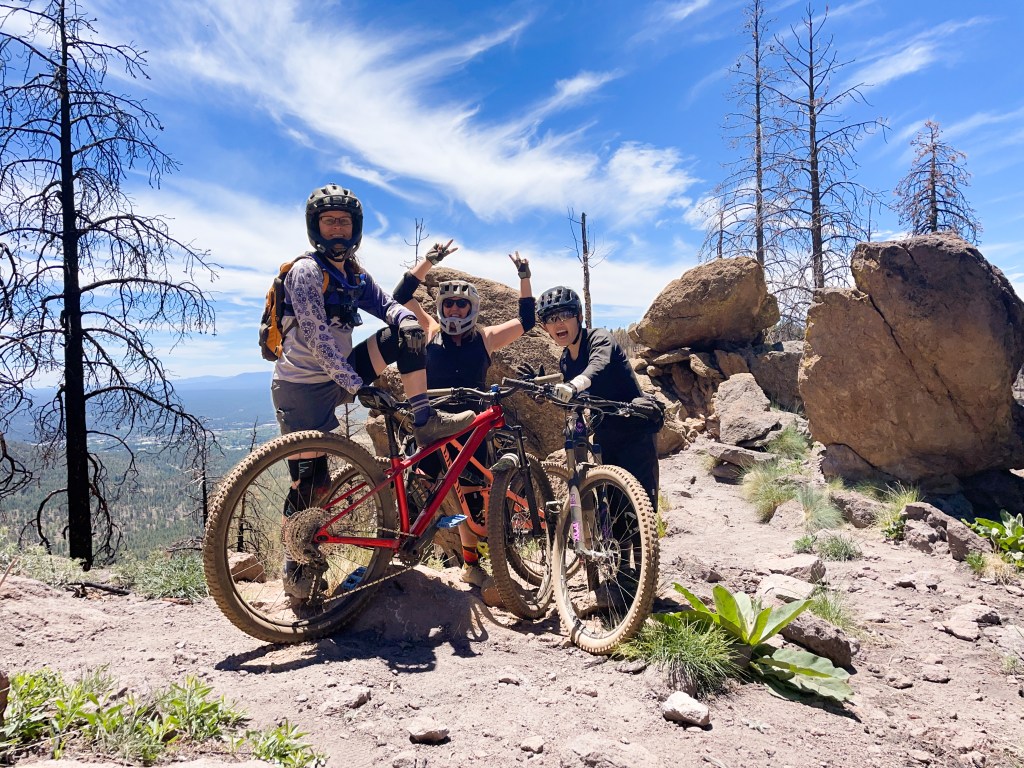
Played hooky for a day and rode in Flagstaff with Sara and Tori to escape the Phoenix heat in June.
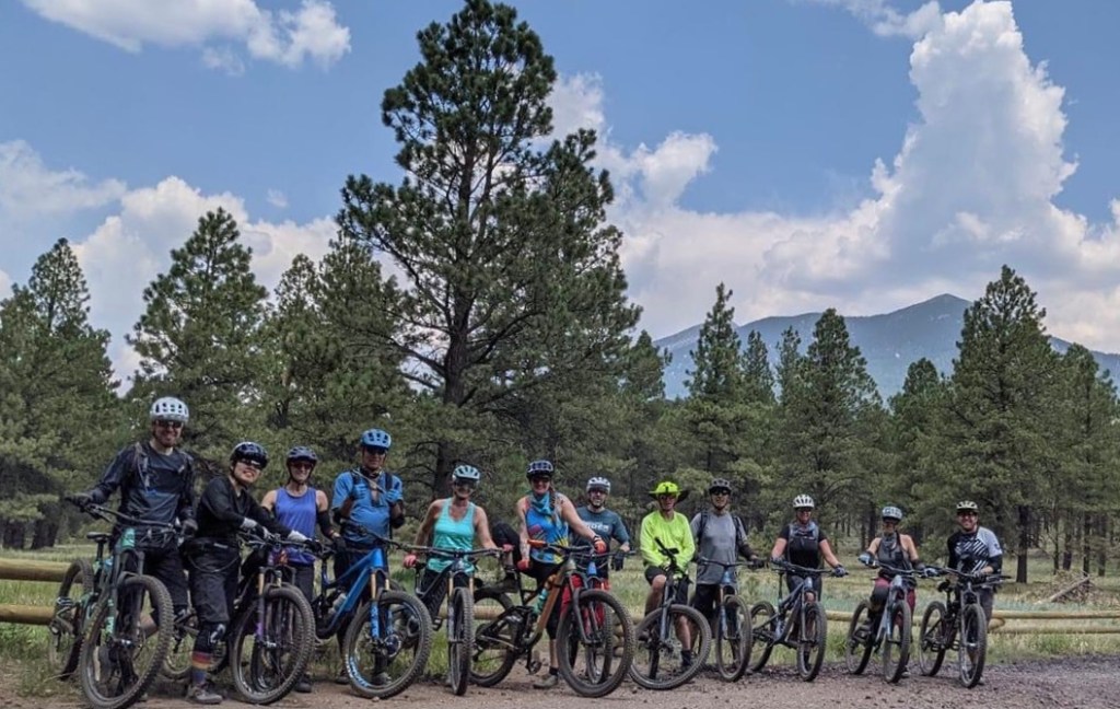
Another ride in Flagstaff, but this time, with a different group.
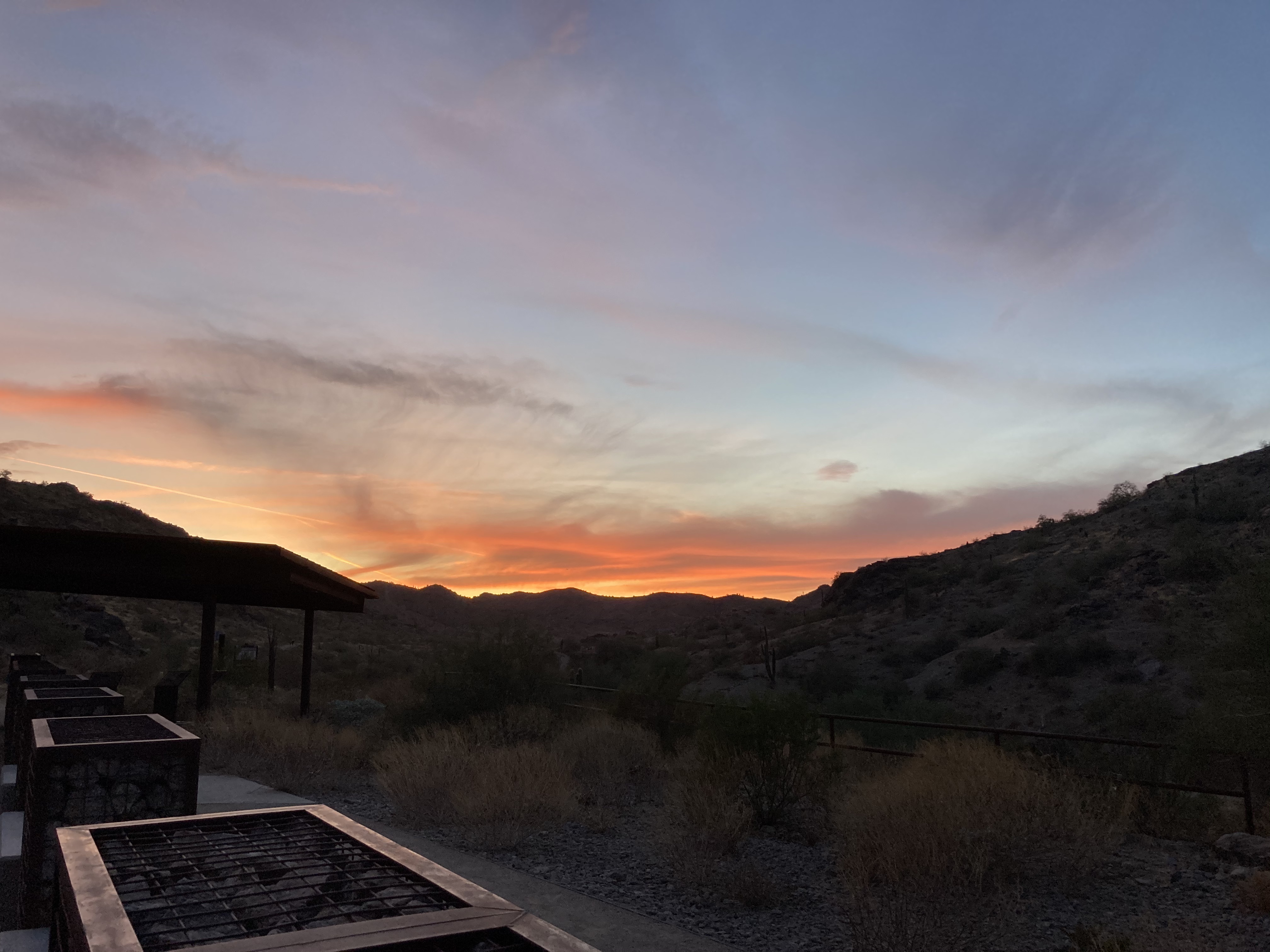
I’m getting up at 4:30am to ride to beat the heat. One benefit: glorious AZ sunrises.
Happy New Year, lovely readers! I hope that you all had a lovely holiday despite COVID’s unwanted presence. Here in Phoenix, “winter weather” means “awesome,” so I currently have the privilege of enjoying beautiful weather whenever I want. As I mentioned in my last post, I really enjoyed the mountain bike clinic I took in November and since then, have been inspired to ride my bike a lot (for me, which is 3-4 times a week). As a result, I am riding trails and “cleaning” (i.e. successfully riding/completing) obstacles and sections of trails that I was way too scared to consider before the clinic. For example, recent successes on my bike at South Mountain include:
just trying things out and “sessioning,” or practicing things, like the Javelina, Mormon, and National trails!
riding the first 2 (of 3) “challenges” along the Desert Classic trail [Note: there is a more inappropriate name for the 3 challenges…if you really want to know what that name is, leave me a comment!]
cleaning the Lower Corona trail up and down
cleaning the north side descent of the “old” Beverly Canyon trail.
I’m also meeting a lot of ladies who ride, which is something I’ve been lacking. It’s way easier to get outside and ride my bike when I have people to do that with me! I’ve even set a riding goal: 30 miles per week. That doesn’t sound like much, but for me, as long as I pursue this goal, I’ll be riding way more than I have in the past 5 years combined. [Note: 30 miles per week x 52 weeks = 1,560 miles this year. Not bad!] And, last but probably not least, my SAT (self-appointed trainer) is thrilled that I’m riding more. I’ve also noticed he’s giving me more “riding tips” (usually unsolicited). Sigh. Some things never change.
What? I’m SMILING while riding my bike?
*”Shredding” refers toriding a trail at a skillful level, riding a trail really fast, and/or just plain having fun while riding.
Now that I’ve had a few days to mull over all the information I received, if not learned, from the Slaydies bike clinic I just completed, I want to jot some thoughts down for posterity (and my unreliable memory). 😉
My overall conclusion is this: taking a bike clinic is a great thing to do, if you’re looking to improve your skills in a safe environment!
The clinic was spread out over 4 weeks (we met each Tuesday afternoon for about 2 hours), so there was time in between classes to practice what we learned. Each class was focused on a few specific fundamental skills. For example, the first class was devoted to the proper position when descending technical trails and braking (very important skill!!). We spent most of the second class on cornering. During the third class, we worked on our front wheel lift, which is crucial to technical climbing, i.e. getting over bigger rocks/obstacles when going uphill. For the last class, we broke down a specific “challenging” trail into sections and “sessioned” those sections, which just means that we worked on specific sections multiple times….i.e., practicing!
After each class, Stef, our coach, emailed us personalized feedback and “homework.” For instance, after the second class, Stef advised me to work on thinking where my body weight is when cornering and where I’m looking as I’m entering and exiting a corner. She even sent me “before and after” pictures of me cornering:
(Left: trying too hard to show that I’m cornering. My right leg should be extended. Right: better cornering position.)
Although I can ride a bike, I’ve never intentionally practiced anything, so my technical ability is pretty much zero. I found it a little overwhelming to think about all the stuff I had to do to corner, descend, climb, etc., which was to be expected. No one was going to magically master all the skills in one day! However, I learned a lot over the past 4 weeks and am inspired to apply my head knowledge to actual riding. In fact, during my last two rides, I tried riding a couple of trails that I still consider “challenging” and successfully rode most of them. So, that’s improvement.
Apart from all the skills I need to work on, I think my biggest challenge will be to curtail my SAT’s (self-appointed trainer, i.e. my husband) expectations and enthusiasm for my “renewed interest in biking” (his words). Based on my previous experience (for example, this ride or this ride or that ride), my SAT has a talent for pushing people to do things they may not want to do. Dear readers, any tips on how to lovingly ignore my SAT? 😉
Left: me with Stef, our clinic coach. Right: taking a photo break during the last class.
I’m doing a new thing! I’m shifting my focus to mountain biking, now that my “rim to rim” hike is done and to that end, I registered for a mountain bike clinic! I’ve never taken a mountain bike clinic before and it seemed like a good time to do one, given what little there is to do this past year (thanks for nothing, global pandemic).
The clinic I’m taking is part of the “Slaydies” series through Adrenaline Coaching. Each series includes 4 classes; my series is the November one and meets each Tuesday afternoon for 2 hours at South Mountain. Class sizes are limited to 5 ladies. The first session was on Election Day and I was very glad to have the distraction! We focused on the correct position for descending (i.e. “active stance,” or “get as low as you can on the bike”) as well as braking on descents.
One of the best things about taking a clinic is getting feedback from a totally objective third-party, i.e. someone other than my SAT (self-appointed trainer/husband). For whatever reason, hearing my SAT tell me to “get lower” when I go down descents doesn’t seem to resonate as much with me compared to when Stefanie (clinic coach) tells me the same thing (maybe because Stefanie doesn’t live with me?).
In addition to verbal feedback, Stefanie assigned us “homework” based on her observations of our current skill level. My takeaways from week 1 are to practice getting as low as I can on the bike while going downhill. Here’s a picture showing what my body position looked like during my first attempt going down a chunky descent vs. the last attempt (we had 4-5 attempts):
(My goal is to match the red line on the right as much as possible when descending.)
I have a ways to go before I would consider my active stance “low enough.” 😉
(Stefanie showing Lauren the video of her descent.)
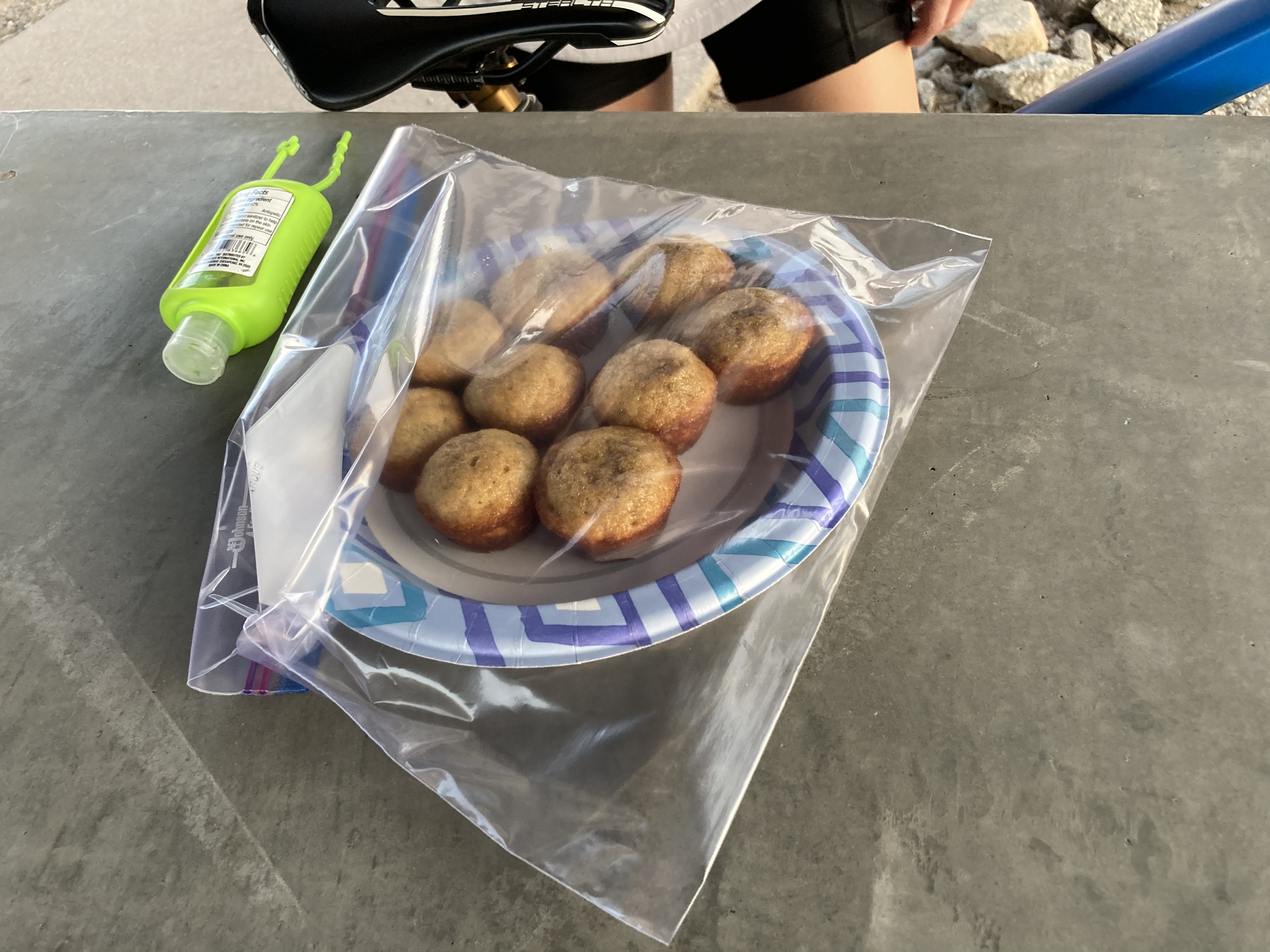
At the end of the class, we had a quick debriefing session over sparkling water (thanks, Stefanie!) and mini banana muffins (thanks, Lauren!) during which we all shared what we learned.
Before writing this blog post, I went for a ride to practice my active descending stance. I can tell that I was much more aware of my body position and could tell when I wasn’t as low in my stance vs. when I was low (or, what I consider “low” for now because I’m still trying to make the low stance second nature). Hooray for getting out of my comfort zone and trying new things!
In my last post, I shared that I was training for my first “Rim to Rim” (R2R) hike. I gave myself 5 weeks to train and after many miles and logistical planning, I’m happy to report that the R2R hike was a success! Bear with me: this post is a long one because it includes all sorts of information pertaining to the training I did, the gear I took, and the hike itself. I wanted to document all that information for future reference, in case I ever wanted to do this again…
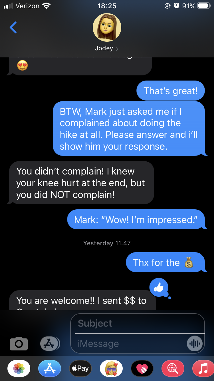
The original idea for doing the R2R came up during a conversation earlier this summer with my friend Jodey. We both had the R2R on our radar, but for various reasons, hadn’t done it yet. When I hiked Humphrey’s Peak with another friend, Crystal, in July, I mentioned that it would be cool to attempt R2R, but I’d need a shuttle driver. Crystal immediately volunteered to be that shuttle driver, and at that moment, R2R became a reality. Jodey, Crystal, and I scheduled our R2R attempt for the October long weekend and I mapped out a hiking training plan.
Training:
I gave myself 5 weeks to focus on hiking and started my training on August 31st. I didn’t want to start my training sooner than that because it was still hot in Phoenix (i.e. temperatures were still hovering around 90F/30C at the coolest part of the day. Yeah. Gross.). My training plan was basically to hike each morning with a rest day once a week. I’d increase my mileage each week and do a big hike on the weekends. This plan went well until my last 2 big training hikes. Jodey, my SAT (self-appointed trainer, i.e. my husband), and I planned a 16 mile loop in South Mountain with just under 4,000 ft of gain. We wanted to use this hike as a “qualifying” hike to see where we were in our training. We started hiking at 4:30am to try and beat the heat, but we were still hiking at 11am, when temperatures hit 100F/38C and my body started shutting down. I was in heat distress and was breathing heavily (while walking on flat trail at that point), walking really slowly, dizzy, and experiencing tunnel vision. We decided that Jodey and I would sit under a tree and wait for my SAT to get the vehicle and pick us up. That experience was a sober reminder that hiking in the Grand Canyon is not a joke. I decided to take the next week to train some more and think about whether I really wanted to do the R2R and if I REALLY felt physically and mentally prepared to commit to the hike. The good thing about this hike is that I didn’t get any leg cramps, which I tend to do on long, difficult hikes. I was trying out some Endurolytes (i.e. electrolyte pills) and they seemed to work.
The next weekend, my SAT and I did another big hike. We planned on doing a 10 mile hike and started hiking at 6:30am. Unfortunately, the hike ended up being 14 miles and we got caught in the heat again. However, I fared a bit better and was able to complete the hike, probably due to my experience the previous weekend. Similar to last week, I didn’t get any leg cramps. Thank you, Endurolytes!
I decided to commit to the R2R and concluded that my goals for the hike were: 1) not to get leg cramps, 2) deal with the heat factor by starting the hike as early as necessary, and 3) not complain. Yes, that last goal was a legitimate goal! (I’m again happy to report that I successfully achieved that goal. Funny story: during the hike, I said to Jodey that my loving SAT would ask if I complained during the hike. Shortly after I got home, he did indeed ask me.
Proof that I was a very good girl during the hike.
The weekend:
Friday October 9
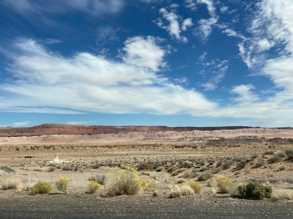
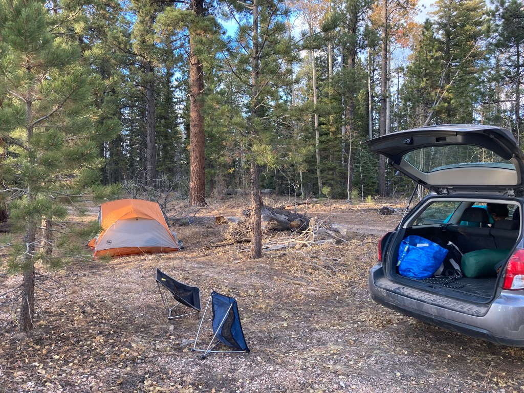
This day was mainly spent driving. Jodey and I left Phoenix at 6:30am and drove to Prescott to meet up with Crystal (and her adorable dog, Bagheera). We then drove to Flagstaff, stopped at Whole Foods to pick up some food for lunch and dinner, then drove to the North Kaibab trailhead to see where we’d be starting our hike the next morning. We then drove to our campsite (we planned on snagging a dispersed campsite), set up camp, then enjoyed the sunset at the East Rim Viewpoint trailhead. Lights were out by 7:30pm and my alarm was set for 4am. It was really happening!
A few pictures of the drive north.
Jacob Lake cookies!
Our dispersed campsite.
Crystal and Bagheera.
Some Ensure to ensure our R2R success! Jodey and I had these for breakfast.
Beautiful golden light.
Our campsite was very close to the Arizona Trail.
Enjoying the sunset.
Sunset at the East Rim Viewpoint.
Saturday October 10
My alarm went off at 4am and we broke camp, repacked the car, and drove to the North Kaibab trailhead, arriving there just after 5am. Our plan was to start hiking at 5am, but nature called REALLY LOUDLY. Fortunately, there was a restroom at the trailhead. Unfortunately, there was a bit of a queue for the restroom. In any case, we started hiking at 5:26am. It was still pitch black and the temperature was probably just above freezing.
When Jodey and I discussed how to approach R2R mentally, we decided to think of it as doing 2 “shorter” hikes instead of one really long one. So, that’s how I’ll describe our R2R experience!
Hike 1: North Kaibab Trail to Phantom Ranch
Starting elevation: 8,241 feet / 2,512 m
Ending elevation: 2,480 feet / 756 m
Elevation loss: 5,761 feet / 1,756 m
Distance: 14 miles / 22.5 km
Length of time: 6.5 hours. We started just before 5:30am and arrived at Phantom Ranch just after 12 noon.
It felt like it was around 40F / 4C when we started the hike. I wore my puffy down jacket, a long sleeve Smartwool shirt, long pants, socks, and hiking shoes. I had to use a headlamp because it was still pitch black. I think the hardest thing about “hike 1” is that it’s mostly downhill. That sounds strange to most people because downhill is considered easier than uphill, which it normally is! But, miles and miles of downhill can wreak havoc on knees, which I will talk about later in this post….
Sunrise occurred about an hour into the hike and wow, the early morning light revealed such pretty scenery!
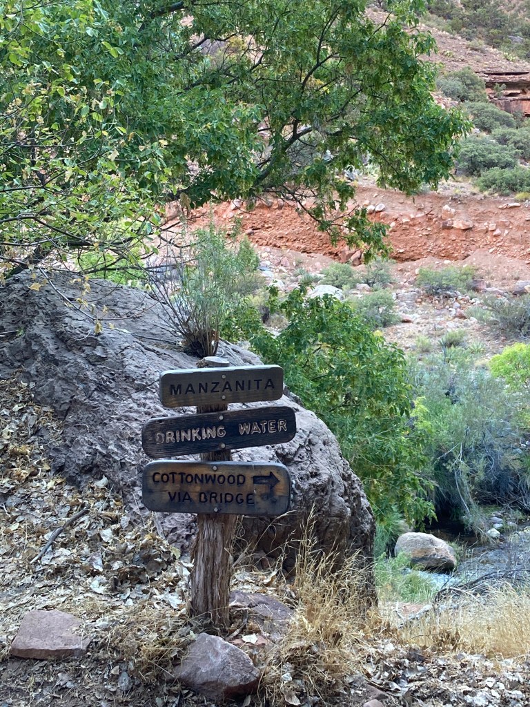
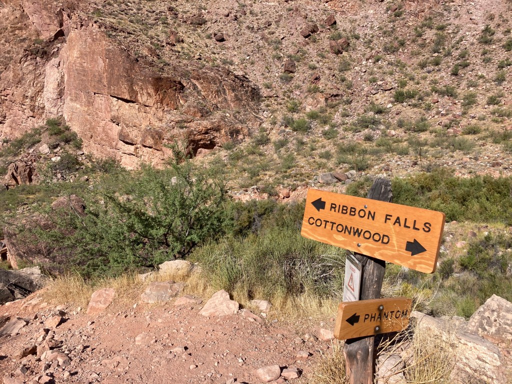
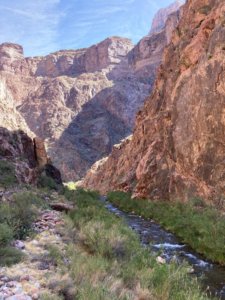
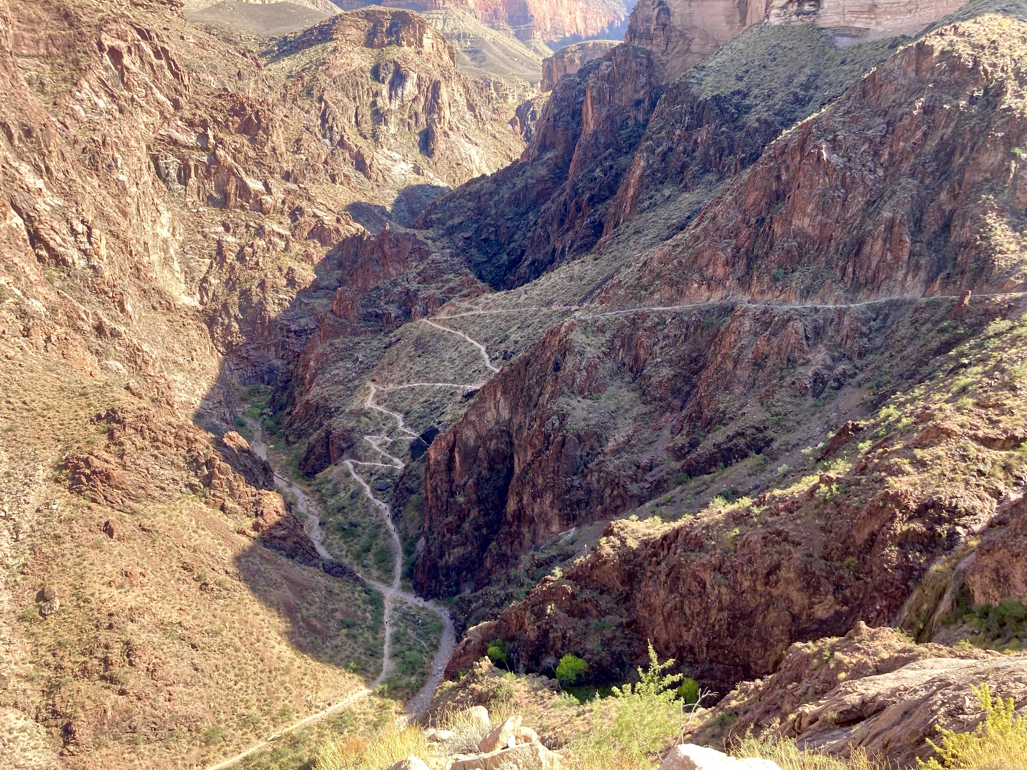
There are several landmarks along the North Kaibab Trail: Supai Tunnel (1.7 miles / 2.7 km), Redwall Bridge (2.3 miles / 3.7 km), Roaring Springs (4.7 miles / 7.6 km), Manzanita rest area (5.4 miles / 8.7 km), Cottonwood Campground (6.8 miles / 10.9 km), Ribbon Falls junction (8.4 miles / 13.5 km), and Phantom Ranch (14 miles / 22.5 km). Most of these landmarks had water spigots for filling up your water bottles and restrooms (i.e. outhouses). Tip: make sure to confirm that the water spigots are working before you hike!
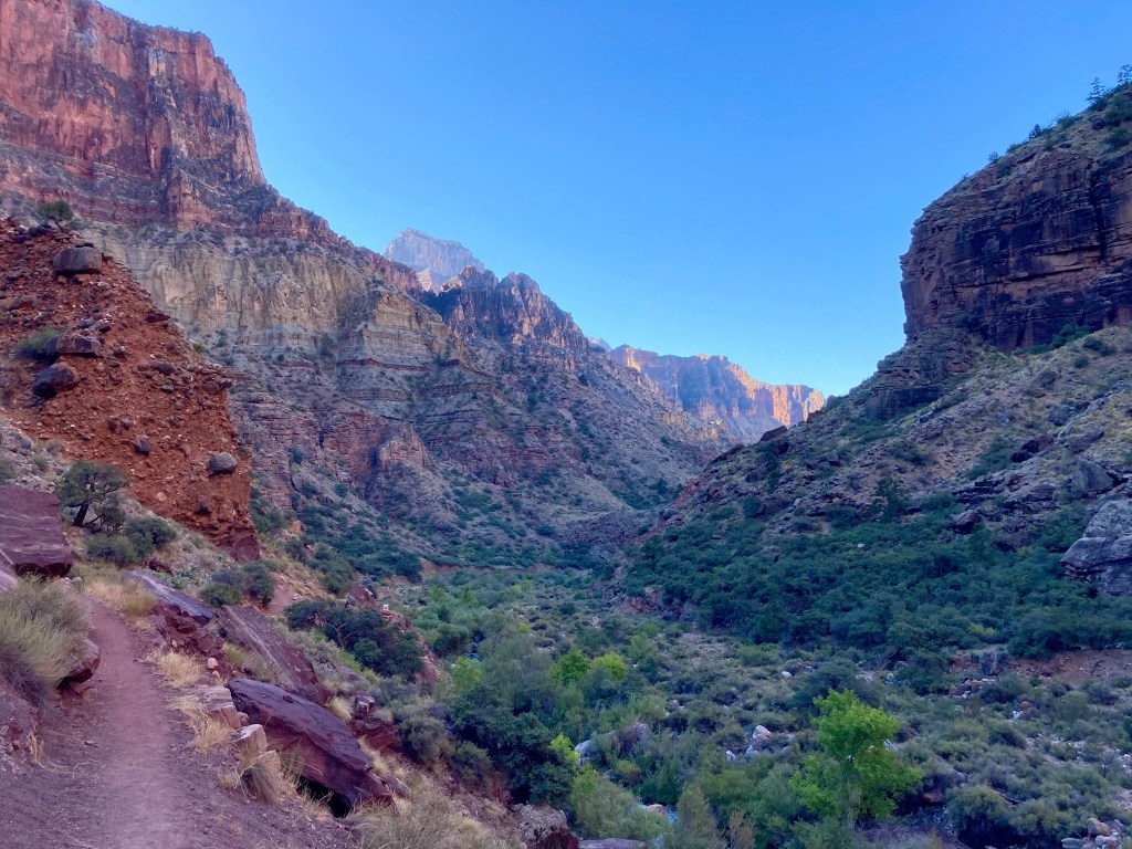
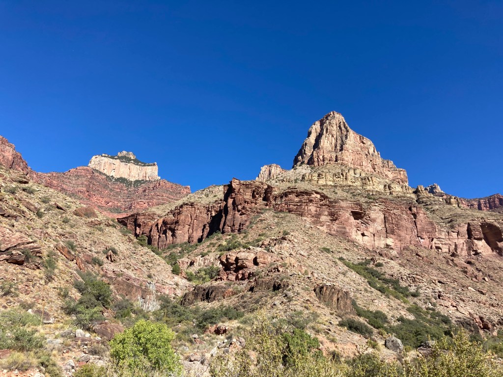
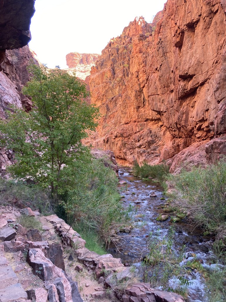
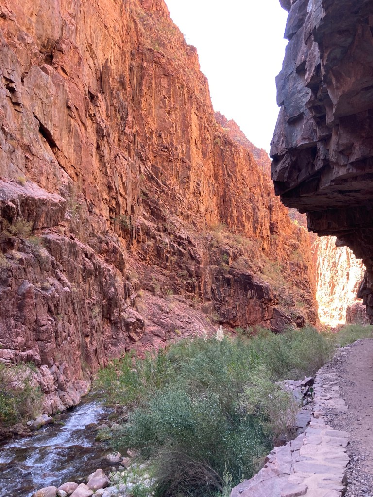
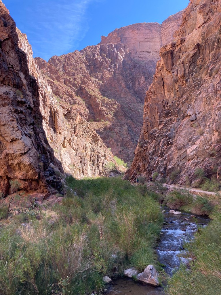
The North Kaibab trail is beautiful and we saw so much red rock, green trees, and fall leaves. Although there were many people on the trail, we were all spaced out enough so that we weren’t crowded. Some parts of the trail were rather exposed (i.e. there was a steep drop on one side), which would probably challenge those who are scared of heights.
At the first rest area 1.5 miles down the trail.
Supai tunnel.
Check out the view!
Jodey on the Redwall Bridge.
Beautiful colours!
More amazing scenery.
Note the exposed trail on the right.
Approaching Roaring Springs. See the waterfall in the bottom center?
Hanging in there!
Manzanita rest area. Most of the landmarks were signed.
It was busy at the Manzanita rest area when we arrived.
On the way to Cottonwood Campground.
This is one of the few times we were in direct sunlight. We had a lot of shade during our hike.
Ribbon Falls junction. Maybe next time!
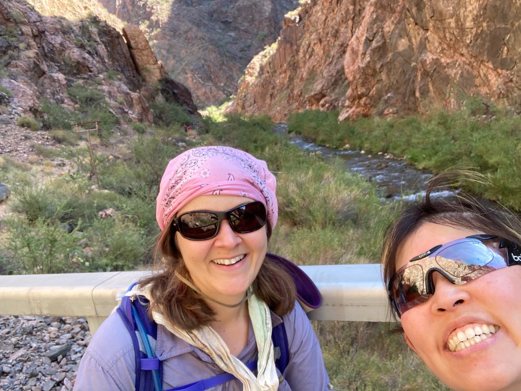
One of the sections I was concerned about was “The Box.” This section of the North Kaibab trail consists of a few miles of narrow canyon right before Phantom Ranch. Note: “narrow canyon” means “heat trap.” In my R2R research, I read that temperatures in the Box can get as high as 130F (54C). (Reminder: I do NOT do heat well.) In order to stave off the heat, we dipped our shirts in the water right before we entered the Box and wore them through the Box. It was great to feel cold for a few moments! Happily, when we hit the Box during our hike, it was mostly in shade and the temperature was nowhere near 130F (it was probably closer to 85F / 29C).
The last little bridge of “hike #1.”
The “Box”
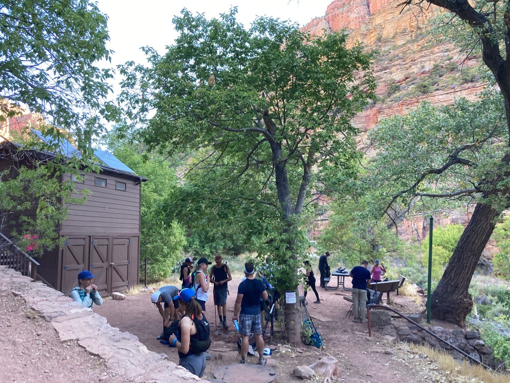
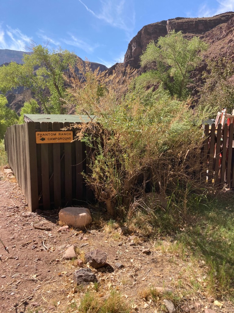
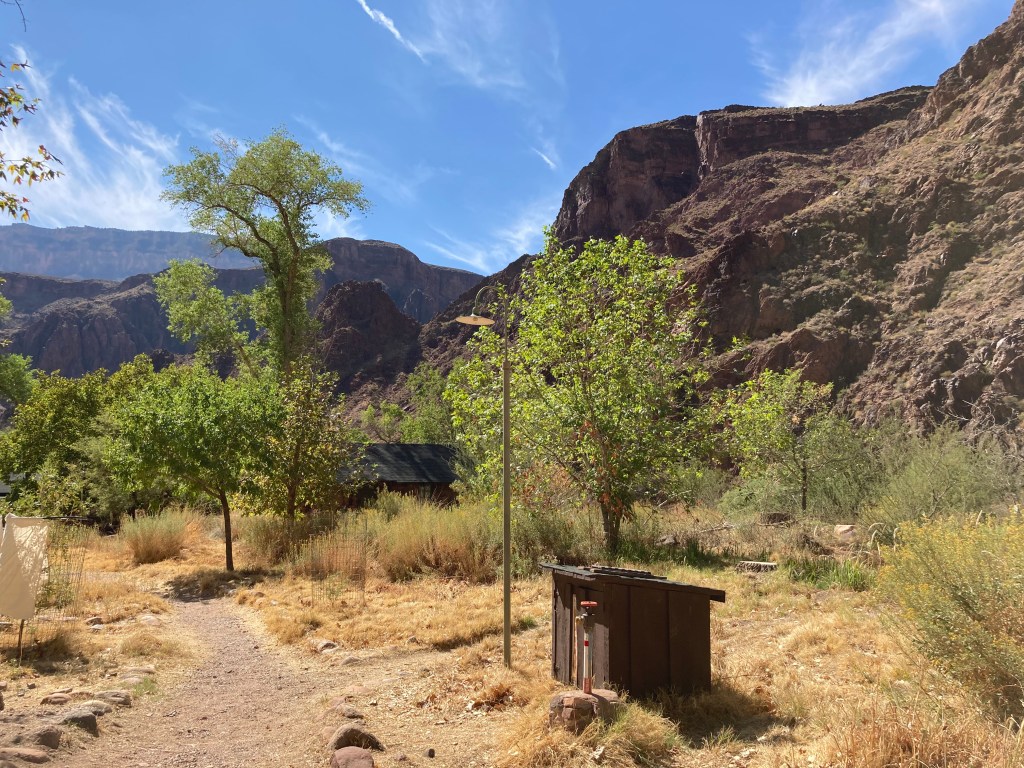
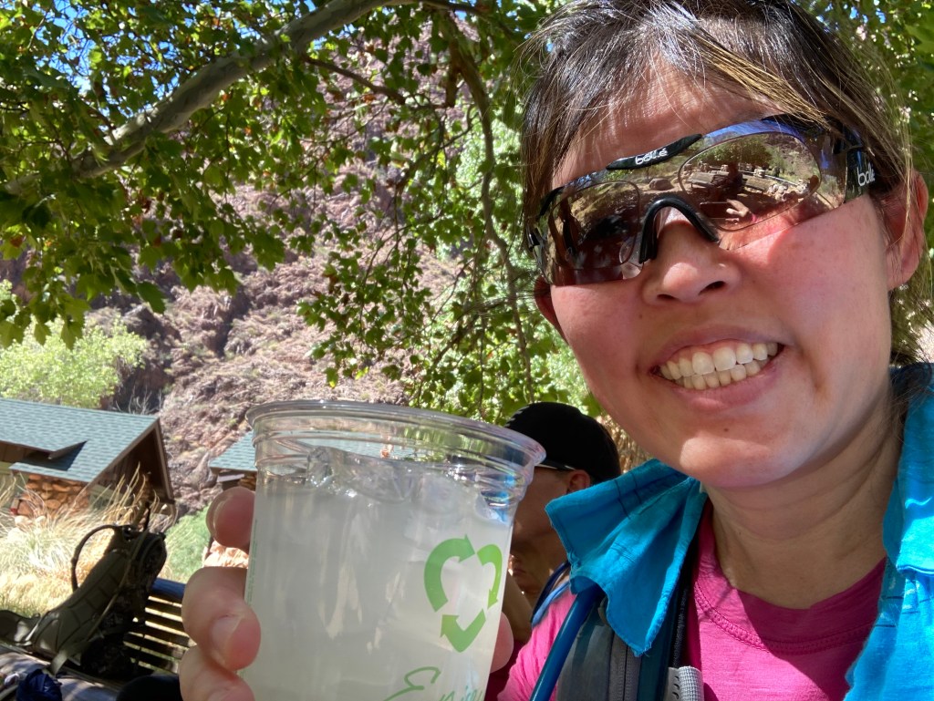
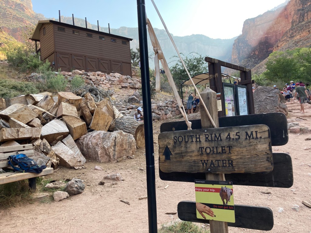
Finally! Phantom Ranch! We finished “hike #1!” I was super happy to reach Phantom Ranch because I REALLY wanted a lemonade. Yes, that overpriced lemonade was probably made from a mix, but it was going to be cold and delicious regardless. I EARNED that drink. In addition to the lemonade, I bought a 4-pack of Oreo cookies and a “sharing size” pack of peanut M&M’s to supplement our respective lunches.
We finished hike #1!
Masks….sign of the times.
My cold, delicious, overpriced lemonade!
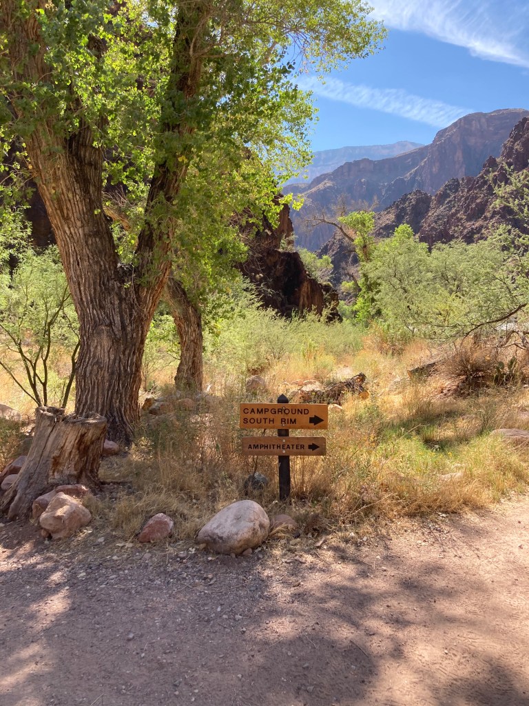
The sign points to Bright Angel campground.
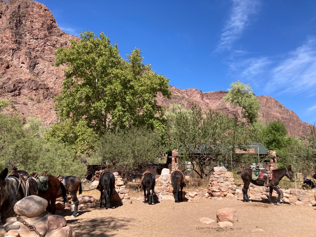
Pack animals.
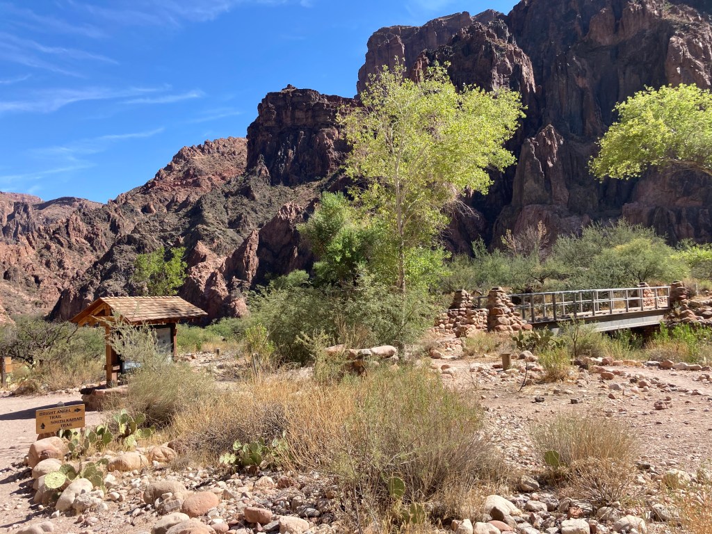
Phantom Ranch
Hike 2: Bright Angel Trail to the top of the South Rim
Starting elevation: 2,480 feet / 756 m
Ending elevation: 6,860 feet / 2,091 m
Elevation gain: 4,380 feet / 1,335 m
Distance: 9.5 miles / 15.3 km
Length of time: 5.5 hours. We started our “second hike” just before 1pm and arrived at the top of the South Rim at 6:30pm.
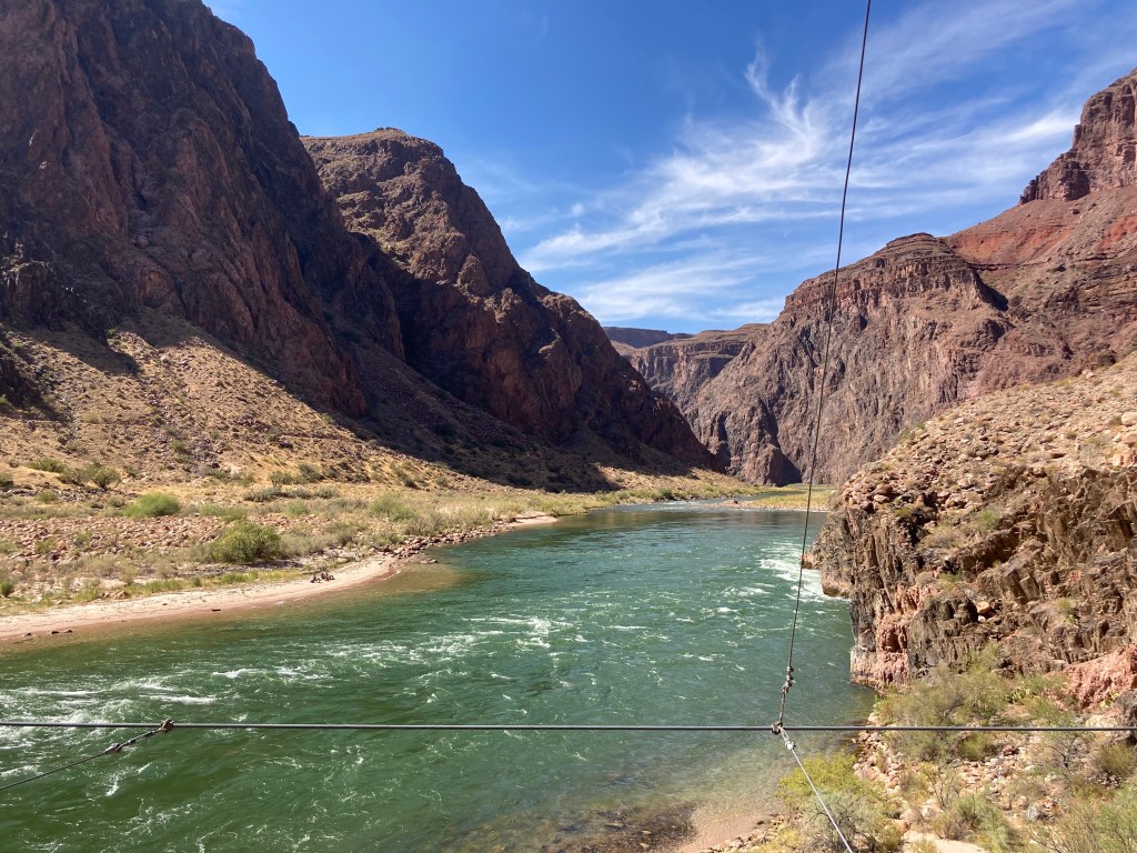
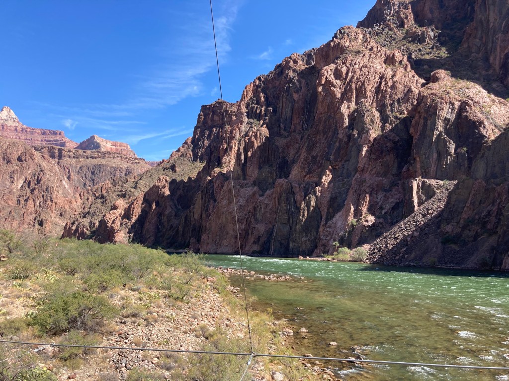
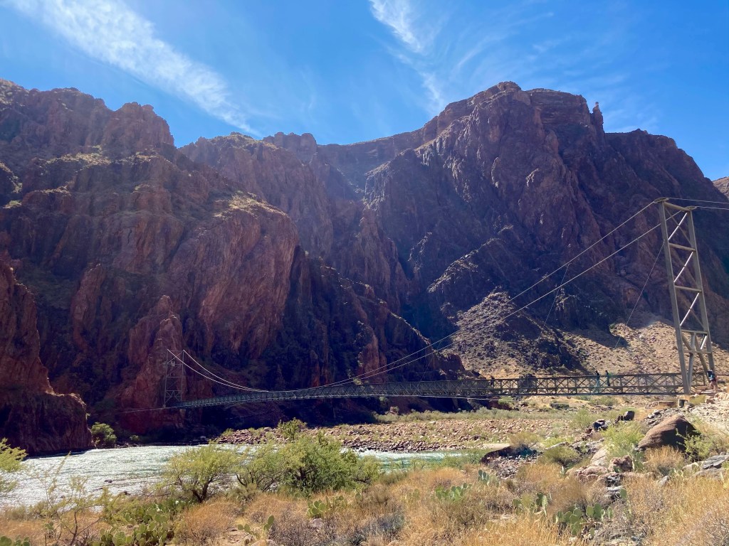
I’m not sure what the temperature was when we started “hike #2,” but it was probably around 95F (35C). We dipped our shirts again before crossing the Silver Bridge and starting the Bright Angel trail. I’m not going to include any “wet t-shirt pictures” because I am a lady. 😉 I WILL include a few photos of the Silver Bridge that crosses the Colorado River and joins up with the Bright Angel trail. Fun fact: in early September, we learned that the National Park Service (NPS) was closing the Silver Bridge “indefinitely” due to structural concerns. That meant that we’d have to hike an extra 1.5 miles to the Black Bridge. However, a week later, we read that the NPS reopened the Silver Bridge after conducting a formal structural assessment. SUCH great news!
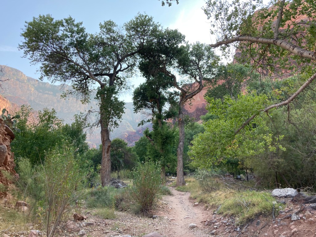
The little bridge at the Bright Angel campground.
View from the Silver Bridge (west side).
View from the Silver Bridge (east side).
The Silver Bridge, which crosses the Colorado River and leads to the Bright Angel trail.
Looking back onto the Colorado River and the Silver Bridge (right side) as we soldier on to the South Rim.
Here we go again….
The first major obstacle we had to cross was the “Devil’s Corkscrew.” I’m not sure if that’s the official name of the series of steep switchbacks, or a nickname that suffering hikers bestowed upon them. In any case, we kept on hiking up and up — thankfully, in shade for most of the switchbacks! — until we looked down and saw THIS:
Devil’s Corkscrew
Perhaps the name “Devil’s Corkscrew” was more appropriate than I thought….shortly after leaving that area, my left knee/IT band started complained loudly. I did not, even though my knee was starting to hurt pretty badly.
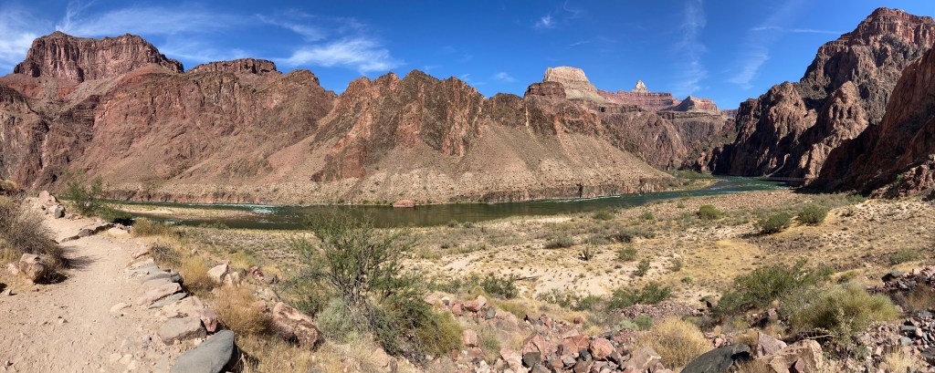
From this point on, the major landmarks along the trail were well-signed and evenly spaced out. The first goal was hitting the 4.5 mile rest area, otherwise known as “Indian Garden.” We topped off our water, soaked our bandanas, and wearily continued our (absolutely amazing, fantastic, beautiful, fun) hike. [Yes, of COURSE the words in parentheses were the actual words running through my head at that point!] 🙂
Indian Garden, the approximate halfway point of the Bright Angel trail.
Our next goal was the 3 mile rest house. We stopped just before we got there to get a picture taken in the soft, late-afternoon light.
Then, the BEST thing happened. Right in front of us on the trail, maybe 25-30 feet away, was a big-horned sheep! It was definitely a morale booster seeing that sheep.
I love seeing animals on the trail!
Next stop was the 1.5 mile rest house. Slowly, but surely, we were making our painful way up to the top.
I wonder how many people have used that emergency phone to hitch a ride back to the top?
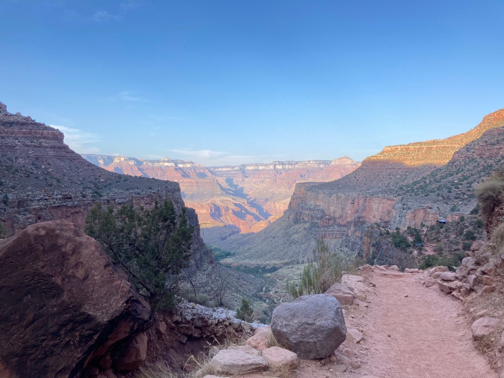
Only 1.5 miles left. Grrrr….my left knee was REALLY yelling at me (but remember, I was NOT COMPLAINING…out loud…). At this point, I was alternating between 2 walking methods: 1) a weird cowboy two-step that made me look like I just rode a horse for the first time in years, and 2) using my right leg to climb over rocks and tree roots, while limping/dragging my left leg behind me. Truly, I was a picture of hiking grace and beauty. One thing that helped me continue on was looking back to see how far we’d come. The last beautiful view we enjoyed was this one:
The last 2 landmarks were 2 tunnels right before the end, but it was getting too dark to get any good pictures of them. However, one picture I DID get was of the two of us triumphantly posing in front of the Bright Angel Trailhead sign, victorious!
Hooray!
I’m not sure what the temperature was when we finished our hike, but I had to get my puffy jacket from my backpack because I was feeling chilly. After Crystal picked us up, we drove to Tusayan (this little town is only a mile from the South Rim!) and tried to find somewhere to get some food. Unfortunately, nothing much was open, so we ended up grabbing some fries and hamburgers from McDonald’s. What a grand celebratory dinner, right? 😉 I was happy enough because I always want fries after a huge hike!
Sunday October 11
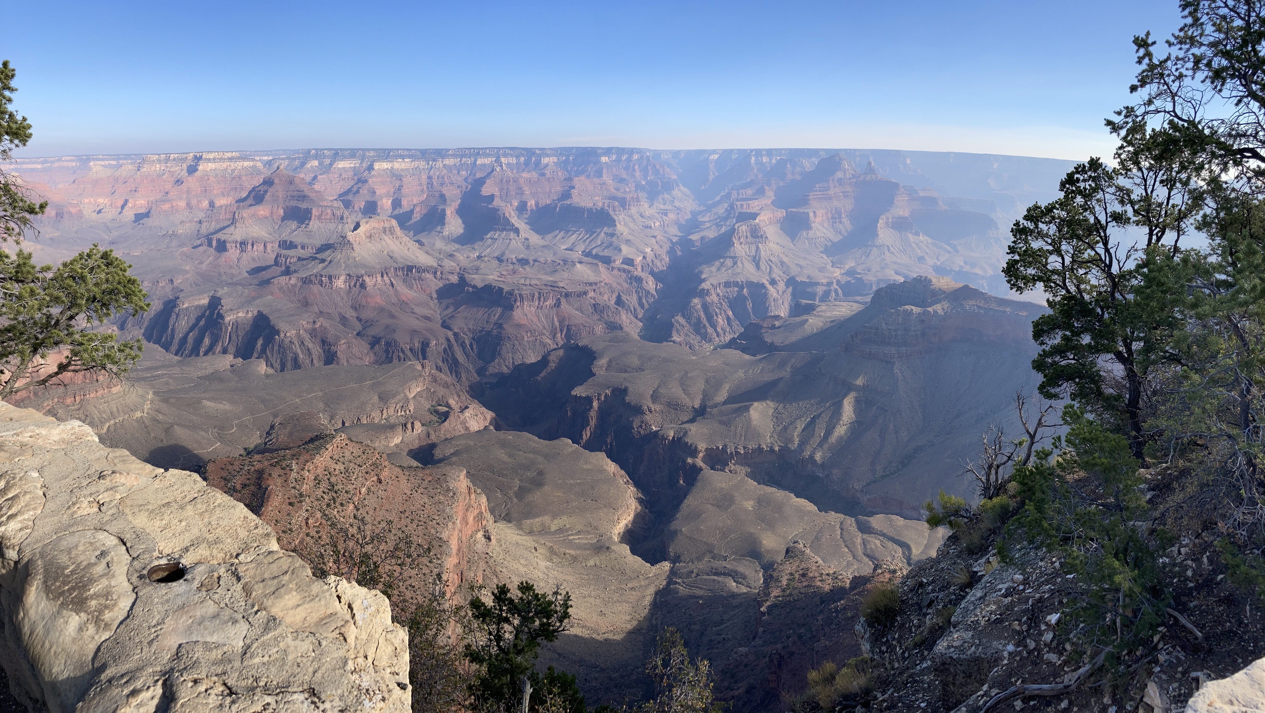
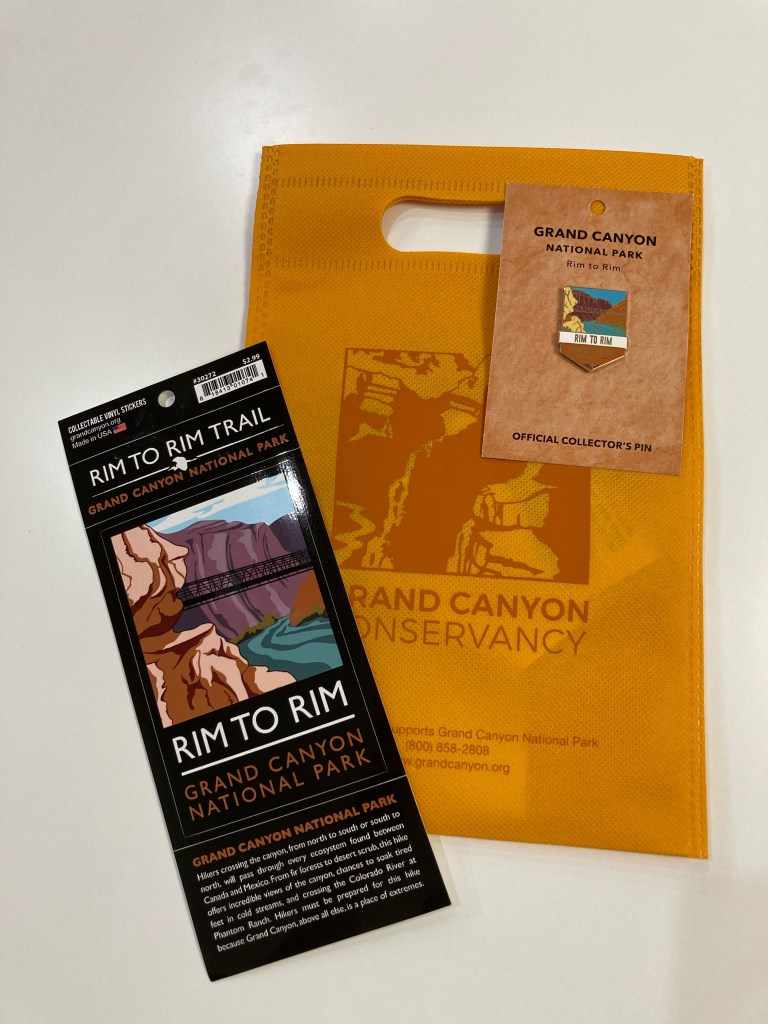
We enjoyed a leisurely morning getting some breakfast and enjoying the canyon views from the South Rim. Before we started our drive back to Phoenix, Jodey and I bought some “swag” to commemorate the occasion.
View from the South Rim.
Another view from the South Rim.
My hard-earned swag: a vinyl R2R sticker and pin.
Overall numbers:
Distance (according to my Garmin): We hiked 24.87 miles!
Elevation change: The Grand Canyon National Park website states that there is a 5,761 feet elevation loss (North Kaibab trailhead to Bright Angel Campground) and 4,380 feet elevation gain (Bright Angel Campground to the South Rim on the Bright Angel Trail). As a reference, there are 5,280 feet in one mile. According to my Garmin, we gained 4,696 feet in elevation (my Garmin didn’t record the elevation loss).
Total time (according to my Garmin): 13 hours, 20 seconds. Of that, 9 hours and 48 minutes were moving time, which means we took just over 3 hours in breaks.
Temperature: it was just above freezing when we started at the North Rim. The high temperature was 95F / 35C at Phantom Ranch. I’m not sure what the temperature was when we finished the hike at 6:30pm, but it felt like it was 45-50F / 7-10C.
The Grand Canyon Facebook page said that there were 430 hikers/trail runners who passed through Phantom Ranch between 5:30-9:30am on Saturday!
What workedfor me during the hike:
Training, obviously. Although, I think I’d train more next time. Specifically, I’d train for a longer period of time and increase mileage more slowly.
Train with a backpack.
If you think you want to use poles, train with those poles. I have poles and have used them on other long hikes. However, I didn’t use them very much in my R2R training. I decided not to take them at the last minute. Would they have helped my knee by taking a bit of weight off of it? Perhaps. If I do R2R again, I think I’ll try using poles, if only to compare experiences.
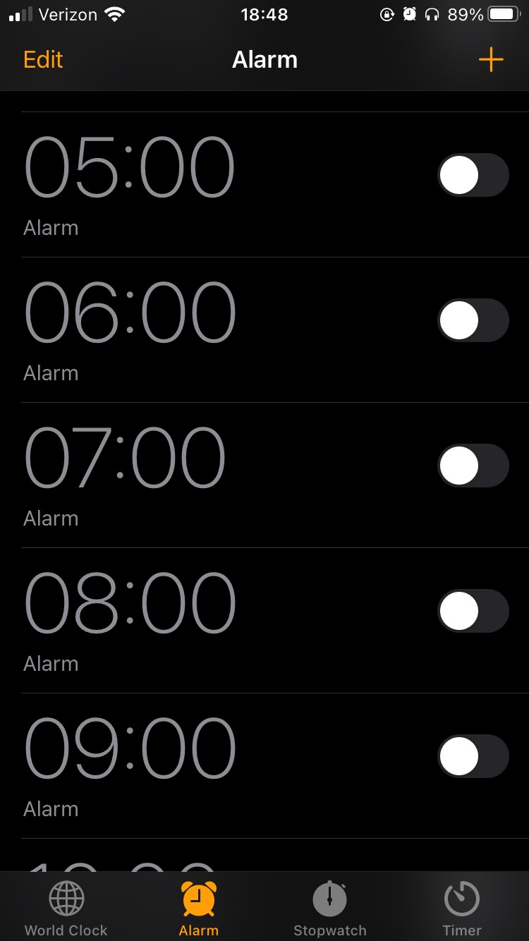
I set hourly alarms on my phone as reminders to eat. I knew it was important to keep my energy up and I didn’t want to risk not finishing the hike because I didn’t eat enough calories. [My SAT — self-appointed trainer, a.k.a. my husband — told me a few times before I left to eat during the hike. HA! I already had that covered! So there!]
Proof that I was a very responsible girl during the hike.
Dipping my shirt and bandanas in the river to cool off. This really helped a lot. Hooray for evaporative cooling!
Endurolytes to avoid leg cramps. I took one pill when my hourly alarm went off. I’m never going on a long hike or bike ride without these again!
Use a checklist (paper or digital) to pack. Compose your list, then check off items as you pack them.
Remember to look up once in a while when hiking to enjoy the views!
Gear:
Headlamp (with fresh batteries)
phone, portable charger, AirPods
Garmin cycling computer (to record the hike)
puffy jacket, Smartwool gloves, buff (took all these off a few miles into the hike)
Smartwool long sleeve shirt, long pants, socks, hiking shoes
extra pair of wool socks to change into (this felt amazing!)
3 bandanas: wet them, pack into ziplock baggies, wear around neck to cool off
hat
sunscreen, lip balm
bandaids, Neosporin, tweezers, mini Swiss army knife
toilet paper, some wet wipes
a garbage bag to pack trash
2L camelbak bladder and two 1L foldable water bladders
Food:
To figure out how much food to bring, I estimated that the hike would take 12-14 hours. Then, I decided to eat something every hour (remember those hourly alarms?). From there, I gathered a variety of “trail” food and “real” food:
a tube of Nuun electrolyte tablets (I added one to my 2L Camelbak)
some Trader Joe’s salt and pepper chips (in a ziplock baggie)
2 peanut butter and jelly sandwiches
a quarter of a Whole Foods vegan breakfast burrito (bought this the day before on the way to the Grand Canyon. Ate most of it for dinner and saved the rest for the hike.)
It’s been a little over 3 months since I last blogged. In those 3+ months, nothing much has happened because nothing much is going on. The world is still in the middle of the COVID-19 pandemic and, as a result, much of normal life has been suspended, such as going out to restaurants, meeting people in large groups, and working in offices. Instead of going out to eat, you could order takeaway. Instead of meeting people in large groups, you may socialize with your immediate family or restrict yourself to gathering with a handful of your friends at least 6 feet apart. Instead of working in your normal place of work, you may be working from home. There is a “sameness” to life, a monotony that covers each day, making you wonder “what is the point to all of this???”
In an attempt to stave off boredom and to salvage my mental health, a friend and I decided to tackle an ambitious hiking challenge: the Grand Canyon “Rim to Rim” (R2R) hike. We both enjoy hiking and are both suffering from a lack of purpose during this pandemic. R2R is something we both wanted to do in the past, but never got around to doing because of schedules, lack of fitness, etc. Well, we’re tired of not doing anything big or fun or challenging! So, we’re planning on doing R2R starting at the North Rim of the Grand Canyon and ending at the South Rim. We want to do this hike in 1 day and we are fully aware that we will be in pain because total mileage is about 25 miles (40 km). You lose about 5300 feet (1615 m) in elevation when you hike from the top of the North Rim down to the canyon floor….then you have about 4400 feet (1341 m) to climb on the way up to the South Rim. Yes, pain. BUT….I’m choosing to think about the bragging rights and all the fries I can eat without guilt!
We scheduled our R2R attempt for mid-October, which only gives us about 6 weeks of training time (note: I started my training on September 1, which gives me a total of 6 weeks). Last week, my goal was to hike my 3.5 mile fitness loop near my house every morning before work. Goal accomplished. Side note: it’s STILL really hot here in Phoenix. The high temperatures last week hit 46C (115F). Gross.
This week, I scheduled a few longer hikes for my morning workout, with a 10 mile hike for Saturday to end the week. I’ll gradually increase my mileage over the next couple of weeks until I hit my longest training hike at the end of September, then taper off the week leading up to the actual R2R hike.
So…yay? I have a plan? I mean, I have a plan! 😉 Wish me luck (and good weather)!
It’s been about 2 months since I last posted and the world has been in lockdown mode that whole time. Here in Arizona, the Governor’s “stay at home” order expired on May 15, which means that things have slowly been opening up. Salons are accepting clients for haircuts, restaurants are offering dine-in service, and malls are welcoming shoppers again. My SAT (self-appointed trainer, a.k.a. my husband) and I are fortunate to be working from home and are enjoying spending a lot of time with our cats. I don’t think the kitties mind us being at home, but since they haven’t actually said that, I’m not entirely certain. 😉
During the lockdown, I tried to get outside each morning before work to hike or mountain bike. On the weekends, my SAT and I tried to explore a new area and get out of town….which is a novelty for sure during this weird time! I want to share three blog-worthy “trips” that occurred in the past couple of months.
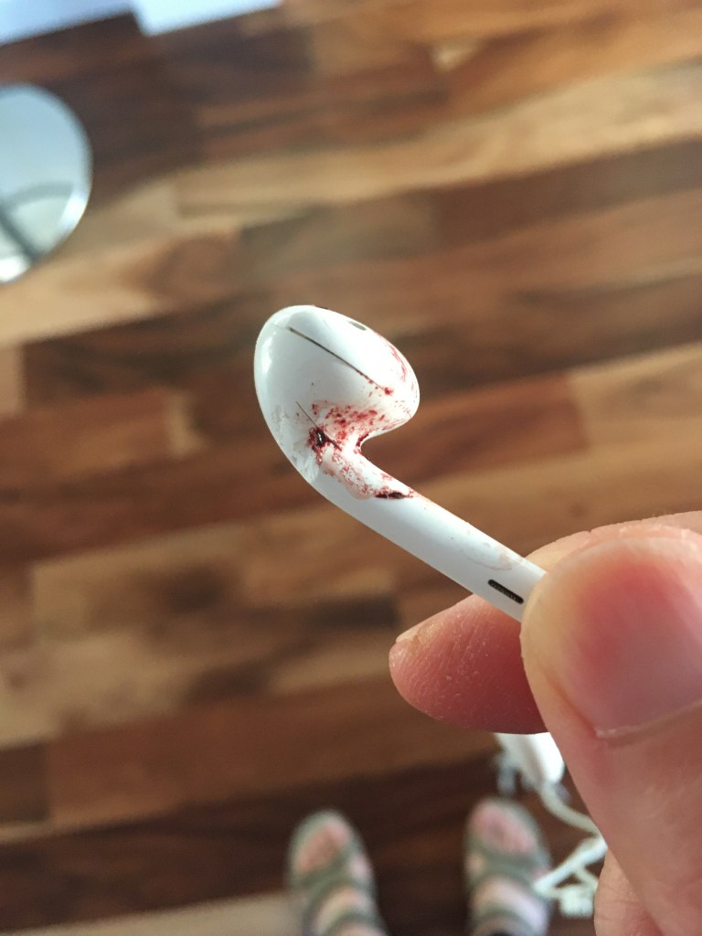
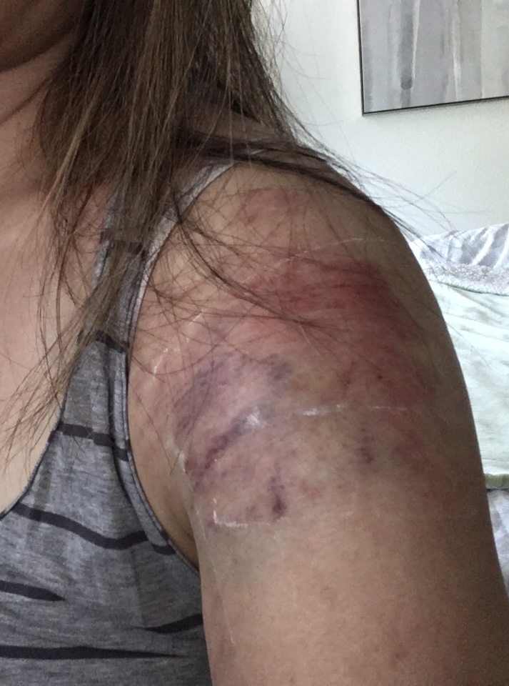
First, about a month and a half ago, I decided to go for a mountain bike ride, as normal. I was happily riding on a trail I’ve ridden dozens of times, when I came upon a little bit of rock (that I’ve ridden over successfully dozens of times) and fell onto my left side. I’m still not sure what happened, but I think my front wheel must have “tripped” and caught a rock. I landed on my left ear, shoulder, and hip. My first thought was that I lost my hearing in my left ear because the podcast I was listening to was only audible in my right ear. Turned out that I broke my left earbud when I crashed. I didn’t incur a concussion, thank goodness, and other than a couple of minor cuts on my left ear and a wicked “tattoo” on my left shoulder, I was fine. My bike escaped unscathed, no scratches at all. I feel like I earned some mountain bike “street cred” with that crash and honestly felt like a bada$$ when I talked about it to some friends who wanted details. 🙂 Still, I took the rest of the week off the bike to recover.
My broken left earbud. RIP. My mountain bike “tattoo.”
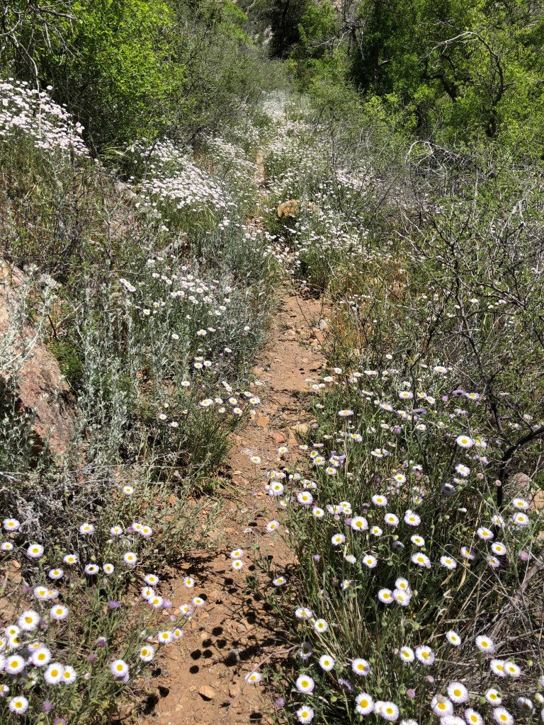
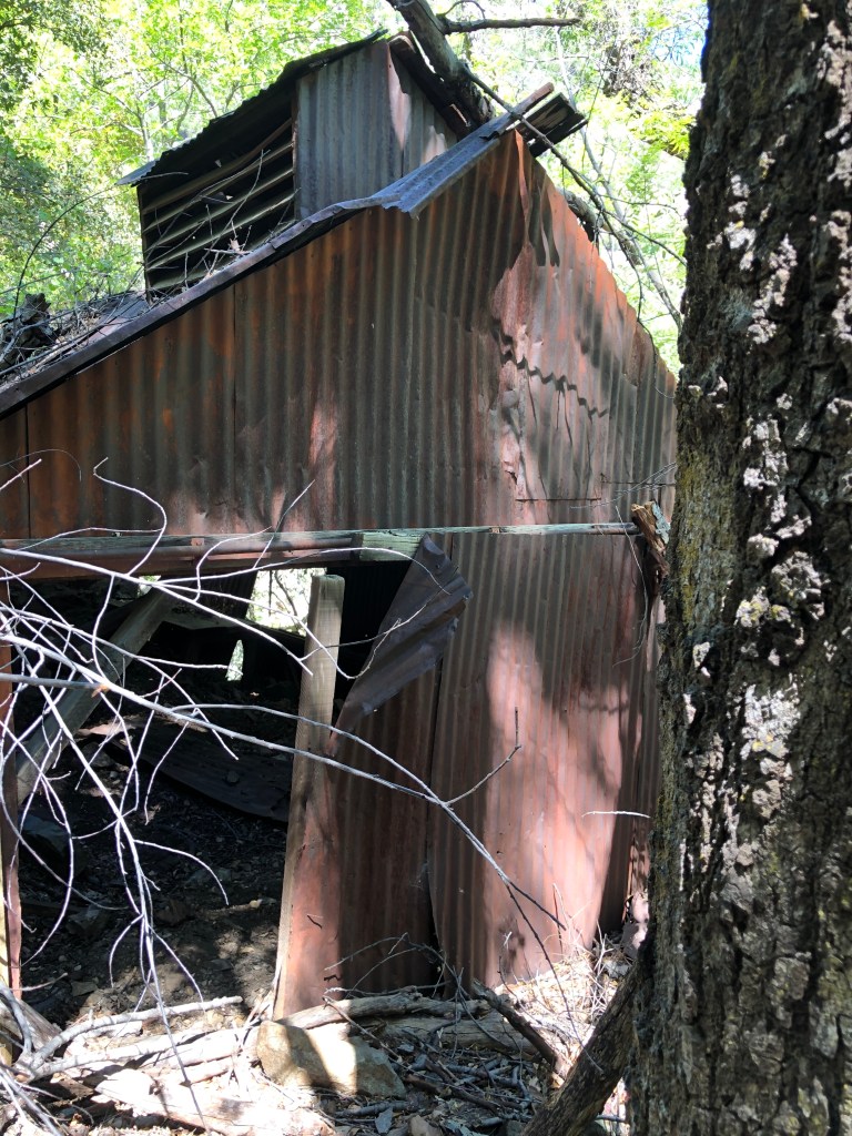
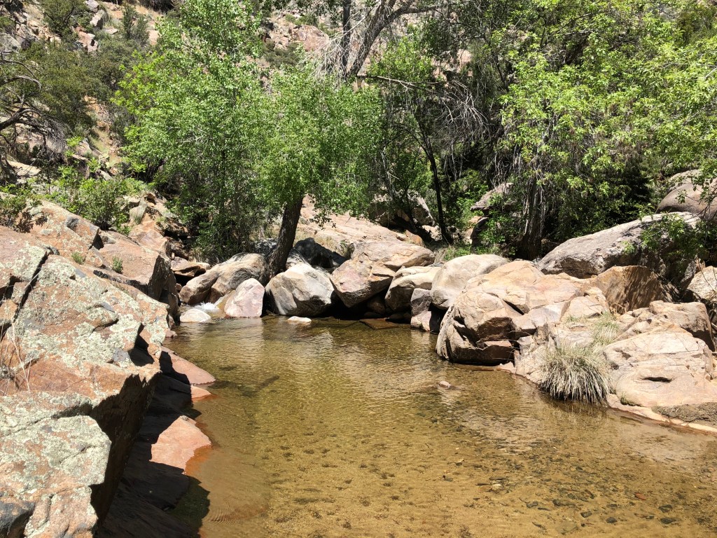
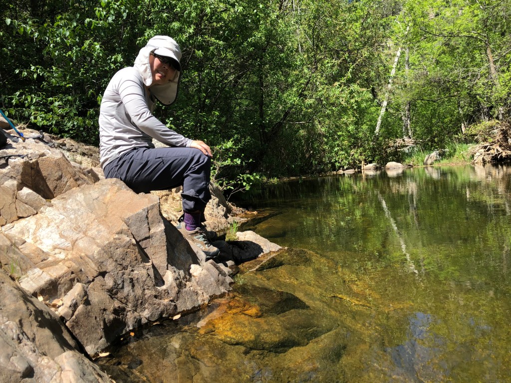
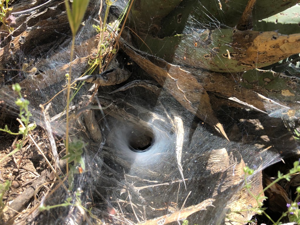
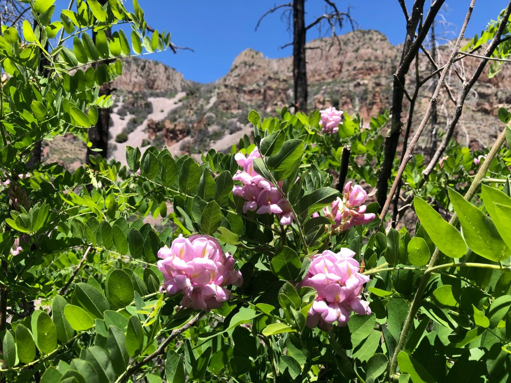
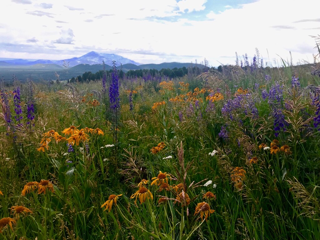
Despite popular opinion, Arizona is not one large desert. There are many different landscapes and microenvironments throughout the state, some of which look like they should belong to Colorado or the Pacific Northwest. Arizona also has a surprisingly large number of creeks and waterfalls. The second “trip” was to a hidden water playground hidden in the eastern side of the Bradshaw Mountain range (closest large city is Prescott, closest little town is Crown King). We decided to do the Big Dipper hike, which required driving on about 25 miles of “washboard-y” road. Once we got to the trailhead (Algonquin trailhead #225), we headed down about 1200 feet to the creek (named Poland Creek), which is only about a mile and a half at most. It was a very pretty hike and we saw lots of wildflowers, an old cabin, great swimming holes, and tunnel webs. I dipped my feet in the water, which felt great. It was super cool to visit a hidden oasis in the mountains.
Such lush, green mountains!
Lovely trail
Carpet of daisies
Old mining cabin
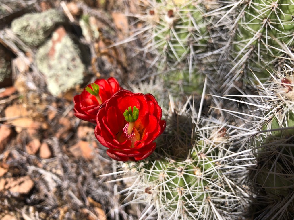
Pretty flowers
One of several swimming holes we saw
More flowers
Water felt great!
Tunnel spider’s web
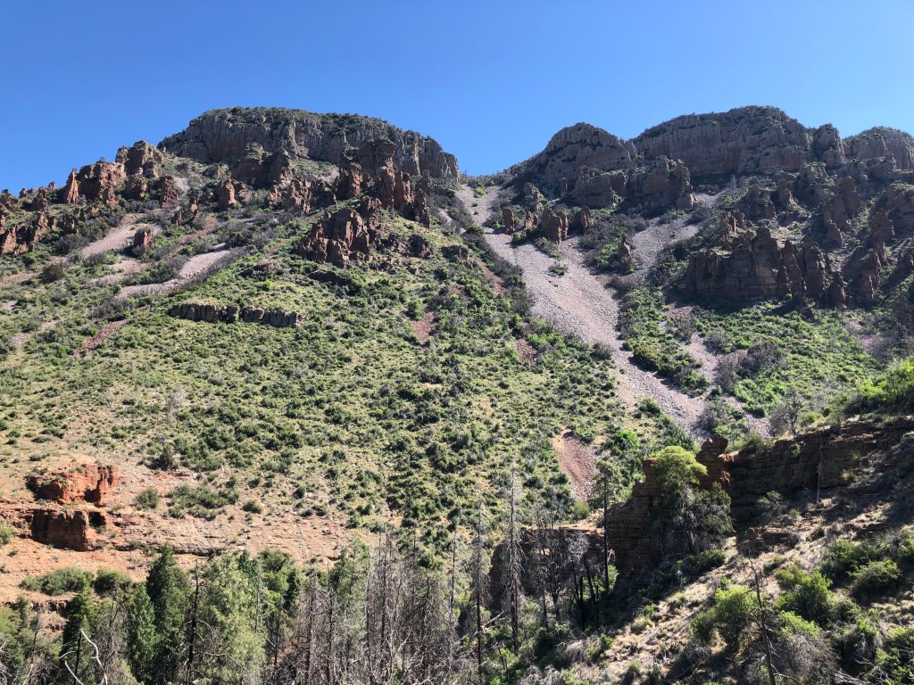
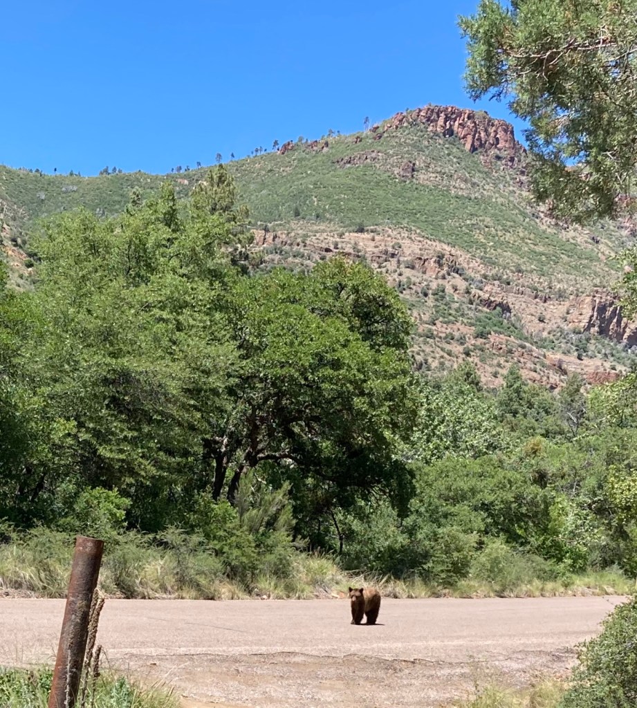
The last little “trip” I wanted to share was one we took to Parker Creek, just outside of Globe. The trailhead (Parker Creek Trail #160) starts at around 5000 feet and I definitely felt the higher altitude right away. Along the way, we got great views of the Four Peaks mountains, Lake Roosevelt, and all the wildflowers. We also passed through a burn area, which contained SO MUCH OVERGROWTH on the trail. We were basically hiking through overgrown branches and some thorny bushes. OK, it wasn’t as bad as the Mazatzal hike, but it was annoying enough that we decided to turn back at around the 4 mile mark. There’s only so much fighting I want to do with bushes and branches.
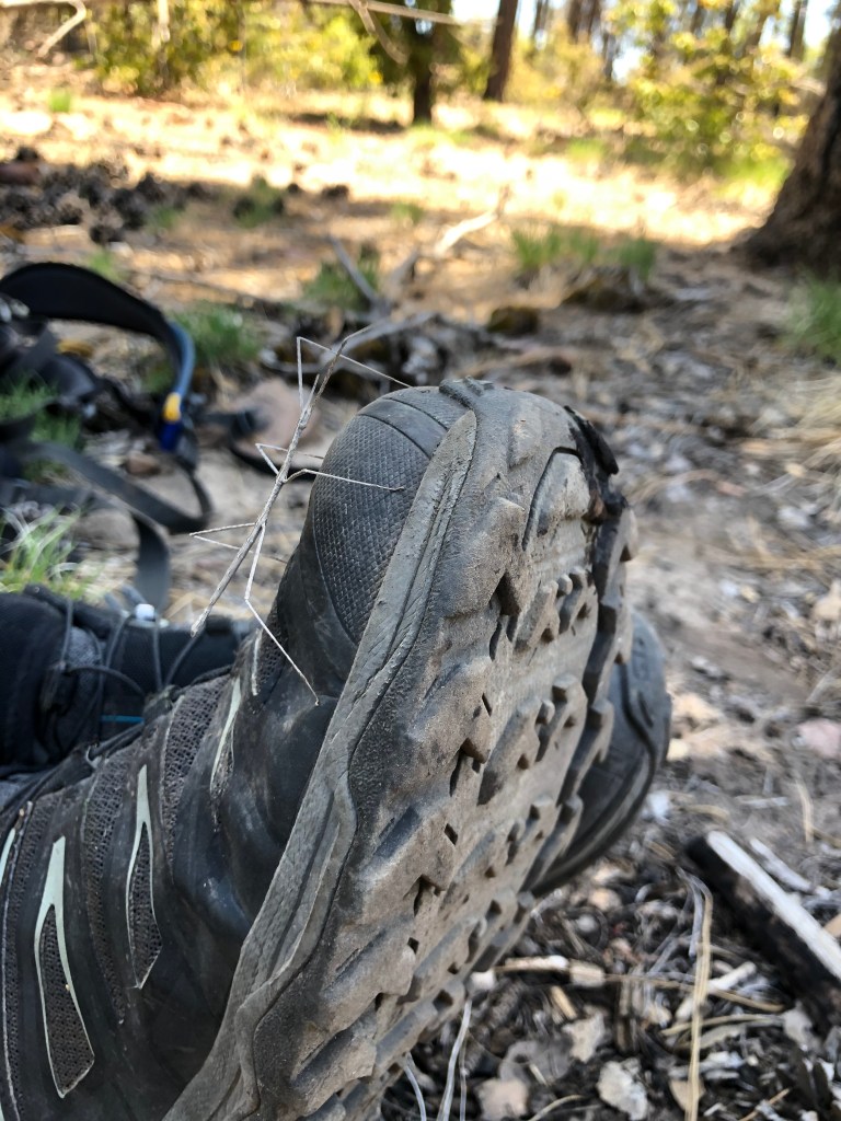
Perhaps the best part of the hike (to me) was seeing a bear at the trailhead! I don’t think that bear was afraid of people because it appeared that it was looking for food. I think my SAT’s best hike moment was seeing a stick bug. Well, each to his/her own. I think the funniest moment occurred during our brief encounter with a military dad and his 4 kids; they were coming up the trail and we were heading back down and they warned us of the bear. After they told us of the bear, my SAT excitedly told them that “we saw a stickbug!” Silence. Well, each to his own.
Start of hike
Good photo opportunity
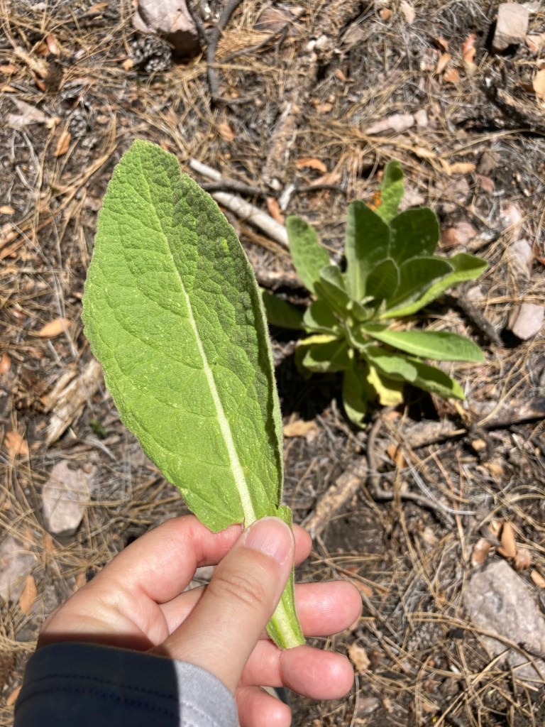
Don’t know what this is, but the leaves were so soft
They say that March comes in like a lion and out like a lamb. Well, March definitely arrived with a vengeance. For those of you who’ve been living in a cave the last couple of weeks (and honestly, that’s probably one of the safest things you can do right now), the current global issue is COVID-19, a.k.a. the coronavirus. This virus is the cause of the current global pandemic and has affected hundreds of thousands of people worldwide. Here in Phoenix, schools have closed until April 10th, bars/restaurants are closed except for takeaway and delivery, and basically all “non-essential” services are shuttered. Grocery stores, medical institutions, and other essential services (e.g. utility companies, banks) are still open. Those who can are working from home. Most people are “social distancing” themselves from anyone outside their home, i.e. staying at least 6 feet away from each other when in proximity to other people. It’s a strange time for sure.
One of the few things one can still do is go outside and take a walk, hike, or bike ride. Although the 6 foot social distancing rule still applies when going out into nature, it’s a relief to be able to get some fresh air and sunshine. It’s somewhat amusing to see how many more people are visiting the local trails; I’ve noticed some dads riding mountain bikes from the 90’s….those bikes were probably collecting dust in the garage!
I’m still going outside and working on one of my goals this year: developing some mountain biking skills. I’m making some progress….slowly, yes, but progress nonetheless. For instance, I’ve ridden on some sections of trail at South Mountain (the closest biking area to me) that I hadn’t done before. I’m doing better on most uphill sections. And I’m not uttering all of my thoughts out loud while riding uphill. 😉
Last weekend, my S(elf)A(ppointed)T(rainer) and I checked out the Ma-Ha-Tuak Perimeter trail to try something new. WOW. It was hard. Super steep in so many places. It was a pretty trail and there were lots of wildflowers along the way. Not a lot of people (see “super steep” sentence). We ended up taking the road back for the last few miles because my legs were done and close to cramping. While I was crying and dying inside, my SAT went on about how “this trail rocks!” and “this is so cool!” and “yeah, this trail is a bit steep.” Dear readers, I really tried to keep most of my thoughts to myself, but sometimes, enough is enough and a few thoughts did not stay filtered. Don’t worry, my SAT and I are still on speaking terms. 🙂
However, I have to admit that the scenery was pretty nice. I’ll leave you with a few pictures and well wishes as we all continue our #socialdistancing and #quarantining. Stay well!
So much green due to the recent rain.
Smiling on the outside, dying on the inside.
More pretty scenery.
Are we done yet?
Beautiful desert bloom.
More pretty wildflowers.
Scenes from Ma-Ha-Tuak Perimeter trail, South Mountain, AZ.
Today, my friend Jodey and I visited east Mesa to ride some of the Hawes trail system. We were both interested in trying out new-to-us trails and potentially testing our resolve to “challenge ourselves” on the bike. Well, after our 10 mile ride, I can definitely say that Hawes is hard. That is, hard for someone who is hesitant about trying steep, rocky inclines and descents (at this point, you may ask why I mountain bike at all?). Because the Hawes trails are right in the middle of a rather posh residential area, we knew that the first couple of miles would be on residential streets, eventually leading to a trail access point.
When we hit the access point, this is what we saw:
I wish the above picture did a better job of showing how crazy steep the beginning is. Normally, when I go for a mountain bike ride, I expect to ride my bike. Today, I mainly hiked the first few miles of the trail, accompanied by my bike. The trail was so steep that I actually lost traction, slipped, and fell. Also, I wasn’t a fan of the rutted trail (i.e., there was a narrow track that you either followed or avoided by riding on the sides of the trail) and the loose gravel/rock that made the trail slippery.
On a brighter note, it appears that any falls I’ve had while mountain biking occurred when I was OFF of my bike. Does that mean I can bike better than I can walk?
Our goal those first few miles was to reach the power towers, where the trail levels out a bit.
Goal accomplished, albeit with a lot of huffing and puffing. The second half of the ride was MUCH more enjoyable, as we got to RIDE our bikes for more than 2 seconds at a time. I surprised myself a few times by successfully riding some downhill sections I wouldn’t have considered riding normally and even (halfheartedly) tried sessioning a boulder obstacle. Did you read that, my SAT (self-appointed trainer)? I tried doing something hard voluntarily!
The weather was beautiful today and we got to see some pretty views, like this one:
All in all, a successful day: we didn’t incur any injuries, we tried something new, and stepped out of our comfort zones. Bonus: no boys to tell us what to do. 🙂
Today, my SAT (a.k.a. self-appointed trainer and my husband) and I went on some different local mountain bike trails. Instead of riding the same (easy) trails, we did one trail backwards and one entirely new trail. I don’t tend to do the same trails backwards because I like doing what I know in the direction I know. I found that doing the one trail backwards was….harder. But, I got one obstacle on my first try and have another obstacle to work on for next time. The new-to-me trail is a wee bit out of my comfort zone, but still within my reach. There are about 3 obstacles on the uphill I need to work on….but, I “cleaned” (i.e. complete a section of trail on the first try) the downhill! In addition to doing new stuff, I “sessioned” things I didn’t get on the first try, which means that I repeated the sections I didn’t get until I did get it. It’s similar to practicing a hard part in a piano piece until you master it.
Anyway, I thought I’d document my first (and only, so far) session ride of 2020 for posterity. I have to admit that being able to do harder things is cool. Yes, the practicing part is work, but the concept is something with which I’m familiar from years of piano practice. Stay tuned for more skill development on the mountain bike from yours truly. 🙂
Happy New Year, dear readers! I trust that all 5 of you had lovely holidays. 😉 I’m amazed that we’ve hit the year 2020 and still don’t have the ability to apparate, i.e. transport oneself instantaneously, or have access to flying cars. However, with this new year, the temptation to make one of those ubiquitous resolutions is strong and I am currently trying to come up with a resolution (or, at least a challenge) for….mountain biking.
<insert shock, awe, gasps of surprise>
Although this blog started as a training log for my first (and only) double century via road bike, I expanded the scope of the blog to include adventures of all kinds, like hiking, mountain biking, and becoming acat mom. I have a fancypants mountain bike and in keeping with my penchant for using everything I own, along with pressure from my SAT (i.e. self-appointed trainer, a.k.a. hubby), I’m now officially soliciting ideas for a mountain biking goal. Should that be a weekend bikepacking trip? A challenge ride of 50, 75, 100 miles? Skill development?
Side benefits of increasing my riding include a stronger cardiovascular system, losing a bit of holiday weight, and french fry consumption (the last benefit is the best one, in my opinion). #eyesonthefries
So, chime in, dear readers! What should I consider doing on the mountain bike this year?
Last year, I organized a DIY version of the annual PHX 7 Summit Challenge (click here to read last year’s blog post). At the end of the event last year, everyone said that they wanted to do it again. So, I organized the 2nd annual version and we completed it yesterday.
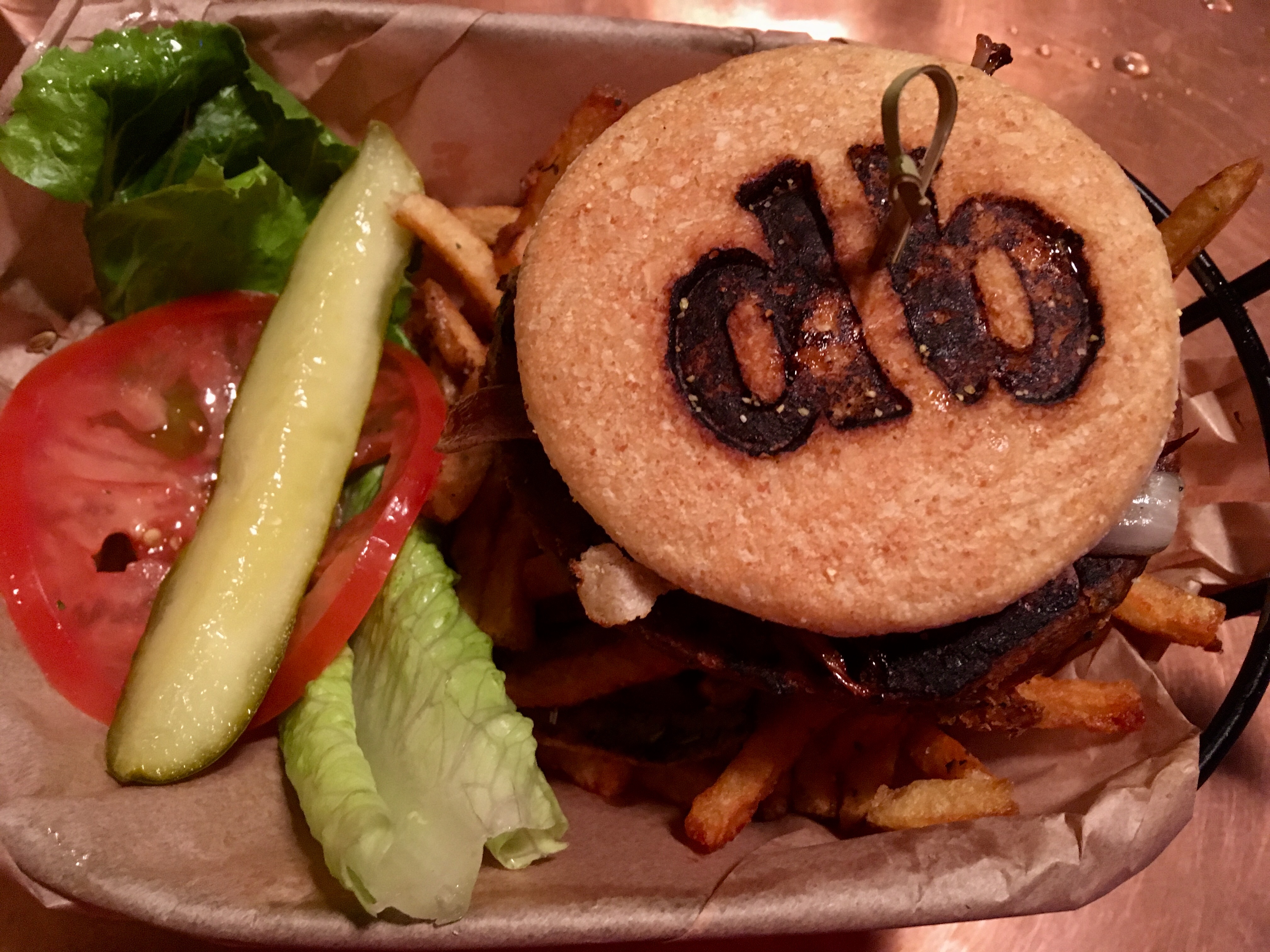
Based on the event last year, I knew I wanted to change a few things. The most important one is to trim down the transition time between hikes. In my last email to the group the night before the event, I requested that we all do our best to minimize the time between hikes by eating/drinking in the drive to the (next) trailhead and by using the bathroom as soon as you get to the trailhead (or right after finishing whatever hike we completed). The second most important thing I wanted to ensure is GOOD FOOD. Last year, we ended with the longest, hardest hike in the dark….and we were all ravenous….and there weren’t any great food options. Although we ended up at Five Guys last year (and enjoyed the fries there immensely), it just didn’t scream “celebration dinner!” So, I re-ordered the hike order to begin with the longest, hardest hike and end with a hike close to a lot of “celebratory” type places, i.e. guaranteed (veggie) burgers and fries.
I’m very pleased to report that we not only completed all 7 hikes, we finished much faster than last year (about 1.5 hours faster) and enjoyed a great celebratory dinner with really yummy burgers and fries! #goteam #eyesonthefries
Event recap
Order of hikes: Holbert Trail (South Mountain); Apache Vista and Ridgeback Overlook; Deem Hill; Lookout Mountain; Shaw Butte; Dreamy Draw.
Stats: according to my Garmin, we hiked a cumulative 23.4 miles with 4,550 ft gain. We started shortly after 6:30am and finished at 6:30pm, enjoying a beautiful sunrise and sunset. Eight hikers started the day at Holbert Trail and 5 hikers ended the day at Dreamy Draw. However, only 3 hikers completed all 7 hikes. My reason for starting a little later this year is because we had a slightly smaller group.
Dinner: thanks to SanTan Brewing Company (north Phoenix location) for being open (haha) and for having some fantastic fries and black bean burgers. 🙂
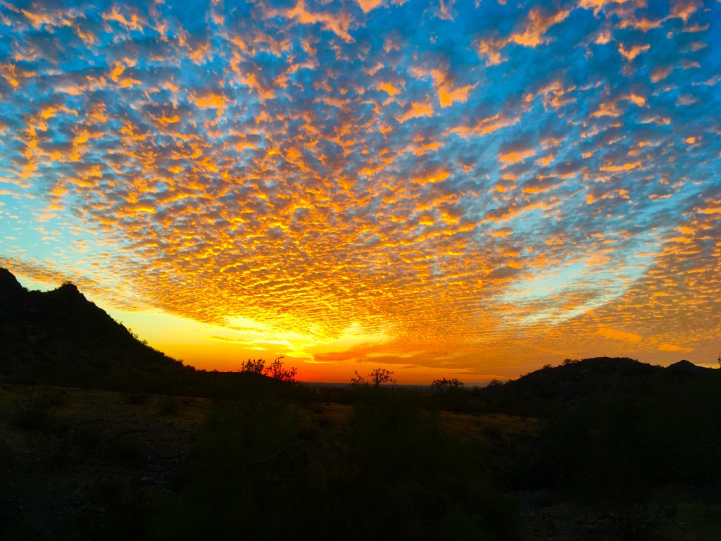
Highlights of the day included a gorgeous sunrise and sunset, beautiful cloud formations, cool temperature, great company, no injuries, and did I mention those awesome fries?
Things to consider for next year’s event: include some different hikes, admission fee/donation to charity (this is to lock down commitment), and an event t-shirt.
Stay tuned for more details. Until then, merry Christmas and Happy 2020!
Sunrise on summit of hike 1 (Holbert trail)
Hike 1 summit selfie
Scenic for sure!
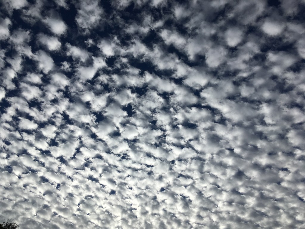
Very cool cloud formation.
Someone put a Christmas tree halfway up hike 6 (Shaw Butte)
View from top of hike 6
Fantastic sunset!
Enjoying the sunset before starting our last hike!
Some people are naturally flexible, easily able to touch their toes (with legs straight) or do those cool backbends that scream “Look at me! I’m young and supple!” Not me. Sitting cross-legged is a, um, stretch for me. My usual state of being is tense and knotted up. Although I exercise regularly and enjoy doing things like long day hikes or bike rides, I am not good at stretching my poor muscles. However, I am very open to doing yoga/stretching and thought that if I could find a Groupon special or some other deal for yoga, then maybe I could use that to start incorporating more stretching in my life. So, I went online and found a local yoga studio that is currently offering 30 days of yoga for $30.
My first class was this past Monday and I chose to try an aerial yoga class. First, let me say that this blog post will not have any pictures of me and YOU ALL SHOULD BE VERY GRATEFUL.
OK, what is aerial yoga? Essentially, it’s a yoga class conducted in hammocks. The instructor leads you through the same yoga poses as a mat class (i.e. yoga done on a mat), except that you’re in a hammock. Practitioners claim that some benefits of aerial yoga include greater range of mobility (because you can hang onto the sides of the hammock, which enables you to stretch further) and a better ab/core workout (because you have to use those muscles more to balance yourself). The online pictures of aerial yoga do look really cool, somewhat similar to what you see in any Cirque du Soleil show. For example:
I actually managed to do this during the class. For the first 5 seconds, I felt really accomplished and cool and awesome….which quickly degenerated into helplessness, nausea, and panic.
My conclusions? Aerial yoga is not for me. When my aerial yoga class started, the first thing we were told to do is to get into the hammock. That took me several minutes. After I maneuvered my old, stiff body into that swinging piece of suspended nylon, I immediately started feeling dizzy and nauseous. My next thought: “This is going to be a LONG 60 minutes.” (Note: I was correct.)
The instructor was encouraging and helped me in and out of the hammock several times, probably feeling sorry for the girl whose limbs kept getting in her way. She said that “most people need 3-4 sessions to get the hang of getting in and out.” As for the dizziness? She was sympathetic and said that the more I practiced aerial yoga, the less I’d experience dizziness. Hmm. How about I don’t do aerial yoga again and not feel dizzy (because of it) again?
More fun poses followed the actual getting into the hammock, like tree pose (standing on one leg with the other leg leaning against the standing leg), butterfly (sitting position with the feet touching and knees bent out), and my personal favourite, the “floss,” which required you to straddle the hammock, grip both ends of the hammock in one hand and pull up while sticking one foot in front into the hammock. (Use your imagination to picture the “floss” part of the pose. Aren’t you glad I don’t have pictures for this blog?)
Strangely enough, my least favorite part of the class was the last 10 minutes, which was in corpse pose, a.k.a. the easiest pose. All we had to do was lie on our back in the hammock. We were told to relax and to breathe. All I remember thinking is “why is my hammock still moving??” and “please please don’t throw up.” The dizziness lasted well into the next day!
Am I glad I tried aerial yoga? Yes. Will I try it again? No (read above blog post). However, I’m all for the “conventional mat” yoga and I already feel the benefits of doing that this past week. Hooray for trying new things. 🙂
Yesterday was Backpacker magazine’s 2nd annual “National Summit Day.” Last year, my friend Crystal and I hiked Arizona’s Humphrey’s Peak on what was the 1st annual National Summit Day. It was a beautiful day and despite no training, we made it to the top. I didn’t know we peaked AZ’s highest point on such an auspicious day, but it was a happy surprise.
This year, I thought it would be fun to hike Humphrey’s again on National Summit Day (hmm, perhaps an annual tradition?), so I got a few friends to join me. Humphrey’s is just outside of Flagstaff, which is generally about 30 degrees cooler than Phoenix due to its higher elevation. Here in Phoenix, the highs right now are averaging 110F/42C. My friends were more than happy to join me and escape the heat.
We left Phoenix at 5:30am and arrived at the trailhead by about 8:25am, hitting the trail a few minutes later. The park rangers warned us to get off the summit by 11am because of impending thunderstorms. We decided to play it by ear and turn around if necessary.
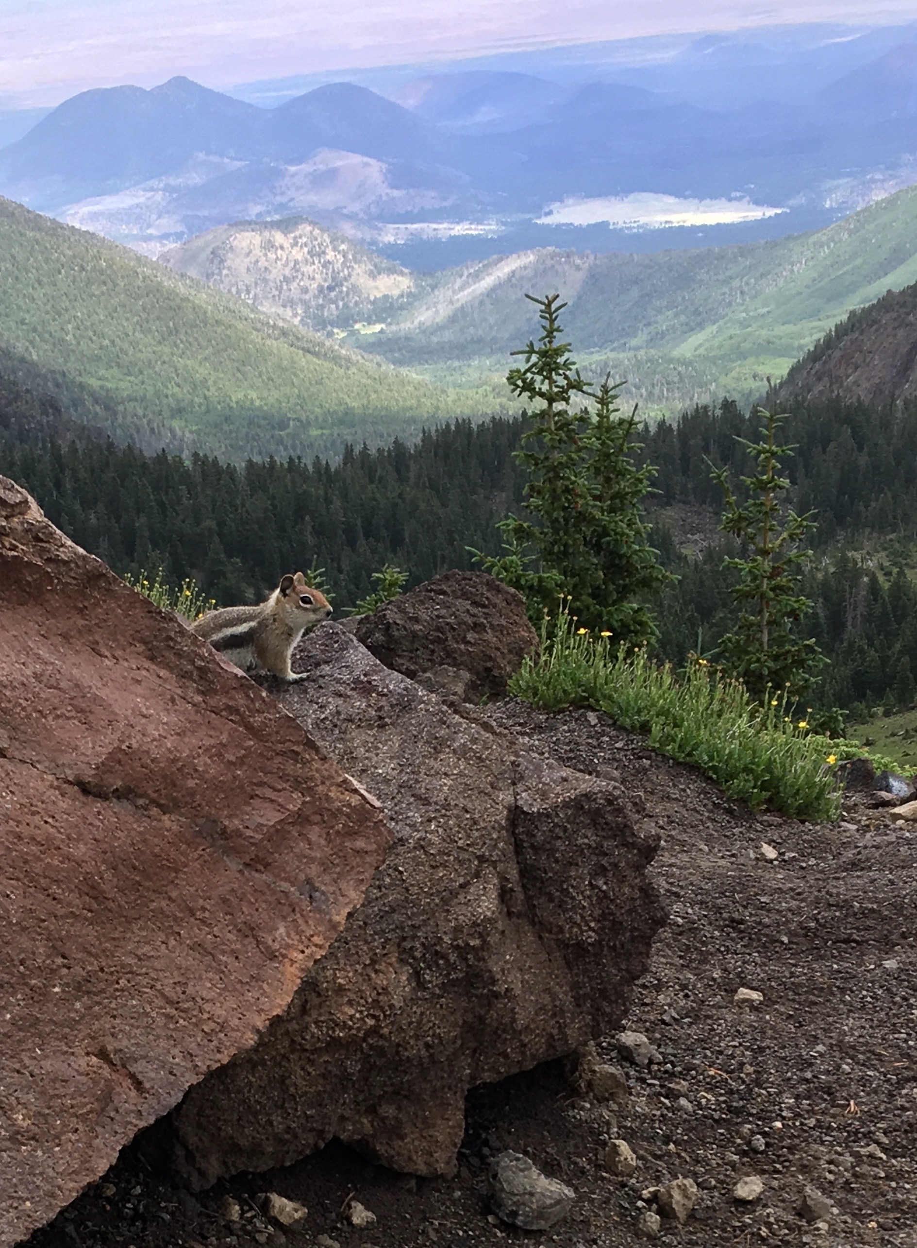
It was a refreshing, cool day with loads of wildflowers in the meadow and tons of lovely tree coverage. When we got to the saddle, 2 gals decided to turn around, while Jodey and I decided to press on to the top and risk the storm.
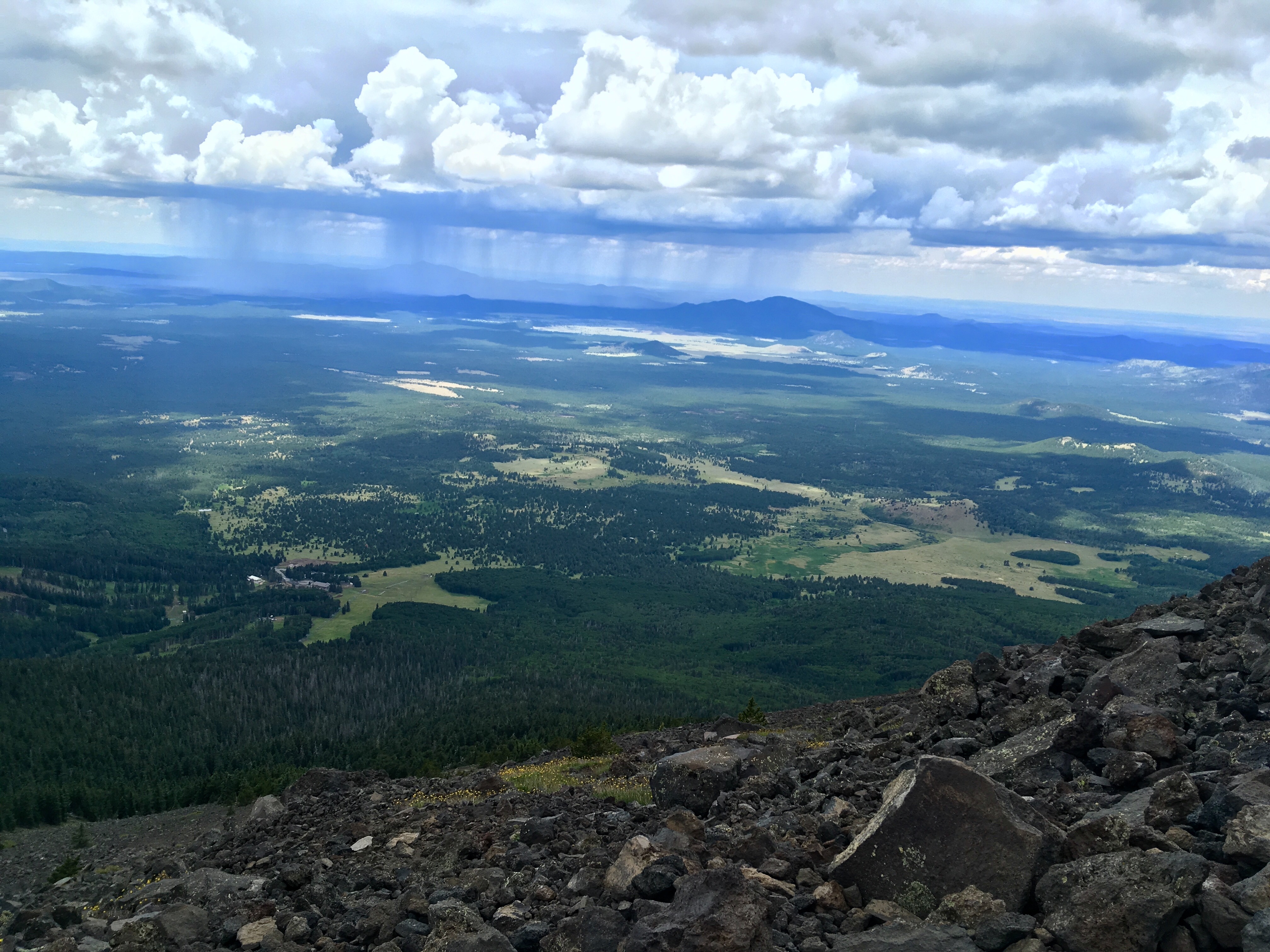
However, my legs decided that they didn’t want to face the storm and cramped up about 25 minutes from the summit. The cramp in my right leg was so bad that I literally fell to my knees. I may have uttered a bad word or two….in any case, I thought that was my cue to turn around because I had to get back down to the car! I told Jodey to go ahead and “get to the top for all of us.” She did! I waited for her back at the saddle and after a little lunch break, we made our way down in pretty good time (my legs didn’t cramp up again). We did get caught in some pretty heavy rain and hail and heard a lot of thunder. (We later learned that the temperature at the top was 58F/14C and the high in Phoenix was 110F….that’s more than a 50 degree difference!) Each time I heard thunder, that made me pick up the pace a little bit more.
We made it back to the car around 3:15pm and after changing our shirts and shoes, drove back to Flagstaff for some really great burgers and fries. Seriously folks, the food is probably the best part of any big outdoor adventure! Wishing you all happy adventures!
Beautiful meadow.
Here we go!
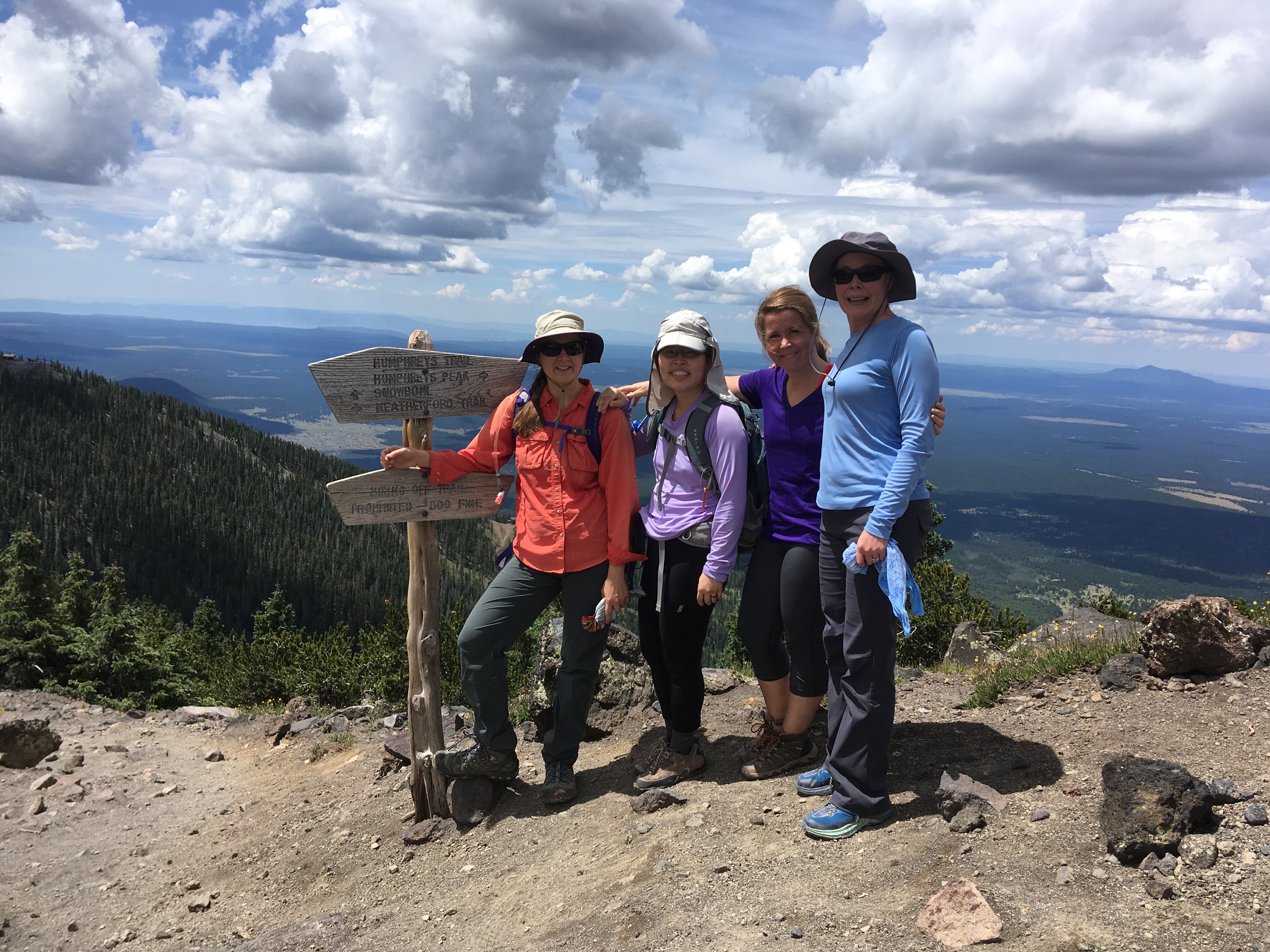
At the saddle. L to R: Jodey, Karen, Crystal, Ann-Marie.