After 4 years of barely tolerating our “aesthetically offensive” kitchen, we finally started our kitchen remodel. We are doing much of the work ourselves in an attempt to save money. That DIY work includes designing the kitchen, doing the demolition (i.e. “gutting” the kitchen), moving a door several feet, replacing/repairing drywall, removing tiles and installing new flooring.
[I should clarify that when I say “we” are doing much of the work ourselves, I really mean that my SAT (i.e. self-appointed trainer) is doing much of the work himself. The demolition occurred this past weekend and he removed all the cabinets, countertops, and pantry walls. I am so impressed!]
We have 3 main objectives with this daunting project: 1) increase storage space, i.e. have a specific place for everything; 2) increase counter space (via a gigantic island that’s about 10 feet in length); and 3) make it look modern and pretty. Some of our wish-list items include:
new, modern cabinets with the soft-close feature;
spice drawer, knife drawer, gadget drawer;
a real pantry;
espresso bar with sink;
a large island with a sink and seating for 3-4 people;
double wall oven and induction cooktop;
stone countertop, i.e. granite or quartz.
Today is the end of day 6. My SAT was working super hard for the first few days, until his parents arrived earlier this week to help out. So far, the following has occurred:
temporary kitchen set up;
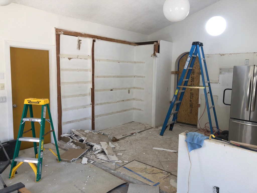
kitchen gutted (cabinets and countertops removed, old makeshift pantry shelves and enclosure removed);
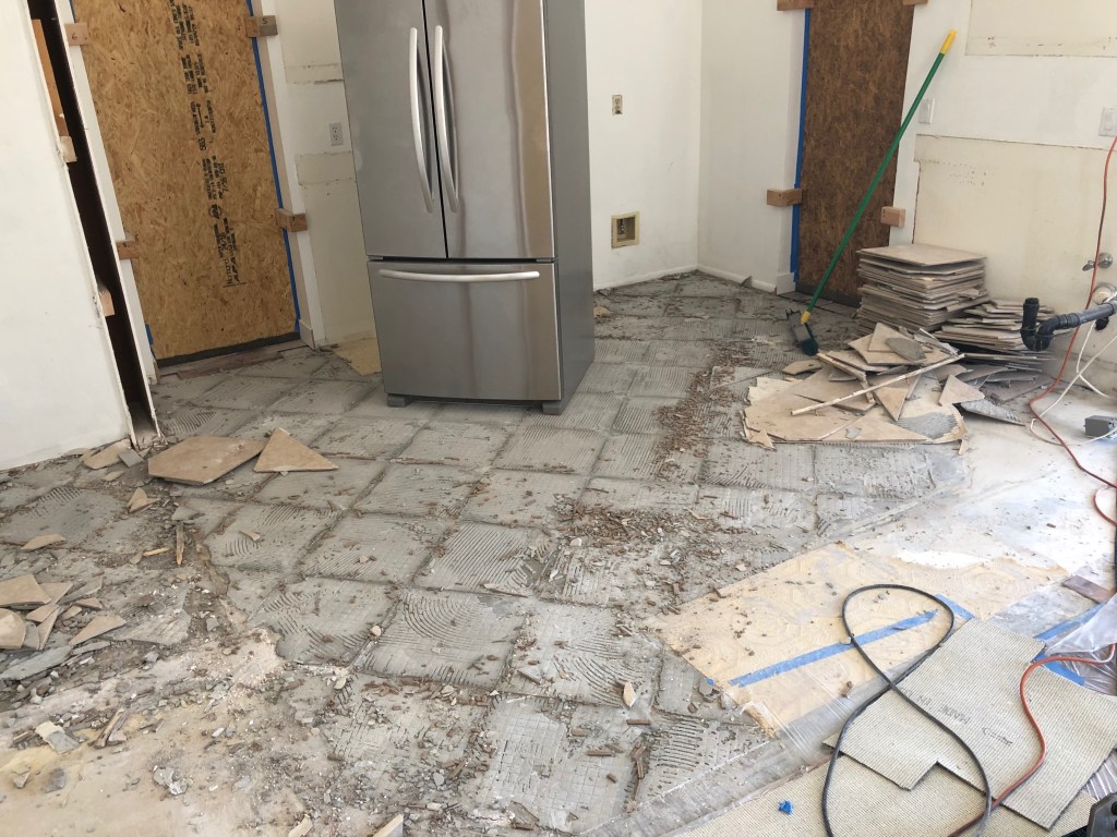
old tile and mortar removed;
old drywall removed (as needed);
old appliances removed (and a couple of them sold!);
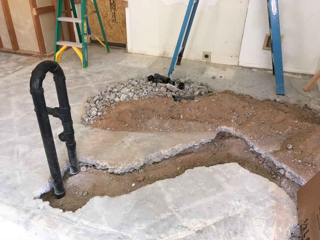
plumbing for island completed;
kitchen door moved down a few feet to accommodate new design.
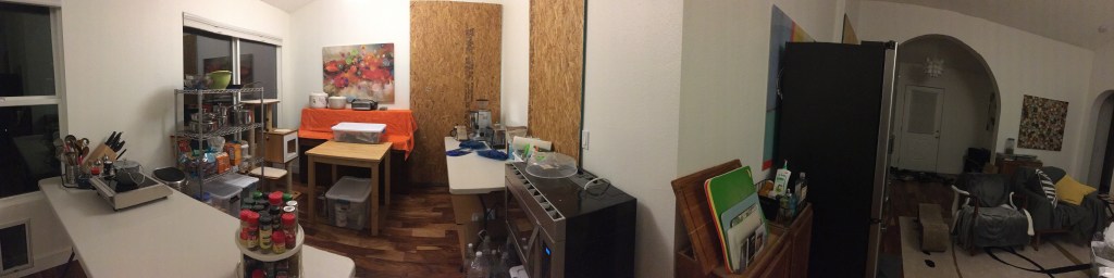
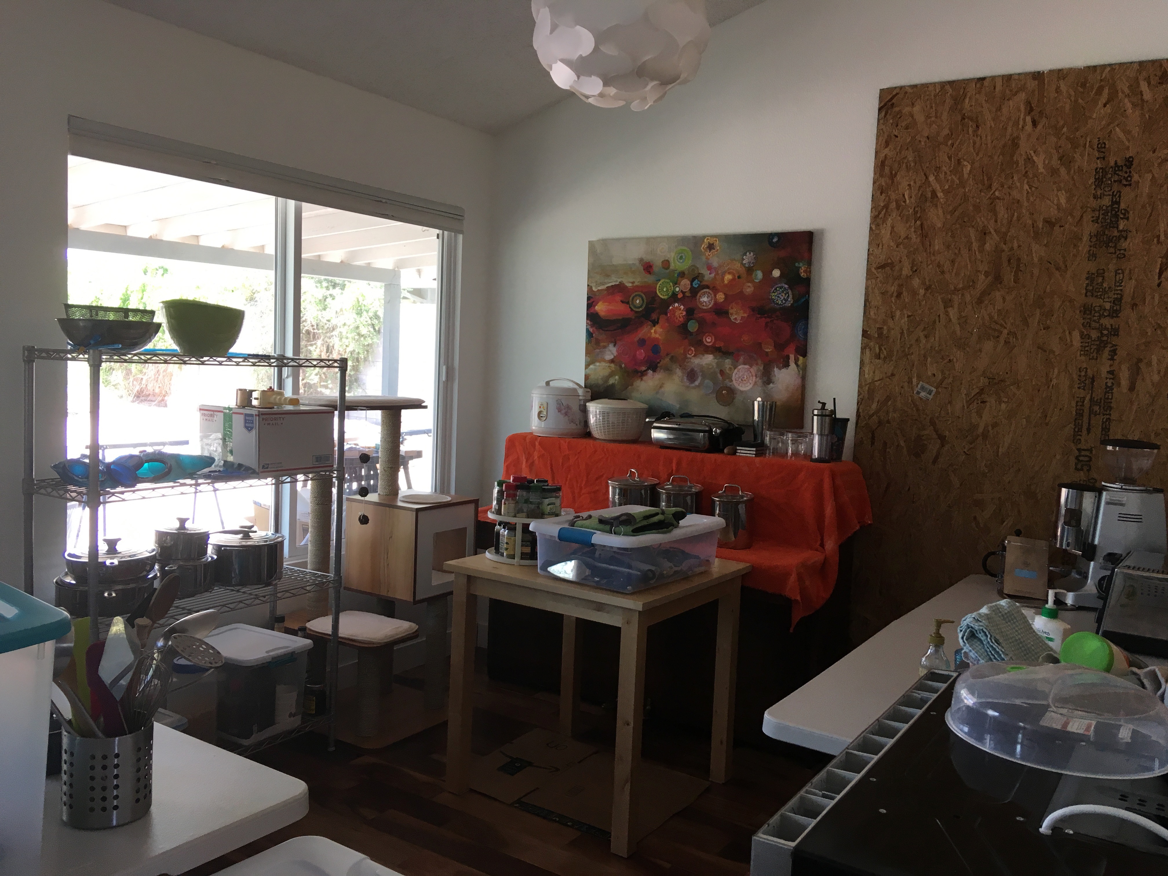
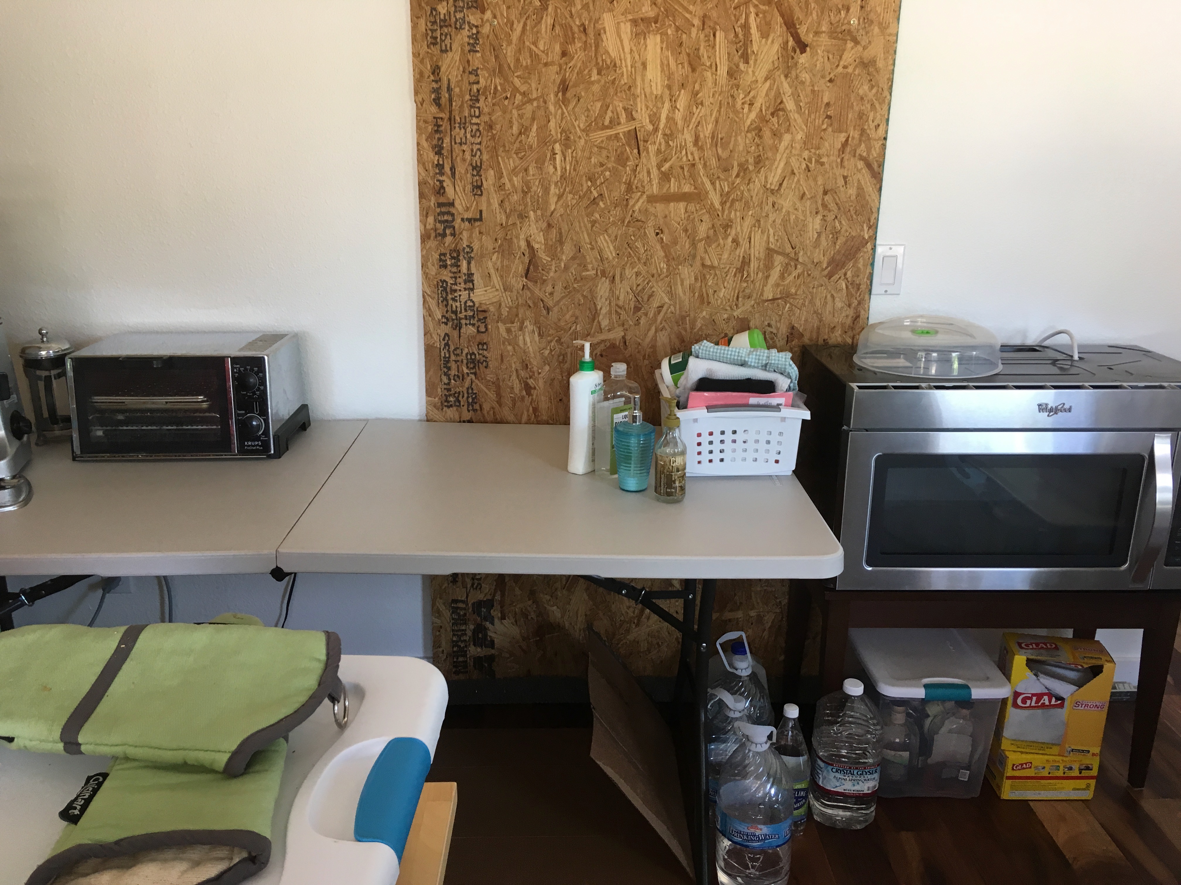
One challenge during the remodel process is cooking without a sink. I set up a temporary kitchen in our “piano area,” complete with a single induction burner, fridge, and microwave and a couple of tables that serve as countertops. I also found a lot of “one-pot” recipes that should yield simple meals.
Now, some pictures! Stay tuned for more…
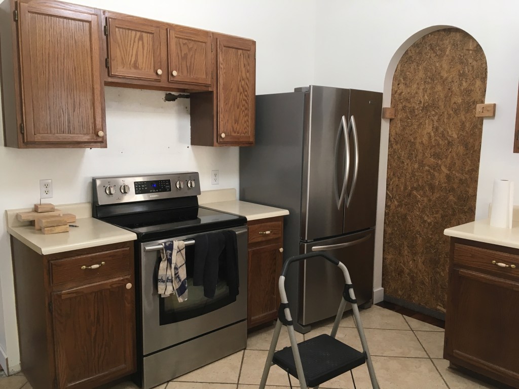
Tired cabinets (the arch is covered by a plywood barrier).
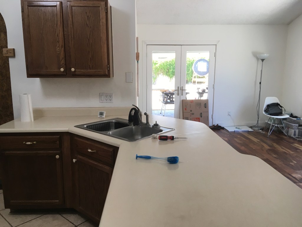
Another view of tired kitchen.
Goodbye old kitchen!
Makeshift pantry gone.
Old tile removed.
Kitchen door moved down a few feet.
Plumbing work for the island.
Temporary kitchen in main room. The plywood functions as dust barriers.
This weekend, I participated in my first obstacle race. The Rugged Maniac is “more than a just a mud run,” according to the website. And, after this weekend, I agree! The event consists of 25 obstacles spread out over 5 km / 3.1 miles. Obstacles included ones that you run over, run under, run up (or attempt to run up), and run down. There are also obstacles that are essentially large/high monkey bars suspended over mud pits (of course). For example:
Quadburners (basically little dirt hills that you run over)
Commando crawl (crawling through mud under barbed wire)
Jump start (run up to the obstacle, jump up and grab onto a rung, then climb over the top and down)
Claustrophobia (crawl through dirt tunnels)
Accelerator (basically a giant waterslide and the last obstacle of the course).
I did the race with a group of people from my gym and it was really fun! None of us trained for the event and none of us were “in it to win it,” i.e. seriously competing. We just wanted to have fun and get a good workout.
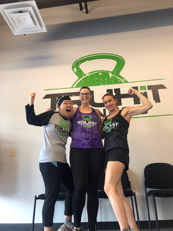
Me, Aurora, and Jessica (Jess is the owner/trainer of my gym) just before we left for the event.
My favorite obstacles included all the ones where I had to get into the mud (i.e. Commando crawl), the “Hell and High Water” (jumping from floating surface to floating surface while dodging swinging mats), and the Accelerator (I like waterslides!).
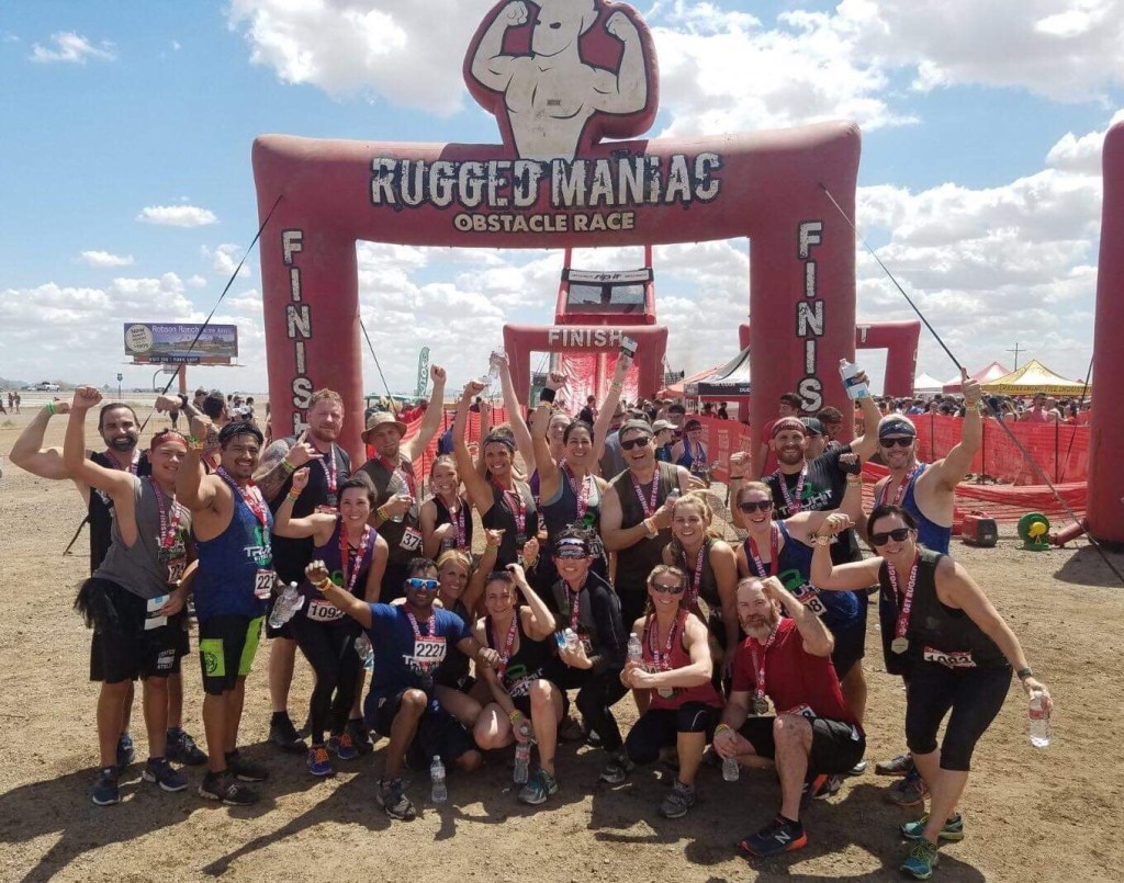
The whole crew after finishing the obstacle course. We are RUGGED MANIACS!The obligatory post-event glamour shot.
Other fun elements of the day included pull-up contests, a pie-eating contest, food trucks, beer vendors, and local merchants giving out free samples of their products. Anyone out there want to do this with me next year? You get a finisher’s medal, event t-shirt, a free beer, and a good workout! 🙂
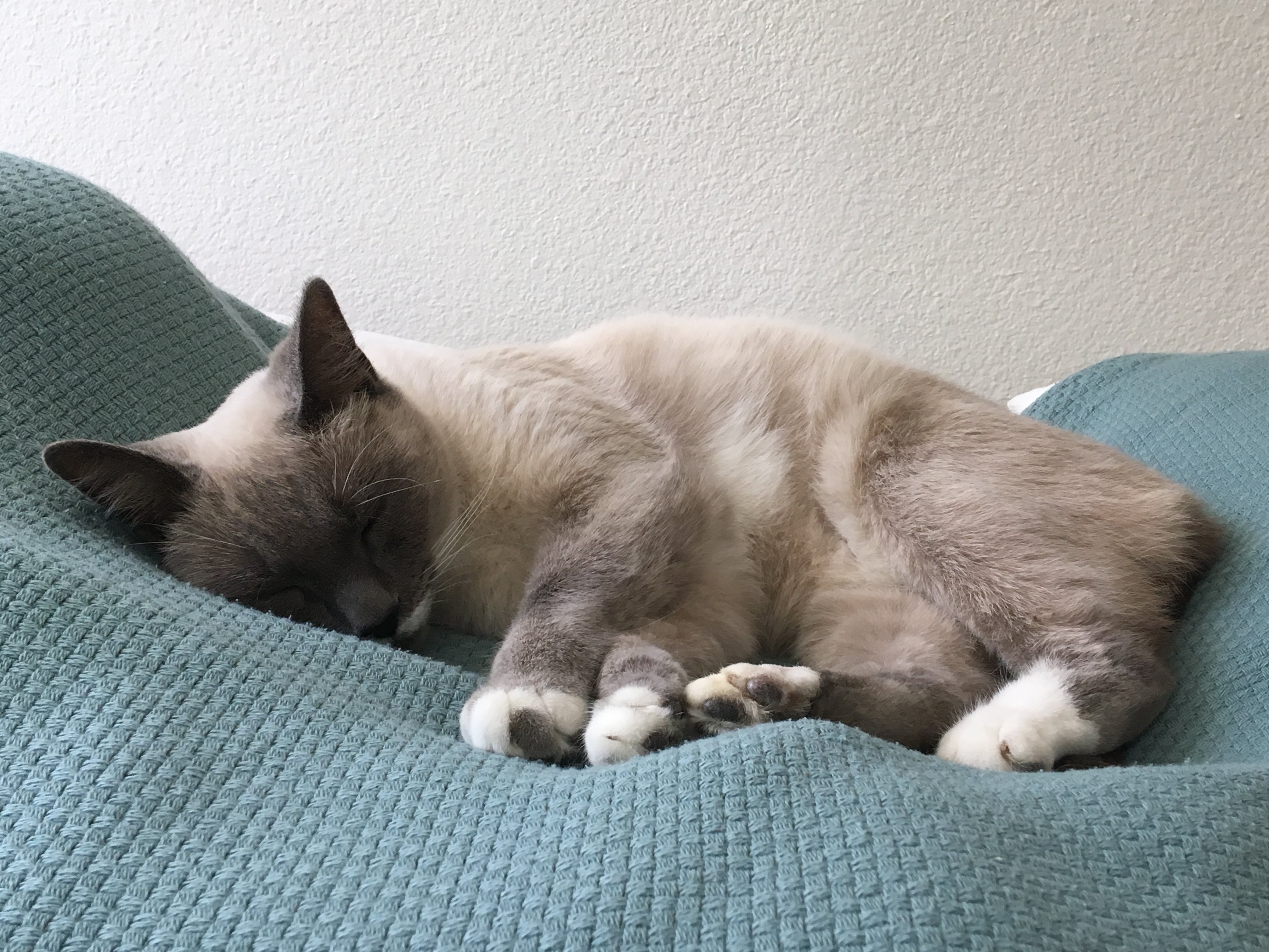
Ever since we adopted our (first ever) kitty, Simone, my SAT (self-appointed trainer) has been talking about getting a “friend” for Simone. I was much more hesitant about that idea because I wanted Simone to adjust more to our house and to us….and although I loved having Simone, the thought of another kitty seemed a bit daunting to me. What if the two don’t get along? Would we have to give up the second cat? What if the two take FOREVER to become, if not friends, tolerant of each other?
As a compromise, 2 weekends ago, we decided to check out a local pet rescue to learn about volunteer opportunities. Lost Our Home is a “no-kill” shelter that was founded in 2008 as a response to the recession at the time. A local mortgage banker noticed a lot of abandoned homes and animals; often times, the animals did not have access to any food or water. We were impressed upon hearing the story and wanted to give back to the community in a small way. (Plus, hanging out with cute animals is fun!)
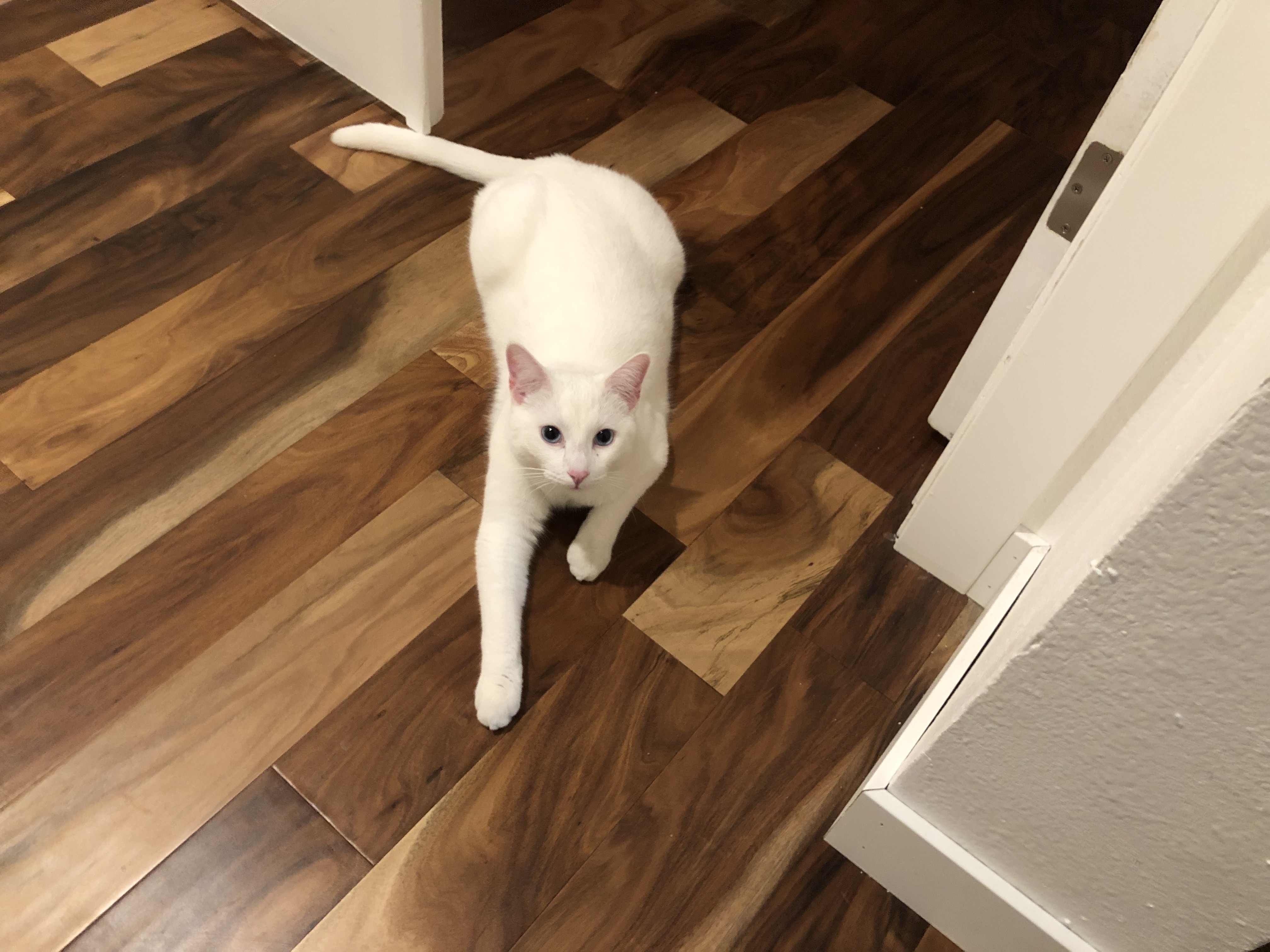
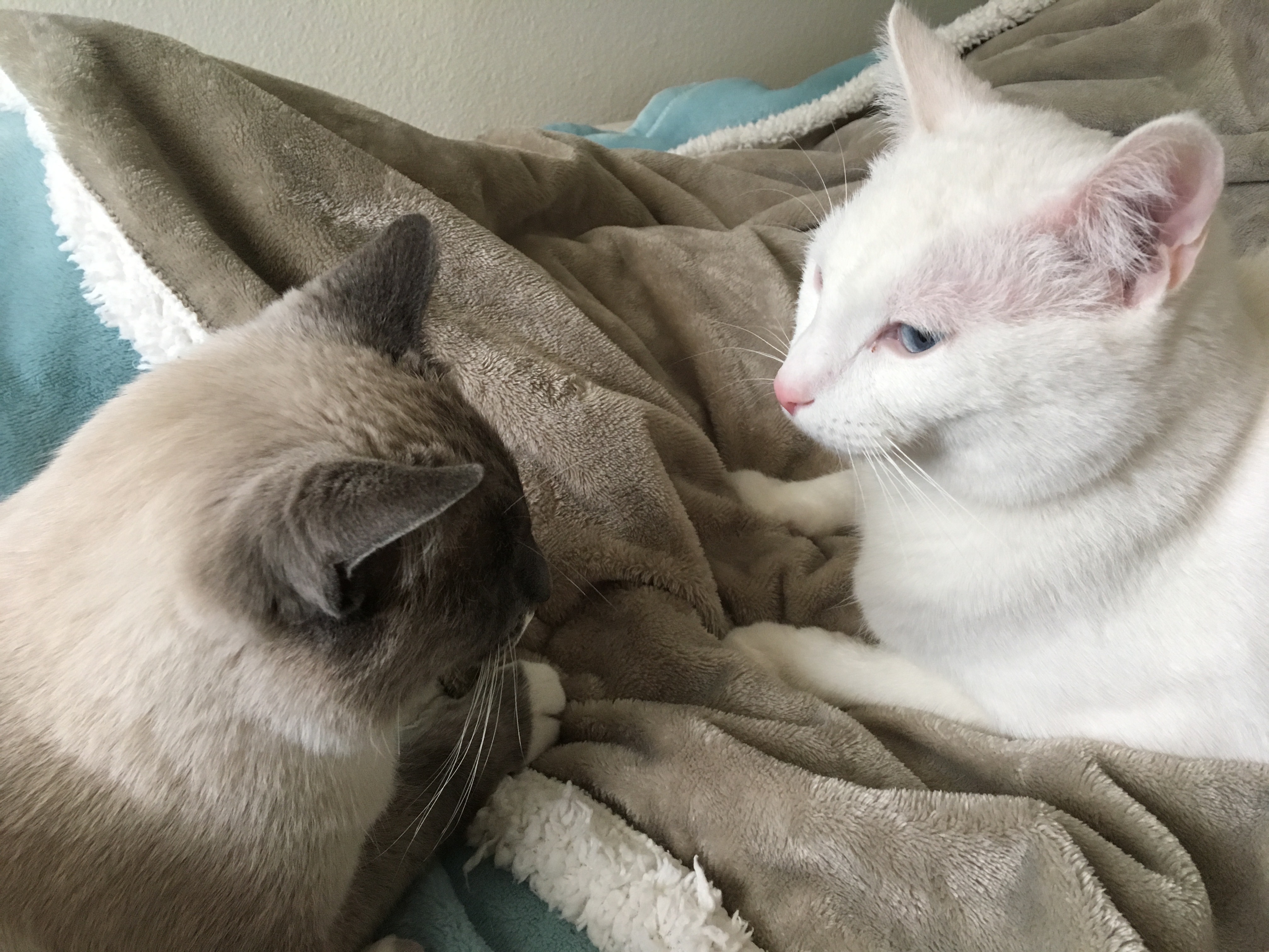
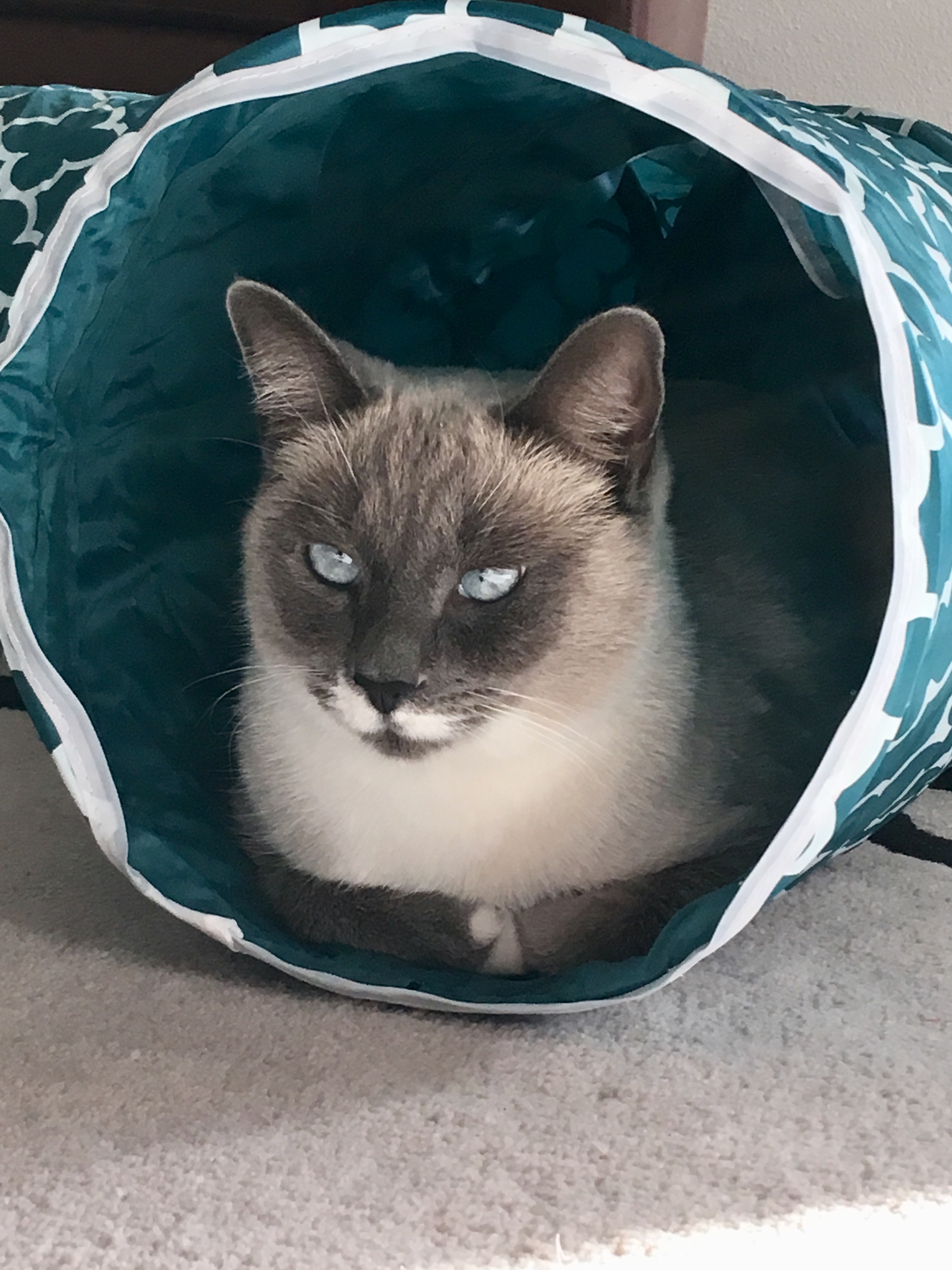
When we visited Lost Our Home, we checked out the “cattery” (i.e. the area in which the cats were housed) and saw a number of very social and charming felines, all available for adoption. One in particular caught my SAT’s eye: a striking boy named Jack. According to Lost Our Home, most white cats with blue eyes are deaf. Jack is a white cat with blue eyes who is not deaf….therefore, he is a “purrfect” specimen. He’s about 1.5 years old and is almost twice as big as Simone, weighing in at 14 pounds (she’s almost 3 years old and about 8.5 pounds).
Introducing Jack!
Well, we adopted Jack and started the same process with him as we did with Simone to begin acclimating him to our house (i.e. keep him in one room). However, it was more important to keep him in his own room this time because of Simone, who was showing territorial behavior. The first 3 days were a little rough: we kept Jack in one room the first night, then listened to him meow and meow. We would go and hang out with Jack that first night, where he would exhibit some signs of anxiety (pacing, frenetic head-butting, lots of vocalization). The second day and night was more of the same with the addition of cracking Jack’s door open so Simone could smell him (and sort of see him) better. That resulted in Simone hissing at Jack, her hackles rising, and her tail becoming really bushy, all classic signs of aggression. Jack just made some pitiful meows and stayed in his room. I actually spent the night in Jack’s room to try and comfort him.
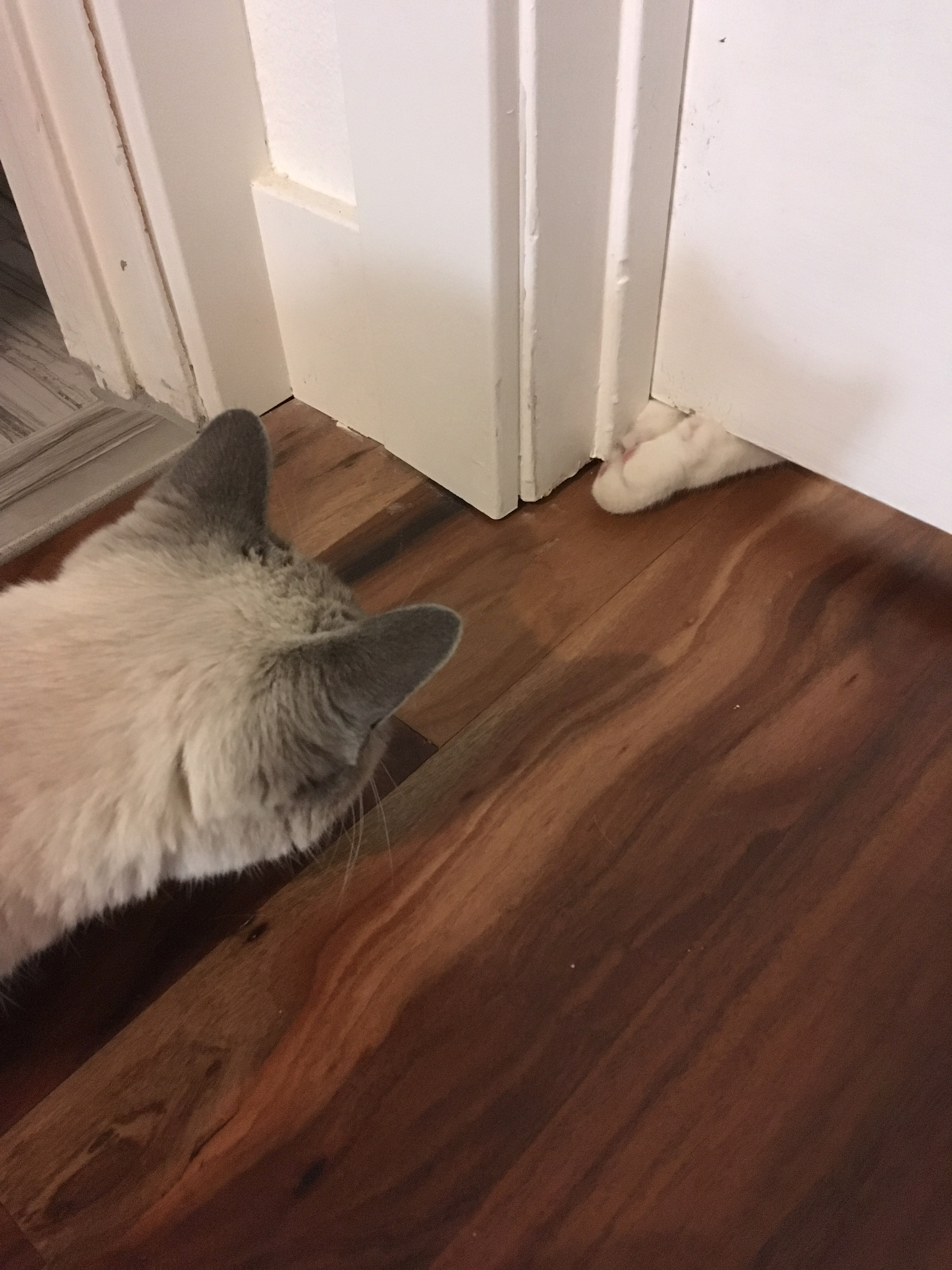
Who or what is THAT?
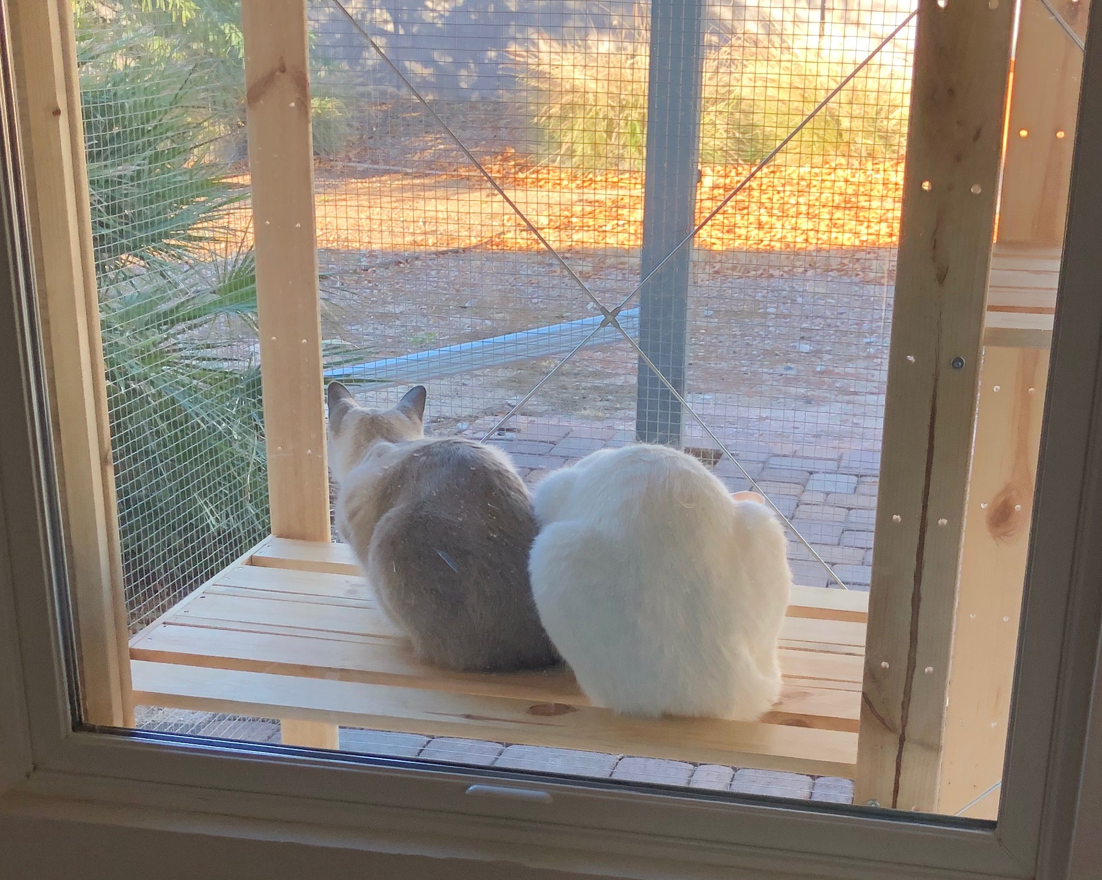
Day three: my SAT worked from home that day and was rather distracted by Jack’s constant meowing. During my commute home that night, my SAT called me and reported that the two cats were in the same room AND NOT KILLING EACH OTHER. Day 3 ended with both kitties on our bed. What??? Of course, there were a few not-so-nice interactions, mainly instigated by Simone, but ever since that night, the two have been existing in relative harmony. We’ve noticed their relationship developing really nicely and observed some key indicators that point to a good friendship: 1) they’ve chosen to use the same litter box, 2) they eat their food beside each other, 3) they sleep near each other on our bed during the day when we’re not home, 4) they sleep on our bed with us, and 5) they hang out on their “catio” together (a “catio” is an enclosed outdoor space for kitties).
Breaking bread together.Making music together. Hanging out on their catio together.Napping together (with the occasional conversation).
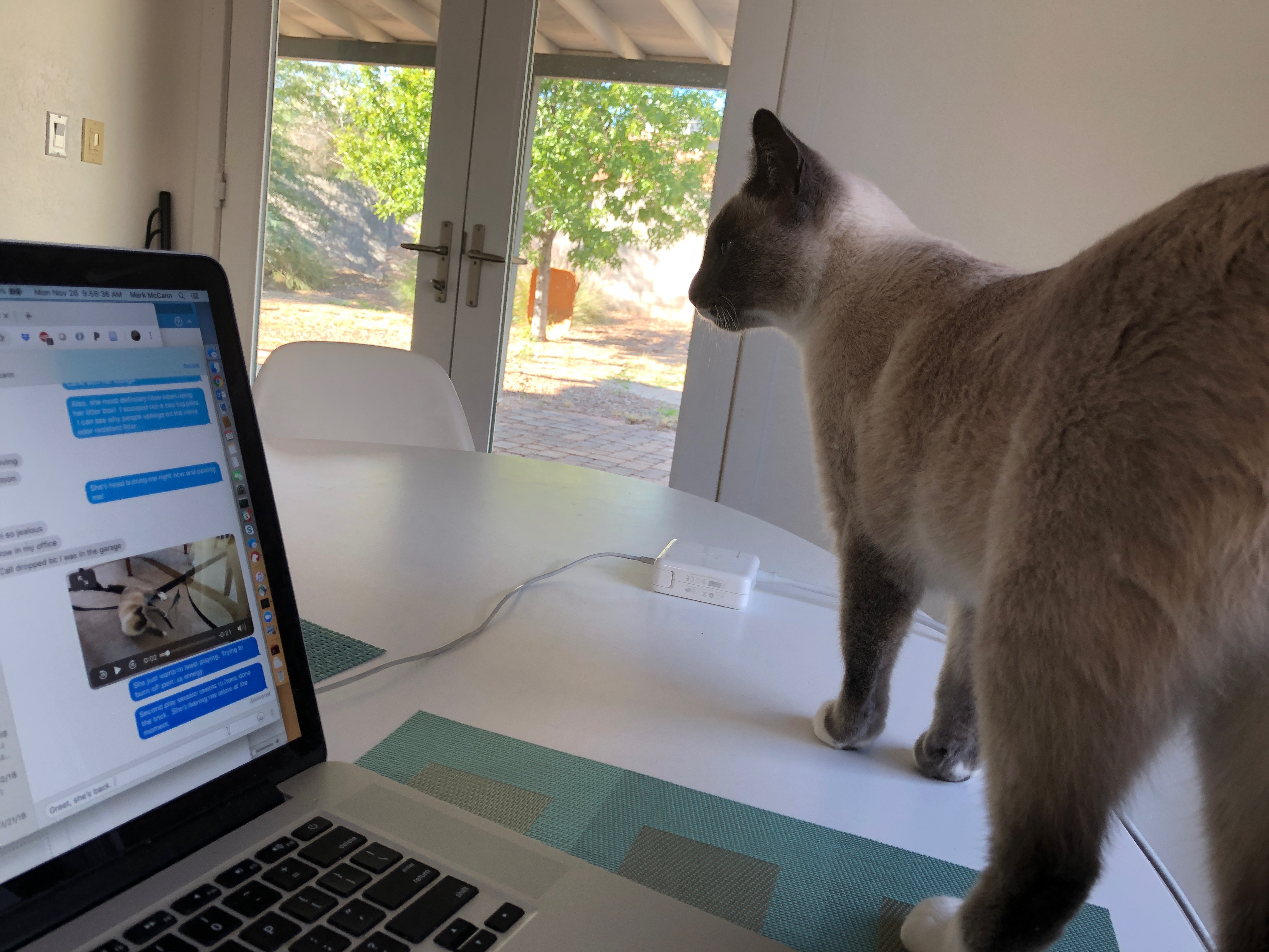
Jack is a friendly guy who LOVES to know what you’re doing at all times. If you’re in the bathroom, he will follow you. If you’re working at home, he will lounge by you. He’s always up for some petting and he always greets you when you come home. He’s also a little impulsive, sticking his nose into whatever he can get it into. I think he’s a good foil to Simone, who’s more reserved and cautious.
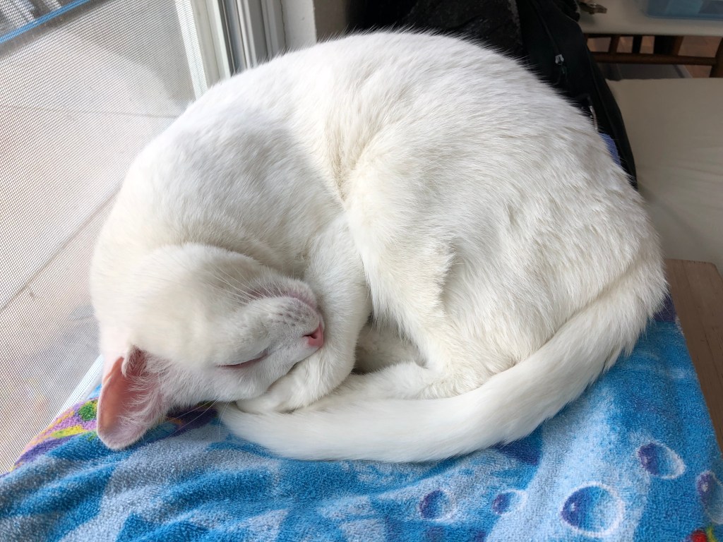
Hygiene is very important to Jack.Yoga cat.
It’s been really fun to see the two of them playing together and chasing each other around the house. They are both very lovable and we love them a lot! Now, maybe I won’t feel too guilty when I go on my next day hike or bike ride because the kitties have each other for company!
New adventure! We got a kitty! Her name is Simone and, as the blog post title indicates, she’s perfect. 🙂 My SAT (self-appointed trainer) and I both like animals and have been talking about adopting a cat for a while now. I learned about Simone at work: my coworker and her sister rescued a little kitty in their neighborhood and fostered her for the past month or so. (They think she was abandoned.) They initially thought the kitty was a boy, so they named him “Simon.” When they took Simon to the vet, they learned that he is a she and rename her “Simone.” The vet also told them that Simone is about 2 years old and is a blue point Siamese. My SAT and I met Simone almost 2 weeks ago and picked her up this past Sunday. We’re head over heels for her.
Simone is a pretty kitty, if I do say so myself, and has been revealing an inquisitive, affectionate nature. She’s shy and skittish now, but I hope that over time, she’ll get used to loud, unexpected sounds, like the doorbell or the garage door opening and closing. I love it when she head-butts me, demanding attention, and when she purrs because that is one of the best sounds ever.
Side benefit of having a kitty? We’re cleaning our floors more! (Note to self: get lint rollers.) Drawback of having a kitty? How am I supposed to leave her all day to do all-day hikes and bikes??
Long post ahead! For the short version, here’s the summary: “No pain, no (elevation) gain.” 🙂
~~~~~~~~~~~~~~~~~~~~~~~~~~~~~~~~~~~
Way back in September, I mentioned that I was starting to organize my DIY version of the Phoenix 7 Summit Challenge. I’m so very happy to report that my hardy band of hikers successfully completed the challenge this weekend. Who knew I had so many friends who like to spend their free time hurting themselves?
For those unfamiliar with the summit challenge, the purpose is to hike 7 different summits in Phoenix in one day. The day is like a pub crawl, except instead of driving to different pubs to drink different drinks over the course of a night, hikers drive to different trailheads to hike numerous trails over the course of an entire day. Which sounds more fun to you, my dear readers? 😉
The hikes range in length from 2.8 miles to 5 miles and elevation gain per hike varies from 340 feet to 1000 feet. At first glance, the idea of doing the complete summit challenge seems doable…until you get to hike #6 and your brain is thinking more of the food you want/need instead of moving your feet step by painful step. But, I digress. Total cumulative distance for all 7 hikes is 25 miles and total elevation gain is 5000 feet (1524 metres, for my Canadian friends).
Now that the details are out of the way, I’ll get into a play-by-play of the day (yes, rhyming is intentional):
Alarm goes off at 4:30am. Groan, shut off alarm, stumble out of bed. Be thankful I packed up everything the night before. Too bad my SAT (aka, “Self-appointed trainer”/husband) didn’t. Watch my SAT scramble to get his stuff together, as usual. Get annoyed.
Leave home at 5:07am for the first trailhead/meeting place: Apache Wash, way north in Cave Creek. Arrive there at 5:45am.
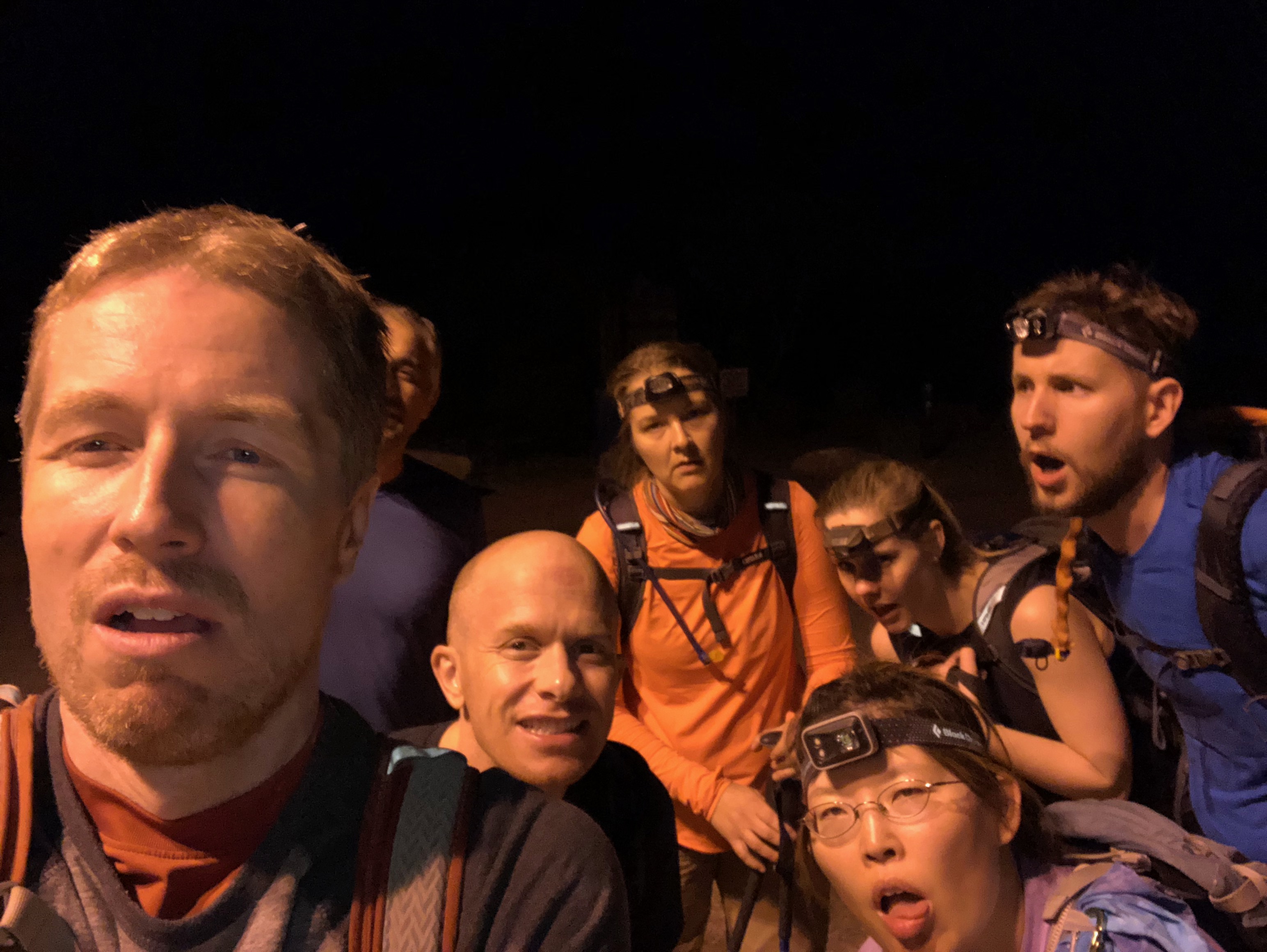
After making sure everyone is present, headlamps are working, and trail located, my valiant group of 9 hikers starts our day-long adventure shortly after 6am.
Sunrise during our first hike.
The Apache Wash trailhead is where our first 2 hikes occur (Apache Vista and Ridgeback Overlook). Both of these hikes are pretty gentle and are a good way to warmup. (It is possible that the “friendliness” of these first 2 hikes is a little misleading….but I’ll get to that later.) One of my personal highlights of the day was seeing all the colorful hot-air balloons:
Silhoutted hot-air balloon.
So cool!
I felt like we could almost jump into the balloons!
Second summit selfie.
Drive to the 3rd trailhead, Deem Hills. Stuff face with food during drive. Arrive at the trailhead, use the restrooms, get the backpacks organized, and start hike #3. Observations: Deem Hills has a great dog park! Also, because we were now hiking in full daylight, we could see a TON of caterpillars on the trail. Not sure if there were that many caterpillars on the previous 2 trails, since we didn’t have as much light, but wow, we sure saw a lot of those critters.
The wonders of nature.
Hike #4 is Lookout Mountain and it is aptly named. The summit gave us fantastic views of the city (i.e. “lookout”). I liked the tiny little scramble to the top–thank you, palo verde tree for providing a strong foothold! This hike started off nice and flat….then it became vertical. At this point, I remember thinking how long ago the Apache Wash hikes were (and how gentle and lovely and easy they were…). I believe we finished hike #4 just after 12 noon.
#4 conquered! (Megan was already on the way down at this point!)
Views from the summit of Lookout Mtn.
Another summit view.
A 3rd summit view.
OK. So, hike #5, Shaw Butte, felt really hard to me. Maybe it’s because I already hiked 4 hikes by this point? Or, maybe the driving around gives me enough time to stiffen up (getting old isn’t fun!!)? Whatever the case may be, my legs weren’t happy with most of the Shaw Butte hike, mainly because the trail consisted of a(n) (annoying) gravel road that was fairly steep. I think this hike was when most of us started talking about what we wanted to eat when we finished the day (burgers and fries was the #1 answer, with the #2 answer being “food”).
We’re still smiling…at least on the outside…
Look at the city!
I think hike #6, Dreamy Draw, is the prettiest one. We were a tad confused about which trail to take (wasn’t super clear on our trail map), but our “walking GPS,” i.e. Skyler (he made gpx files for his GPS), led us to our goal. I’d like to come back and explore a bit more because what I saw was really nice.
Thankfully, this sign was NOT applicable!
Pretty green everywhere.
Summit block.
FINALLY. Hike #7, Holbert trail in South Mountain. Honestly, I think we were deep in the “grin and bear it” stage. We were in the home stretch. It was about 4:30pm when we started our last hike and we were tired and sore and questioning (again) our decision to do this challenge. But, we soldiered on. The Holbert trail is essentially a long staircase; the trail is rocky and features SO MANY BIG STEPS. Not gonna lie, I was getting mad at the trail for having so many big steps. Yes, I realize the previous sentence makes no sense….I mean, why should I get angry at an inanimate trail? (Answer: because I could and because I was tired of feeling tired.) However, since this challenge was my idea, I needed to pretend to be positive. (I think that worked.) Sooner than I thought, we reached the summit of our last hike and were rewarded by some great views.
7 tired hikers at the top of the 7th summit. Back row, L to R: Mark, Skyler, Jodey, Stevo, John. Front row: Megan, Karen.
Sunset is starting.
Dobbin’s Lookout (stone house)
The hike back down to the trailhead was slow and painful, mainly because it was getting dark and because of those DUMB BIG STEPS. I started singing that classic motivational song “99 Bottles of Beer,” but that didn’t have the intended motivational effect I hoped (sorry Jodey and John! I tried!).
Phoenix’s night lights.
Skyler and Megan saw a scorpion on the way down!
Just before 7pm, the group stumbled back to the cars, grateful to be alive…er, very happy to be done. We mustered up the energy to take one last group selfie and to decide upon a place to get food:
WE ARE DONE.
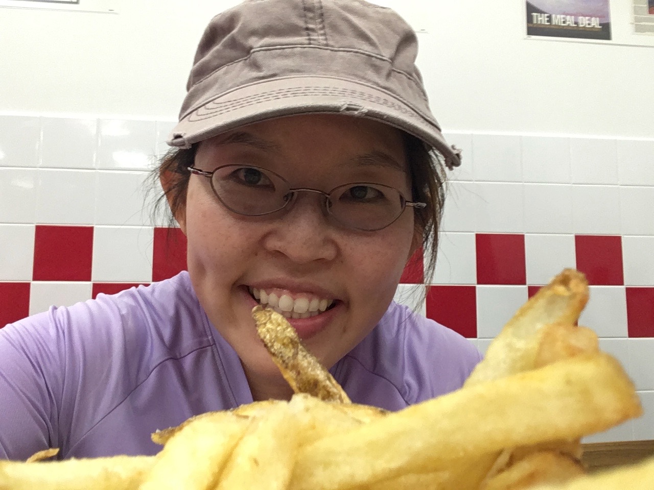
The best part of a long day playing outside is the food you get to inhale afterwards. In our case, we drove straight to a nearby Five Guys for burgers, fries (!!!), and milkshakes. Heaven.
The best fries I’ve had in my life. I may not be exaggerating.
~~~~~~~~~~~~~~~~~~~~~~~~~~~~~~~~~~~~~~~~~~
Would I do anything differently?
*Before I answer the above question, I want to say that most of the group WANTS TO DO THIS AGAIN. I think I have an annual event on my hands!
Did I learn anything for next time? Yes. In no particular order:
I can eat really fast.–I wolfed down food during the drives in between the hikes. I surprised myself.
Bring blister tape, or bandaids.–I got a blister, nothing major, but a little uncomfortable.
Make transition times shorter.–By “transition times,” I mean the time in between the hikes. Maximize the drive: eat your food (see point #1), hydrate, get whatever you may want/need packed in your backpack. When you arrive at the next trailhead, go to the restroom as soon as you get there, not after everyone else has. Basically, think ahead about what you need to do and do it quickly. I’m not sure how much time was lost due to transitioning from hike to car to next hike, but I’m pretty certain transition time can be cut down, which would make the whole day shorter (and food acquisition earlier).
I think I’d rather do my DIY version of the summit challenge!–I’d rather drive around and hike with fewer people on the road/trails.
If possible, schedule next year’s summit crawl during a long weekend.–It’s so nice to have an extra day to recover and relax!
Prepare my own GPS maps.–I was lucky this year because Skyler did all that. But, what if there’s no Skyler next year? I can’t assume that someone else will do that. Note to self: PREP MY OWN GPS MAPS.
Bake more pumpkin bread.–I made some pumpkin bread for the group. They liked it. 🙂
I didn’t do a big hike last weekend due to the torrential rain (really! Phoenix does get rain and we’ve had a lot of rain this October, so much so that this month has been the 3rd wettest month in state history). However, yesterday was a great day, so I chose to do a solo hike up Mount Ord near Payson. Longtime blog readers (all 5 of you?) may recall that my SAT (self-appointed trainer) and I hiked Mount Ord earlier this year, enjoying a good climb, better views, and junk food at the summit. I really enjoyed the hike and thought it would be a good training hike for my DIY summit challenge.
I had a great hike. The temperature was around 19-20 C/high 60s F, which felt amazing, and there was green everywhere due to the recent rains. The scenery was lovely, even though there were no purple bushes like last time. My legs felt strong due to the hiking training I’ve been doing and I believe I kept a pace of at least 2.5 mph according to my GPS. My GPS also said that my total mileage was 15 miles and almost 4000 feet of elevation gain, which was a little off of the statistics the last time I hiked Mount Ord. As a treat, I brought some pizza and a Coke for my summit snack, like last time.
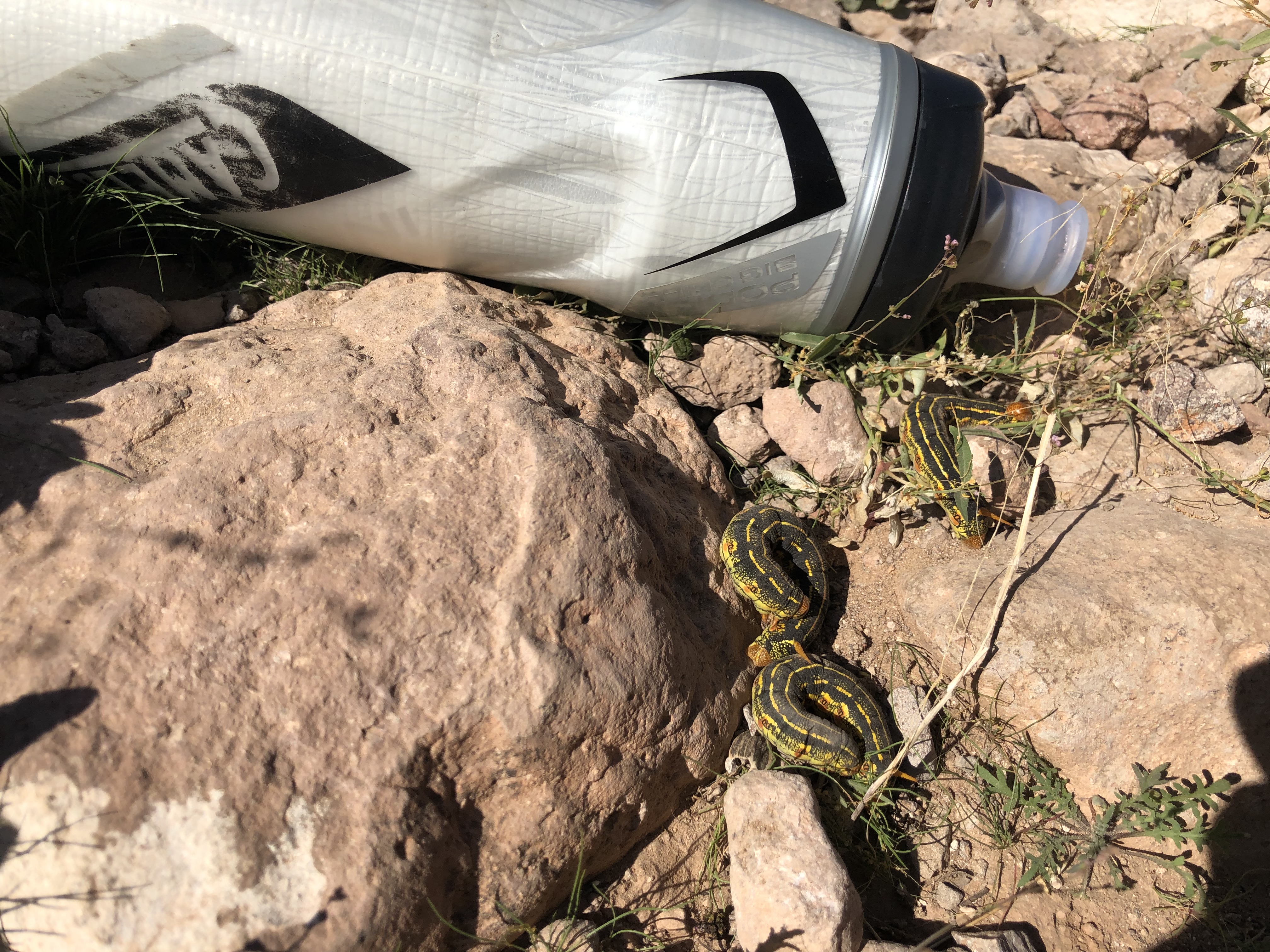
What I saw yesterday that I did not see last time were 2 snakes and 1 tarantula. I almost stepped on the first snake, because I thought it was just a piece of wood….then I noticed some spots and a forked tongue….!
The second snake scared me a bit because I did NOT notice it until I heard its rattling. I was listening to a podcast and was pretty focused on it when I noticed a weird rattling noise. My internal monologue kind of went like this: “What’s that weird sound? It’s not in the trees…..or on my right…or AAACK!!” The rattlesnake was maybe 3 feet to my left and it was upright and looking kind of territorial. I backed away slowly, then took a quick video of it (because if something isn’t captured on social media, it never happened). (I only took a video of the 2nd snake, i.e. no photos.)
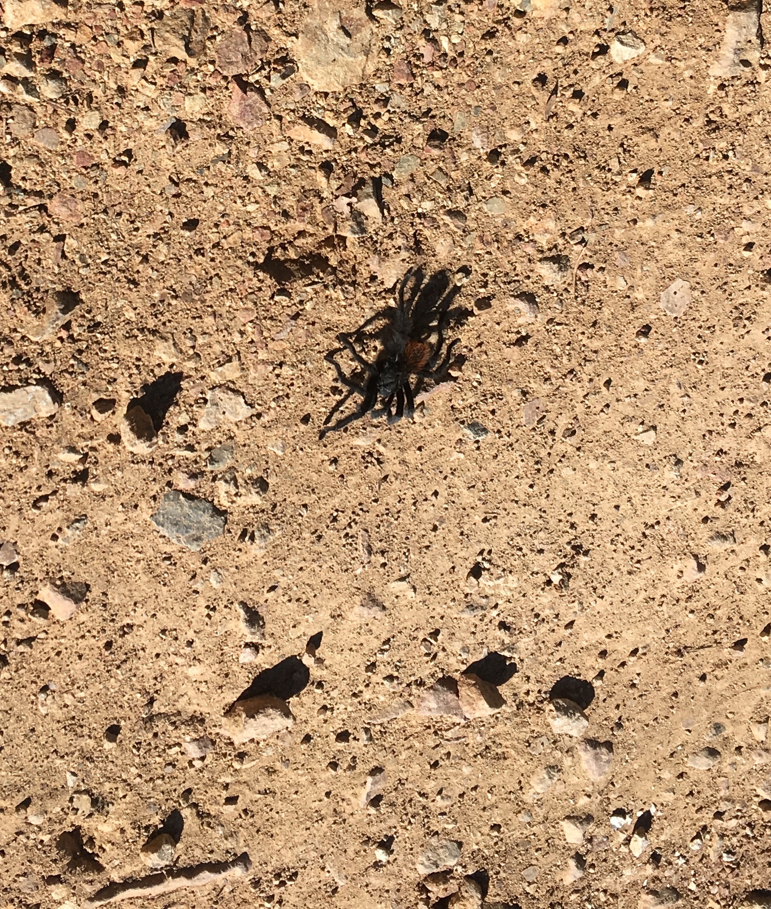
My third encounter with a creepy crawly thing was with the tarantula. It was scrambling across the road minding its own business. I’m not a fan of spiders, but got over my initial “ick” factor to document it with my phone.
All in all, I got some great training in, my legs feel totally normal today, I got to see some wildlife up close and personal, and got to eat junk food. It’s a win!
Beautiful view from the summit.
Look at the blue sky!
I really like the color contrast.
Super green vegetation due to the recent rains.
Me and my (baby) Coke!
*”Slytherin,” of course, refers to one of the 4 school dormitory houses in the Harry Potter universe (Gryffindor, Ravenclaw, Hufflepuff, Slytherin). The Slytherin house mascot is a snake and typical characteristics of Slytherin students include cunning, resourcefulness, and ambition. The main villain of the Harry Potter universe is Lord Voldemort, who is a Slytherin and could talk to snakes. For the record, all online “sorting” tests I have taken indicate I am a Gryffindor (courage, chivalry, determination, and just plain cool). I believe my snake encounters yesterday prove my courage and my photos/videos prove my determination to capture the best and most interesting content for my readers. I cannot communicate withs snakes, although I DID verbally express my gratitude to the 2nd snake for letting me know it was there, i.e. rattling!
Remember when I said in my last post that I was planning a DIY hiking event? Well, it’s (still) on and I did a training hike yesterday which felt really good and I’m still feeling kind of proud of myself for doing it.
This weekend is a long weekend for me, as Monday is Columbus Day/Indigenous People’s Day (choose your preferred name), so my first thoughts were “when should I hike?” and “what should I hike?” I was suffering from indecision until late Friday night, when I decided to do a solo hike of a loop trail in South Mountain: the Pyramid–National trail–Bursera (PNB) loop. Total distance is about 11 miles/18 km and total elevation gain is almost 2500 feet/762 m.
My thought was that if I finished that hike and could walk somewhat normally the next day, I would probably be able to finish my DIY hiking event. Well, I did finish my hike yesterday and I can actually walk normally today, so I’m cautiously confident that I will be able to finish the 7 hikes in my DIY event in one day. (I’ll continue training over the next month, though….I don’t want to assume anything!)
(FYI, the statistics for the PNB loop hike are just under half of what I would complete if I successfully climb all 7 summits in my DIY challenge. I suppose one could consider my PNB loop hike a test of my current fitness. I would say that I passed.)
I really enjoyed my PNB loop hike and REALLY REALLY enjoyed the cooler temperatures! The high temperature yesterday was only 28C / 82F….I started hiking at 7:45am because I didn’t have to start my hike at some awful early hour to avoid the heat….there was a nice breeze….the ocotillos were so green because of the recent rains we’ve received….it was just a nice morning. I even brought a baby Coke with me as a “halfway point” reward. As usual, it tasted AMAZING. It’s the little things in life!
Happy September, my dear readers! I hope your September is cooler than mine; although the calendar indicates that it is now autumn, here in Phoenix, the average high temperature is still hovering around 105F (40C), which sadly is lower than last month.
GO.AWAY.SUMMER.
Despite the summer-in-fall temperatures, I’m managing to look ahead to winter-in-Phoenix, i.e. November, and all of the lovely opportunities to play outside ANY TIME OF THE DAY. It will be SO NICE not to wake up at some unearthly hour just to breathe fresh air and not get baked/fried by the sun.
(Can you tell I am tired of the heat?)
One opportunity to play outside is Phoenix’s annual “7 summit challenge,” which occurs in mid-November. This event challenges hikers to hike 7 different summits in the Phoenix metropolitan area in one day. If successful, hikers will have hiked about 25 miles (40 km) over the day, achieving about 5000 ft (1525 m) of elevation gain. My SAT (self-appointed trainer) and I were on holiday in Canada when registration opened up, so we missed our chance….or did we? I really wanted to do this event and thought that I may as well organize my own DIY 7 summit challenge. (Why pay good money to hurt yourself when you can do it for free?) I’m currently in the initial stages of finding other willing “hiker-victims” and mapping out logistics.
Of course, in addition to planning my actual DIY summit challenge, I have to train for it. A friend suggested hiking Camelback mountain yesterday, a very popular local hike. Hikers can use 1 of 2 trails to the top, both of which are short (each trail is about 1.25 miles long) and steep (~1700 ft gain for each trail). However, instead of hiking up one side, she said we should do Camelback “over and back,” i.e. hike up one side and down to the bottom of the other side, then back up and over to where we started. “That sounds good!” I said.
The reality:
Start hiking at 5:50am, i.e. before sunrise. Temperature was in the low 70s/25C, so was bearable. Not having the sun beat down on you was also nice.
Watch sunrise! This was pretty and (almost) made the ridiculously early start (almost) worth it.
Become hot, sticky, and sweaty. Remain hot, sticky, and sweaty for the rest of the hike.
Worry about the possibility of falling and not being able to get back up due to leg cramps, fatigue, and general crankiness.
Cry with joy (internally) when we reached the car.
As a post-hike treat, I packed some baby Cokes into a little cooler bag. THAT WAS AMAZING. Do not underestimate the power of sugary carbonated liquid….magical.
I’m happy to report that my legs are still in working order and I’m looking forward to getting myself into better hiking shape so I can conquer the 7 summits….stay tuned. 🙂
On Saturday, my hiking trio (my SAT–self-appointed trainer–Ian, and myself) drove up to Payson to hike the Barnhardt trail. My longtime blog followers may recognize that name; it was only in January when we summitted Mazatzal Peak. Part of that hike included the Barnhardt trail, but unfortunately, we only got to experience the trail at the end of our hike, which meant a lot of what we saw looked like this:
My memories of Mazatzal Peak are not warm and fuzzy. They are cold, painful, and bring tears to my eyes. In an attempt to exorcise those unpleasant memories and to create new, positive ones of the Barnhardt trail, I suggested we hike the Barnhardt trail in daylight.
We started on the trail around 7:45am and the temperature was in the mid 70sF. It was still fairly humid, though, so I wasn’t feeling as cool as I would have liked. The trail is very pretty and we saw lush green vegetation all around us, due to the recent rains. We even saw some gorgeous butterflies enjoying the breeze. For the record, we did NOT see any gorgeous butterflies the last time we hiked this trail.
Beautiful butterfly on Ian’s sock.
SO GREEN!
Pretty sky.
More green.
I like the colour contrast between the green vegetation and red rocks.
I’m not sure how far we went, as there is no summit point for the Barnhardt trail (this trail connects up with numerous other trails but does not lead up to Mazatzal Peak or any other peak), but according to Ian’s phone GPS, when we were almost at 6000 ft, the humidity was gone, leaving nothing but fantastic temperatures with a lovely breeze. Don’t forget the pretty views! I think we probably hiked about 4 to 4.5 miles when we decided to stop for a quick snack break before heading back down to the car.
Panoramic view.
My Coke says it all.
A strange fruit we saw on a bush where we stopped for a snack.
Required selfie.
A cool grotto off to the side of the trail near our snack spot.
Did this hike erase my previous memories of the Barnhardt trail? No, not really. While hiking, I couldn’t help compare my previous and current experiences:
darkness vs light;
cold vs warm(er);
painful vs pleasant;
lost vs not lost;
no Coke vs Coke;
no one read the hike description vs I read the hike description; and
angry/in despair/scared vs happy knowing that our lives were not in danger (that is not a joke).*
In any case, I enjoyed THIS hike on the Barnhardt trail and am looking forward to Phoenix’s winter and all the great hiking that awaits us!
Summer in Phoenix is not a joke. It is “normal” to have temperatures of 95F (35C) by 7am. But “normal” does not mean “enjoyable.” The heat gets oppressive, which means Phoenicians have to find places to escape to, if only for a few hours. That’s what we did today–we drove up to Pine (about 1 hr 45 minutes’ drive from home) to hike the Pine Canyon Trail, with our friend, Ian. Best part of the day? Hiking in the morning without the danger of heatstroke. Second best part of the day? Drinking my can of ginger ale (I didn’t have any baby Cokes!).
The Pine Canyon Trail starts at the aptly-named Pine Canyon trailhead, just outside of Pine, AZ. Ok, so the names aren’t the most original, but they work! Some online hike descriptions say that the distance end-to-end is 8 miles, while other descriptions say 12 miles. If one were to hike the trail “out and back,” that would have been a minimum of 16 miles, a distance none of us were ready to do today. So, we decided to hike about half of the trail, then turn around and hike back to the trailhead, for a total of 10+ miles. The trail is well-marked, easy to follow, and features a gradual (i.e. gentle) incline (at least, the first 4-5 miles we did were gentle).
It was a lovely day, with lots of pine trees, some manzanita trees, and lots of greenery due to the recent rains. Also, Pine is a lot closer to us than Flagstaff, which is the more popular escape option for Phoenicians in the summer. I can’t wait for the fall…!
Pine Canyon Trail is part of the Arizona Trail, a 790 mile trail that bisects Arizona.
What the heck have I done the past few months? Nothing exciting, which is why Memorial Day weekend was great! My SAT (self-appointed trainer) and I joined our friends Carl, Lifan, Steve, and Ian for our (sort of) annual mountain biking camping weekend near Prescott. I did go on a few “training” mountain bike rides in anticipation of the Memorial Day weekend trip, during which I saw a gila monster (!) and saguaro cacti in bloom:
A gila monster! So cool!
Pretty saguaro cactus blossoms.
Currently, there are fire restrictions in place all around Arizona, which means camping spots are super limited. A lot of campgrounds are closed, including most primitive camping areas. However, we decided to do the primitive camping thing at Thumb Butte, which was open (the fire pits were taped up as a visual reminder not to start campfires).
The temperature was lovely and cool, albeit windy (the highs were in the high 60sF/low 70s….a.k.a. low 20s celsius). I was actually cold and delighted in wearing my favourite puffy jacket.
Phoenix has been heating up a lot lately, i.e. we are basically back to cookie-baking temperature now, so enjoying the cooler weather in Prescott was a treat. Being outside at noon is always more fun when you’re not concerned about heatstroke.
The happy group.
More proof that I actually ride a mountain bike!
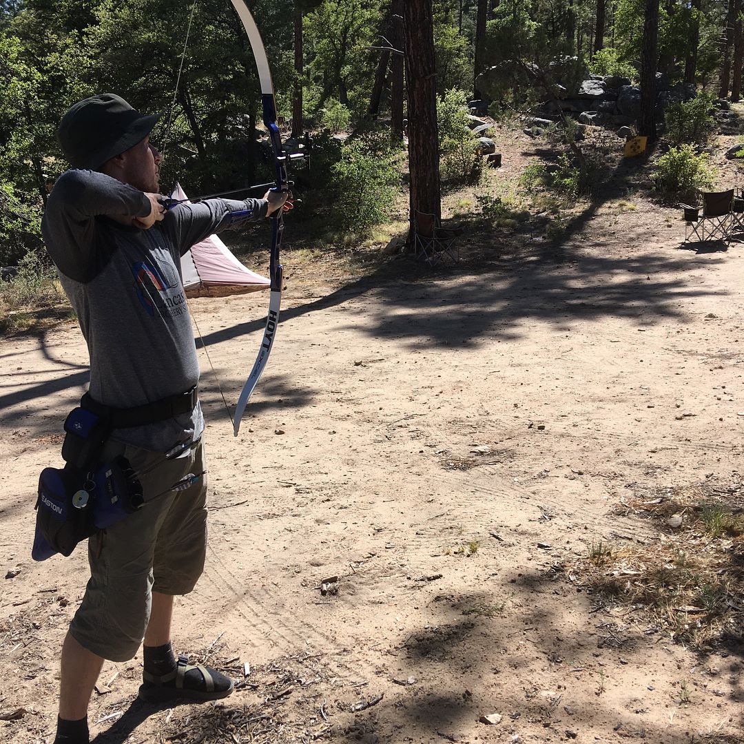
My SAT has gotten into archery recently, and brought his bow, arrows, and practice target on the weekend to practice. Here he is, pretending to be Robin Hood:
Whenever we camp with our friends, one of the highlights is making s’mores around the campfire. Sadly, that did not happen this year due to the fire restrictions. However, Lifan made some s’mores bark that was absolutely delicious! I would have included a photo of the bark, but we ate it too quickly. I am DEFINITELY making some s’mores bark for the next camping trip, even if campfires are allowed.
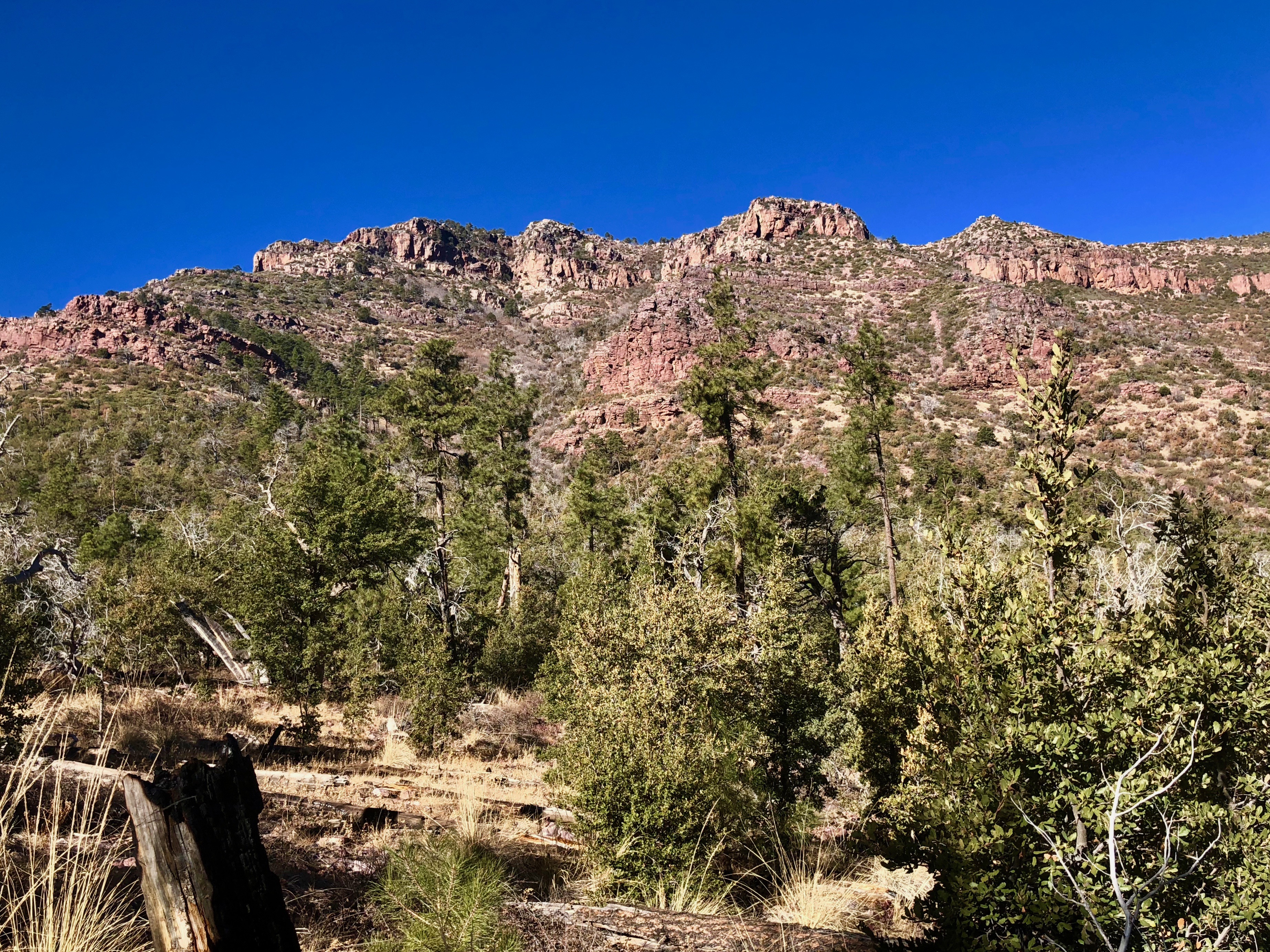
Yesterday, we (me, my SAT–“self-appointed trainer”, and our friend Ian) joined another Meetup group on a hike up to the highest point in the western Superstition mountains: Superstition Peak 5057. Not the most creative name for a peak, but it’s definitely descriptive. As you may have guessed, the elevation at the summit is 5,057 feet. (Official statistics from hikearizona.com: 7.8 miles round-trip and 3000 feet elevation gain.) It was a lovely day with good company, beautiful views, and an actual TRAIL! Another bonus of hiking with this Meetup group vs the last one: we took a few breaks! That last point is really important because that meant I could breathe.
We started from the Hieroglyphic trailhead in Gold Canyon, so named because of the petroglyphs you will see:
Waterfall and pool area in Hieroglyphic Canyon.
Petroglyphs!
(Clarification point: “hieroglyphs” refer to stylized pictures of objects that represent different words, syllables, or sounds, as found in ancient Egyptian and other writing systems. “Petroglyphs” refer to rock carvings, especially prehistoric ones. I think that the specimens we saw are actually petroglyphs because they looked more like rock carvings than a quasi-writing system, but I’m not an archeologist.)
After the canyon, we followed the trail up to the saddle. The trail is fairly steep the whole way, but the group took a few breaks to breathe, regroup, and enjoy the views. Some online hike descriptions warned potential hikers that the last mile before the saddle features a grade of almost 30%. My legs certainly felt the steepness of that section.
Early in the hike.
I like this saguaro cactus.
Getting higher…
Even higher yet…
Artsy photo of a large saguaro cactus.
We finally reached the saddle and had a last break before the final push to the top. The summit was probably about 10-15 minutes away from the saddle.
At the saddle. Note how flat the ground is.
View from saddle.
Our ultimate goal is to the right.
Then, the summit. The views from the top are fantastic and it was lovely to soak in the landscape (and to sit down).
Panoramic view from the top.
Enjoying the views.
There’s a lot of air below us.
Requisite summit photo.
We took the same trail back down and boy, was that hard on my quads! In addition to descending the same steep trail we took up, we had to deal with a lot of loose rock, which made the way a bit slippery in spots. Some folks ended up with minor cactus puncture wounds from accidentally grabbing onto them whilst losing their balance. Despite those minor setbacks, it was a great day to get out in nature and meet new people.
Have you ever had a dream in which you were running after something or someone and the harder you tried to keep up, the more you fell behind? Well, a similar experience happened to me last weekend.
Last Saturday, my SAT, Ian, and I joined a meetup group in an attempt to meet other potential hiking buddies. (The meetup website is a portal to thousands of groups categorized by activity/interest. After you join a group, you can participate in that group’s activities and hopefully, make friends!) The group we joined billed itself as a “fast pace group” that does “advanced hikes.” I thought we’d be ok, as we’ve been hiking hard hikes for the past month and haven’t died (well, perhaps I may have felt close to expiring when we did Mazatzal Peak recently). The scheduled hike was in the Tucson area: the “Window” via Ventana Canyon. According to hikearizona.com, the hike is 12.8 miles (round trip), boasts 4,310 feet in accumulated elevation gain, and takes about 8-10 hours to complete. I was a little concerned at my ability to keep up with a fast-paced hiking group, but my SAT was optimistic, citing our recent weekend hikes and my propensity to keep up appearances, i.e. ‘save face.’
We elected to meet the hiking group at the trailhead and left our place around 6:30am, giving us 2 hours to get to the trailhead by 8:30am. Unfortunately, we were not even 15 minutes into the drive when we noticed that we had slowed down a lot….and were in the company of dozens of other cars. Turned out that there was a bad accident up the freeway that was blocking traffic and the cars up ahead were being detoured. I contacted the hike leader and told her that we were stuck in traffic, would probably be late, and the group should go on without us. To be totally frank, I was sort of relieved that we would probably not meet the group (I don’t have to prove myself as a “fast hiker!”). However, things have a way of working out and we actually ended up meeting the group at the trailhead only 15 minutes late (they had just arrived themselves).
After exchanging greetings, we took off. And by “took off,” I mean “started running.” Good grief, the starting pace really scared me. I was 3rd in the line of hikers and the pace was the fastest hiking pace I had ever encountered. It really was more like running. Ian was behind me and I muttered to him that “this is really really fast!” He agreed. My SAT, on the other hand, was 2nd in the line and was chattering like a blooming chipmunk, not even pretending to be out of breath or terrified at how painful this day was going to be.
After a half hour or so, the trail got steep pretty quick and the hike leader slowed down a lot. Half of the group (all guys who had 1% body fat and didn’t need oxygen to climb steep mountains) told my half that they were going to “run up for a bit.” I would have said something, but that would have required air and I didn’t have any to spare.
Most of the hike was pretty challenging for me, not because of the amount of elevation gain, but because of the overall pace. The pace, while not the terrifyingly fast pace initiated at the start of the hike, was still strong and I was struggling at times to keep up with the group (but I DID keep up, as my SAT kept on telling me).
Aside from my SAT (who took this picture) and one other group member, my perspective during the hike was from the very back. Sigh.
This group hike was also the first time that there were NO BREAKS. I’m used to having a break or two on the way to the top. This group does not stop. The break occurred at the top. Lastly, because I was hiking faster than my normal pace, my legs were shaky a few times….so much so that my SAT literally had to give me a boost up over a number of large steps/boulders. He was actually lifting me up. It was sad (for me) and amusing (for him).
Despite my pain, I still have to say that the group was pretty nice and we enjoyed getting some food with them after the hike (by the way, it’s a LOT easier to pretend that all is well when you’re done the hike, sitting down, and eating good food). The temperature was lovely and there were great views from the top. I also really enjoyed the break we had at the top. Very much. As a side note, total hiking time was just under 6 hours. (Remember the estimated time I cited of 8-10 hours? Apparently, that timeframe is only for people who want to breathe during their hike.)
Here are some views from the “Window:”
Pretty rock formations near the top.
One view from the top.
If you look closely, you will see fatigue, resignation, and fear in my eyes.
Standing in the “Window.”
Another view from the top.
Our new friends. Their smiles are genuine. Mine is (mainly) manufactured for the picture.
(*not true. I just wanted an attention-grabbing headline.)
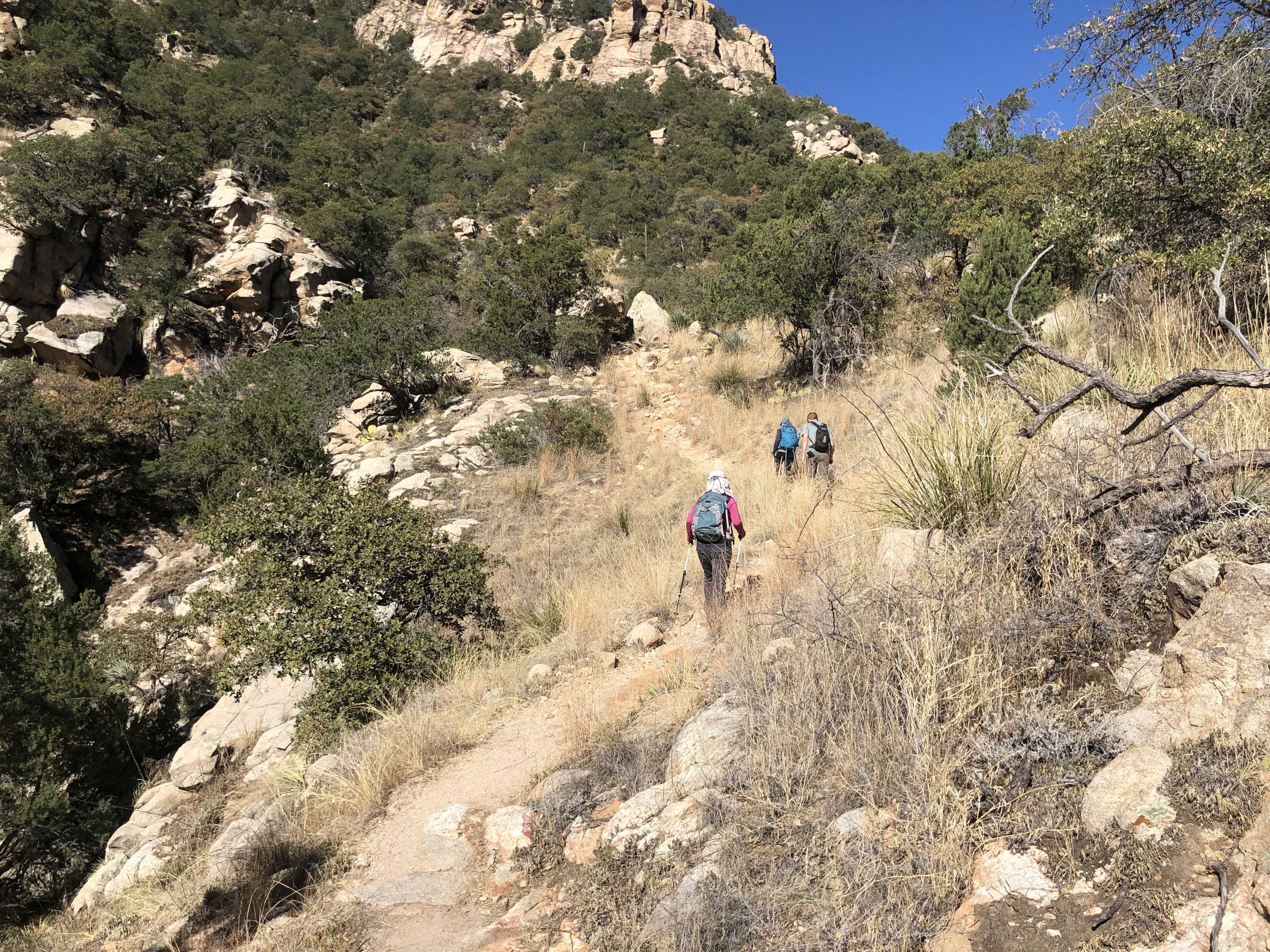
Yesterday, my S(elf)-A(ppointed)T(rainer) and I completed a hike we’ve been wanting to do for a while: South Mountain’s National Trail. Over the past few months, we have been slowly tackling the peaks around the Phoenix valley and have kept the National Trail on our radar for when the weather is cool and when our legs have been trained up a bit more. My SAT asked his work friend, Matt, to join us for this adventure, to which he agreed. (For the record, Matt told my SAT that he wasn’t in great hiking shape. Cool! I thought I’d be able to keep up with him at least, or maybe even make him feel inadequate by hiking faster than him. Well, Matt lied. He’s in plenty good hiking shape. Lying isn’t cool, Matt.)
The National Trail is 13.71 miles long (22 km) and gains 2,611 feet (796 m) in elevation. In an effort to be environmentally-conscious, we hiked to the trailhead from our house, adding 3.25 bonus miles. Yay us! However, since we were only doing the trail end-to-end and did NOT want to do a round-trip hike (that would be about 35 miles of pain), we had to drop off a car at the end….which was not being environmentally-conscious. Boo on us. Anyway, we knew our limitations, so about an hour before Matt was to arrive at our place, my SAT and I drove both our vehicles to the end point, then drove back home together in one vehicle.
The weather was great for a lower elevation hike (trailhead sits at around 1400 feet): it was cool (high of 14C / low 50s F) and partly cloudy with 0% chance of precipitation (true, even though I did feel a few drops at one point). [Note: a thru-hike is when one hikes a long-distance hike end-to-end within one hiking season. Examples of iconic thru-hikes include the Pacific Crest Trail (PCT), the Continental Divide Trail (CDT), and the Appalachian Trail (AT). Obviously, my use of the term “thru-hike” to describe what my party did today is for humorous purposes only!]
We started our hike on the east end, which is the more popular end. As we hiked west, we saw fewer people and mountain bikers (the National trail is also a popular mountain biking trail). However, we did see a horseback rider and his dog, which was unusual. Another surprising thing we saw was a summit register. Generally, summit registers are on peak summits for hikers to sign. Instead of marking an actual summit, the National Trail summit register marked the highest point on any trail in the park. The last surprising thing we saw as we were firmly on the west side of the park was a cholla cactus forest.
A man, his horse, and his dog!
I like summit registers.
Go team!
So many cholla cacti.
I’m happy with our day today for a number of reasons:
we got some more good hiking training in;
we got to do a hike “close to home;”
we didn’t have a huge drive to the trailhead (other than setting up the car shuttle);
we got to see the remote west side of South Mountain;
we got to hang out with Matt!; and
we got to eat a lot after the hike! (We went to a local Mexican restaurant to refuel and rehydrate.)
Stay tuned for more hiking adventures!
All by myself on the trail.
Gray skies, but not a gloomy day.
At the end of the trail…but we still had to hike a mile to the car!
In our quest to hike the biggest peaks in and around the Phoenix valley, we decided to attempt Mazatzal (“Maz”) Peak, the highest point in central Arizona and the Mazatzal Mountain range. Maz measures 7903 ft / 2409m in elevation. My SAT’s (self-appointed trainer) GPS said that we hiked 12.4 miles / 20 km and gained 4185 ft / 1276 m. That GPS did not measure the large number of scratches, bruises, and overall pain we incurred during the hike. Let me explain…
When my SAT chose Maz Peak as our weekend challenge, he neglected to inform me or our friend Ian (our delightfully agreeable hiking buddy) that he did not read any of the multiple hike descriptions he found. Therefore, we all assumed that we would be hiking on a groomed trail and that we should be finished the hike by mid-afternoon. That was mistake #1.
We left Phoenix at 6:45am after picking Ian up and arrived at the trailhead at 8:17am (Maz Peak is near Payson, AZ). After organizing our stuff, we started the hike by 8:30am, choosing the “Y Bar” trail for the ascent portion of the hike. The trail was a bit chunky in sections, but was definitely a clear path. Views were pretty and we noticed A LOT of manzanita bushes along the way (this is foreshadowing…).
The “green” stuff = manzanita bushes.
The trail is my friend. Note the green on the hills in front of me = manzanita bushes.
Around mile 4, we noticed that the trail just…vanished. My SAT checked his GPS (he downloaded a gpx track recorded by a previous hiker) and said that the route just goes…up. We looked up:
The GPS said we were supposed to go up the red rock. My stomach just dropped.
At this point, we had a LOT of climbing to do. Most of the climbing was bushwhacking, or forcing one’s way through manzanita bushes and thorn bushes. We also had to climb up little cliffs, like this:
See if you can find some cacti hidden in the red rocks.
I’m smiling here, but that was purely for the camera.
It was very slow going. Because none of us thought to bring an axe, the bushwhacking part was just plain annoying. Good thing we all wore long pants and shirts. After 5 hours, we reached the summit. I think I almost cried, and not because of the views.
View from summit.
More nice views.
Humphreys Peak, the highest point in AZ, in the distance.
Geological survey marker on the summit.
Again, we are smiling, but it’s (mostly) for show.
We were the first to summit in 2018! Maz Peak is not climbed often; the summit logbook only had 2 entries for 2017, March and October.
Now that we made it to the top, how do we go back down? We all agreed that going down the way we came up was NOT a feasible option. That left us with going down “the other side.” So, we started our way slowly — the word of the day — making our way through the snow and rocks and those dratted bushes. Our goal was to hit the other trail (the Barnhardt) before sunset. We kept moving down the gully over boulders and pine logs, instead of staying on the ridge as the online instructions directed (this was mistake #2). Because we were descending in the gully, we ended up stopping at a couple of points because we were “cliffed out” (i.e. when you want to climb down a mountain, but find yourself on the top of a cliff and have to find another way down). After much tedious work, we finally FINALLY reached the Barnhardt trail after only 3 hours.
We just descended from the summit into the gully. Again, Ian’s smile is mainly for show.
Making my way over the millions of boulders and logs in the gully!
We had to climb down stuff like this rock wall.
A wide-lens perspective of what we had to go through to reach the trail.
Because I did not want to be dramatic or anything, I did not indulge in my first reaction upon hitting the trail (i.e. kissing the ground). Being on a trail again felt amazing. Realizing that we had another 2+ hours to hike back to the car was not as amazing, but hey, we made it to the trail with about an hour of daylight left. This is what we saw in the waning light of day:
The Mogollon Rim in the background, just below the sunset colors.
More prettiness that *almost* distracted me from the fact we had 2+ hours left to hike.
Pretty light on the hills of dratted manzanita.
Ok, so it was pretty!
We finally made it back to the car at 7:17pm, which meant that we were “out there hiking” for almost 11 hours! (Of course, we weren’t moving the whole time, as we took some breaks to eat, check the GPS, or cry (internally).) We thought about going for a celebration dinner, i.e. “We made it out alive!” dinner, but decided to go for something fast and ended up grabbing some Chipotle when we got back to town.
Final note: during the drive back, I read the hike description that Ian and I thought SAT read. Turns out that after my SAT read the first paragraph, he thought “hey, that doesn’t sound too bad! Since we’ll be on trail the whole time, we’ll just wing it.” THAT WAS A BAD DECISION. The first paragraph of the hike description says this: “This is a loop hike beginning at the Barnhardt Trailhead. It takes the Barnhardt Trail to about the 4 mile point, freestyle your way to the top, then a fairly direct route down to the Y Bar Trail for the return.” If my SAT read the NEXT paragraph, he may not have been so cavalier about the hike, because the writer indicates that 1) the Maz Peak hike is the most difficult he’s done, 2) there is a lot of route finding and bushwhacking, and 3) his accompanying GPS route is “possibly not the best.” And that route was the one we used. Read the full hike description for yourself for more detail on how challenging the route is (we actually ended up doing the reverse of the hike description writer’s route).
Next time my SAT plans a hike, Ian and I are not going to agree to do it so readily.