New Year’s resolution: eat more junk food!

Before any of you comment on how unhealthy my resolution is, let me explain. I consider myself a healthy eater and primarily eat a vegetarian/vegan diet, i.e. no meat. Junk food is not a staple of my diet. However, I do let myself enjoy a treat or two after a big hike or bike ride, like a Coke or fries. Therefore, I figure as long as I engage in physical activity, I can eat junk food! This may be a resolution I can keep….

Today, my SAT (self-appointed trainer) and I hiked Arizona’s Mount Ord, which is the second-highest mountain in the Mazatal Mountain range (7128 ft / 2173 m). Some online accounts record the hiking distance to be 14 or 15 miles round-trip and the elevation gain to be anywhere between 3800–4720 ft (1158–1440 m). Our Garmin recorded the following statistics:

  • round-trip distance: 12.66 miles (20.4 km)
  • elevation gained: 3890 ft (1186 m)

Whatever the “true” statistics are, all I know is that my legs are sore. It’s an easy hike to follow, as you are on a jeep service road the entire time (the road is heavily eroded for the first 5 miles then comes to a junction with a newer, better quality service road for the rest of the way up to the top). However, all of the views along the entire trail/road are beautiful. (This was good, because the higher we hiked, the more we hurt….but the views were a pleasant distraction.) For instance:

At the summit, we saw a cluster of communication towers:

IMG_2110

And more amazing views, this time of the entire Phoenix valley:

We were pretty hungry when we reached the summit. Remember my resolution of eating more junk food? Here’s me eating some leftover pizza on the summit:

IMG_2102

On the way home, we went through a McDonald’s drive-thru so I could get some fries and a Coke. Both were consumed quickly. Overall, it was a successful day and we are excited to “bag” more peaks and eat more junk food!

A (potential) new tradition to ring in the new year

My S(elf)A(ppointed)T(rainer) and I spent the last weekend of 2017 camping and hiking in the beautiful Chiricahua National Monument. (Fun fact: according to a Jesuit priest named Juan Nentvig who lived in the mid 18th century, the name “Chiricahua” is an Opata word meaning wild turkey. Apparently, the Chiricahua mountain range was known for the wild turkeys who could be found there. However, by the mid 1900s, most of the turkeys were gone.) I don’t know why more people don’t know about this amazing place, but was sort of glad more people did not know about it because it was wonderful to have the place almost all to ourselves! The official webpage uses the phrase “a wonderland of rocks” to describe the landscape, and that phrase is very appropriate. We did 2 hikes, the “Natural Bridge” trail and the “Big Loop” trail (which was made up of several smaller loops). The first hike was lovely and features a pine forest and a small water-carved rock bridge at the end of the trail. The “Natural Bridge” trail is the least used trail, according to the official website, but the 4.8 mile/7.8 km hike is definitely worth doing, with its pretty woodland landscapes. However, the “Big Loop” is the hike that passes by all of the amazing rock formations. If you do the whole Big Loop, you will have hiked 9.5 miles/15.4 km and seen otherworldly rock landscapes. My words can’t do the scenery justice, so I’ll leave you with the following pictures:

We stayed in the Bonita campground (the only campground in the park). The campground has running water, flush toilets, and lots of wildlife! There are 4 different ecosystems that pass through Chiricahua National Monument, which means that there are a lot of different animals that call the area home, including deer, mountain lions, bears, skunks (all 4 North American varieties live in the Chiricahua National Monument), and birds. The area is a birdwatcher’s paradise (according to the official website, about 200 different bird species have been documented in the area). We enjoyed the numerous Mexican blue jays that hovered around our campsite, waiting for us to drop crumbs. I actually fed a Mexican jay from my hand!

IMG_4992

We ended our New Year’s weekend by watching the moon set and the sun rise. Happy New Year to all of you and get out and enjoy nature!

IMG_2068

(Me and my SAT say “Go play outside!”)

No planes, lots of trains, and one automobile.

As I mentioned in my last post, my S(elf)A(ppointed)T(rainer) and I spent the Thanksgiving holiday weekend seeing lots of new things. Our original plan was to camp overnight in White Sands National Monument, check out the Carlsbad Caverns, and see whatever other interesting things along the way as appropriate. Well, like many a well-intentioned plan, ours fell apart. SAT was hesitant about driving more hours to get to Carlsbad Caverns, then facing a massive drive home….also, he was playing the “I have so much work to do” game and wanted to get back home early enough to have a bit of time left in the weekend to clean up and do those adult-y things before the work week begins, like grocery shopping and laundry. Therefore, we (that is, me) came up with a revised itinerary: White Sands, Las Cruces, and a roadrunner.

We reached White Sands around 1:30pm on Friday. (Fact #1: White Sands National Monument neighbours a couple of NASA missile ranges. Make sure to check the White Sands website for closures, because if there is missile testing, the Monument is closed to the public.) As my title indicates, there were no planes (or missiles)! When we arrived, we noticed that there were hundreds of people there too. Looks like holiday weekends make national monuments popular. (Fact #2: if you want to secure one of the 10 first-come, first-served primitive campsites, arrive by 11am or noon at the latest. We arrived around 1:30pm and did not secure a campsite.) Therefore, we decided to do the longest hike in the monument (5 miles) and play in the sand along the way.

White Sands is amazing. As the name suggests, the sand is white. As the sun was setting, the sun’s rays cast a lovely golden glow over the sand.

I had previously looked up the GPS coordinates of a few free primitive camping spots as potential places to camp for the night. (“Primitive” campsites are exactly that. There is no water, running or otherwise, no bathrooms/outhouses, nothing. You need to bring everything you need to survive, like food, water, and a tent…..and you need to “pack out” all trash, including human waste. But….it’s free!) My SAT was NOT looking forward to finding the primitive campsite in the dark (it was now after sunset), setting up the tent in the dark, or trying to sleep in a cold tent. Therefore, to appease his delicate nature, we ended up getting a room in nearby Alamogordo. Upside: cheap rate, really clean, reliable wi-fi. Downside: queen bed (SAT thinks we got a double bed) and the loud trains that rumbled nearby nearly every hour. SAT didn’t get much sleep due to the trains. He is a very light sleeper. The trains only woke me up once. I am a very good sleeper.

The next morning, we drove out to Las Cruces to check out a cool coffee shop, farmer’s market, and the historic Mesilla plaza, just outside of Las Cruces. The plaza had a number of cute touristy shops featuring chocolate, jewelry, and other such knickknacks.

(L to R: Mark charging himself up at the Tesla charging station in Las Cruces, NM; Basilica San Albino Catholic Church in Mesilla Plaza; a shrine to Our Lady of Guadalupe in Mesilla Plaza)

As we were leaving Mesilla Plaza, I was looking out for the famous “recycled roadrunner.” Very soon, we realized we were on the wrong side of the freeway….so we drove our one automobile to the nearest exit off of the freeway and drove a mile or so in the other direction to the rest stop in between mileposts 134 and 135. According to roadsideamerica.com, the roadrunner is worth a detour. Also, the rest stop is an award-winning one! I have no idea why the rest stop is considered “award-winning,” but the roadrunner is pretty cool.

New Mexico is a pretty interesting state. Next time, we will make sure we arrive at White Sands in the morning to secure a campsite and we will DEFINITELY visit Carlsbad Caverns.

Blogging sabbatical is over?

So. It’s been a year since I last posted a blog on this neglected site. I wish I could say that the reason I haven’t blogged the past year was because life was so incredibly exciting! Nope. I’ve just been preoccupied with work and doing the regular home improvement stuff that first-time homeowners tend to get caught up in. However, this winter, there are a few good changes as compared to last winter. First, I’ve taken this season off from accompanying my choir, which means I have weekends off! Second, it’s winter in the desert, which means it’s safe to go outside! (Remember that “winter” in the southwest means “awesome weather” and “summer” in the southwest means “death due to heat exhaustion and dehydration.”) Third, because of reasons one and two, I’ve been doing some more hiking lately.

Two weekends ago, my SAT (“self-appointed trainer”) and I teamed up with our friend Ian to hike Wasson Peak, just outside of Tucson. This hike is considered to be a moderate trail hike: 7.5 miles (round-trip) and 1900 ft elevation gain. It was an overcast day, so temperatures were on the cool side. I enjoyed stretching my legs out and remembering what it felt like to do a long walk.


(1: pretty cactus pattern; 2: SAT and Ian near beginning of hike; 3: view of what we have hiked; 4: view from top; 5: view from top; 6: summit selfie)

~~~~~~~~~~~

Yesterday, SAT, Ian, and I successfully summited Quartz Peak in the Sierra Estrella mountain range. The top of this peak is made up of white quartz boulders, thus, the (unimaginative) name. This hike is a workout! It’s almost 6 miles long and gains about 2,550 feet in elevation (my legs hurt yesterday). From the top, you have great views of the Phoenix valley while relaxing on the pretty quartz rock. Two extra cool things about this hike include the scrambling that you have to do to reach the top and the many pieces of mica available near the top. The drive to the trailhead is a bit of a chore: the last 5-7 miles is on a dirt road that requires a high-clearance vehicle (preferably 4×4).


(1: our goal is the white peak!; 2: SAT peering at me through a transparent piece of mica; 3: sitting on top of the peak; 4: peek-a-boo!; 5: view from the top; 6: another view from the top; 7: I made vegan Oreos to enjoy at the top….and they were GOOD.)

What’s next? Well, my SAT and I are planning to visit White Sands Monument in New Mexico over Thanksgiving weekend, which should be really cool. Stay tuned for the trip report!

Reluctant roadie plays in the dirt

Yesterday was another “first” for me in my athletic career. I participated in my first mountain bike race and survived, with minimal damage. The 2016 “12 Hours of Fury (THOF)” is now but a distant, slightly painful memory and resulted in a surprise 3rd place showing by my 4-girl team!

Earlier in the summer, I decided to register for the THOF and thought that that would inspire me to ride more. Well, between day job and night job, there wasn’t much time for anything else, let alone mountain biking. I managed to pre-ride the race course twice this past week….which ended up being my “training” for the actual race. The objective of THOF is to ride as many loops as possible within 12 hours. The race started at 10am and ended at 10pm. Each loop is 15 miles long [N.B. Locals, THOF was at McDowell Mountain Regional Park and the loop is made up of sections of the Shallmo, Pemberton, Granite, Lariat, and Escondido trails. Click on this link for more race details.] There were different categories: solo, duo, quad (4 person team), solo single-speed (SS), duo SS, etc. The course itself isn’t difficult, as it is relatively smooth single track and does not feature excessive climbing. Miles 1-6 were a steady, gentle uphill that gave way to a fast, flowy downhill section between miles 6-9, followed by a roller coaster up and down section between miles 9-15. My team completed 7 laps to secure 3rd place. All of us were first-time racers and 1 of us had never ridden at night before, so this race was a milestone for everyone.

I was the first on my team to ride, so I got to experience the “mass start.”

(Left: just before the start of the race; Right: my race number!)

All competitors gathered at the start and on the word “go,” started pedaling. It was pretty slow at the beginning because there were so many people; the first mile was like one long bike caravan. All those bikers and no recent rain resulted in a very dusty day. Pretty soon, riders started to spread out according to speed and I started to hear some words that became somewhat familiar over the rest of my first lap: “on your left….when it’s safe, I’d like to pass.” [Those words were my indication that I was not the fastest rider on the trail.] About 2/3 of the way into my first lap, I fell. I misjudged a corner, skidded on some sand, and landed on my right arm and right hip. [N.B. When I called my SAT after I finished my first lap to tell him about my fall, the first thing he asked was “did you hurt your bike?” Uh, thanks for asking how I’m doing. For you newer readers, “SAT” stands for “self-appointed trainer,” aka husband.] I now have some impressive bruises and road rash. If it weren’t for my fall, I would have earned myself a PR (personal record) for doing the 15 mile loop. (I had ridden the course twice in the past week, and was aiming to beat the time I set on my second pre-race ride.)

When I was done my first lap, I had a long time to hang out before riding my second lap, as the rest of my team had to do their respective first laps. Here’s a picture of my team during the rubber ducky handoff between our 2nd and 3rd riders (all duo and quad teams had to pass a rubber ducky from the finishing rider to the next rider):

15094407_10100670641560974_7516756039299844762_n

(From left to right: Meg, Hailey, me, Alana. Meg, our 3rd rider, had just finished her first lap and was handing the rubber ducky to Hailey, our 4th rider.)

So, what do riders do in between their laps? In no particular order, hang out, eat, and drink beer. The whole atmosphere was like a festival, with lots of people, high spirits, and frequent updates via PA system regarding which rider was approaching the finish line. There were also a handful of vendors onsite that riders could visit, such as a coffee bar, energy bar stand, and hot dog stand. I got to chat with some other riders on our collective team, San Tan Racers, as well as hydrate and eat some junk food (I worked hard for that privilege!). I’d also check on the status of our other San Tan riders. Eventually, it was time for my 2nd lap. Because sunset was around 5:30pm and because I knew I would be starting my 2nd lap around 4:30pm, based on what I knew about Hailey’s average speed, I got my bike lights attached to my bike and helmet, drank more water, and ate more food. My goals for my 2nd lap were: 1) don’t fall, and 2) beat my 1st lap time. Despite the darkness for the last 5 miles, I achieved both goals. Hooray!

As mentioned at the beginning of the post, the biggest surprise was the news that we got third place in our category (women’s quad team). Not only did we get to stand on the podium, we all won special race beer glasses! That beer glass is probably my most valuable piece of kitchenware in terms of expended effort, aka blood, sweat, and tears. Here we are on the podium:

15094836_10100670648701664_1969104379641601536_n

And here is a pic of my hard-earned glass:

fullsizerender

A lot of people elected to camp onsite this weekend, but I didn’t want to bother with packing camping gear AND biking gear, so I chose to drive home after the awards ceremony. As a result, I didn’t get home until close to midnight, tired, dusty, sweaty, and triumphant. Just kidding. I’m glad I survived. I would say that my first bike race was positive and that it was a good experience. Would I do another one? I’m not sure. If you were to ask my SAT, he would say “yes, most definitely.” But then again, this is MY blog, so I get the last word. 🙂

Random thought of the day

We went for a bike ride this morning and climbed South Mountain. Total distance was 35 miles and total elevation was about 2100 feet. The South Mountain climb is not as difficult as cycling the Red Rock Scenic Loop (that was my first ride on my road bike!), but when you’re out of shape, climbing up a mountain on a bike gives you plenty of opportunities to count your gasps and to entertain random thoughts.

Speaking of out of shape, here’s a random thought: most road cyclists, or “roadies,” wear kits when riding their bikes. A kit is a cycling outfit that includes shorts or bib shorts, a jersey, and accessories (i.e. socks, shoes, and a cap). Many athletes like to dress to impress, and cyclists are no exception. The truly committed coordinate their kits with their bikes. Kit material tends to be stretchy, like spandex, and are typically made out of some fancy material that wicks away sweat. Wearing a kit can be considered more daunting than riding a bike because that form fitting outfit reveals EVERYTHING. [N.B. I believe that buying and wearing one’s first kit is like a cycling initiation rite, of sorts.] In fact, wearing a kit is rather like wearing your underwear in public….kind of like wearing Spanx in public. Why Spanx? Because the form-fittedness of the kit sucks all the loose jiggly bits closer to the body. Take a look:

(The first 2 photos are of a Spanx tank top and shorts. Both items are supposed to be worn underneath regular clothing. The photo on the far right is me on my first road bike ride [Red Rock Loop]. Note the form fitting kit. I am not happy in the picture because riding the Red Rock loop was really challenging for a beginner. Guess whose idea it was to ride the loop for my inaugural road bike ride?? My shoes that day were regular old running shoes and not the fancy clip-in shoes; the idea of being clipped into my pedals horrified and terrified me.)

In conclusion, if I ever want to feel tight, toned, and tucked in, all I have to do is wear my cycling “Spanx,” i.e. kit, and all will be hidden and camouflaged.

It’s autumn in AZ….at least according to the calendar.

Dear readers, I confess that I have neglected this blog. Why? Because I haven’t had any grand adventures to share with you. Since my last post, I’ve done a few “outdoorsy” things, such as sharing a lovely camping weekend with friends (we ate and lounged for the entire weekend. The only exercise I did was raise my fork to my mouth!) and going for a few local bike rides. Work has been rather intense lately and my boy choir has started up again, so that’s also been taking up time. However, I have a couple of events coming up in November that will hopefully inspire me to DO SOMETHING BIG. The first event is my first bike race! Well, technically, my 4-girl team is doing this race more for fun than for any racing glory. The “12 Hours of Fury” race consists of solo riders and teams riding a 15 mile loop. The most number of laps completed during the 12 hours wins! I plan on doing a wee bit more bike riding between now and November 19.

The other event coming up is an idea I had while talking with my SAT (that’s “self-appointed trainer,” a.k.a. wheel addict husband) yesterday. Here in Phoenix, there is such a thing as one trail system connecting the various regional parks in the metro area. That trail system is called the Maricopa Trail and most of it is completed. The trail is open to recreational users, like hikers and cyclists. The main trail is currently 242 miles long, according to Wikipedia; if one decides to explore the “spur” trails off of the main Maricopa Trail, that will add distance onto the 242 miles. Anyways, my idea is to bike pack the entire Maricopa (main) Trail in one weekend, probably Thanksgiving weekend (this date could change!). This self-appointed event would give me a training goal and an opportunity to DO SOMETHING BIG. Also, I like the fact that my SAT and I could do this starting from home without having to drive to a specific starting point. (Yes, my SAT will be doing this with me. Who else would carry all the bike packing gear?)

The last thing I wanted to share with you is that I will have my first guest post very very soon. This guest will share details from his recent crazy ultra epic bikepacking race that crossed Nevada, affectionately known as the Trans Nevada Trail, the TNT, or “the race across Nevada that almost killed me.” The official name is the Comstock Epic. Stay tuned!

“That is a luxury. We can’t take it.”

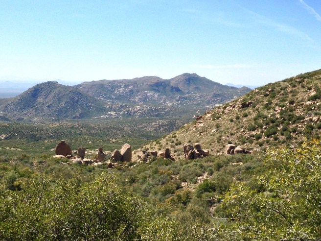
This past weekend, my SAT (“self-appointed trainer”) and I joined a few other novice bikepackers to camp on the Mogollan  Rim. The Rim, as it is more commonly and easily known because NO ONE knows how to pronounce “Mogollan,” sits at around 7500 feet elevation, which results in perfect summer temperatures of 80-85f. Phoenix, in comparison, is averaging 107-110f everyday….

“Mogollan” can be pronounced “muggy-own,” “mo-GOY-an,” and “mug-goy-OWN.” However you say it, the Rim is gorgeous. It is easily accessed via the small communities of Payson, Strawberry, and Pine on the west side (the way we drove). Drive time was about 2.5 hours from Phoenix to the Forest Road 300 trailhead, including one bathroom break.

Let me say a few things about the preparation for this trip before I get into the details of the actual trip. Because this trip was our first bikepacking  trip, we didn’t really know what to bring. Although we have backpacked a few times, bikepacking  is a little different. Most of your gear is in bags that are attached to your bike. So, in addition to the usual camping gear (tent, sleeping bags, sleeping pads, clothes), you have to bring bike stuff like spare tubes, lubricants, pump, etc. Let’s not forget food and water and a stove to cook the food.

The night before the trip, we were up late trying to cram whatever we thought we needed into our bike bags….or, rather, my SAT’s bike bags. He has the full bikepacking setup because he will be doing a weeklong bikepacking race next month. I do not have any setup. My bike frame is too small to accommodate m(any) bags, so my plan was to let my SAT carry all of our gear. Hey, he has to train and I am happy to help!

As we were picking and choosing what items to bring, I kept hearing my SAT say that we are not going to bring a stove because that’s a luxury….not going to cook….that means no coffee…camp towel is a luxury so no….no cokes or chocolate….Meanwhile, I’m thinking, how fun will this trip be without “treat” food and drinks? The moratorium on luxuries would make us a little sad at dinner the next day….

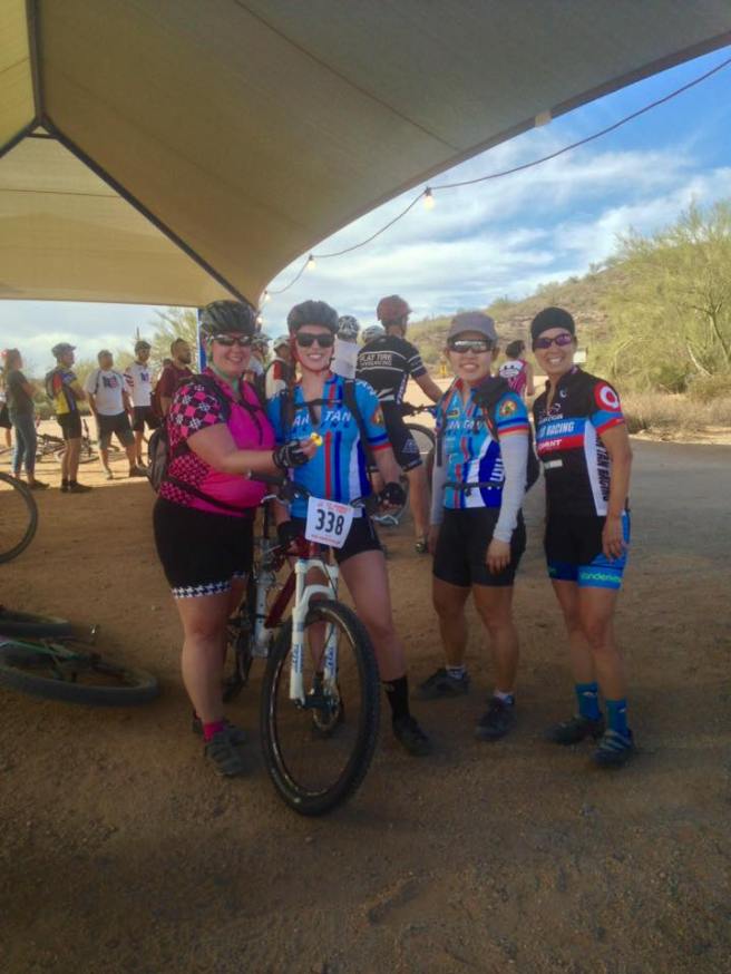
The next morning, we met up with the other riders at McDowell Mountain Cycles in Fountain Hills, just north of Scottsdale, AZ. After going through the introductions and arranging carpools, we were off. A couple of hours later, we were ready to roll.

13717276_10154582926084505_2124909157191901700_o

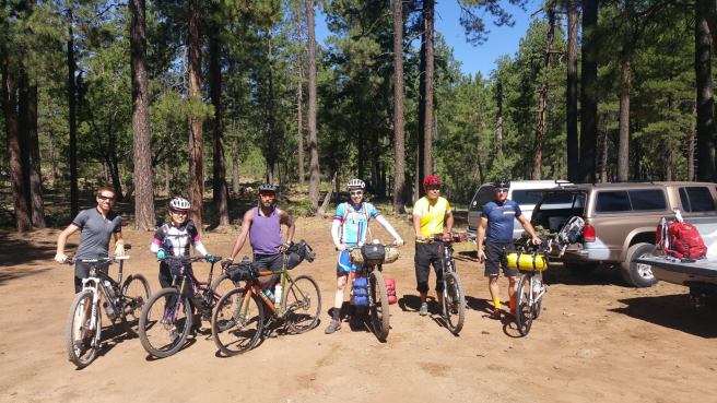
(Before we got covered in dust.)

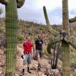
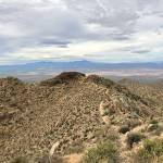
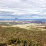
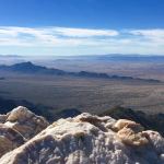
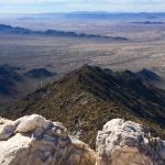
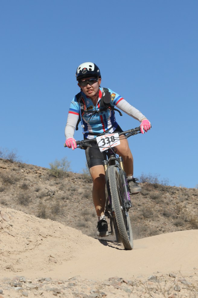
Our plan was to ride along Forest Road 300, aka Rim Road, to Knoll Lake campground. That was a distance of about 30 miles with approximately 2500 feet climbing. I quite enjoyed the descents as they were really fast. The climbs? Well, anyone who knows me on the bike knows that I don’t tend to talk much on climbs. I don’t like to waste oxygen talking when I need to BREATHE. The whole ride was very beautiful with gorgeous views of the valley, perfect temperature, and good company. We got pretty dusty from the vehicles passing us both ways, but decided to remedy that when we got to the campground and lake.

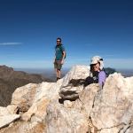
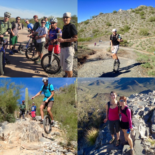
(Clockwise from top left: enjoying the view; my SAT on the left loaded down like a pack mule; at the turnoff for Knoll Lake campground; Rob and Gary pedaling away.)

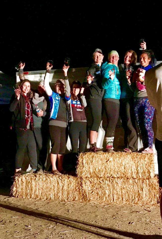
Knoll Lake campground is on a first come first serve basis. When we arrived, we thought that all of the campsites were full because there were white slips of paper attached to the numbered campsite posts. Those slips of paper were actually informational papers, not campsite reservations. We scored a campsite near the bathroom and water spigot. Easy access! After setting up camp, which ranged from bivy sacks to our 3 person tent, we ride down to the lake and had a refreshing swim. That felt AMAZING. The water wasn’t too cold at all. Well, the water wasn’t too cold for all of us, except for my SAT, who complained about how “my feet feel cold and I don’t need to get in the water” (except he was wistfully gazing at the rest of us enjoying ourselves in the water) and “it still feels cold.” I told him that the water felt SO refreshing and wow, I didn’t think you were such a baby and didn’t you swim competitively as a kid? He finally took the plunge – literally – and swam to the other side of the lake and back. (The other side of the lake was about 60-70 metres by my SAT’s estimation.)

(Our campsite, bikes, and Gary’s “Christmas tree” clothes drying rack.)

Side note: neither my SAT not I brought swimsuits. That’s right, they were deemed luxuries. I went into the water in my cycling clothes and my SAT dove in wearing only his underwear (when he FINALLY went into the water).

(Enjoying the water and getting all that dust off!)

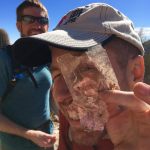
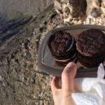
Back to camp. Dinner was highly anticipated by all, except us (remember the “no luxuries” motto?). Everyone else had a little stove of some sort, from a JetBoil to an ultra tiny, ultra light folding camping stove like this. They all had soup or pad thai or quinoa for dinner. We had peanut butter and honey sandwiches. But wait! As we were munching away on our less-than-gourmet sandwiches, our campsite neighbor walked over bearing 2 freshly caught and cooked trout. “Hello! We can’t finish these, but we thought y’all could use them!” They were traveling from Alabama and were just so gracious (and apparently felt sorry for the bedraggled looking bikers.) We happily accepted the trout and wow, they tasted great!

image

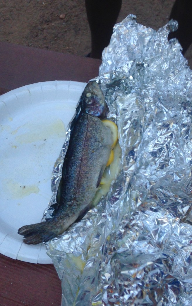
(I will happily violate my vegetarian leanings when someone offers me this.)

The next morning, we all enjoyed camp coffee and oatmeal, except us. We had a few biscuits and more peanut butter and honey sandwiches. My SAT really missed his morning coffee….I think he will allow us some luxuries next time.

Ian, my SAT, and I left camp earlier than the others because we were already packed up and the others hadn’t started doing so. We ride back the way we came, arriving back at the trailhead in under 3 hours with many great memories, loads of dust, and one lesson learned: luxuries may actually be necessities in order to have a more enjoyable camping experience.
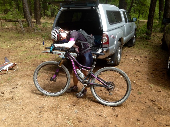
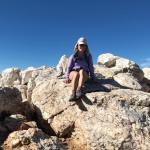
image

(I was tired.)


Let’s do something different

This is not a blog post about any sort of bike ride. Keep reading though….!

A couple of days ago, a few work friends and I spontaneously decided to check out the Flagstaff Extreme Adventure Course. This is something I’ve wanted to do for the past year, ever since I learned about it during a random internet search. The adventure course is essentially an obstacle course that is  suspended in the trees. You have to wear a harness and clip yourself into the cables that run all along the course at all times. Safety first! There are 5 courses that progress in difficulty and you are not allowed to continue to the next course until you finish the previous one. At the end of each course, you get to zip line to the next (that was my favorite part because, well, no effort was involved!).

When I say “no effort,” I mean no effort. Zip lining was definitely the easiest and most fun part of the course. Just clip yourself to the steel cable zip line, step off of the platform, and go! The rest of the course required a considerable amount of upper body and core strength, as well as a head for heights. Anyone with a fear of heights would probably not enjoy this adventure course. For instance:

IMG951193

(Zip lining to the next course. This was super fun!)

What are some other types of obstacles? Well, take a look:

(Clockwise from top left: Connor demonstrating the “no legs” technique on the rope swing; wooden “pogo stick” steps; rock climbing wall; Lindsey navigating the wobbly wooden beams.)

I would definitely do this again….after my arms and core recover….seriously though, I had a great time and would love to take any out-of-town friends here. 🙂  This was a really fun day at higher altitude with good company and a nice change from biking. If you’re in the Flagstaff area, check out the adventure course!

What have I done?

Today marks two straight weeks of riding my bike every morning.

For those who know me, you should indeed find that fact astounding because 1) I have to ride my bike in the MORNING, before work, very early due to the desert heat, 2) I am NOT a “morning person,” and 3) riding my bike is not without effort for me, even after accomplishing the purpose of this blog and gaining all that cycling experience. It has admittedly been difficult to get up some mornings the past two weeks knowing that the third thing I was going to do (the first thing being go to the bathroom and the second thing being eating breakfast) was place my posterior on my saddle and pedal my lethargic body some miles somewhere.

However, I want to lose the pounds I gained while working my day job and get back into shape. Or, get back some of the shape I used to be in….or something like that.

So, my dear “self-appointed trainer” (SAT) enthusiastically and too quickly suggested I start riding my bike each morning with him. The dialogue went something like this:

~~~~~~~~~~~~~~~~~~~~~~~~~~~

SAT: “So it’s summer now and I know you want to get back into shape. The only good time to get out and exercise is the morning because that’s the coolest part of the day. Let’s ride our bikes together each morning!!!! [insert his maniacal laughter at suggesting this “brilliant” idea]

Me: “–urgh–grunt–”

SAT: “It’ll be so great. You’ll get SO STRONG in NO TIME. Think of how awesome this will be!!!!”

Me: “–gs#$98d–meh–blurgh–”

SAT: “It’s settled. We’ll start tomorrow. Let’s not be too ambitious this week. Let’s sleep in a bit, maybe get up around 5:30am, then start riding around 6am. That should allow you to get used to the schedule.”

Me: “–hiss–”

SAT: “After 3 weeks, your body should be fully adjusted! You’ll feel awesome!!!!”

Me: “–whimper–”

~~~~~~~~~~~~~~~~

Another small motivational factor in this new riding regime is the fact that I am now part of a cycling team. Ok, so the “cycling team” is really more of a “social club,” but members have the option of entering whatever cycling races — road bike races or mountain bike races — suits his or her fancy. I decided reluctantly (in keeping with the name of my blog) to enter my first team race in November. It’s a 12 hour mountain bike race and before anyone gets too excited, no, I am not going to be riding my mountain bike for 12 hours. I am not stupid. I will be part of a 4 person (women’s) team and we will all take turns riding a pre-determined loop. The team that rides the most number of loops, or laps, wins!

I don’t want to be the “weakest link” on my team, so I’ll do my best to stick to a regular “training plan.” I’m not certain if I’m feeling stronger yet….I don’t feel “awesome” [you LIED to me, SAT!], but getting regular exercise hasn’t been scientifically proven to harm anyone….yet. So, I will carry on.

I hope to update again soon with some mountain bike stories and pictures. In the meantime, I will leave you all with a couple of pictures from this morning’s mountain bike ride. The first is of a pretty cactus in bloom and the second is of a gila monster (they’re rarely spotted, so seeing one in person was cool!).


More hikes!

In the past few weeks, I’ve been fortunate to hike in a few pretty places. Last month, a couple of work friends and I hiked a little 10 mile loop in the Seven Springs Recreation Area, just north of Carefree, AZ. We started our drive at 6:30am and arrived at the trailhead just after 8am. Pros: great chance to get to know some work people, exploring a new place, exercise….Cons: rather warm that day! Our original plan was to follow trail #4, which would be 16 miles in total. However, around mile 5, we lost the trail due to overgrowth so we decided to go back out the way we came in. Despite the name “Seven Springs,” we didn’t see a lot of water, but when we did, we took advantage of it by wading around a bit to try to cool off. Most of the hike was in direct sunlight, which made us all feel rather sluggish near the end. One of the things that kept me going was the thought of the icy cold Coke I had in the cooler in the car!

(Clockwise from top left: lots of cacti; lots of saguaro cacti; Lindsey, Jennie, and I posing for a poorly taken selfie; still hanging in there!)

(Clockwise from top left: pretty cactus “hand” holding a couple of flowers; Jennie and I about to wade in the water; a snake we spotted on the trail; water felt great!)

~~~~~~~~~~~~~~~~~~~~~~~~~~~~~

Last weekend, my friend Lindsey and I hiked Humphreys Peak near Flagstaff, AZ to try and escape the record high temperatures in Phoenix. (As an aside, when we left Phoenix at 5:40am, the temperature was already 85F / 29C. The high temperature hit 118F (47C) and the high temperature that my truck’s thermometer hit was 122F (50C)!) When we got to the trailhead, we noted that the parking lot was full. Apparently, most of Phoenix had the same idea we had: drive to Flag to escape the heat. The hike begins in wonderful, shaded, cool forest (adjectives used to convey the sheer joy and relief we felt at being able to walk outside without the fear of sunstroke) then gives way to numerous switchbacks, until finally, the true peak appears, after 3 false summits. Humphreys Peak is the highest point in Arizona, topping out at 12633 ft / 3851 m and the main trail we took is about 4.5 miles (one way), with an elevation gain of 3300 ft / 1005 m. We saw snow at the top, we felt cold enough to wear a jacket at the top, and we rejoiced in the much cooler temperature! In addition to feeling cool, neither of us experienced any altitude sickness, which is always a possibility when one is at a high enough altitude. After the hike, we stopped in at a local brewpub to devour some well-earned calories.

(Clockwise from top left: The temperature at 5:40am!; snow near the peak; we did it!)

~~~~~~~~~~~~~~~~~~~~~~~

Yesterday, my SAT (self-appointed trainer for all of you who are new to the blog or have forgotten what the heck “SAT” means) and I hiked the Granite Mountain trail just outside Prescott, AZ with our friends Ben and Colleen. I met Ben, a clarinet player, in grad school and we played a number of recitals together. Turns out that he and his wife Colleen are moving to CO very soon, so we all thought it would be nice to get together one more time before they leave us. 😉

Total round trip distance is about 8 miles, with about 1500 ft / 457 m of elevation gain. The temperature was very delightful; Prescott sits at 5400 ft, which makes the town very appealing to us “lowlanders” in Phoenix (elevation 1100 ft), as the temperature is much more bearable higher up. [Temperature seems to be a recurring theme in this post!] As we hiked, we saw lots of burnt trees (evidence of a recent forest fire) as well as rock ledges, which are popular with rock climbers. This wilderness is a protected area for the nesting of peregrine falcons, which were almost extinct just a few years ago, and the protective order keeps the cliffs off-limits to climbers for much of the summer.

Once we reached the overlook at the end of the trail, we sat and enjoyed the views. From this viewpoint, you can see the lake which looks like a puddle from 7186 ft (2190 m). There are lots of extremely large boulders, rocks and huge stone slabs in the area. It would be easy to spend an entire afternoon just climbing the rocks and exploring. Reaching the actual summit would require some bushwhacking, rock scrambling, and navigation skills. If we had more time, we may have considered that. Perhaps next time…

(Clockwise from top left: start of the hike. You can see the granite in the top right hand corner.; Burnt tree; some sort of baby dragon?; view from the overlook. The lake on the left looks like a little puddle!)

I like long weekends.

I am writing this blog post on Memorial Day, which is the unofficial start of summer in the US. I feel that the Memorial Day long weekend is highly anticipated by many people because of the lack of long weekends in the first part of the year. What do I mean? Well, in the US, the calendar year begins with New Year’s weekend, which comes right after Christmas. The holiday festivities are winding down and people start thinking about all of those noble New Year’s resolutions they are going to break in the first 2 days after starting those resolutions. Martin Luther King, Jr. day is the third Monday in January, which seems rather soon to have another long weekend (or federal holiday, to be more precise). But hey, I am not going to complain about having another long weekend in January! The third Monday in February is President’s Day and is usually a good time to get some great deals on bedding, for some reason.

Then….nothing. It’s a long haul from President’s Day to Memorial Day. Three months. It’s no wonder, then, that everyone seems to anticipate Memorial Day weekend. The parties, the camping trips, the barbecues, the start of nicer weather….

This Memorial Day weekend, we spent a couple of days in Prescott, AZ with some friends. We camped, ate great food, and mountain biked. There are a ton of great trails in and around Prescott, with the biggest and most challenging being the Prescott Circle Trail. As the name implies, the Circle Trail circumnavigates the town of Prescott and is about 54 miles long with about 5500 feet of elevation gain. All you road cyclists who are scoffing at the low mileage of the Circle Trail: this is a mountain bike trail! So, biking it is more challenging. How do I know how challenging the Circle Trail is? Because my SAT rode it yesterday. (For all of you who thought I was going to describe my Circle Trail ride….thank you for thinking I could do that!!) He was gone by 6am and rode the entire Circle Trail (and a few extra bonus miles for “fun”); click on this link to his Circle Trail statistics.

While my SAT was torturing himself, I rode a few trails with our friends and got to practice my burgeoning mountain bike skills. Riding a bike on forest trails is very different from riding desert trails; I found the forest trails generally smoother than the desert ones I’m used to riding, except for the huge tree roots and occasional boulders. A number of turns were rather narrow, which made me use my brakes a lot (they work well). And Prescott itself is at a higher altitude than Phoenix, which affected my breathing. (Prescott sits at about 5400 feet and Phoenix is about 1100 feet high). I did not take a lot of pictures, since I was busy trying to stay upright on my bike, but my friend Lifan took a lot and once I get some photos from her, I’ll upload some of those photos to my blog.

One good mountain bike lesson I learned this weekend: when you start riding, try to start with either a climb or flat section. Starting a ride with a downhill section doesn’t get you “warmed up” and “used to your bike.” When we started our first ride yesterday morning, that trail began with a descent. I ended up falling, only because I wasn’t warmed up and wasn’t used to the steepness of the descent. The fall was as gentle a fall could be, i.e. I didn’t incur any injuries, I just got a little dusty. After a half hour or so, I felt more confident and was able to navigate the trail better.

I’m looking forward to my next visit to Prescott, if not for the mountain biking, then for the cooler temperatures!

(Clockwise from top left: view of Prescott’s valley; our camp; the food one can enjoy when exercising all day…burger and (sweet potato) fries and mac ‘n cheese!)


A couple of cool hikes and even a mountain bike ride!

I actually have a few minutes to spare, so I thought I’d write about two beautiful hikes I enjoyed last month. Arizona has a lot of interesting and gorgeous scenery; the state boasts a wide variety of environments and landscapes that surprise most visitors. That said….

Hike #1: Brown’s Peak

This hike leads adventurers to the highest point in Maricopa County and offers fantastic views of the different canyons and lakes. Brown’s Peak is the highest of the Four Peaks mountain cluster north of Phoenix and is a good day hike for those with the time and inclination….and you will need a lot of time, because the drive to the trailhead takes a good two hours, for which you will need a high-clearance vehicle. The last 20 miles of the drive is on a rocky, dirt road and took us a whole hour. Normally, that would be hard to endure, because who likes being in a vehicle that is going THAT slow? Our scenery during the drive was really pretty, which made being stuck in a truck more bearable.IMG_2507

(I called this “Arizona’s Stonehenge.”)

The hike starts at the well-marked trailhead and winds its way through lush forest. After a few switchbacks, we came across a rock nicknamed “Woodstock.” Very cool rock formation! We kept on hiking up and up and passed through burned forest (there was a fire in this area about 20 years ago) then caught lovely views of Roosevelt Lake. The REAL hike started at the saddle; the trail stopped here and we had to climb over boulders to get to the scree chute…then scale a small wall to get up to the final ledge before the peak. The view was worth the effort.

(Clockwise from top left: Me and “Woodstock”…Our goal!…the scree chute we had to climb in order to reach the final ledge to the peak…a view of the valley along the way.)

(Clockwise from top left: We made it to the top! We are with our friend Julia. Roosevelt Lake is in the background….the view of the other 3 peaks from Brown’s Peak…what the scree chute looks like from the other direction, i.e. DOWN….is this an original rock carving from 1867?)

~~~~~~~~~~~~~~~~~~~~~~~~~~~~~

Hike #2 (and a short mountain bike ride): During Easter weekend, the annual AZ Muni weekend took place in Sedona. What is “muni,” you may ask? Muni stands for mountain unicycling and it is exactly what that sounds like….riding a unicycle down mountains. Just like mountain biking, muni riders test their inherent toughness by navigating down trails strewn with rocks, ledges, boulders, and other natural obstacles. My SAT was heavily involved with the AZ Unicycling Club when we lived in Tempe during my graduate school years and when we moved back to AZ, he looked up his old muni buddies and got hooked into the muni scene again. While in Sedona, we camped with some muni friends and enjoyed the beautiful scenery and temperatures. My SAT chose to mountain bike with some other friends that weekend and since they were doing a very long and painful training ride, I decided to hike up to Wilson Mountain, the highest point in Sedona (7,122 feet / 2,171 m). I ended up hiking about 8 miles in total, gaining almost 2,500 feet (762 m) in elevation. The top is actually a 2 mile wide mesa (“table” or plateau) and I hiked to each end to see the views from both sides.

(Clockwise from top left: the start of the trail; view of Sedona; me and my Coke overlooking the view of Sedona; the view from the northern end of the mesa.)

My SAT and I did ride one mountain bike trail together in Sedona….sadly, pretty much all of the mountain bike trails in the Sedona area are rated intermediate level or higher. At first, we thought that I could attempt some of the intermediate level rides, as difficulty levels can sometimes be overrated. However, when I tried riding an intermediate trail that connected with the easy “Bell Rock” trail was on, that intermediate trail got difficult really quickly. Sedona trails are not overrated. The Bell Rock trail was very doable and pretty and now I can say that yes, I have mountain biked in Sedona. I collected a lot of red dirt on my bike during that ride!

IMG_1328


“She’ll be comin’ ’round the mountain with her bike…”

Thanks to work (daytime, full-time) and work (nighttime, part-time), I don’t have a lot of free time to play outside. But when I do, I play hard. 🙂 Over the past month, I have managed to hike my mountain bike up and down a trail with unicyclists, hike up a local peak without my bike (i.e., the “conventional way to hike!”), and ride my bike with my “self-appointed trainer,” i.e. my SAT.

My SAT is an enthusiastic proponent of mountain unicycling, or muni. The Arizona Unicycling Club hosted a mini muni-fest a few weekends ago that saw about a dozen unicyclists gather together to ride the trails in the Phoenix area. My SAT and I joined them one morning at the Dreamy Draw Recreation Area; he rode his one-wheeled steed and I rode, but mainly pushed, my two-wheeled steed up and down the rocky trail. The trail the unicyclists rode was way too difficult for me to ride, so I ended up getting more of an upper body workout than anything else. I joked that I was the “support vehicle” for any unicyclist who may incur injuries during the ride. Watching the unicyclists ride down the steep trail was pretty impressive and they got a lot of comments from the hikers we encountered along the way. The next day, I decided to hike Piestawa Peak with my friend Diane. After all, my leg muscles were primed for hiking thanks to the previous day’s hike-a-bike! Piestawa Peak, or “Squaw Peak” by which it is known locally, is the second-highest point in the Phoenix Mountains after Camelback Mountain and the third-highest point in the city of Phoenix.

IMG_2399

(Top left: the unicyclists before their ride; top right: Steve, the unofficial spokesman for Starbucks; bottom left: Olof getting some air; bottom right: Diane and I at the top of Piestawa Peak.)

To get a sense of what mountain unicycling is, check out this video. Yes, that’s my SAT and his friend Chris. Both are crazy.

~~~~~~~~~~~~~~~~~~~~~~~~~~~~~~~~~~

For the past 3 weeks, my SAT and I decided to set bike training goals for ourselves. His goal was to ride at least 10 hours each week for 3 consecutive weeks. My goal was to ride 8 hours each week for 3 consecutive weeks. My SAT met his goal. I was pretty close. The first week, I hit 8 hours and 7 minutes. The second week, I rode for 9 hours and 23 minutes. In week three, I managed to eke out 7 hours and 4 minutes. In my defense, I had rehearsals and 2 concerts in that third week! Overall, I rode 24 hours and 34 minutes, which results in an average of just over 8 hours per week. I can live with that. May I also add that the so-called highlight of week 1 was a 33 mile mountain bike ride? That was hard. It’s a lot more challenging to ride a mountain bike for 33 miles than a road bike. Those things called rocks and sand really make forward progress difficult.

Why did we decide to set those goals? Mainly to kickstart our fitness. We were both feeling lethargic and old and yucky and gosh darn it, we needed to change that NOW. I noticed that my coughing and wheezing and panting — and I am not exaggerating! I really sounded like I was a pack-a-day cigarette smoker riding a bike — is much better now. Instead of feeling like I was going to cough up a lung, I can almost utter a sentence or two without gasping for breath. My bike handling skills are obviously getting better and tonight, I successfully navigated all 3 tricky spots in our normal route for the first time. The most important thing? The more I exercise, the more I can enjoy eating!

(Left: big boulders on the Pemberton loop in McDowell Mountain Regional Park; center: mountain biking bling [that means “showy jewelry!”] on my gloves; right: pretty sunset)