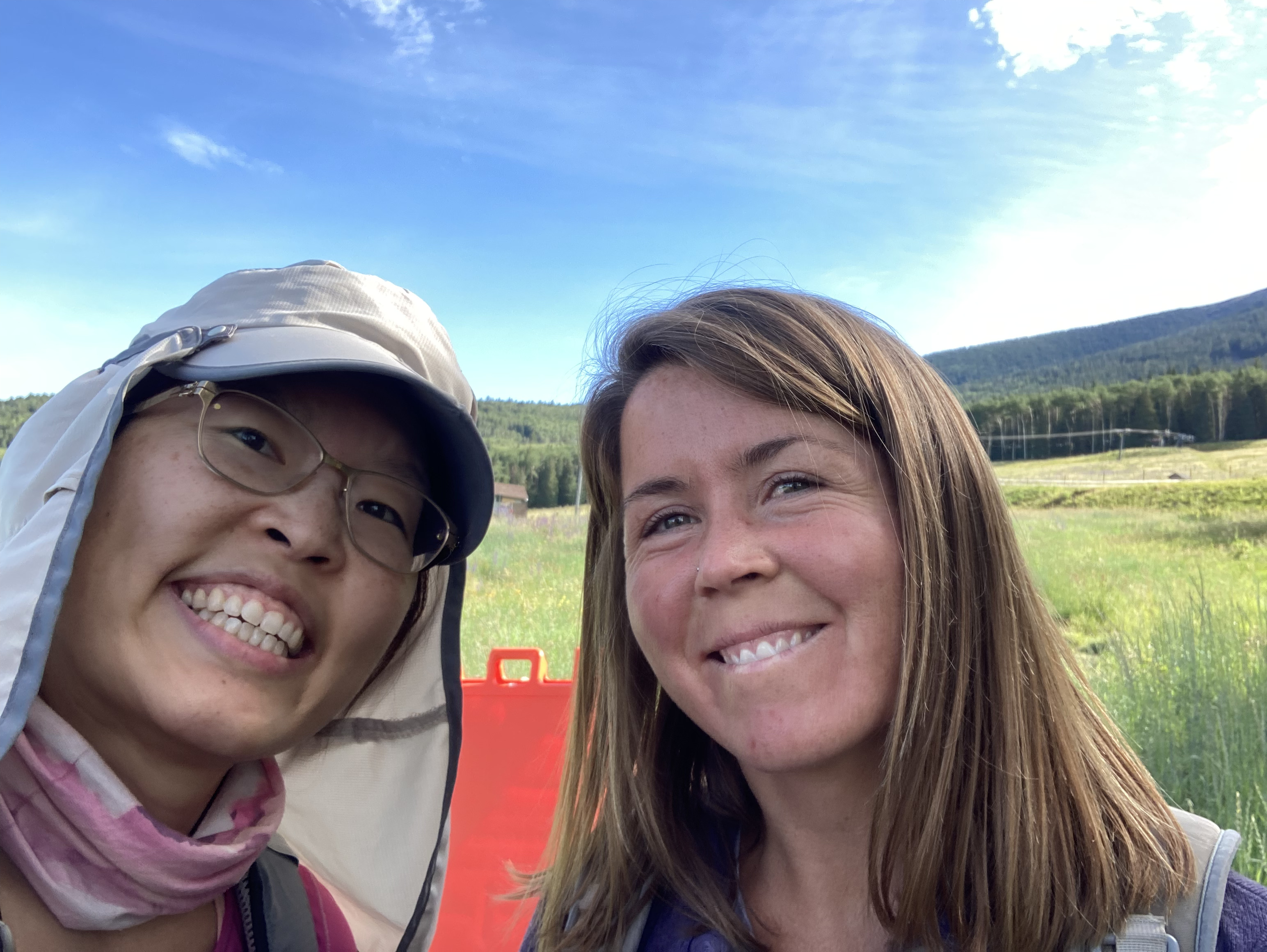
Yesterday, my friend Crystal, and I hiked Humphrey’s Peak, which is the highest point in Arizona. This hike is an annual tradition for us and is our way to catch up, while catching our breath, haha. I call our annual Humphrey’s hike our “do or die” hike because we basically pick a day, meet at the trailhead, and….hike. We don’t train for this. We just do it. Yesterday was also “National Summit Day,” so our hike was particularly appropriate and relevant!
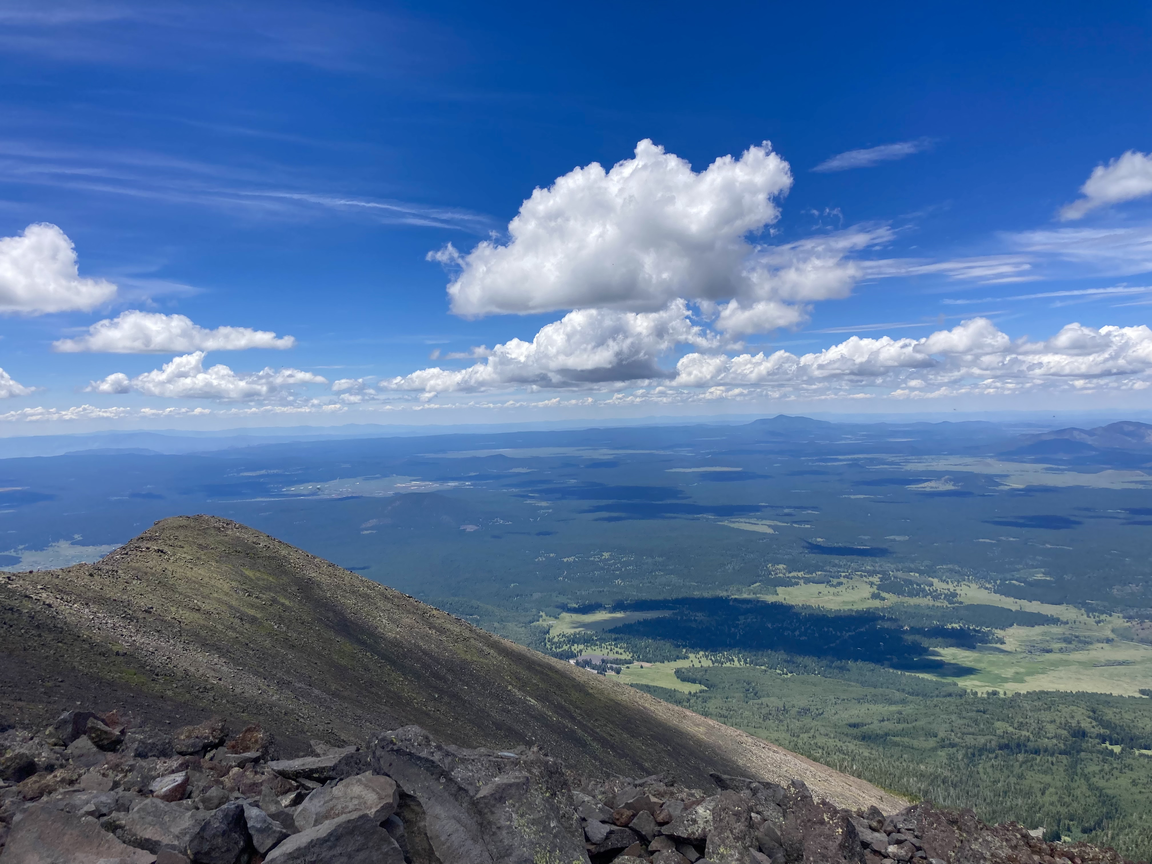
The weather yesterday was PERFECT. It was the best weather I’ve ever experienced while hiking Humphrey’s. Typically, I try to reach the summit by noon, to avoid any potential thunderstorms. However, there was zero chance of thunderstorms yesterday. We had clear skies and a light breeze all day. Beautiful.
The hike took us about 6.5 hours (this includes a few rest breaks and a longer lunch break at the summit). I think we made pretty good time, considering neither of us was in “good hiking shape.” One interesting thing I noticed was that shortly after we reached the saddle, I got a “second wind.” I asked Crystal if she was ok if I hiked on without her (she was) and I motored my way up the last mile to the summit. Hmm. Maybe all the mountain biking I’ve done in the past year, especially the climbing, prepared me more than I realized?
Highlights from yesterday include:
PERFECT weather and temperature.
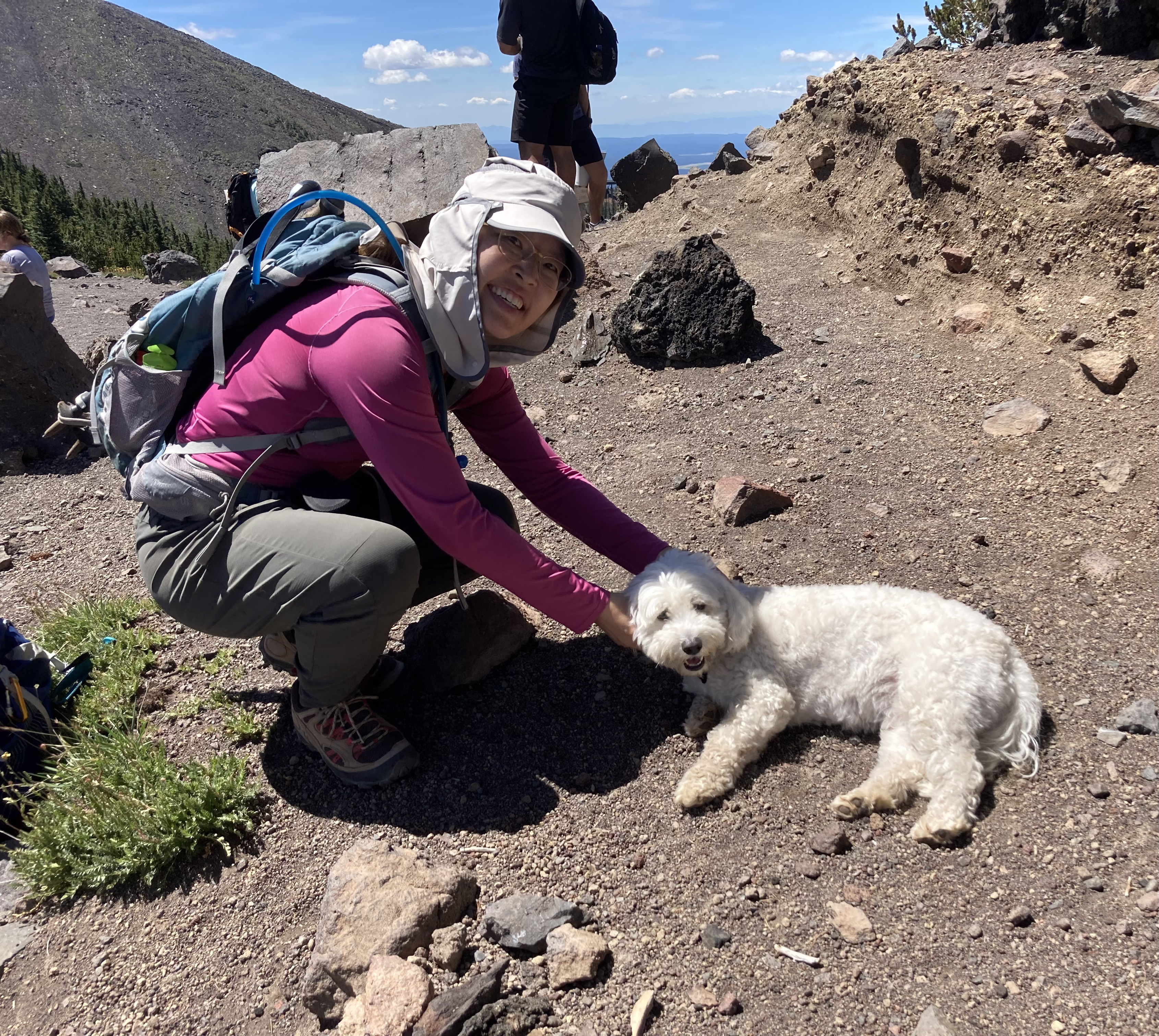
Meeting lots of cute dogs on the trail!
Seeing our friend Stevo on the trail!
NOT seeing the usual amount of little bugs on the summit. For whatever reason, there were few of those bugs at the summit, which meant we could spend more time on the summit!
The summit was NOT windy and cold.
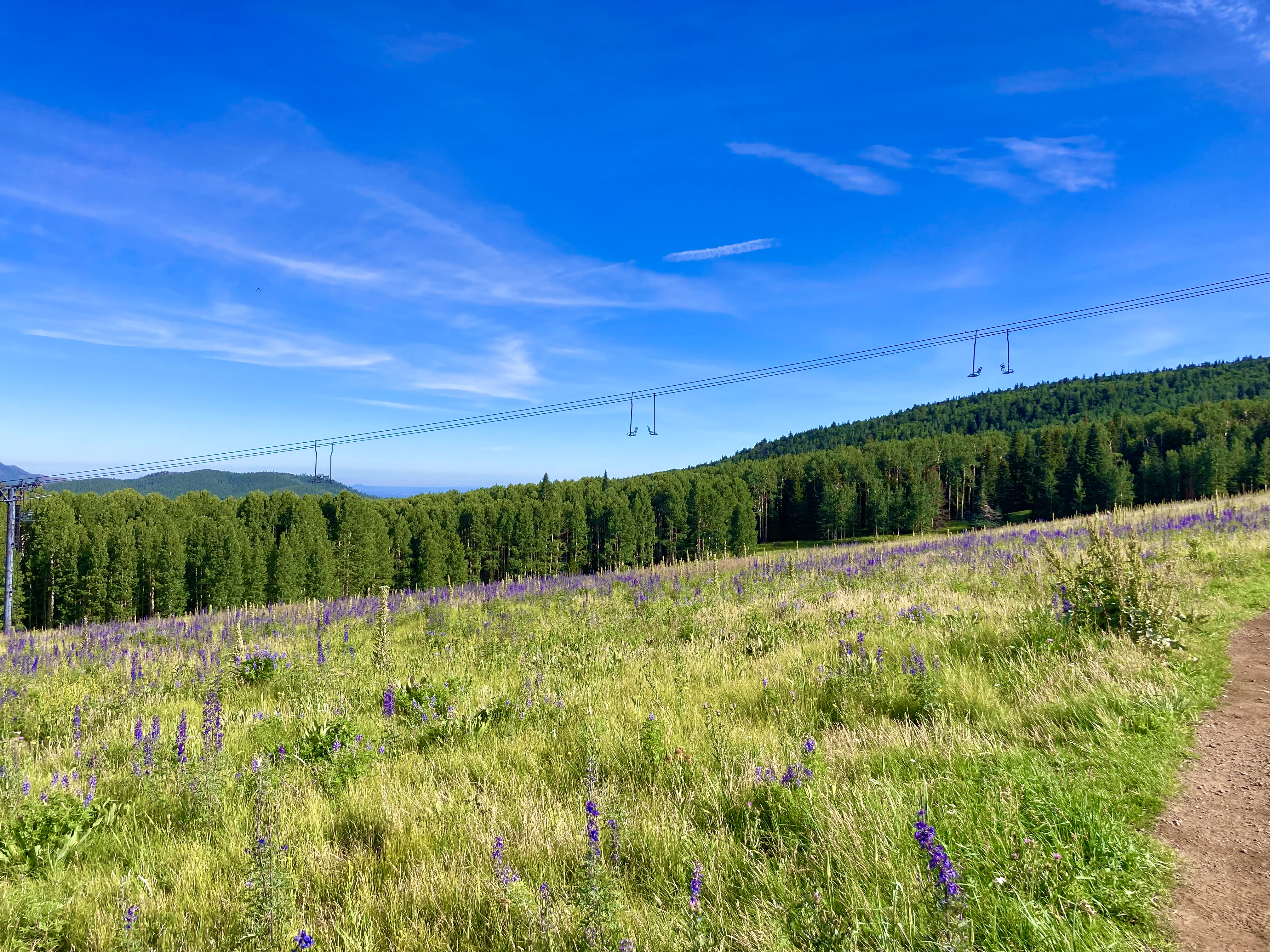
Absolutely delicious smells during the last couple miles. We were hiking through a Ponderosa pine forest and the bark of the pine trees smelled like caramel and vanilla. So yummy!
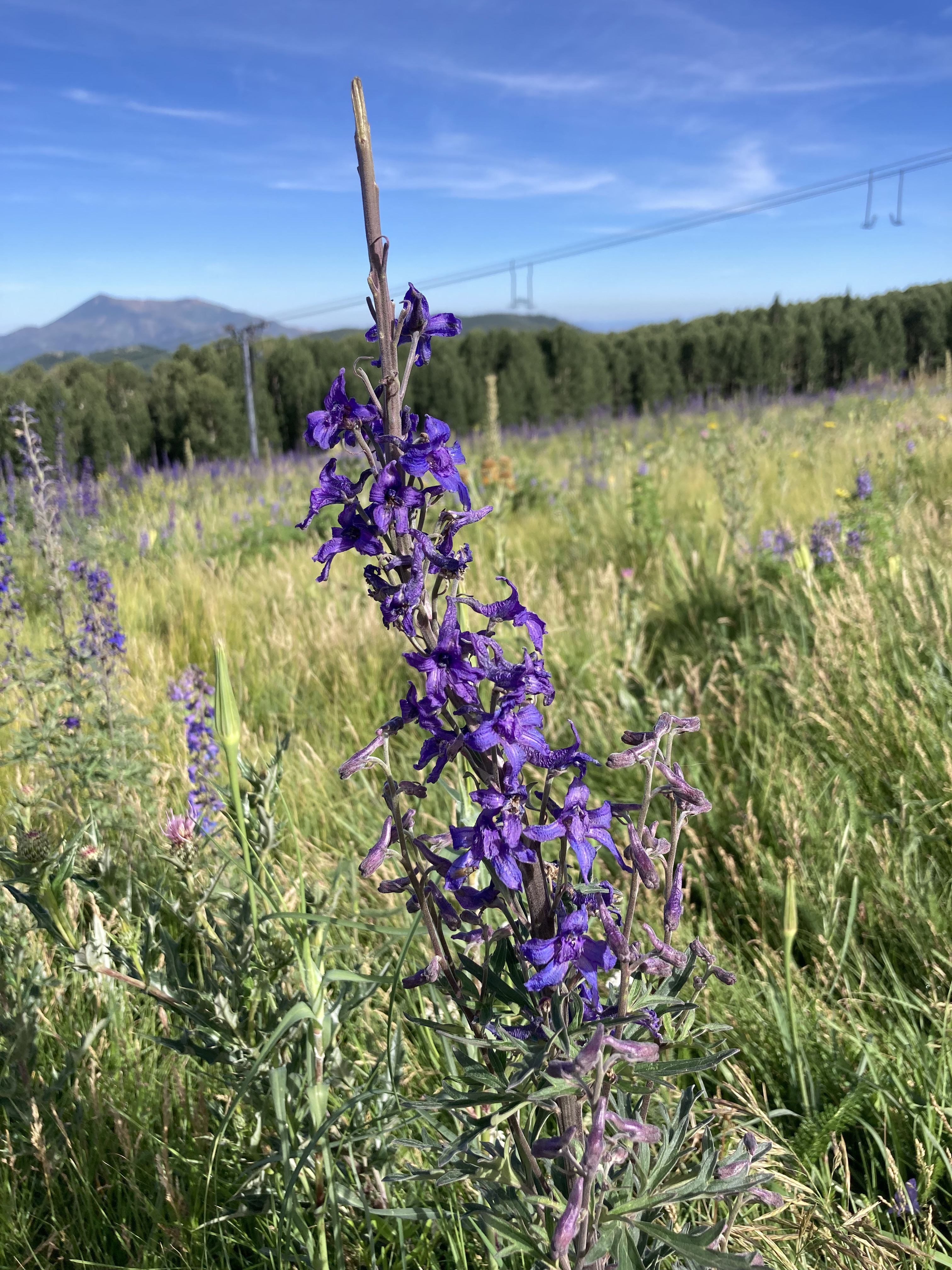
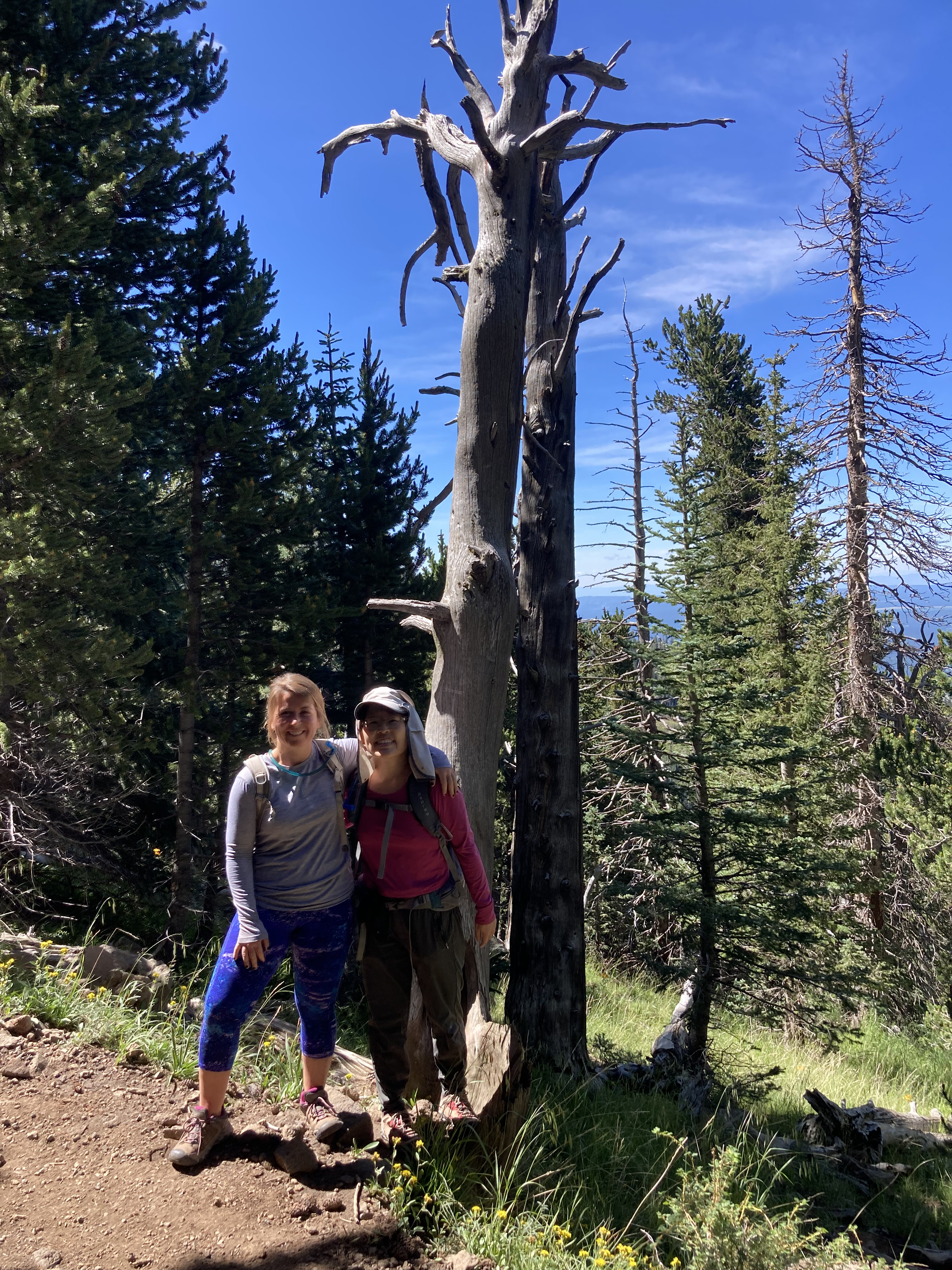
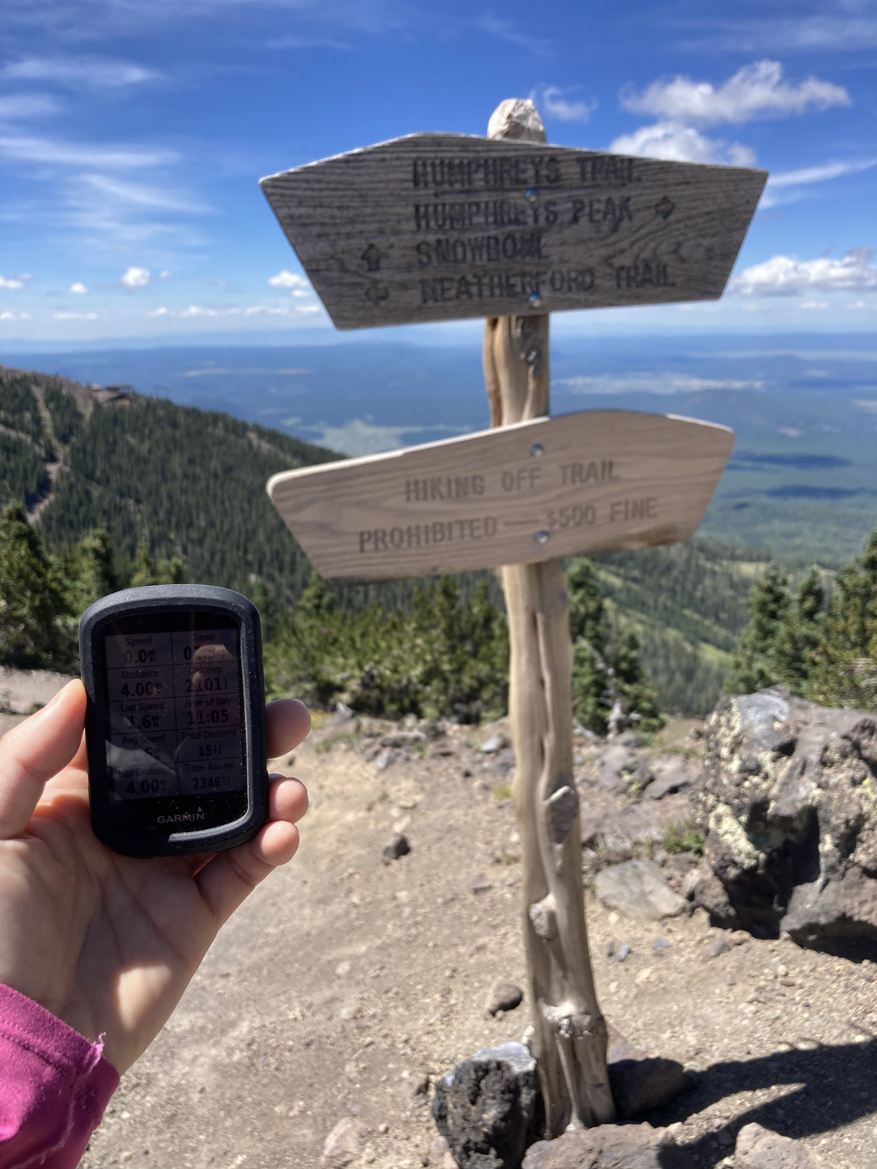
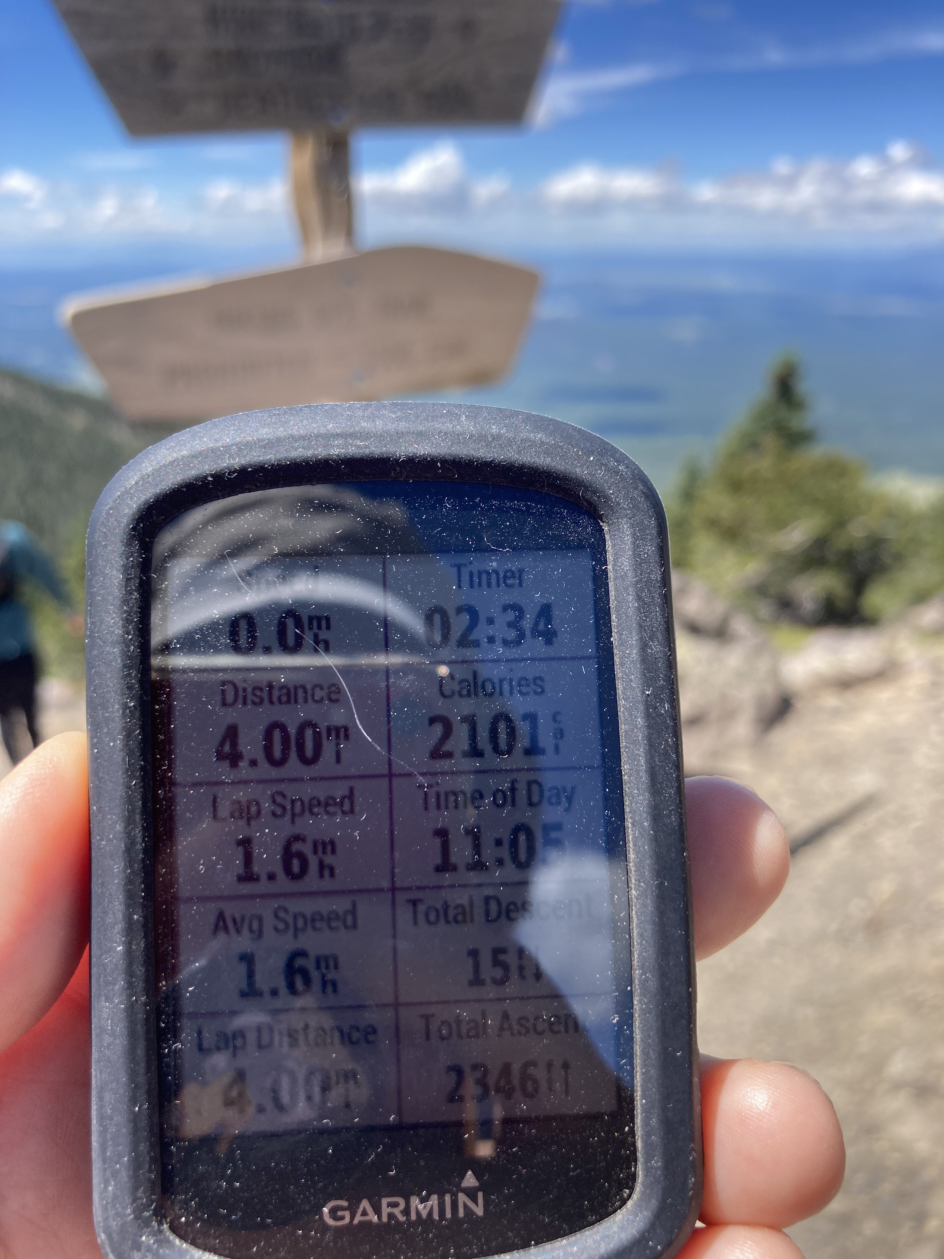
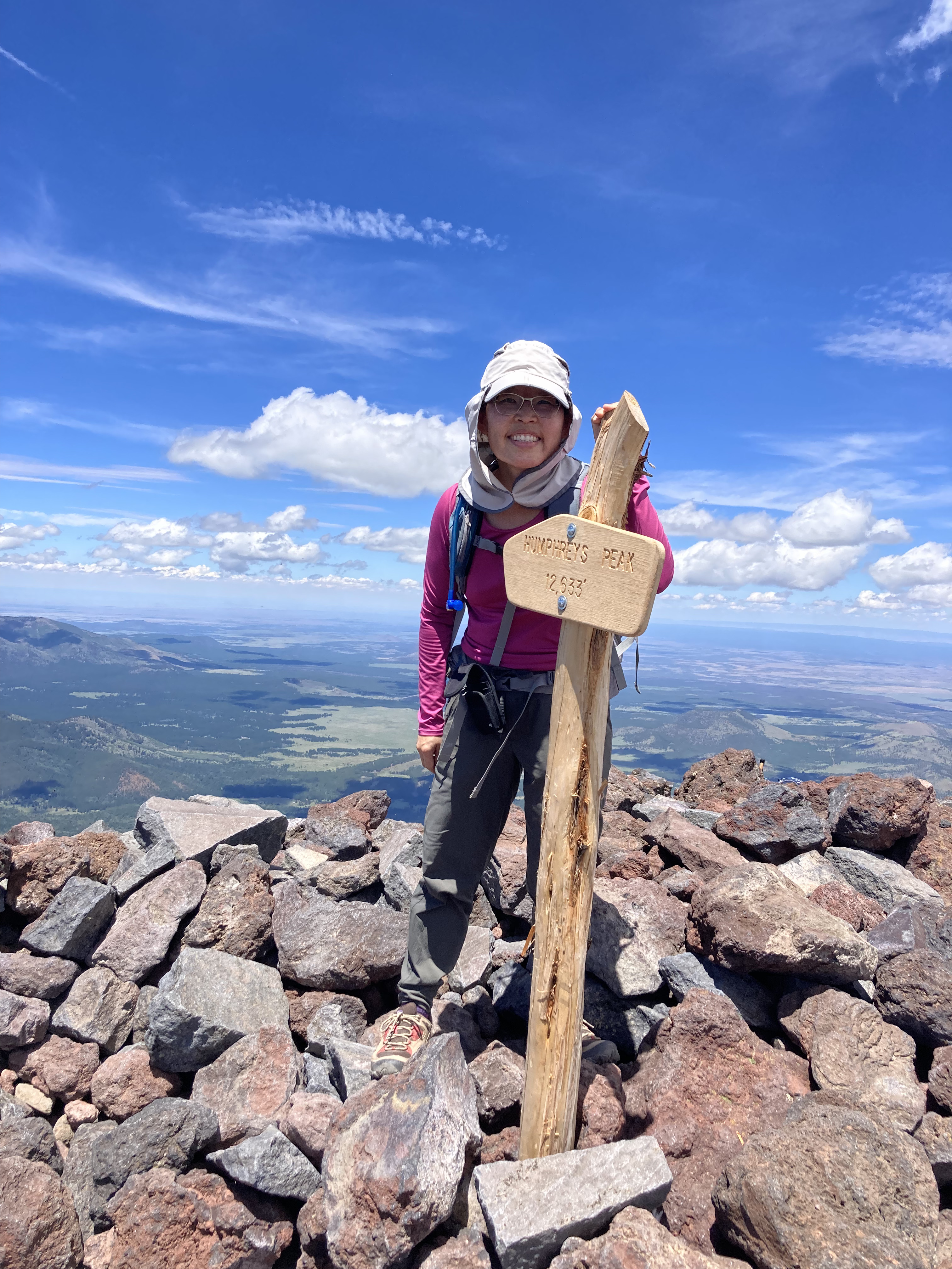
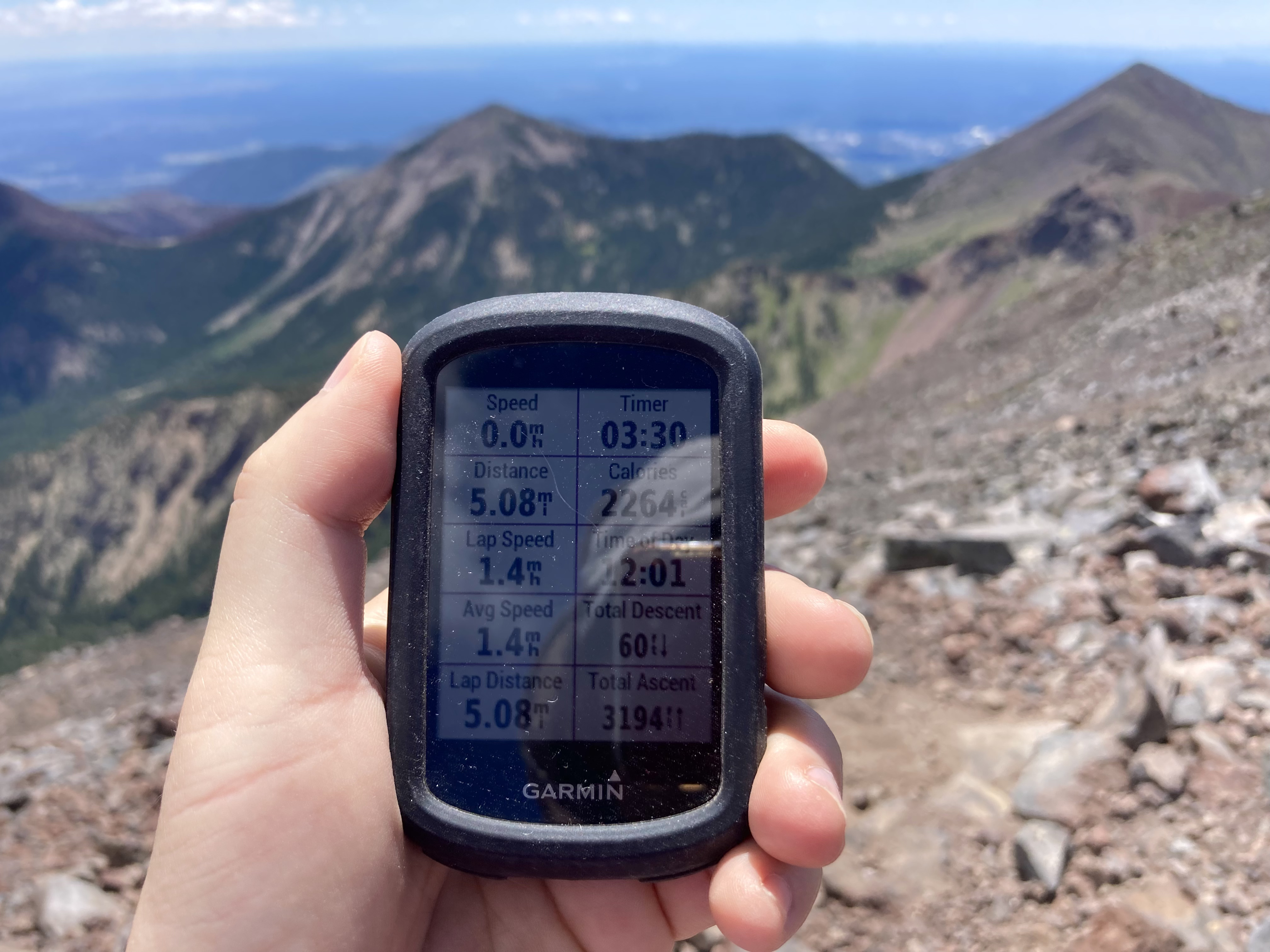
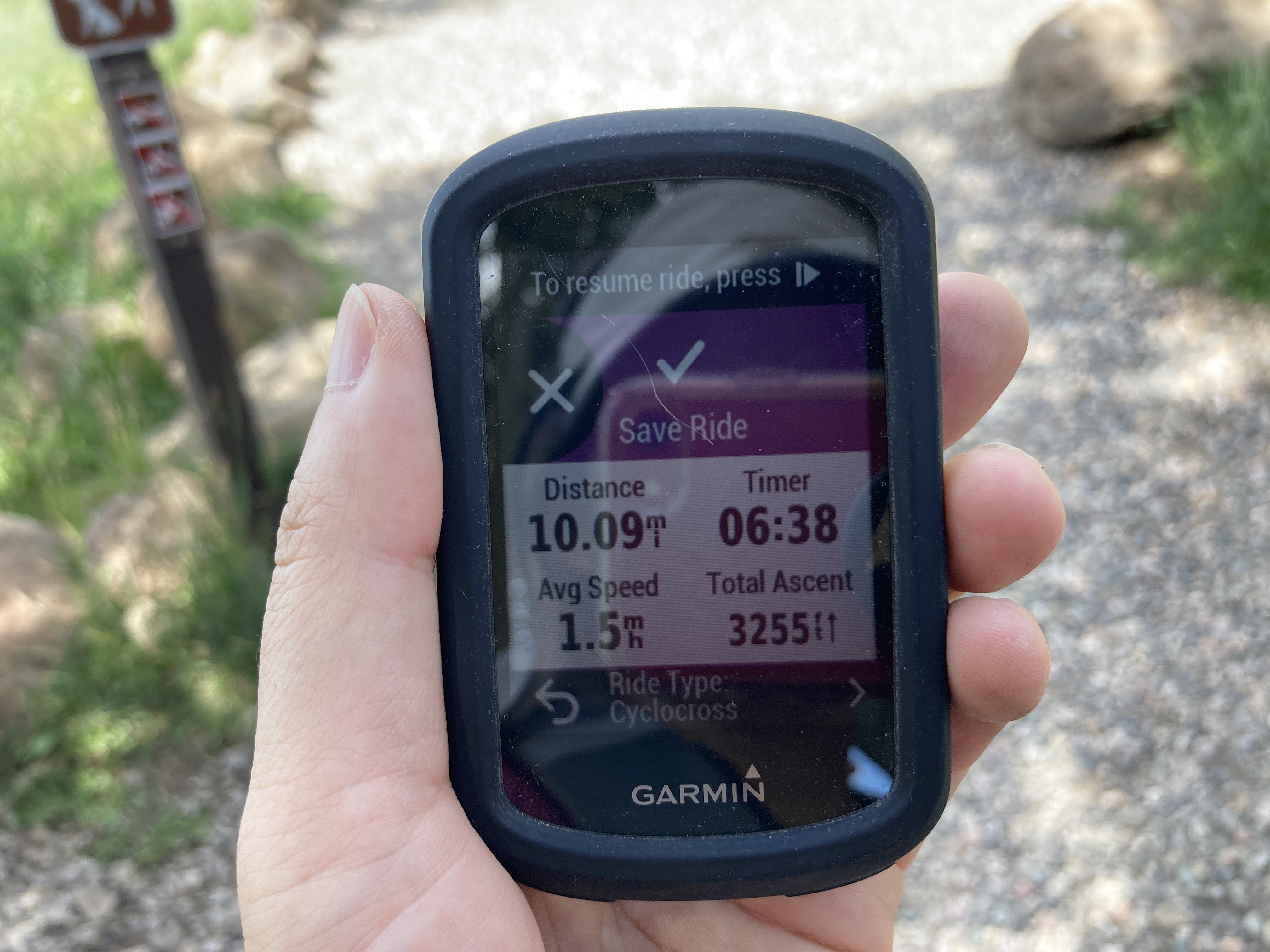
Looking fresh at the start of the hike.This is right at the start of the hike.I love the purple!On our way!We ran into Stevo! Always fun seeing friends on the trail.Getting higher…SO GREEN.Only 1,237 more feet to go!At the saddle. One more mile.Nerdy picture of my Garmin at the saddle.My new friend, Alex!The summit is “somewhere up there.” At the summit! Arizona’s high point at 12,637 ft (3,851 m).Statistics at the summit according to my Garmin.Summit picture (summit sign behind my head).Absolutely beautiful views from the top.Final statistics.The “we’re tired” picture at the end of the hike.
My Garmin said that we hiked 10.09 miles (round-trip) and climbed 3,255 ft (992 m) in 6 hours 38 minutes. My Garmin also said that I burned 2,351 calories. I don’t think I burned that many, but I DID permit myself to eat some fries after the hike!
Seems like I’m making the same excuses for not updating my blog in a timely manner….too busy doing stuff! I’ve been fortunate to have enjoyed some great mountain biking adventures and even an extreme hike since my Bear Jaw race in August. Without further ado, here’s part 1 of my “catch-up blog post,” in chronological order!
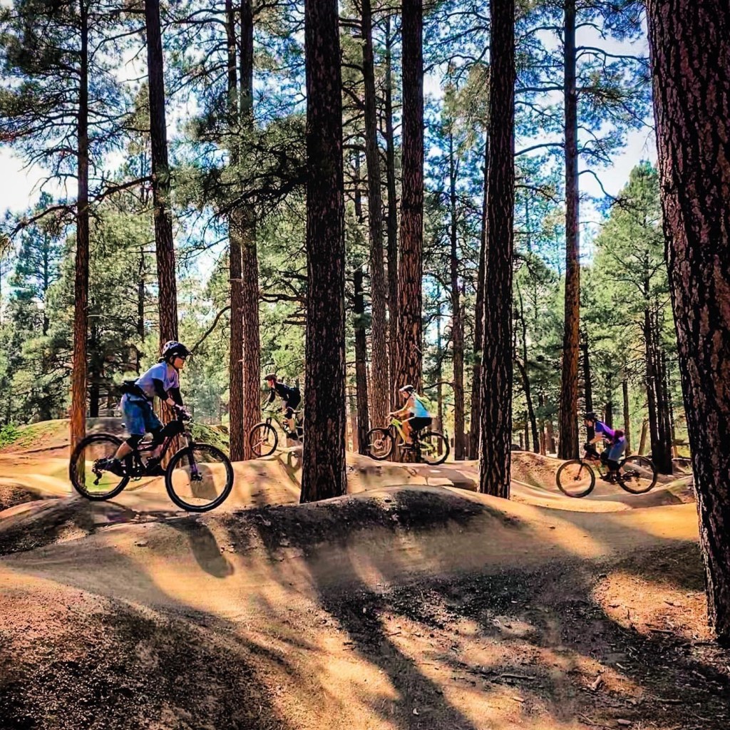
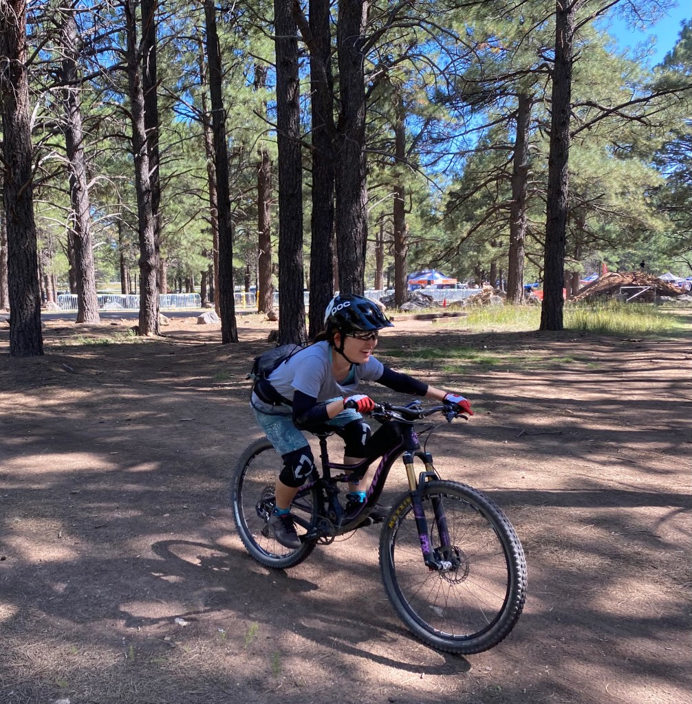
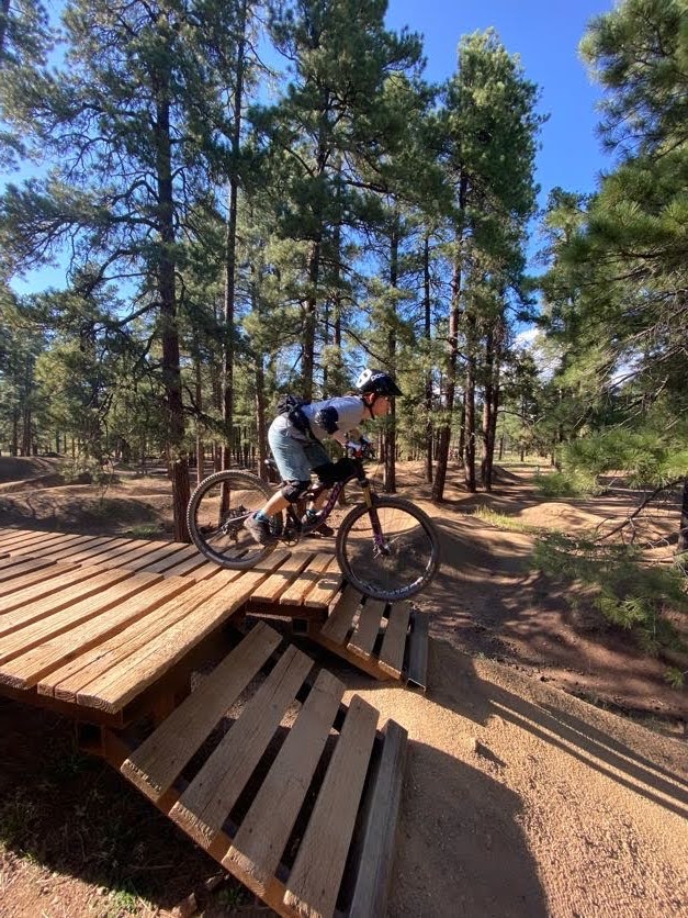
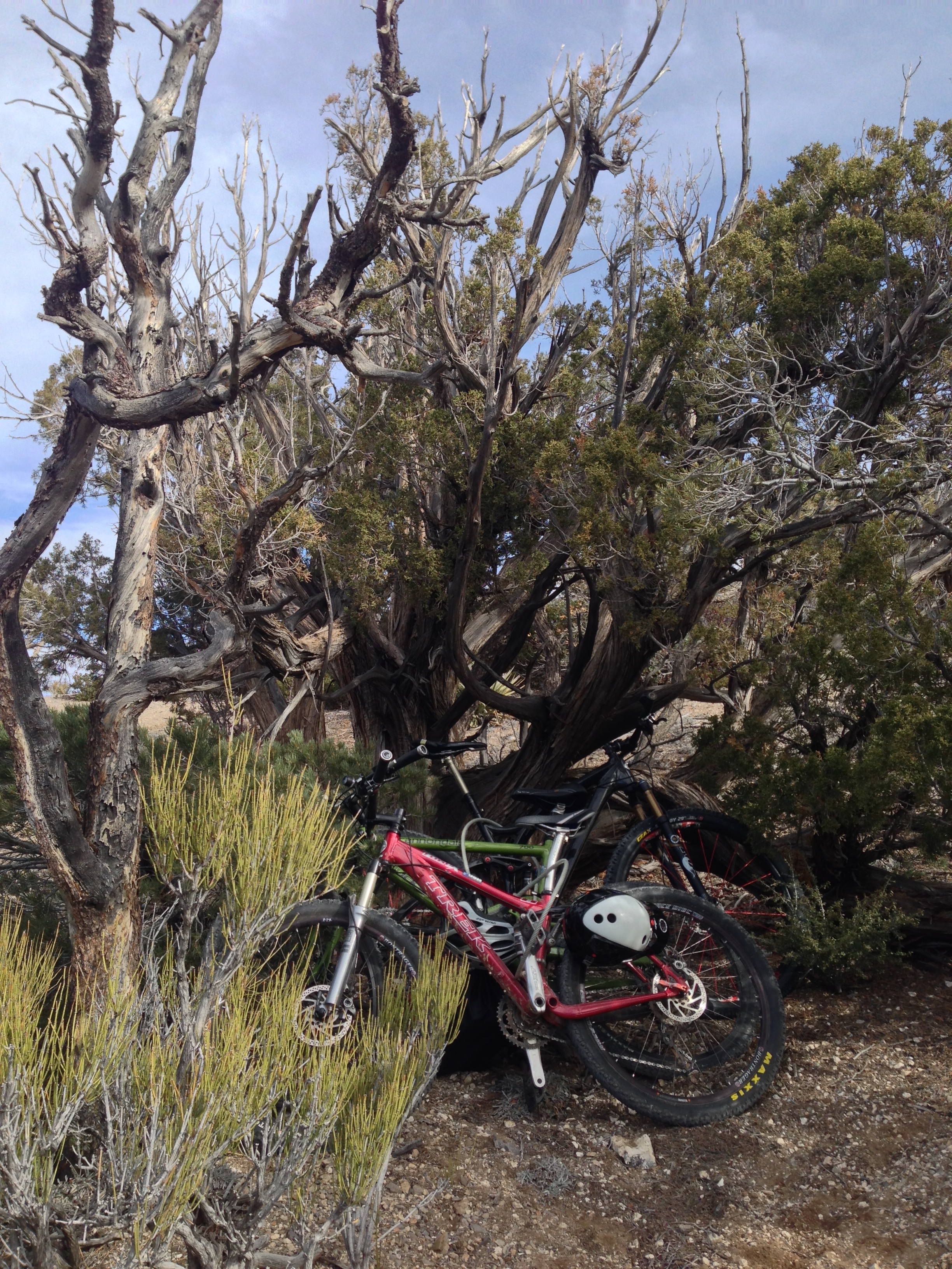
First, in September, I got to participate in a SMBA ladies’ bike park skills clinic at the Fort Tuthill Bike Park just outside of Flagstaff. A bike park is a specially designed place where you can practice mountain biking skills, such as jumping (riding over and past a ramp to “get some air”), dropping (either rolling down or dropping over an obstacle, like large boulders or tree stumps), and pumping (using your arms to create momentum, i.e., pumping, while riding on a closed track). My clinic focused on the mountain bike fundamentals, like cornering and shifting body weight forward and back, then used the fundamental skills to test our abilities on the various bike park features. I’m still a beginner when it comes to doing jumps and drops, but I feel like I now have the head knowledge to attempt baby jumps and drops on my home trails. It was a fun day up in Flagstaff and inspired me to continue working on my skills.
Working my way around the pump track.
Practicing low body position.
Working on drops.
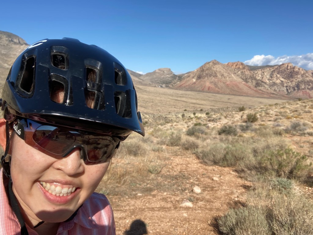
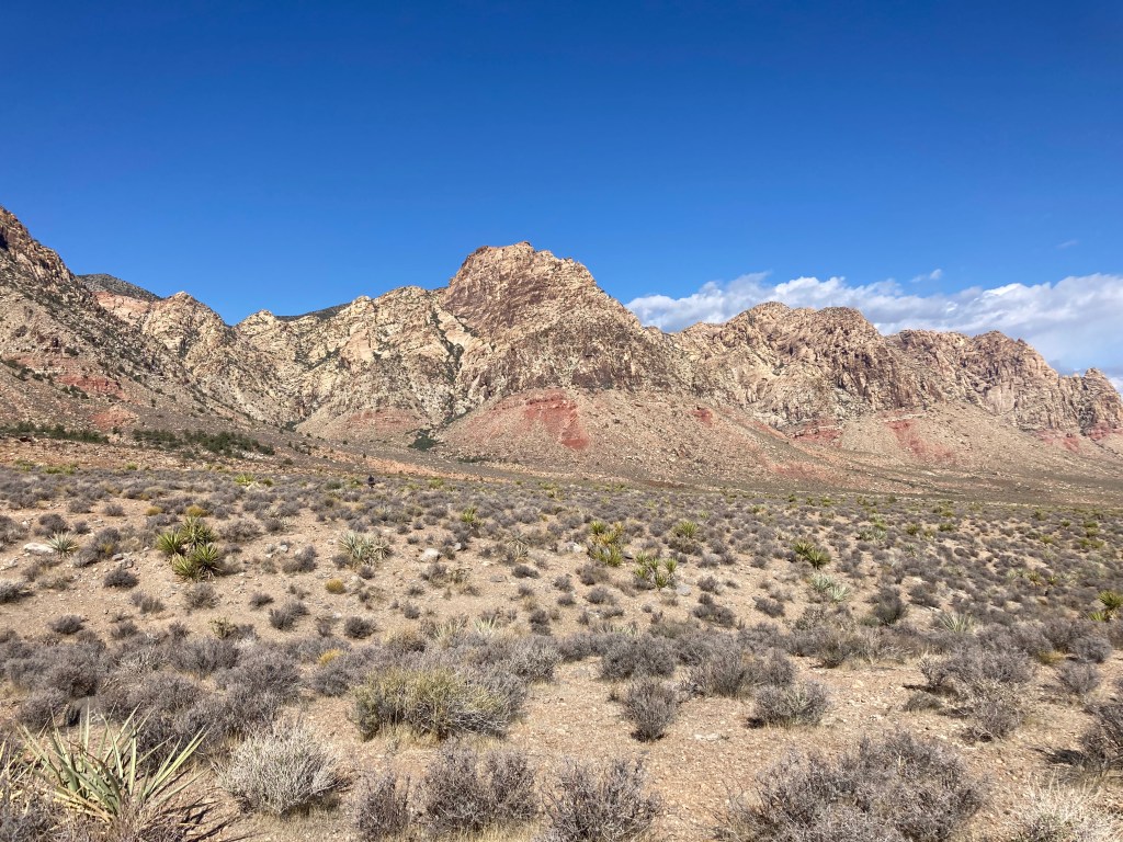
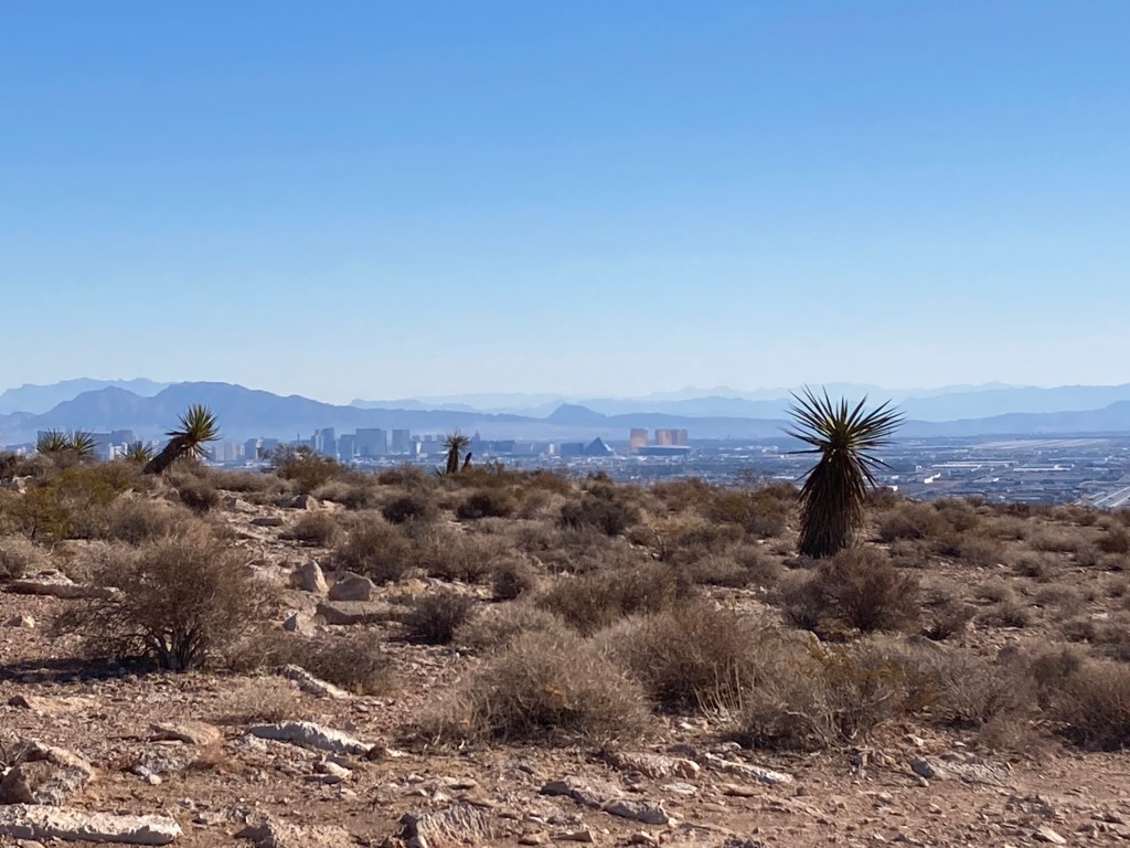
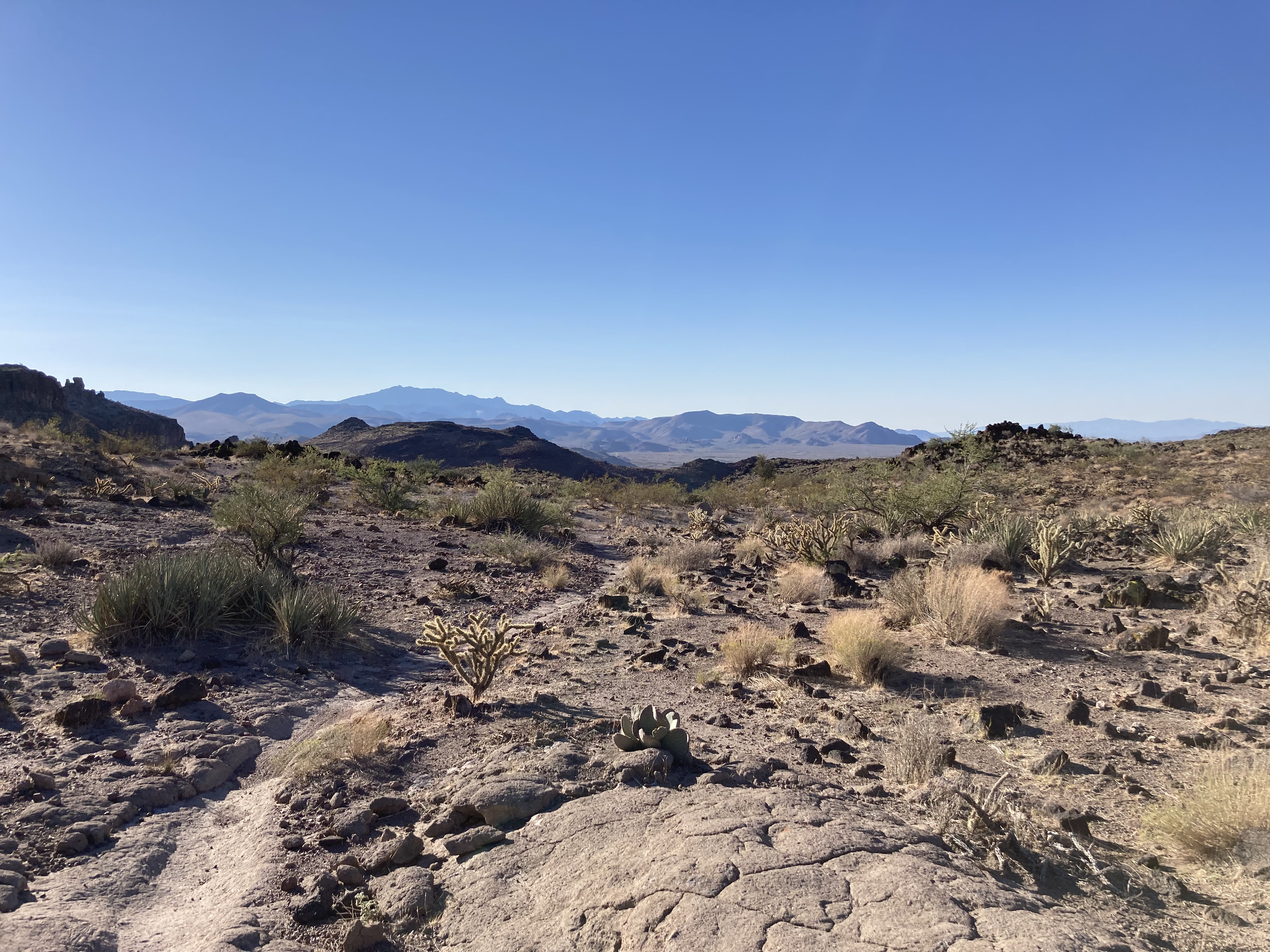
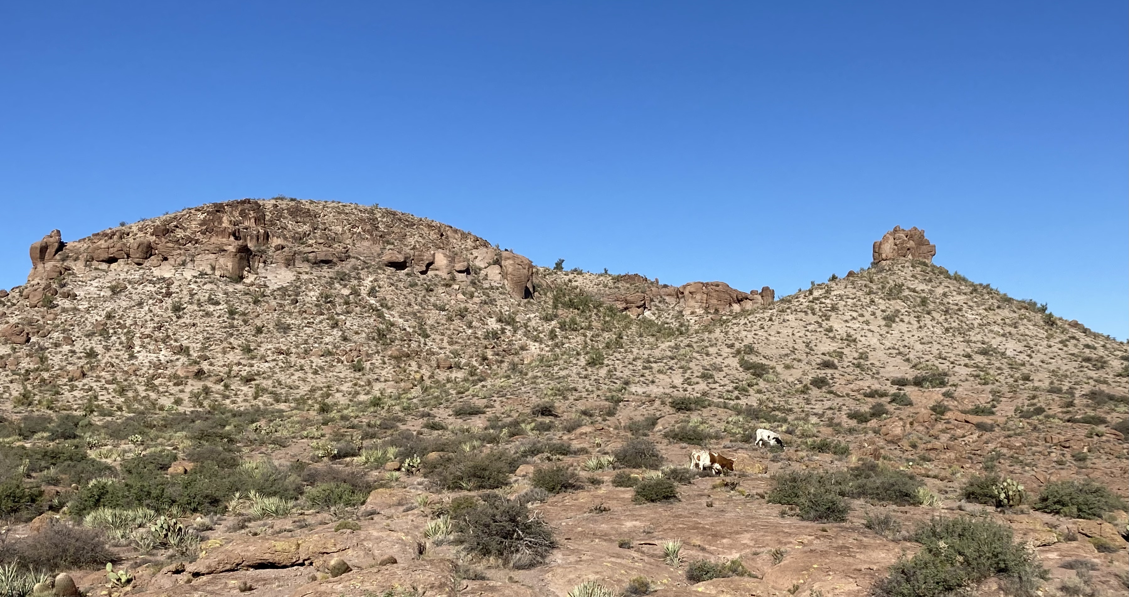
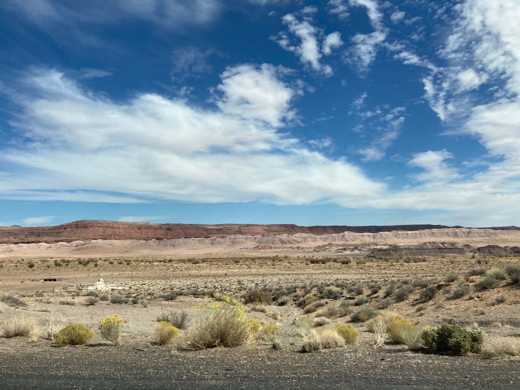
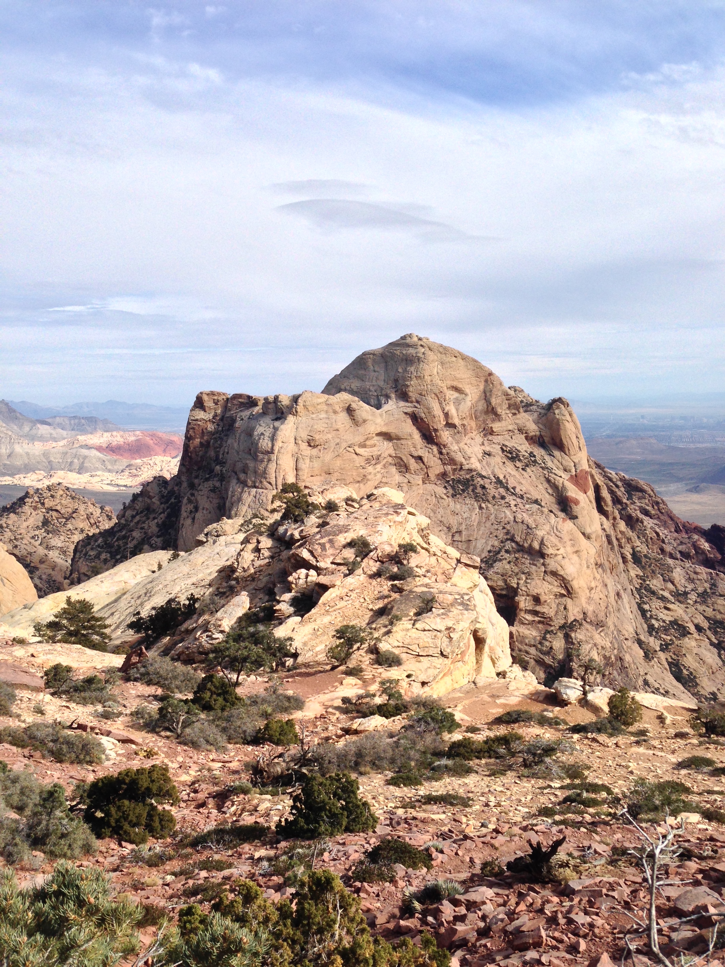
For the October long weekend, my SAT (self-appointed trainer, for you newer blog readers!) and I went to Vegas to visit friends and do some mountain biking. I was particularly interested in seeing how similar/different the Vegas trails are compared to the Phoenix trails. I’d say that the Vegas trails I rode are more rocky and rugged than the Phoenix trails (not that there are no rocks in Phoenix, just that there seemed to be MORE rocks in Vegas). That difference made for a slightly more challenging riding experience for me, but in a good way. I definitely rode some sections that were pushing me out of my comfort zone because of factors such as technical rocky sections, exposure, and the unfamiliarity of the trails. It was really fun to catch up with friends and I know my riding improved because of navigating new trails and practicing “looking ahead” and “reading the line.” During the drive back to Phoenix, my SAT and I stopped at the Monolith Garden trail system just outside of Kingman and checked out the trails there. We really enjoyed the beauty of the rock formations and the solitude of the area (we didn’t see anyone during our entire ride). The rock formations reminded us of the Chiricahua National Monument in SE Arizona–simply amazing.
Hello Red Rock Canyon! How I’ve missed you.
Love this view.
Love the red rocks.
More beautiful SW desert views.
Vegas’ Southwest Ridge. You can see the Strip in the distance.
So good to see friends!
Monolith Garden trail just outside of Kingman, AZ.
Mark testing his balance.
Vista of Monolith Garden trail.
We saw cows near the end of our ride.
I like cows. They are gentle creatures.
Got to get a selfie!
Cool hole in the rock.
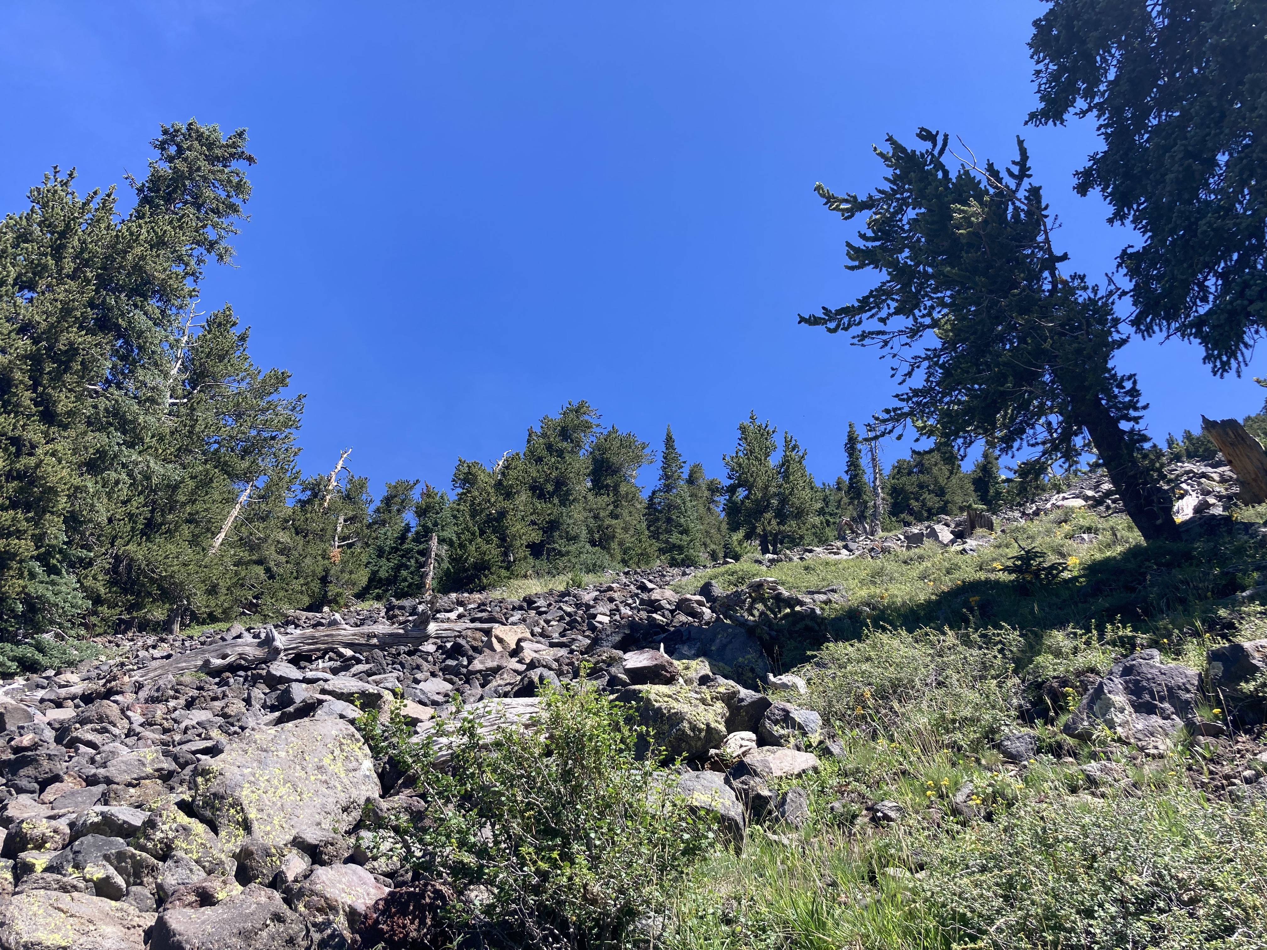
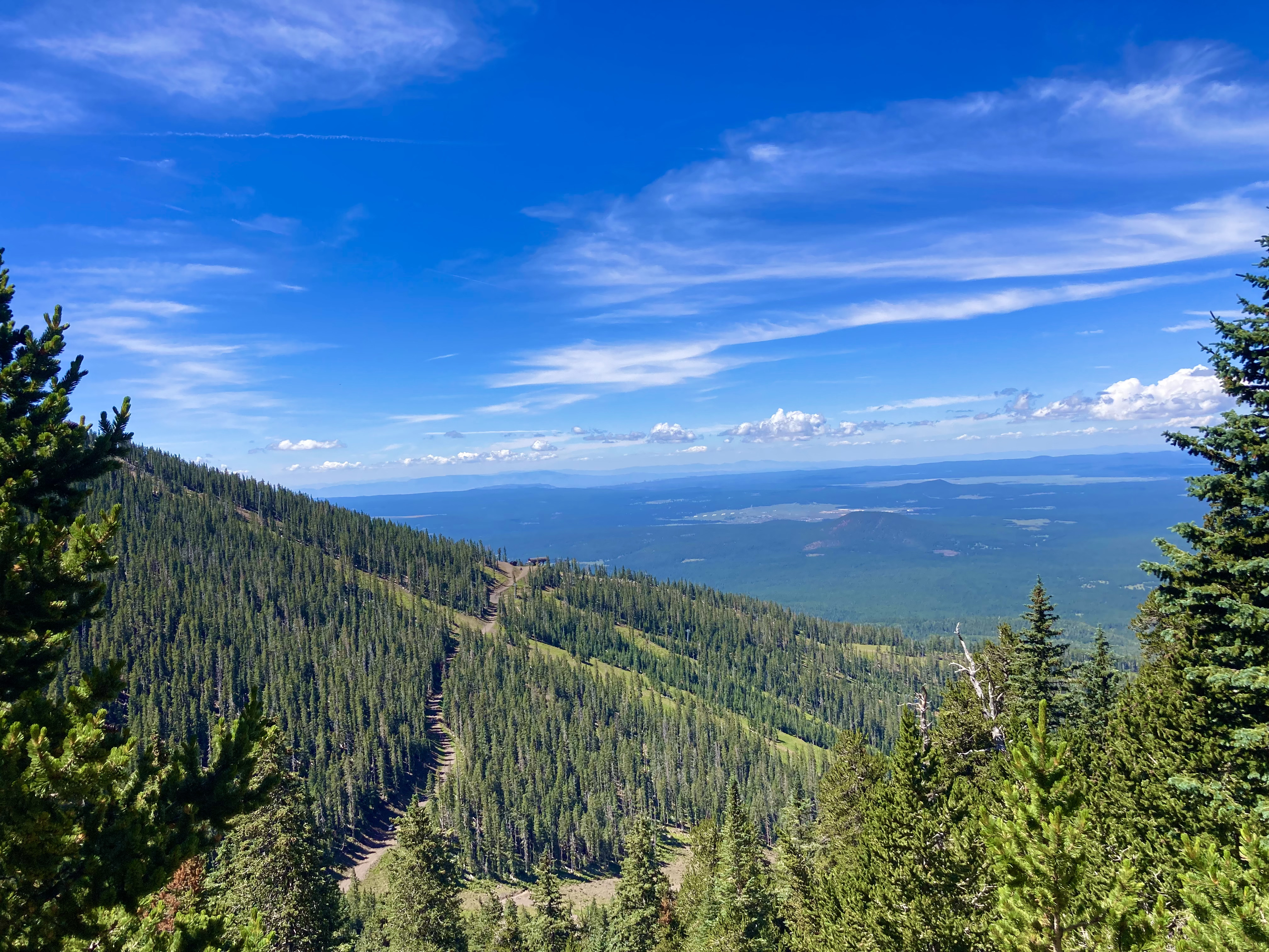
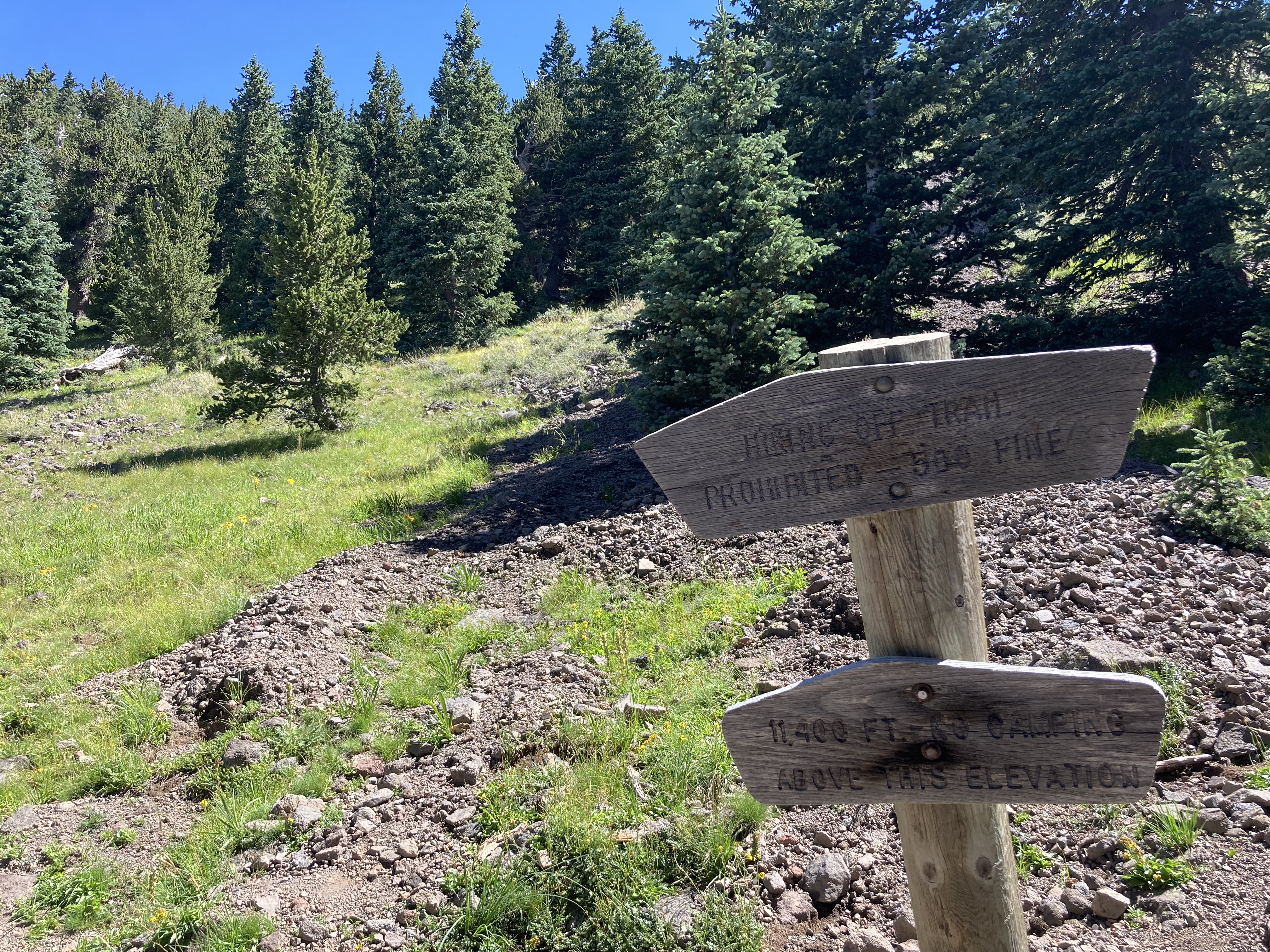
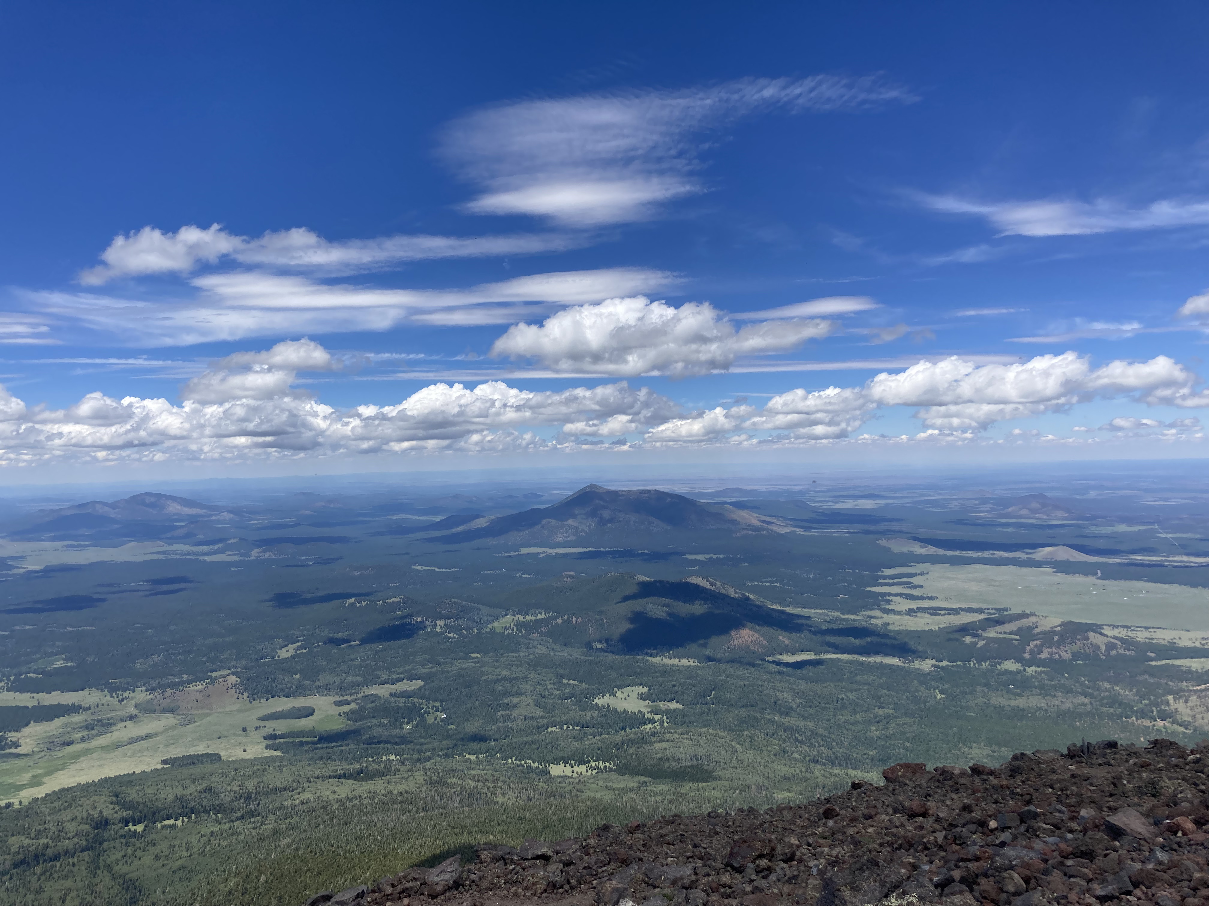
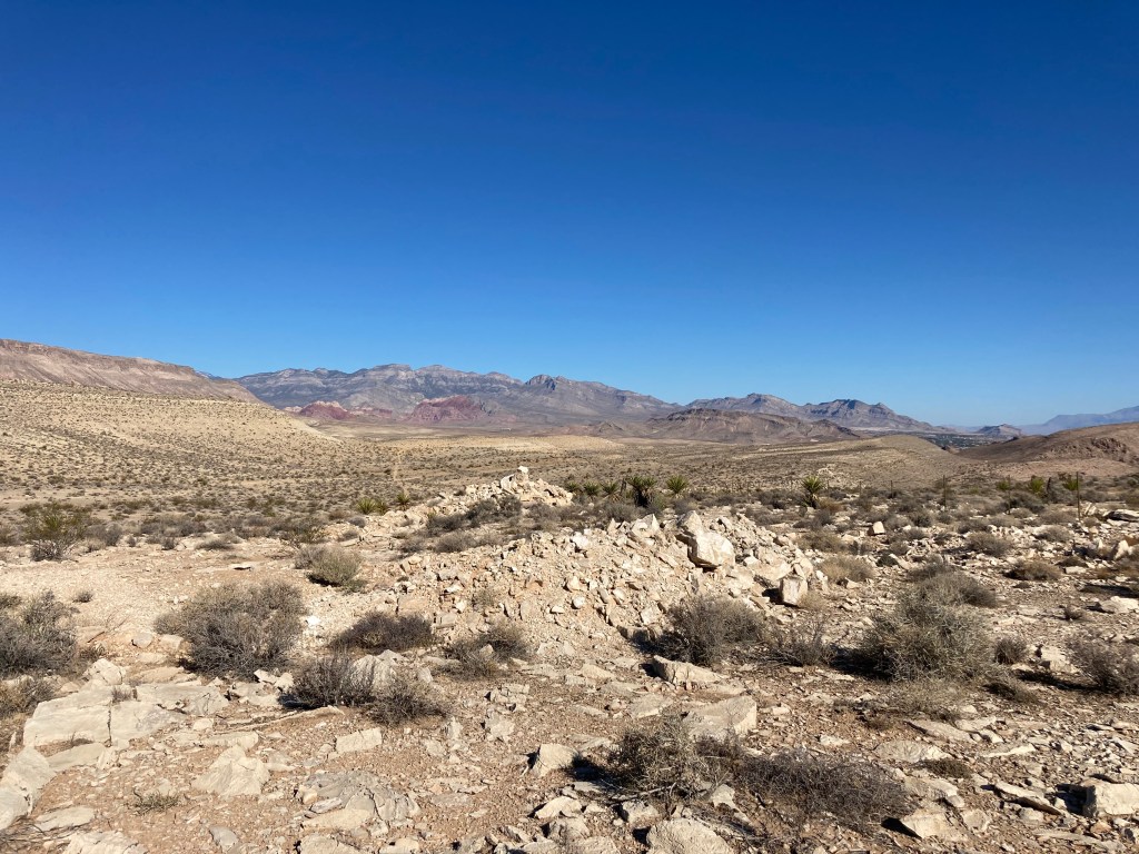
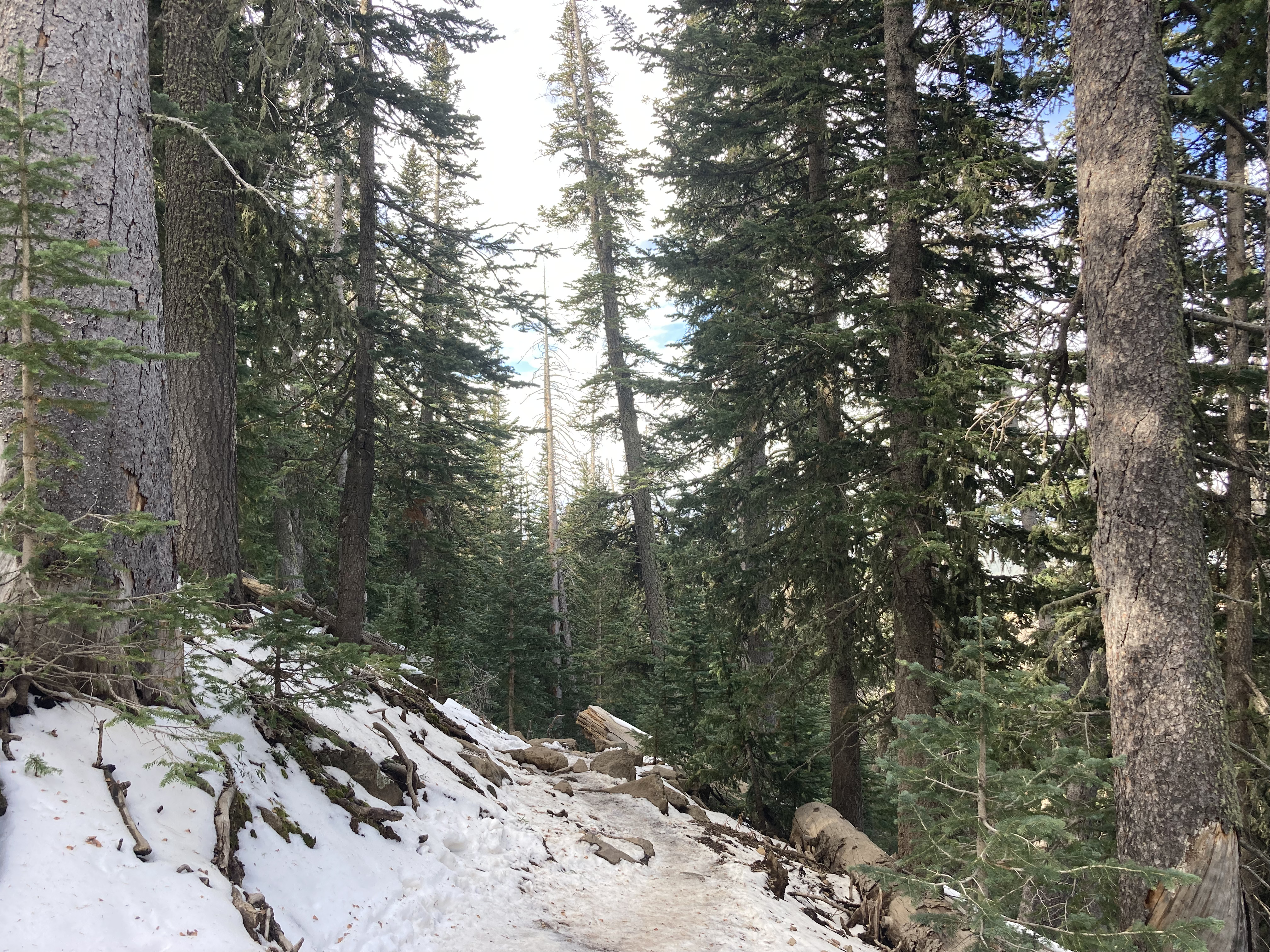
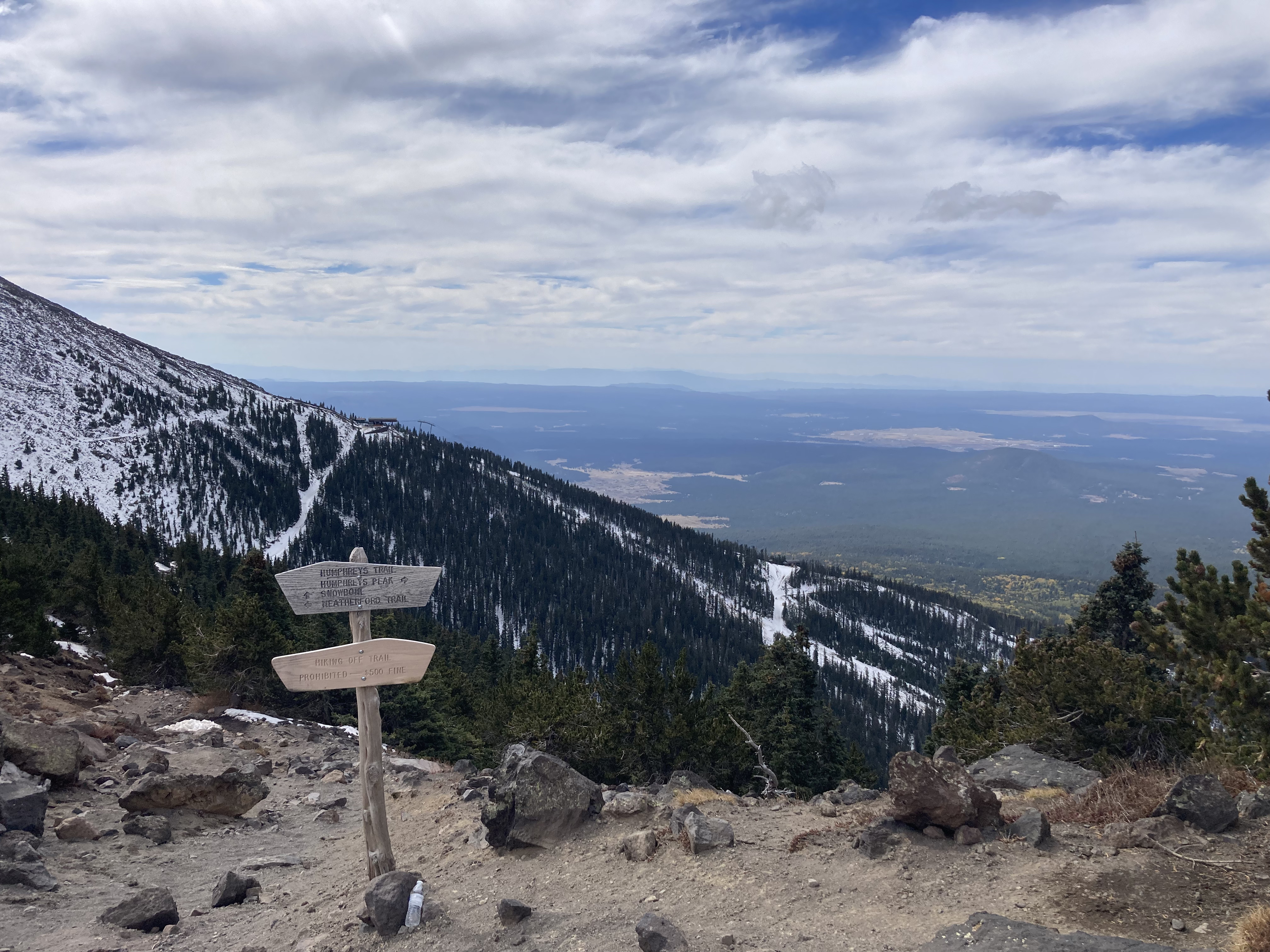
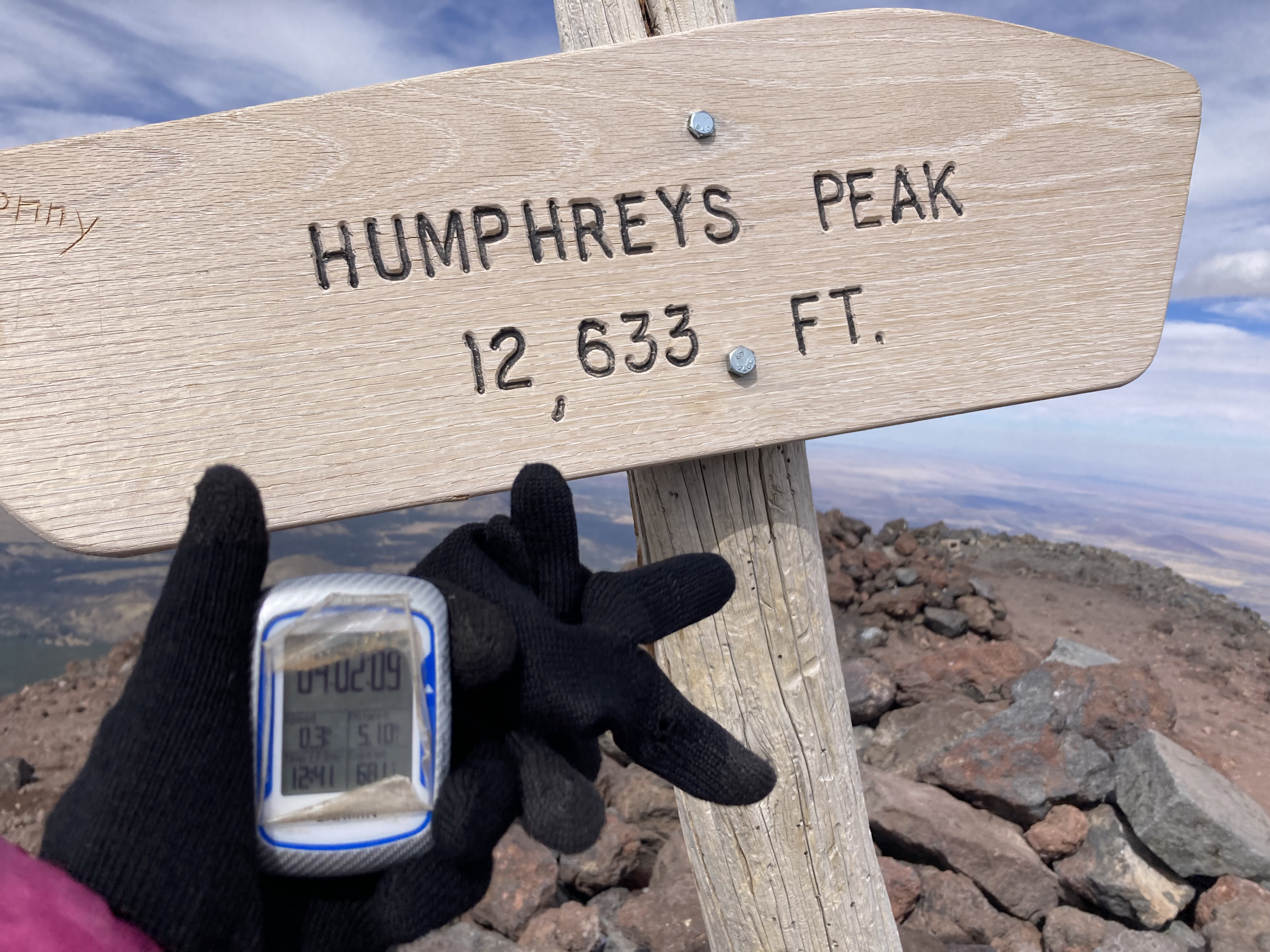
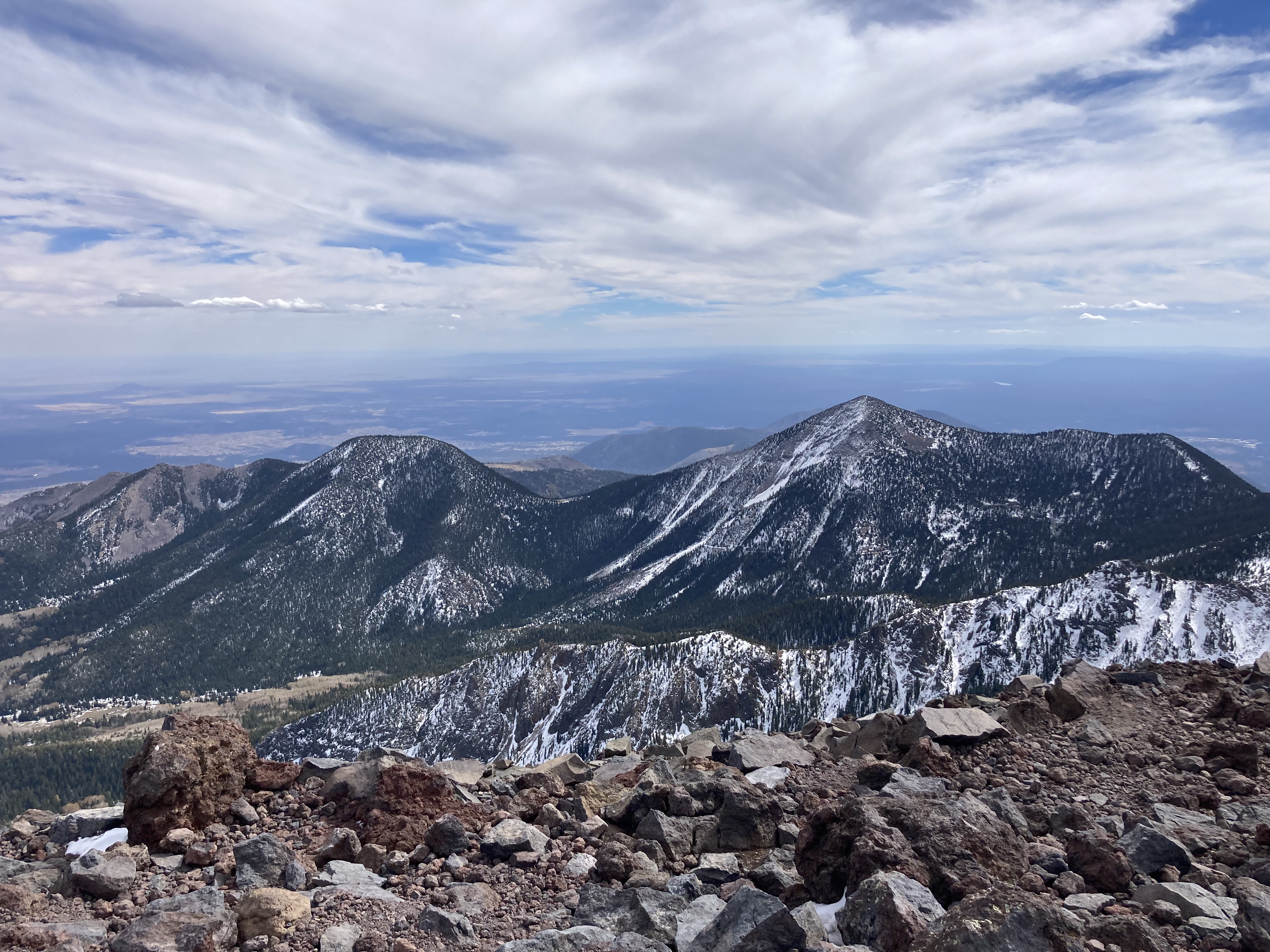
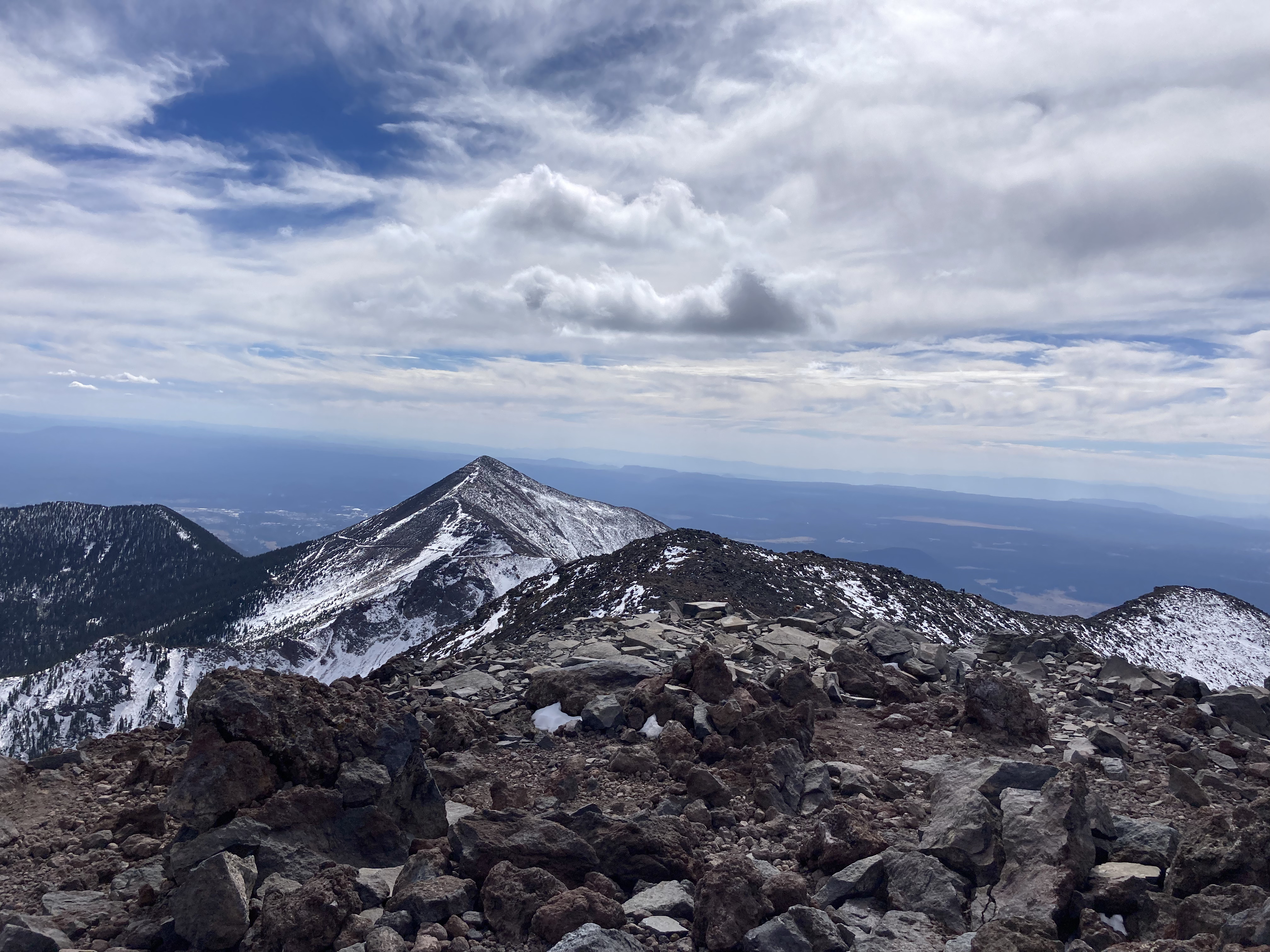
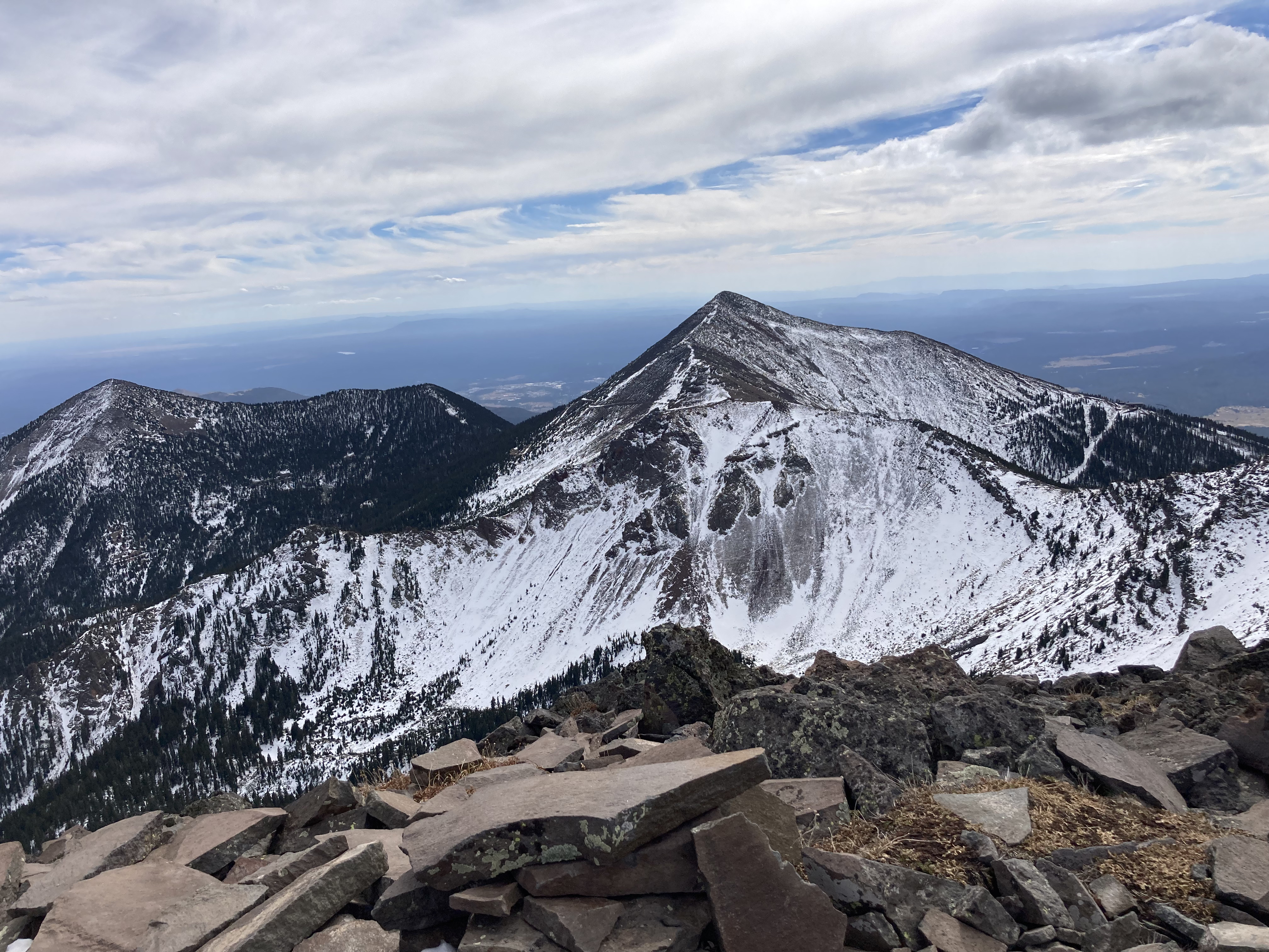
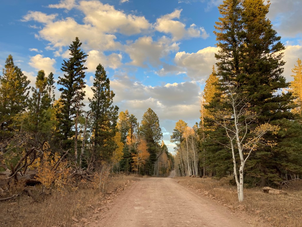
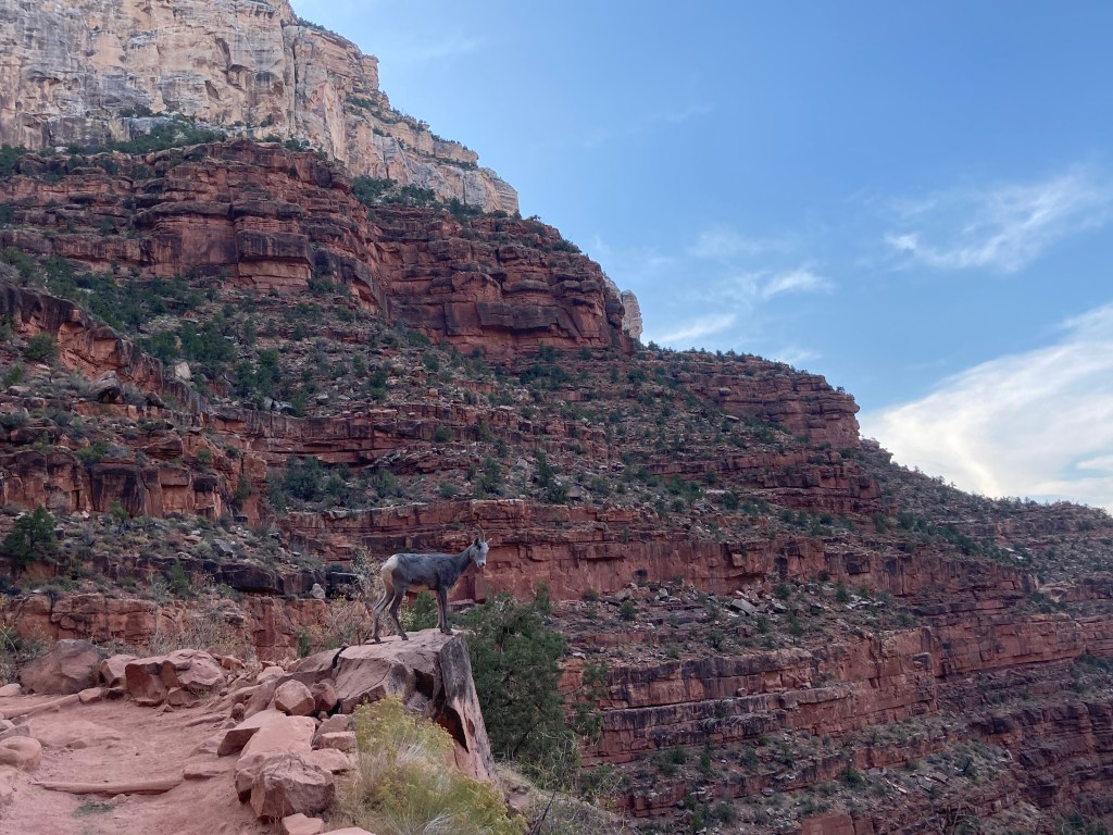
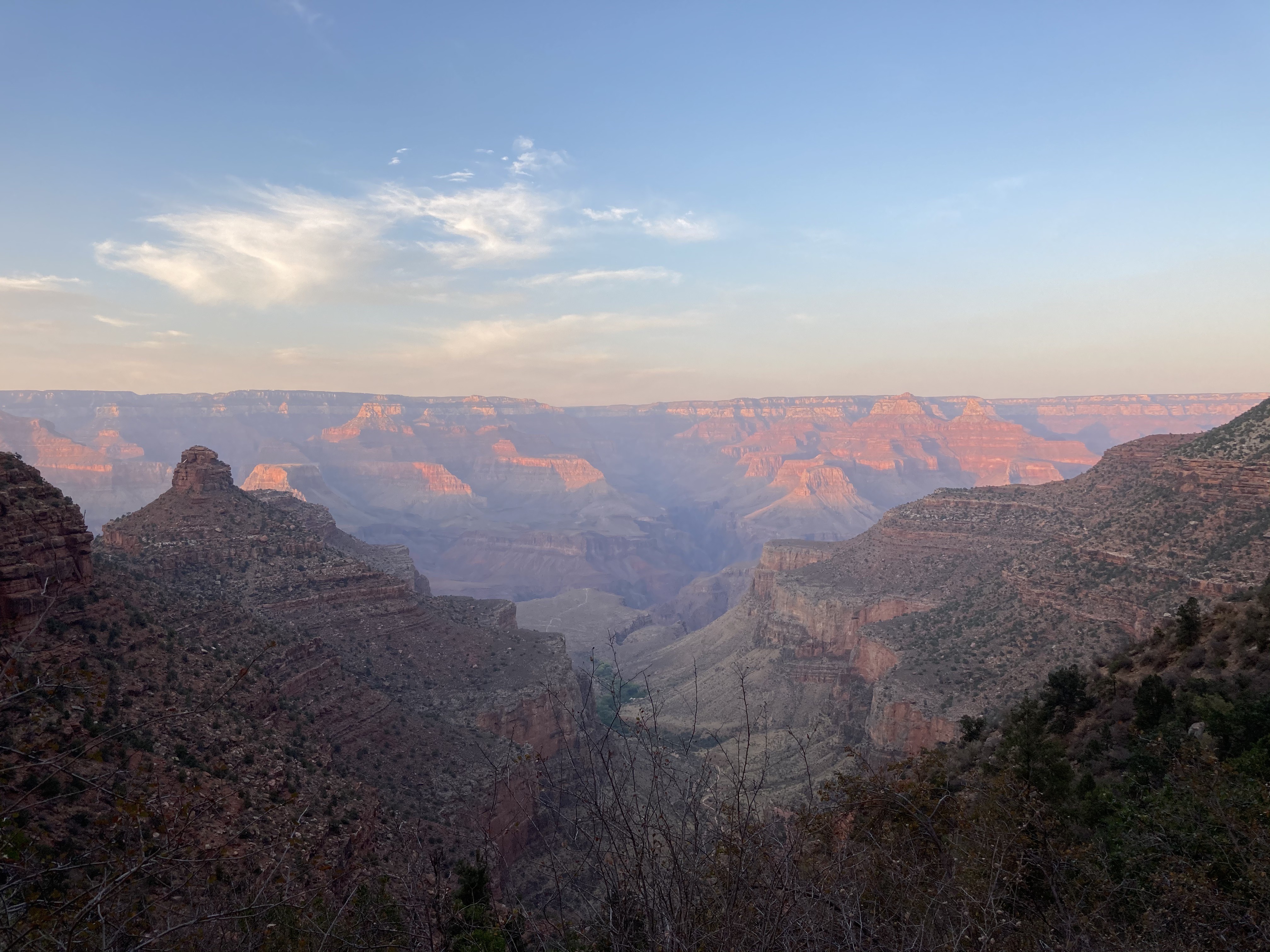
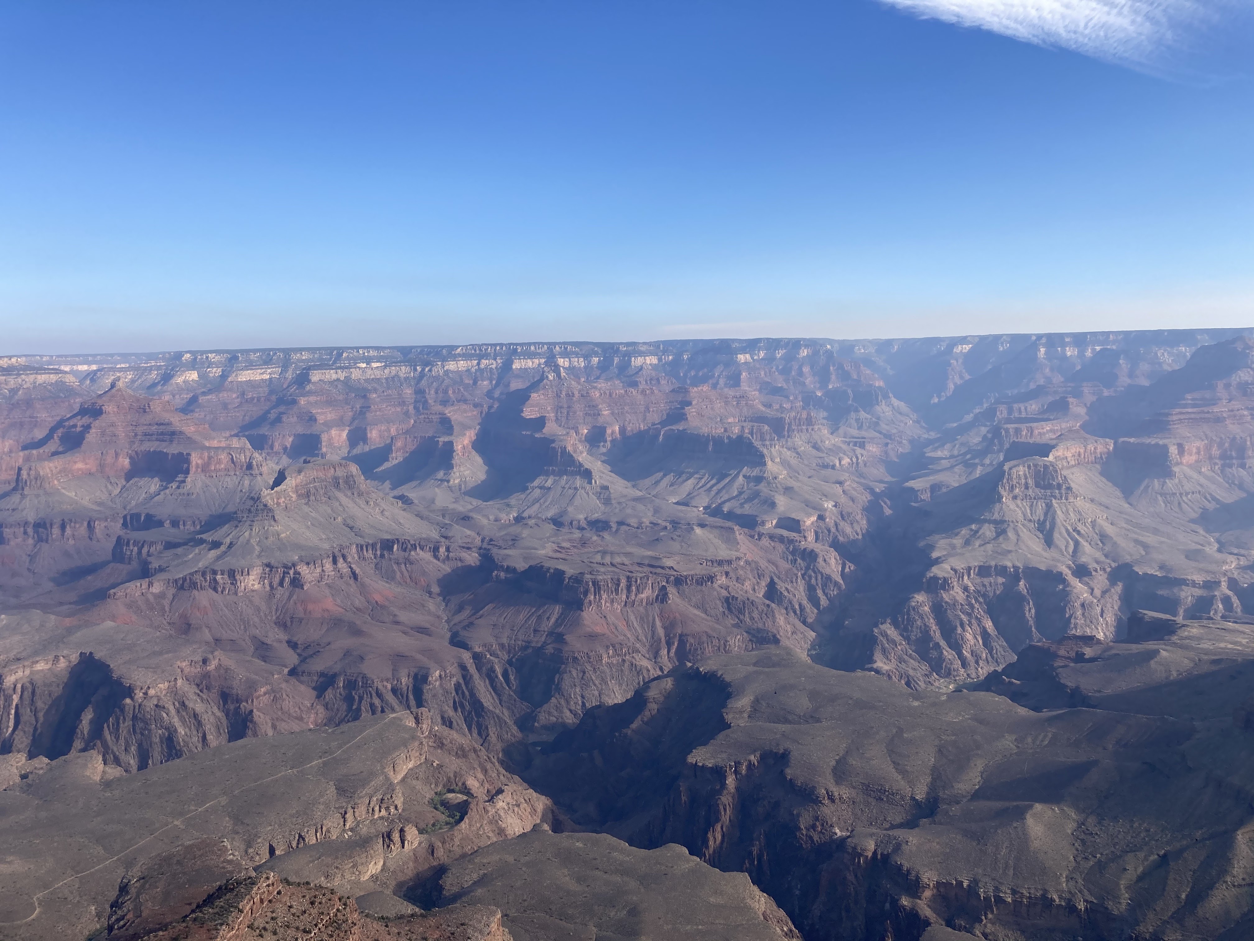
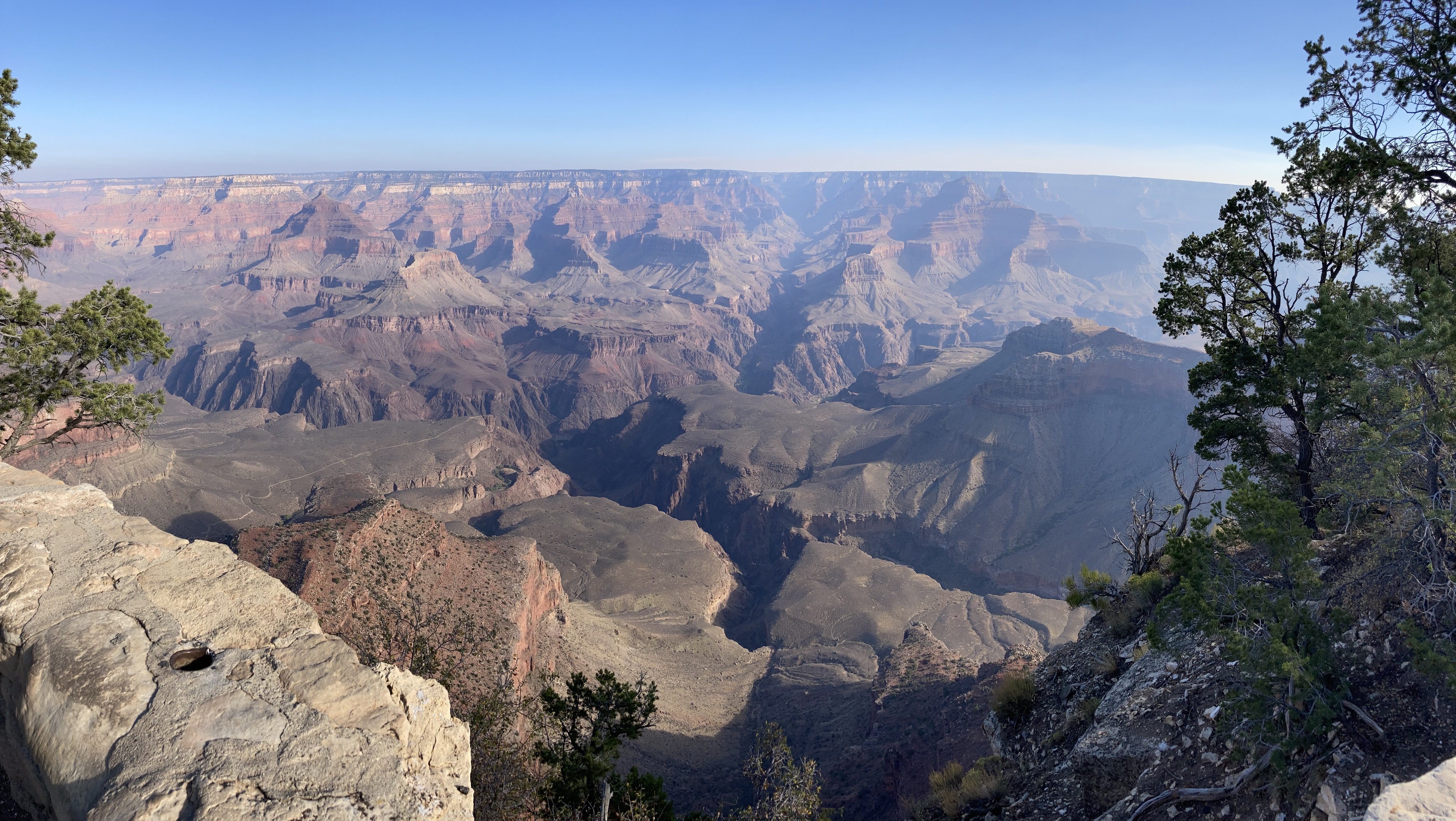
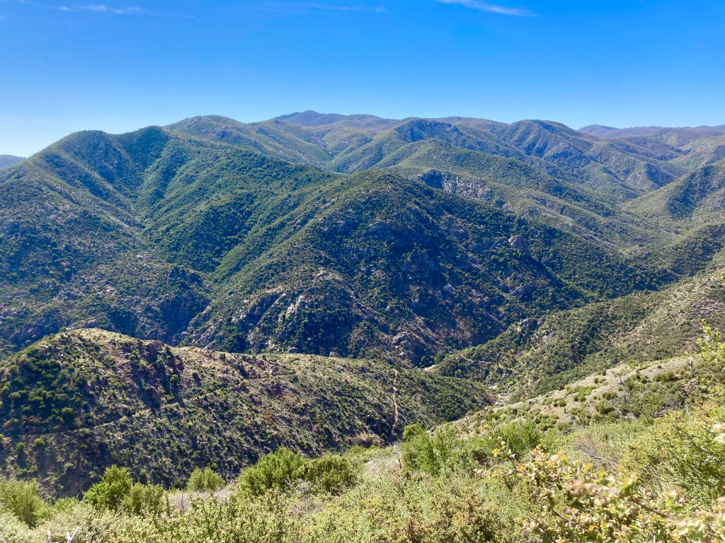
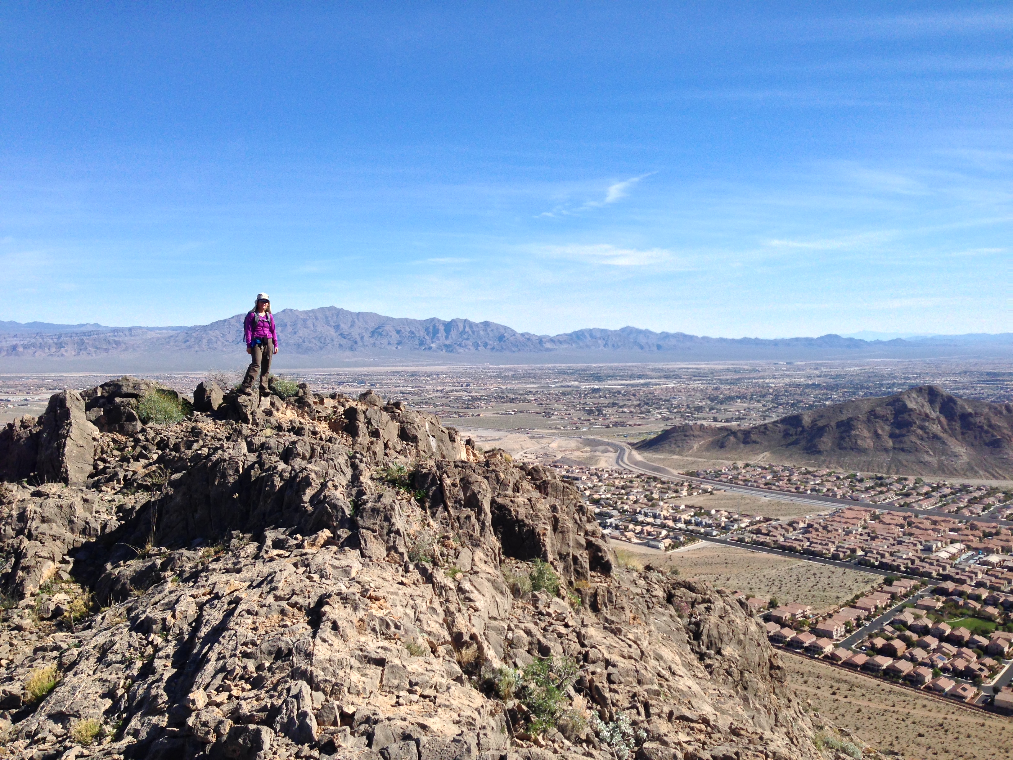
On October 17, my friend Crystal and I successfully summited Humphreys Peak. We do this hike each year, usually in the summer. However, this summer, we could not do the hike because of all the forest fire closures in and around Flagstaff. We were a little bummed to miss out on our annual “do or die” tradition, so when the forest fire closures lifted, we decided to pick a fall date and go for it. [Note: by “do or die,” I mean that we pick a date and hike Humphreys without training for it. We drive up, hike, and drive back in one day.] Our “do or die” approach is not something I recommend because the hike is a pretty strenuous one. Humphreys Peak is the highest point in Arizona, sitting at 12,633 ft (3,851 m), so altitude sickness is a real concern. According to my Garmin (cycling computer that tracks distance, elevation, and other workout statistics), the hike is a total of 10.2 miles round trip. Elevation gain is around 3,500 ft (1,067 m).
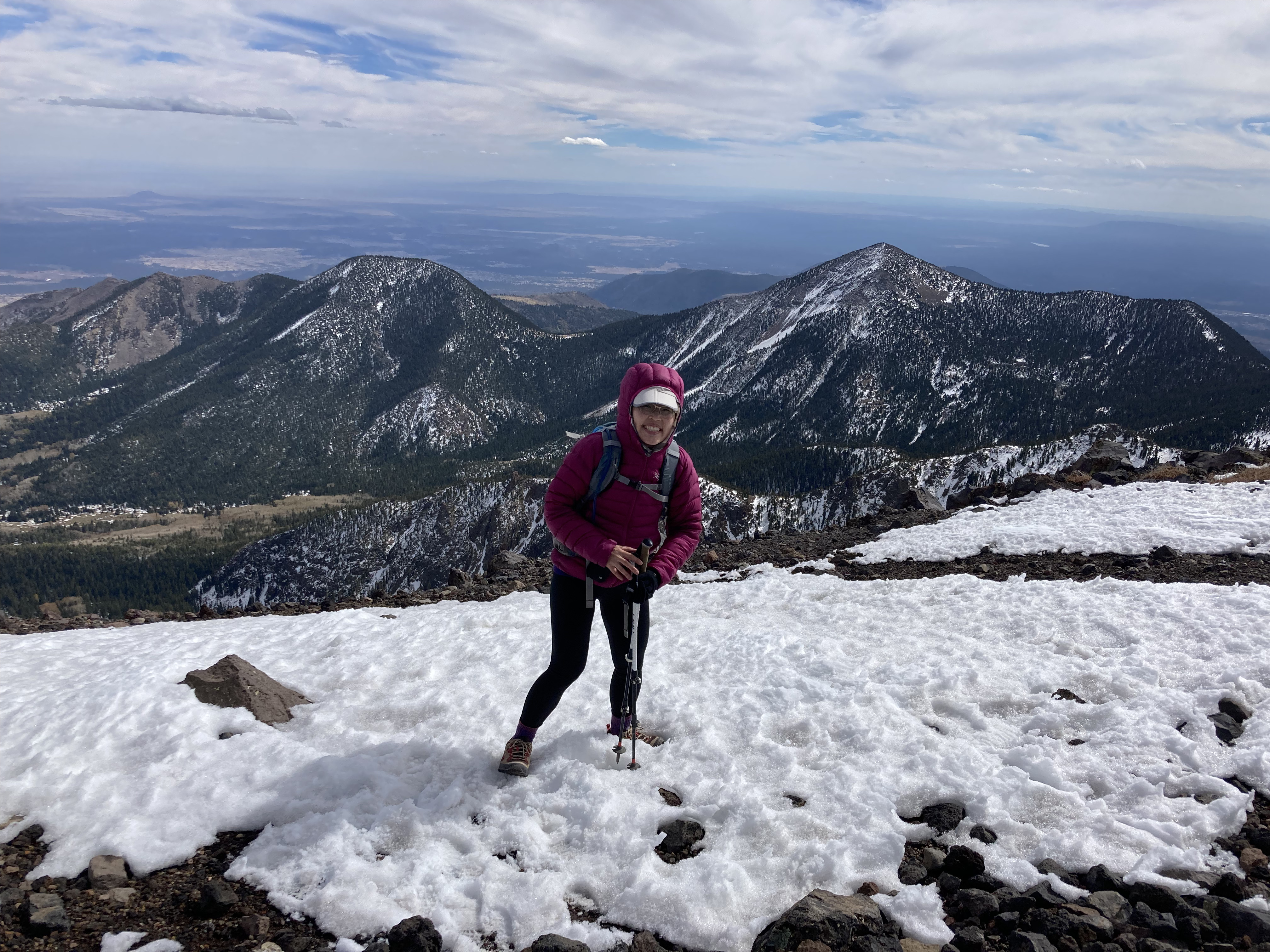
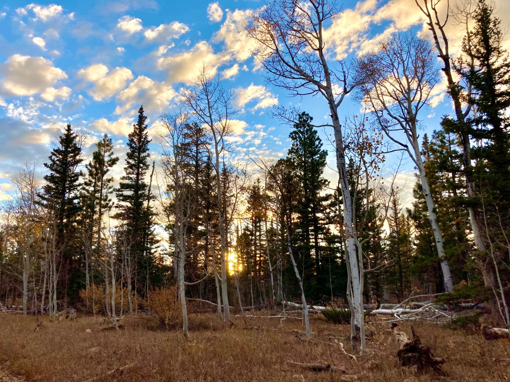
Three things stand out to me from this year’s Humphreys hike: 1) it was really cold and icy on the trail going up, 2) it was SUPER WINDY (and cold) on the summit, and 3) my legs were TIRED at the end. One positive thing about doing this hike in October vs July is that there were absolutely none of the little bugs (gnats?) that are always swarming the summit…probably because of the SUPER HIGH WIND. The wind was so strong that it blew me off-trail several times and almost knocked my phone out of my hand while I was taking photos.
It was a great day despite the wind and cold and I got my hard-earned fries at the end!
Early in the hike and there’s already snow!
The meadow sign that says we were at 11,400 ft elevation.
Finally reached the saddle! Only about a mile or so till the top…
The summit!
Crystal, Ellie, and me. We’re smiling, but dang, we were cold because it was SO WINDY!
Beautiful view from the top.
Doesn’t look like Arizona.
I’m bent over like that because of the strong wind.
Another beautiful view.
Starting the hike down.
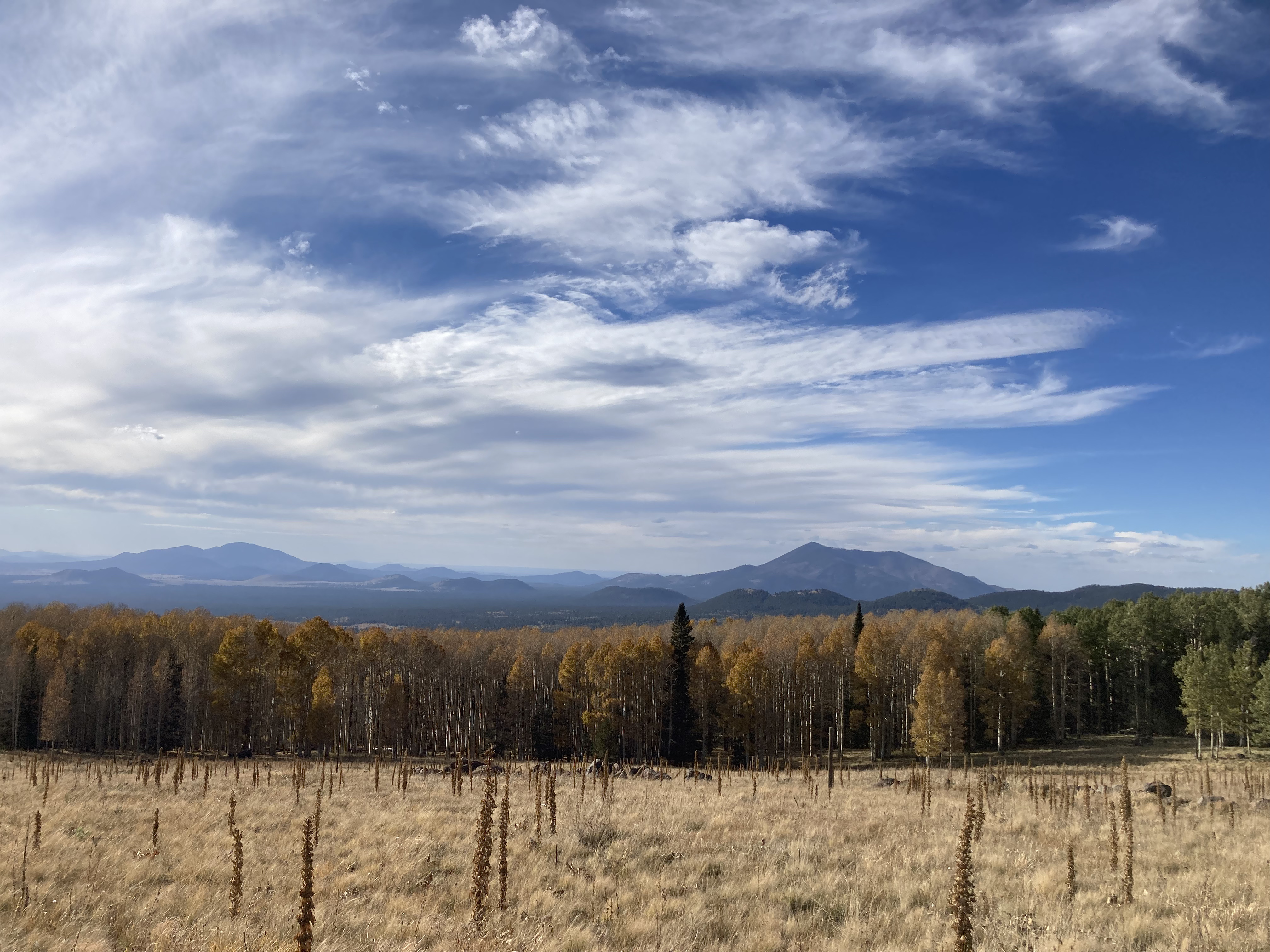
This is at the trailhead. You could still see the yellow aspens.
Tired, but victorious. And so very attractive. 😉
Here ends part 1 of my “catch-up blog post.” Stay tuned for part 2!
In my last post, I shared that I was training for my first “Rim to Rim” (R2R) hike. I gave myself 5 weeks to train and after many miles and logistical planning, I’m happy to report that the R2R hike was a success! Bear with me: this post is a long one because it includes all sorts of information pertaining to the training I did, the gear I took, and the hike itself. I wanted to document all that information for future reference, in case I ever wanted to do this again…
The original idea for doing the R2R came up during a conversation earlier this summer with my friend Jodey. We both had the R2R on our radar, but for various reasons, hadn’t done it yet. When I hiked Humphrey’s Peak with another friend, Crystal, in July, I mentioned that it would be cool to attempt R2R, but I’d need a shuttle driver. Crystal immediately volunteered to be that shuttle driver, and at that moment, R2R became a reality. Jodey, Crystal, and I scheduled our R2R attempt for the October long weekend and I mapped out a hiking training plan.
Training:
I gave myself 5 weeks to focus on hiking and started my training on August 31st. I didn’t want to start my training sooner than that because it was still hot in Phoenix (i.e. temperatures were still hovering around 90F/30C at the coolest part of the day. Yeah. Gross.). My training plan was basically to hike each morning with a rest day once a week. I’d increase my mileage each week and do a big hike on the weekends. This plan went well until my last 2 big training hikes. Jodey, my SAT (self-appointed trainer, i.e. my husband), and I planned a 16 mile loop in South Mountain with just under 4,000 ft of gain. We wanted to use this hike as a “qualifying” hike to see where we were in our training. We started hiking at 4:30am to try and beat the heat, but we were still hiking at 11am, when temperatures hit 100F/38C and my body started shutting down. I was in heat distress and was breathing heavily (while walking on flat trail at that point), walking really slowly, dizzy, and experiencing tunnel vision. We decided that Jodey and I would sit under a tree and wait for my SAT to get the vehicle and pick us up. That experience was a sober reminder that hiking in the Grand Canyon is not a joke. I decided to take the next week to train some more and think about whether I really wanted to do the R2R and if I REALLY felt physically and mentally prepared to commit to the hike. The good thing about this hike is that I didn’t get any leg cramps, which I tend to do on long, difficult hikes. I was trying out some Endurolytes (i.e. electrolyte pills) and they seemed to work.
The next weekend, my SAT and I did another big hike. We planned on doing a 10 mile hike and started hiking at 6:30am. Unfortunately, the hike ended up being 14 miles and we got caught in the heat again. However, I fared a bit better and was able to complete the hike, probably due to my experience the previous weekend. Similar to last week, I didn’t get any leg cramps. Thank you, Endurolytes!
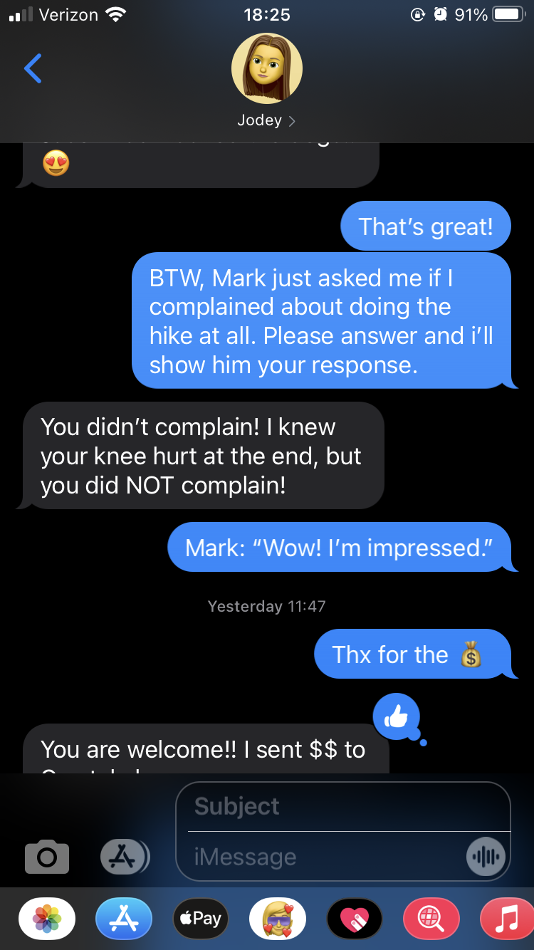
I decided to commit to the R2R and concluded that my goals for the hike were: 1) not to get leg cramps, 2) deal with the heat factor by starting the hike as early as necessary, and 3) not complain. Yes, that last goal was a legitimate goal! (I’m again happy to report that I successfully achieved that goal. Funny story: during the hike, I said to Jodey that my loving SAT would ask if I complained during the hike. Shortly after I got home, he did indeed ask me.
Proof that I was a very good girl during the hike.
The weekend:
Friday October 9
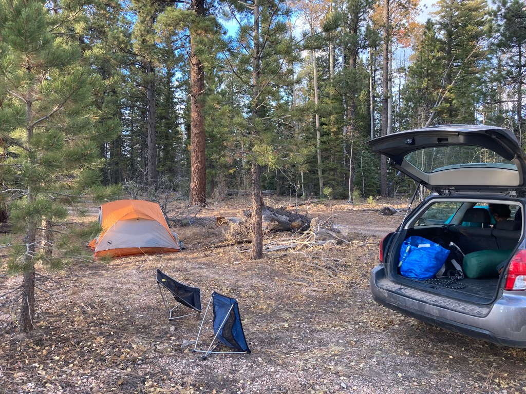
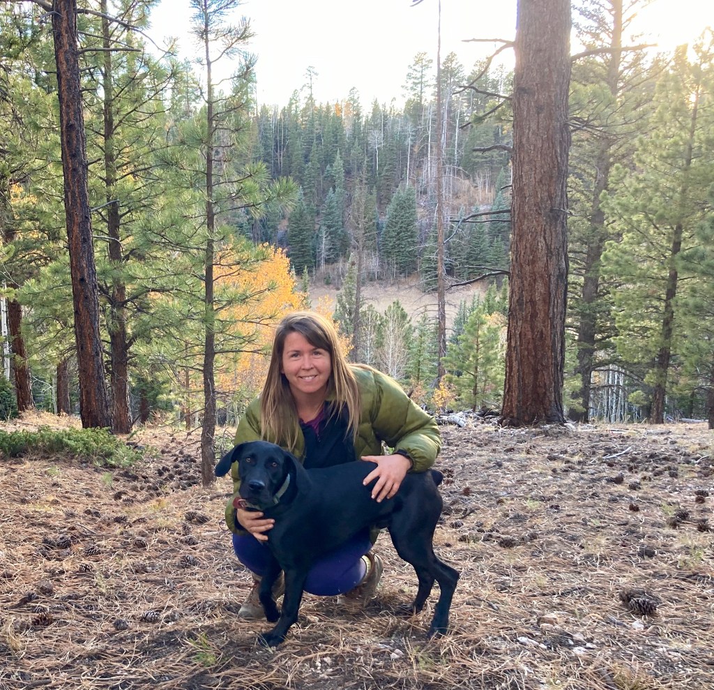
This day was mainly spent driving. Jodey and I left Phoenix at 6:30am and drove to Prescott to meet up with Crystal (and her adorable dog, Bagheera). We then drove to Flagstaff, stopped at Whole Foods to pick up some food for lunch and dinner, then drove to the North Kaibab trailhead to see where we’d be starting our hike the next morning. We then drove to our campsite (we planned on snagging a dispersed campsite), set up camp, then enjoyed the sunset at the East Rim Viewpoint trailhead. Lights were out by 7:30pm and my alarm was set for 4am. It was really happening!
A few pictures of the drive north.
Jacob Lake cookies!
Our dispersed campsite.
Crystal and Bagheera.
Some Ensure to ensure our R2R success! Jodey and I had these for breakfast.
Beautiful golden light.
Our campsite was very close to the Arizona Trail.
Enjoying the sunset.
Sunset at the East Rim Viewpoint.
Saturday October 10
My alarm went off at 4am and we broke camp, repacked the car, and drove to the North Kaibab trailhead, arriving there just after 5am. Our plan was to start hiking at 5am, but nature called REALLY LOUDLY. Fortunately, there was a restroom at the trailhead. Unfortunately, there was a bit of a queue for the restroom. In any case, we started hiking at 5:26am. It was still pitch black and the temperature was probably just above freezing.
When Jodey and I discussed how to approach R2R mentally, we decided to think of it as doing 2 “shorter” hikes instead of one really long one. So, that’s how I’ll describe our R2R experience!
Hike 1: North Kaibab Trail to Phantom Ranch
Starting elevation: 8,241 feet / 2,512 m
Ending elevation: 2,480 feet / 756 m
Elevation loss: 5,761 feet / 1,756 m
Distance: 14 miles / 22.5 km
Length of time: 6.5 hours. We started just before 5:30am and arrived at Phantom Ranch just after 12 noon.
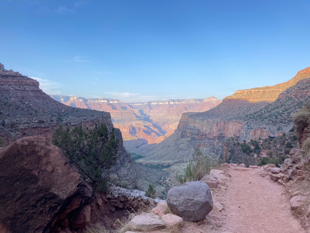
It felt like it was around 40F / 4C when we started the hike. I wore my puffy down jacket, a long sleeve Smartwool shirt, long pants, socks, and hiking shoes. I had to use a headlamp because it was still pitch black. I think the hardest thing about “hike 1” is that it’s mostly downhill. That sounds strange to most people because downhill is considered easier than uphill, which it normally is! But, miles and miles of downhill can wreak havoc on knees, which I will talk about later in this post….
Sunrise occurred about an hour into the hike and wow, the early morning light revealed such pretty scenery!
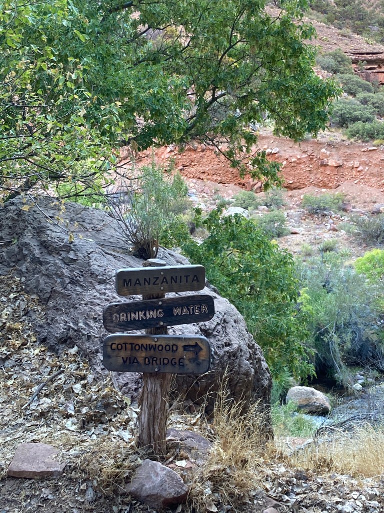
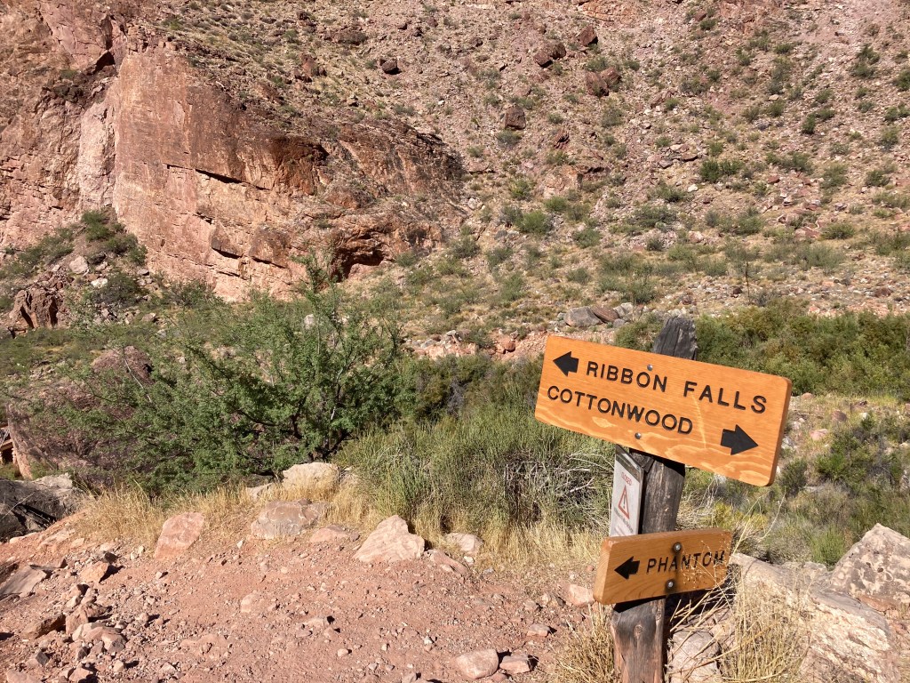
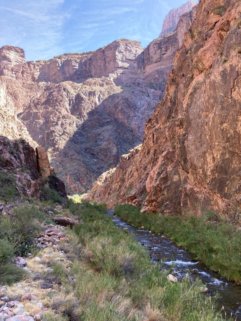
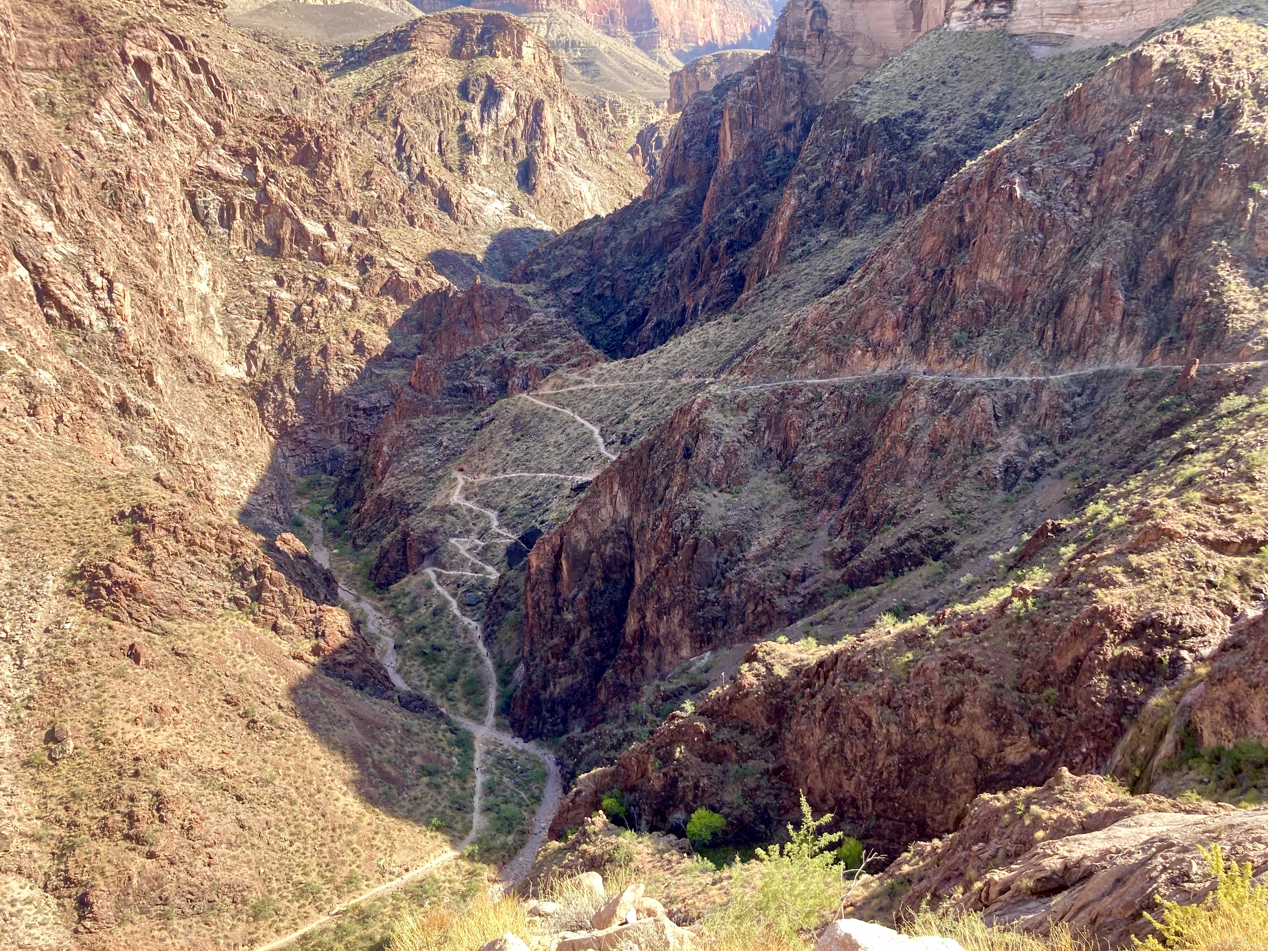
There are several landmarks along the North Kaibab Trail: Supai Tunnel (1.7 miles / 2.7 km), Redwall Bridge (2.3 miles / 3.7 km), Roaring Springs (4.7 miles / 7.6 km), Manzanita rest area (5.4 miles / 8.7 km), Cottonwood Campground (6.8 miles / 10.9 km), Ribbon Falls junction (8.4 miles / 13.5 km), and Phantom Ranch (14 miles / 22.5 km). Most of these landmarks had water spigots for filling up your water bottles and restrooms (i.e. outhouses). Tip: make sure to confirm that the water spigots are working before you hike!
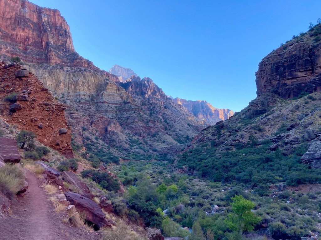
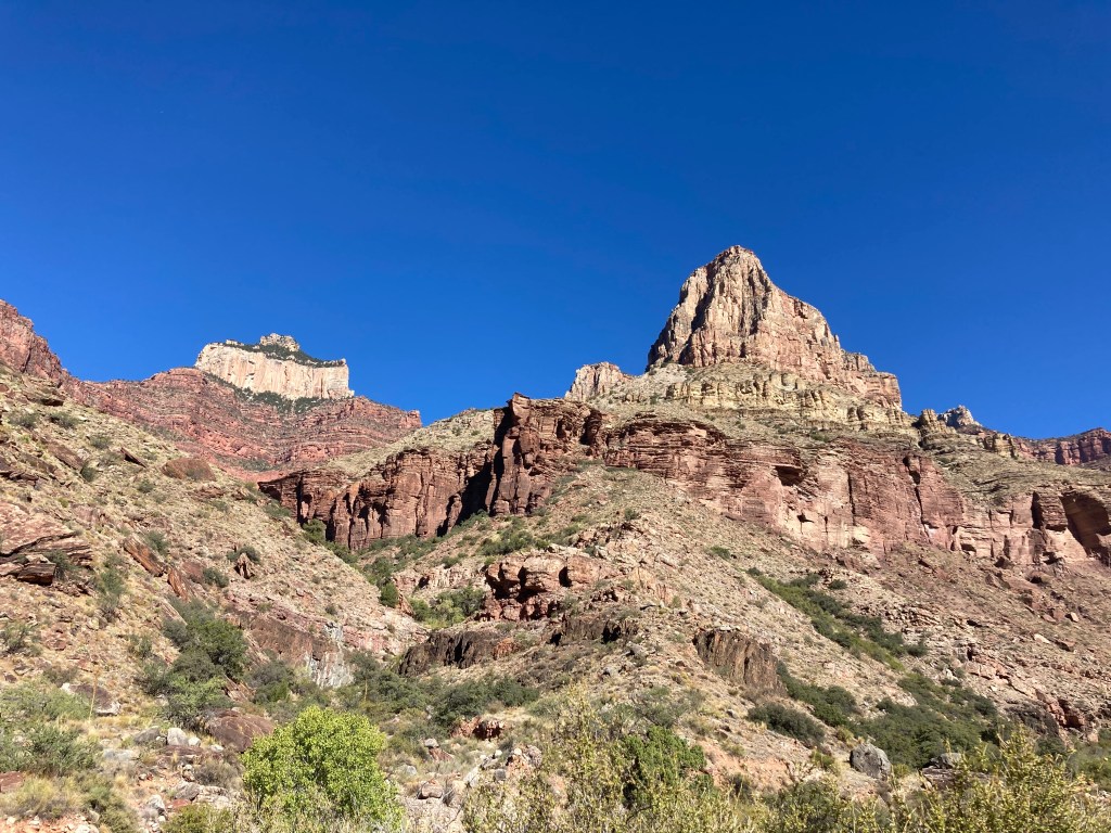
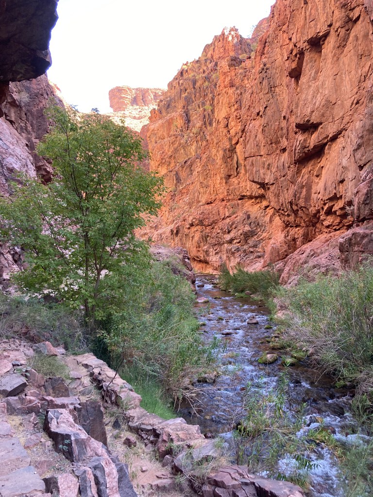
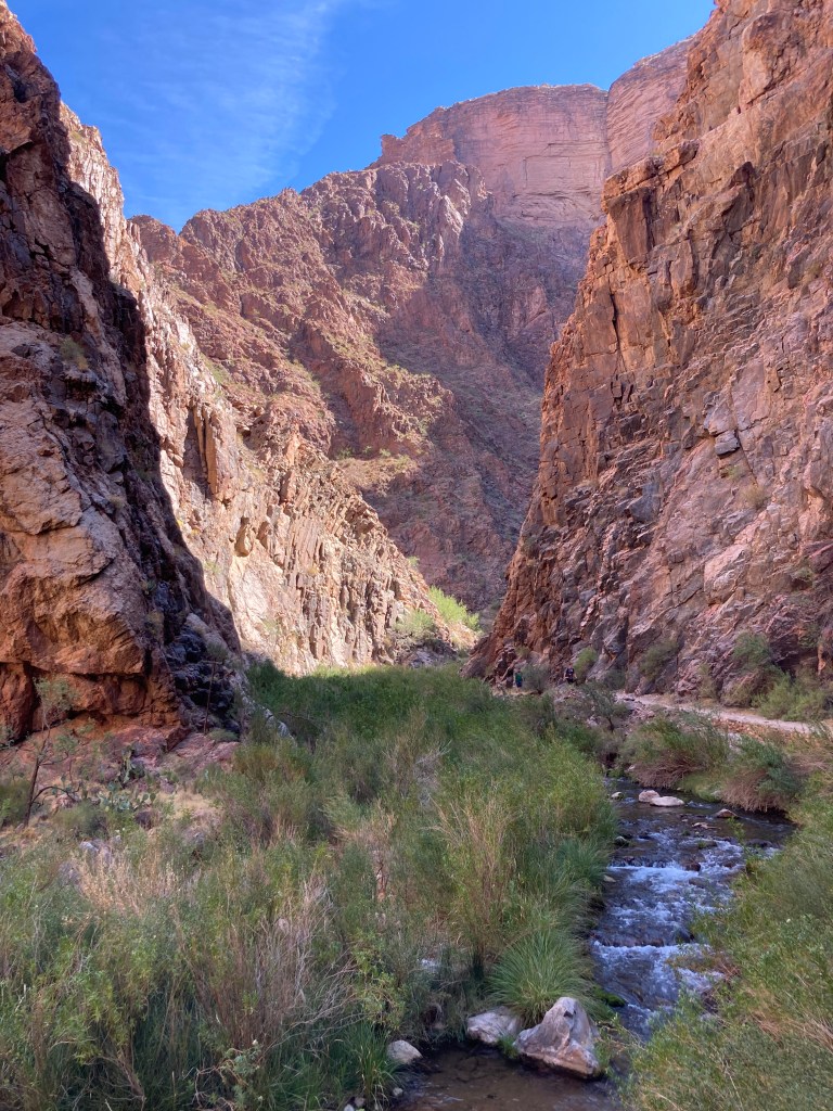
The North Kaibab trail is beautiful and we saw so much red rock, green trees, and fall leaves. Although there were many people on the trail, we were all spaced out enough so that we weren’t crowded. Some parts of the trail were rather exposed (i.e. there was a steep drop on one side), which would probably challenge those who are scared of heights.
At the first rest area 1.5 miles down the trail.
Supai tunnel.
Check out the view!
Jodey on the Redwall Bridge.
Beautiful colours!
More amazing scenery.
Note the exposed trail on the right.
Approaching Roaring Springs. See the waterfall in the bottom center?
Hanging in there!
Manzanita rest area. Most of the landmarks were signed.
It was busy at the Manzanita rest area when we arrived.
On the way to Cottonwood Campground.
This is one of the few times we were in direct sunlight. We had a lot of shade during our hike.
Ribbon Falls junction. Maybe next time!
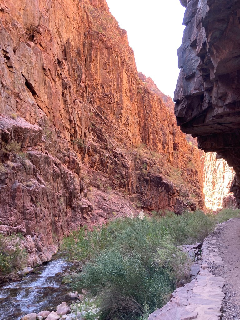
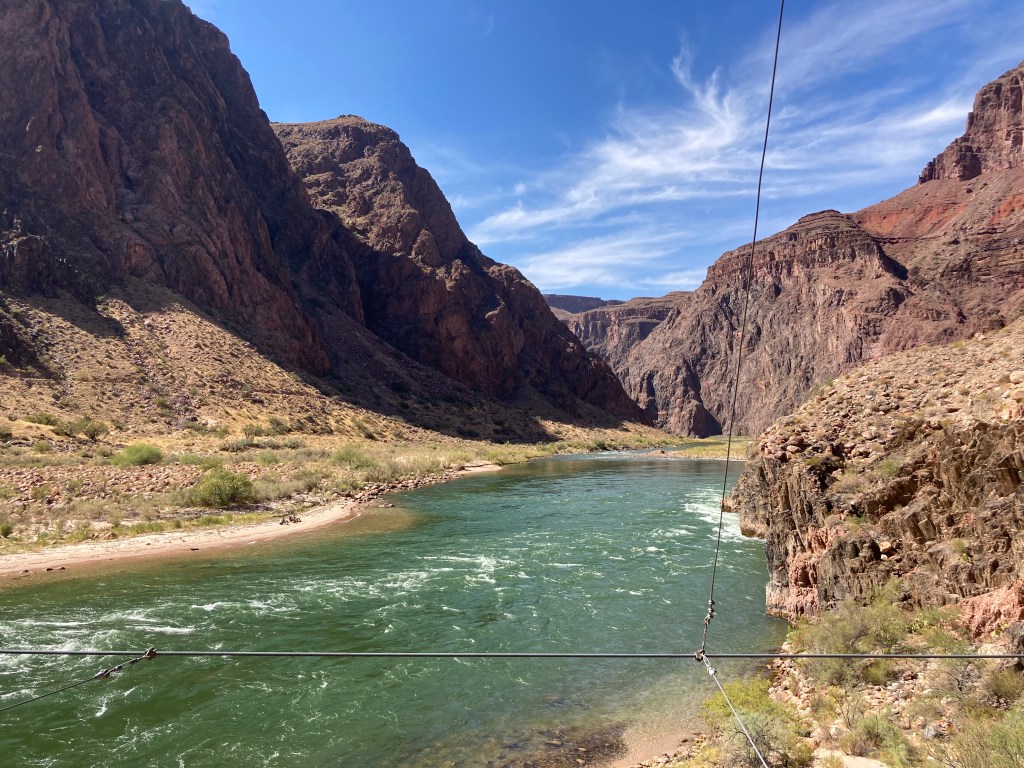
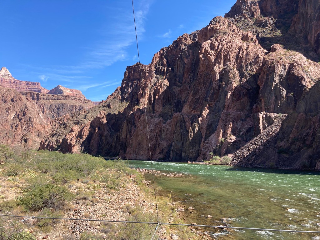
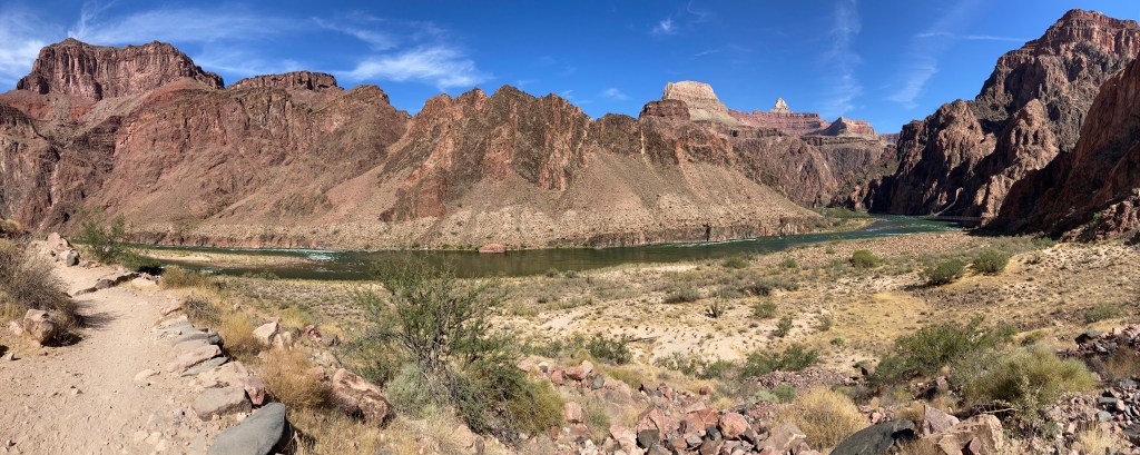
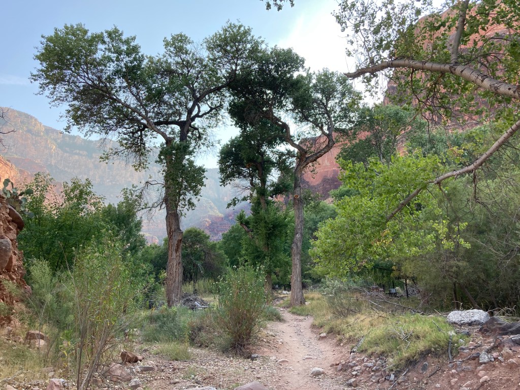
One of the sections I was concerned about was “The Box.” This section of the North Kaibab trail consists of a few miles of narrow canyon right before Phantom Ranch. Note: “narrow canyon” means “heat trap.” In my R2R research, I read that temperatures in the Box can get as high as 130F (54C). (Reminder: I do NOT do heat well.) In order to stave off the heat, we dipped our shirts in the water right before we entered the Box and wore them through the Box. It was great to feel cold for a few moments! Happily, when we hit the Box during our hike, it was mostly in shade and the temperature was nowhere near 130F (it was probably closer to 85F / 29C).
The last little bridge of “hike #1.”
The “Box”
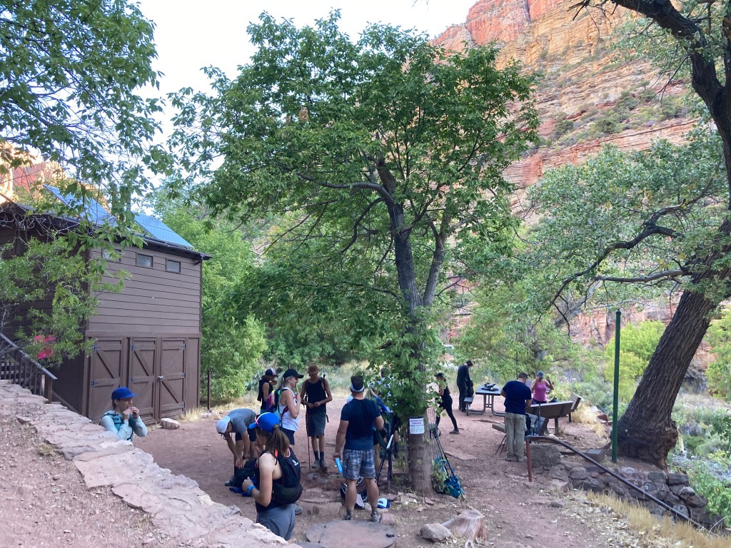
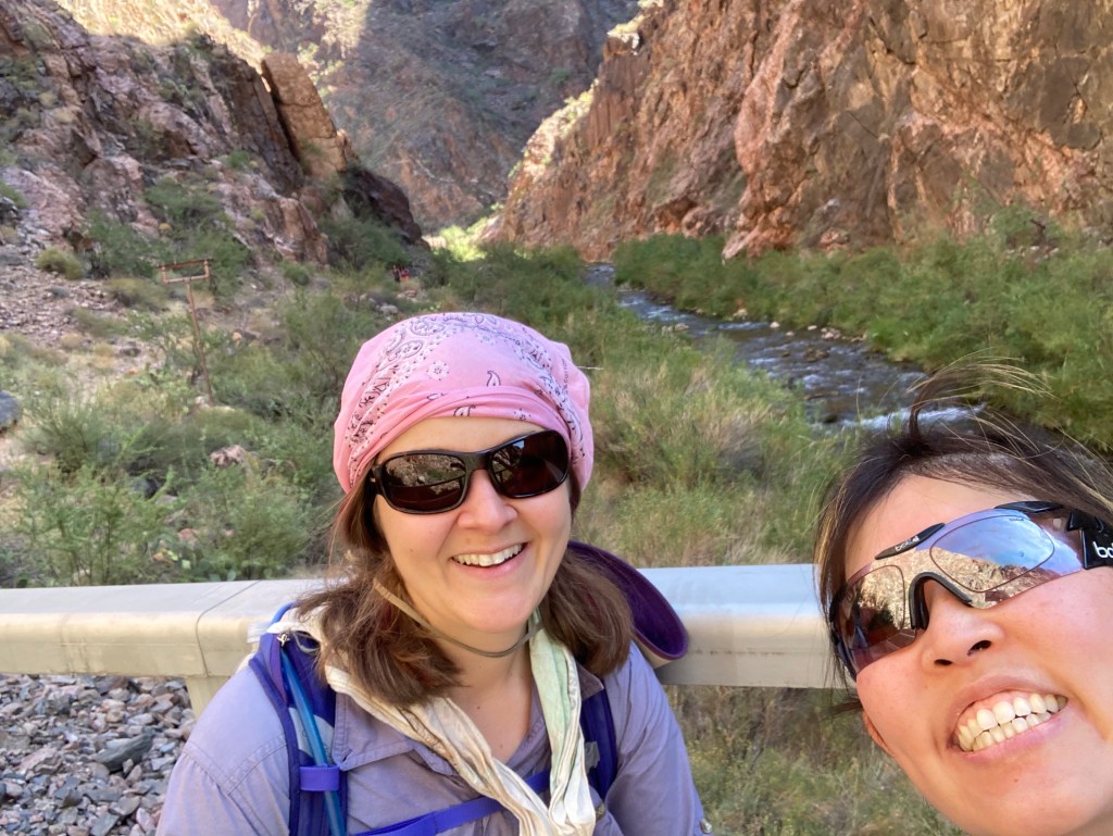
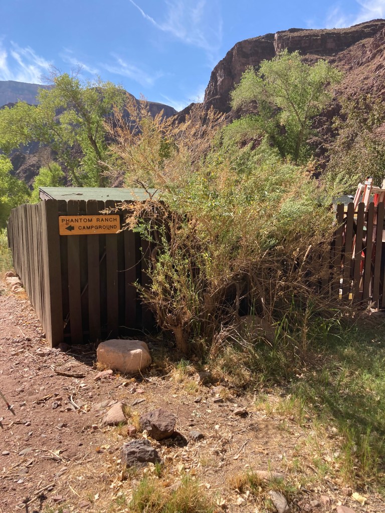
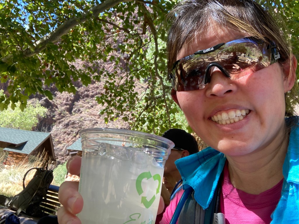
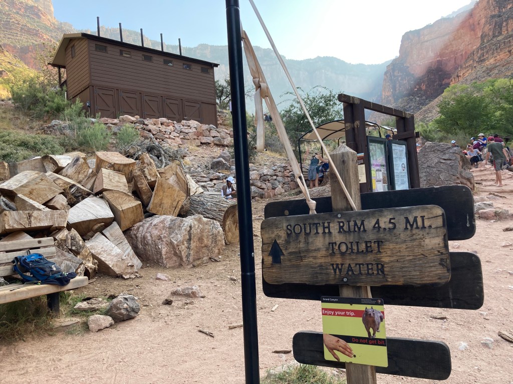
Finally! Phantom Ranch! We finished “hike #1!” I was super happy to reach Phantom Ranch because I REALLY wanted a lemonade. Yes, that overpriced lemonade was probably made from a mix, but it was going to be cold and delicious regardless. I EARNED that drink. In addition to the lemonade, I bought a 4-pack of Oreo cookies and a “sharing size” pack of peanut M&M’s to supplement our respective lunches.
We finished hike #1!
Masks….sign of the times.
My cold, delicious, overpriced lemonade!
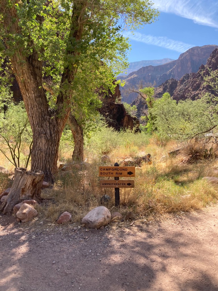
The sign points to Bright Angel campground.
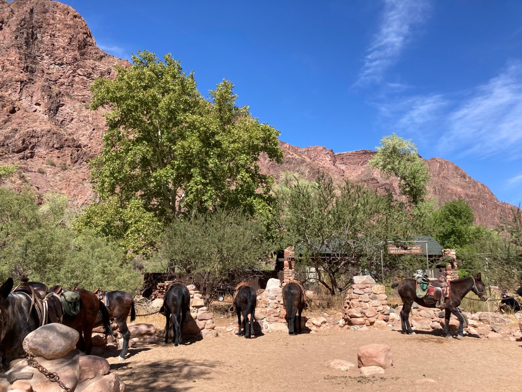
Pack animals.
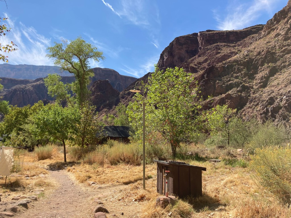
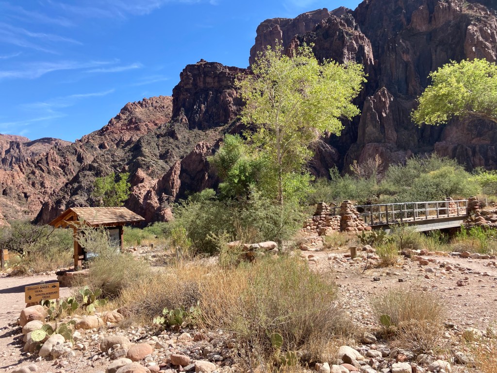
Phantom Ranch
Hike 2: Bright Angel Trail to the top of the South Rim
Starting elevation: 2,480 feet / 756 m
Ending elevation: 6,860 feet / 2,091 m
Elevation gain: 4,380 feet / 1,335 m
Distance: 9.5 miles / 15.3 km
Length of time: 5.5 hours. We started our “second hike” just before 1pm and arrived at the top of the South Rim at 6:30pm.
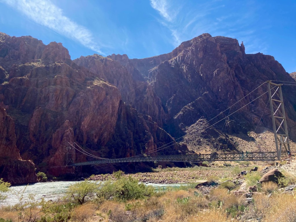
I’m not sure what the temperature was when we started “hike #2,” but it was probably around 95F (35C). We dipped our shirts again before crossing the Silver Bridge and starting the Bright Angel trail. I’m not going to include any “wet t-shirt pictures” because I am a lady. 😉 I WILL include a few photos of the Silver Bridge that crosses the Colorado River and joins up with the Bright Angel trail. Fun fact: in early September, we learned that the National Park Service (NPS) was closing the Silver Bridge “indefinitely” due to structural concerns. That meant that we’d have to hike an extra 1.5 miles to the Black Bridge. However, a week later, we read that the NPS reopened the Silver Bridge after conducting a formal structural assessment. SUCH great news!
The little bridge at the Bright Angel campground.
View from the Silver Bridge (west side).
View from the Silver Bridge (east side).
The Silver Bridge, which crosses the Colorado River and leads to the Bright Angel trail.
Looking back onto the Colorado River and the Silver Bridge (right side) as we soldier on to the South Rim.
Here we go again….
The first major obstacle we had to cross was the “Devil’s Corkscrew.” I’m not sure if that’s the official name of the series of steep switchbacks, or a nickname that suffering hikers bestowed upon them. In any case, we kept on hiking up and up — thankfully, in shade for most of the switchbacks! — until we looked down and saw THIS:
Devil’s Corkscrew
Perhaps the name “Devil’s Corkscrew” was more appropriate than I thought….shortly after leaving that area, my left knee/IT band started complained loudly. I did not, even though my knee was starting to hurt pretty badly.
From this point on, the major landmarks along the trail were well-signed and evenly spaced out. The first goal was hitting the 4.5 mile rest area, otherwise known as “Indian Garden.” We topped off our water, soaked our bandanas, and wearily continued our (absolutely amazing, fantastic, beautiful, fun) hike. [Yes, of COURSE the words in parentheses were the actual words running through my head at that point!] 🙂
Indian Garden, the approximate halfway point of the Bright Angel trail.
Our next goal was the 3 mile rest house. We stopped just before we got there to get a picture taken in the soft, late-afternoon light.
Then, the BEST thing happened. Right in front of us on the trail, maybe 25-30 feet away, was a big-horned sheep! It was definitely a morale booster seeing that sheep.
I love seeing animals on the trail!
Next stop was the 1.5 mile rest house. Slowly, but surely, we were making our painful way up to the top.
I wonder how many people have used that emergency phone to hitch a ride back to the top?
Only 1.5 miles left. Grrrr….my left knee was REALLY yelling at me (but remember, I was NOT COMPLAINING…out loud…). At this point, I was alternating between 2 walking methods: 1) a weird cowboy two-step that made me look like I just rode a horse for the first time in years, and 2) using my right leg to climb over rocks and tree roots, while limping/dragging my left leg behind me. Truly, I was a picture of hiking grace and beauty. One thing that helped me continue on was looking back to see how far we’d come. The last beautiful view we enjoyed was this one:
The last 2 landmarks were 2 tunnels right before the end, but it was getting too dark to get any good pictures of them. However, one picture I DID get was of the two of us triumphantly posing in front of the Bright Angel Trailhead sign, victorious!
Hooray!
I’m not sure what the temperature was when we finished our hike, but I had to get my puffy jacket from my backpack because I was feeling chilly. After Crystal picked us up, we drove to Tusayan (this little town is only a mile from the South Rim!) and tried to find somewhere to get some food. Unfortunately, nothing much was open, so we ended up grabbing some fries and hamburgers from McDonald’s. What a grand celebratory dinner, right? 😉 I was happy enough because I always want fries after a huge hike!
Sunday October 11
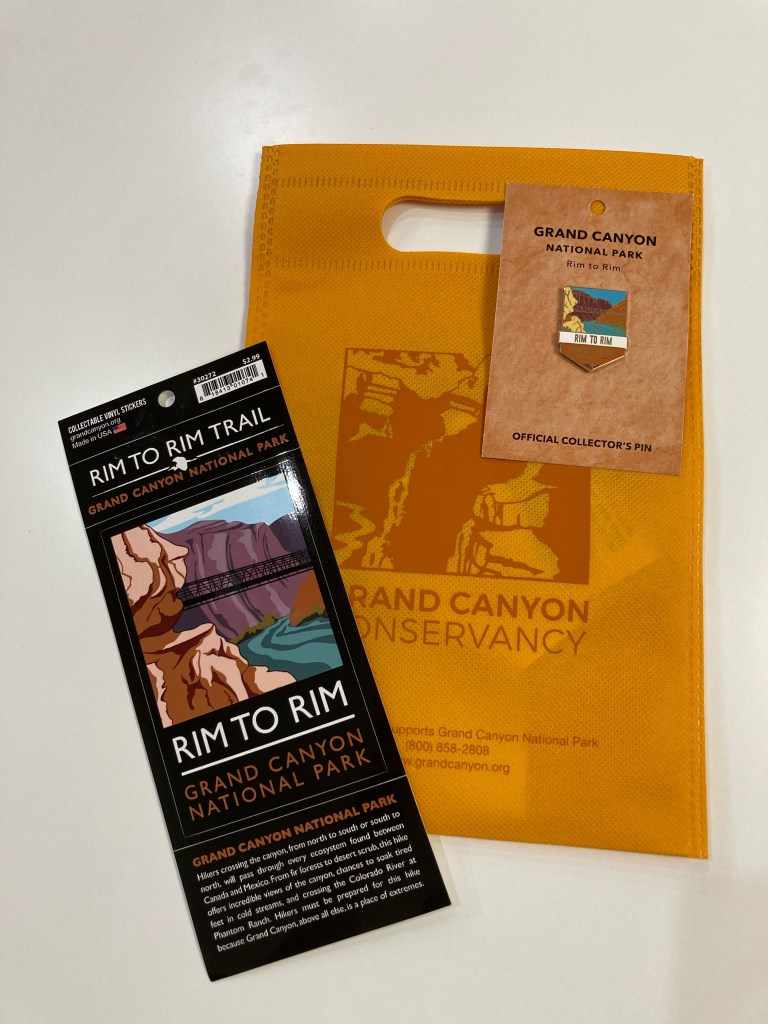
We enjoyed a leisurely morning getting some breakfast and enjoying the canyon views from the South Rim. Before we started our drive back to Phoenix, Jodey and I bought some “swag” to commemorate the occasion.
View from the South Rim.
Another view from the South Rim.
My hard-earned swag: a vinyl R2R sticker and pin.
Overall numbers:
Distance (according to my Garmin): We hiked 24.87 miles!
Elevation change: The Grand Canyon National Park website states that there is a 5,761 feet elevation loss (North Kaibab trailhead to Bright Angel Campground) and 4,380 feet elevation gain (Bright Angel Campground to the South Rim on the Bright Angel Trail). As a reference, there are 5,280 feet in one mile. According to my Garmin, we gained 4,696 feet in elevation (my Garmin didn’t record the elevation loss).
Total time (according to my Garmin): 13 hours, 20 seconds. Of that, 9 hours and 48 minutes were moving time, which means we took just over 3 hours in breaks.
Temperature: it was just above freezing when we started at the North Rim. The high temperature was 95F / 35C at Phantom Ranch. I’m not sure what the temperature was when we finished the hike at 6:30pm, but it felt like it was 45-50F / 7-10C.
The Grand Canyon Facebook page said that there were 430 hikers/trail runners who passed through Phantom Ranch between 5:30-9:30am on Saturday!
What workedfor me during the hike:
Training, obviously. Although, I think I’d train more next time. Specifically, I’d train for a longer period of time and increase mileage more slowly.
Train with a backpack.
If you think you want to use poles, train with those poles. I have poles and have used them on other long hikes. However, I didn’t use them very much in my R2R training. I decided not to take them at the last minute. Would they have helped my knee by taking a bit of weight off of it? Perhaps. If I do R2R again, I think I’ll try using poles, if only to compare experiences.
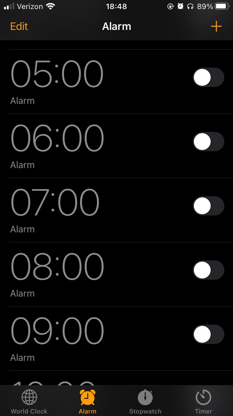
I set hourly alarms on my phone as reminders to eat. I knew it was important to keep my energy up and I didn’t want to risk not finishing the hike because I didn’t eat enough calories. [My SAT — self-appointed trainer, a.k.a. my husband — told me a few times before I left to eat during the hike. HA! I already had that covered! So there!]
Proof that I was a very responsible girl during the hike.
Dipping my shirt and bandanas in the river to cool off. This really helped a lot. Hooray for evaporative cooling!
Endurolytes to avoid leg cramps. I took one pill when my hourly alarm went off. I’m never going on a long hike or bike ride without these again!
Use a checklist (paper or digital) to pack. Compose your list, then check off items as you pack them.
Remember to look up once in a while when hiking to enjoy the views!
Gear:
Headlamp (with fresh batteries)
phone, portable charger, AirPods
Garmin cycling computer (to record the hike)
puffy jacket, Smartwool gloves, buff (took all these off a few miles into the hike)
Smartwool long sleeve shirt, long pants, socks, hiking shoes
extra pair of wool socks to change into (this felt amazing!)
3 bandanas: wet them, pack into ziplock baggies, wear around neck to cool off
hat
sunscreen, lip balm
bandaids, Neosporin, tweezers, mini Swiss army knife
toilet paper, some wet wipes
a garbage bag to pack trash
2L camelbak bladder and two 1L foldable water bladders
Food:
To figure out how much food to bring, I estimated that the hike would take 12-14 hours. Then, I decided to eat something every hour (remember those hourly alarms?). From there, I gathered a variety of “trail” food and “real” food:
a tube of Nuun electrolyte tablets (I added one to my 2L Camelbak)
some Trader Joe’s salt and pepper chips (in a ziplock baggie)
2 peanut butter and jelly sandwiches
a quarter of a Whole Foods vegan breakfast burrito (bought this the day before on the way to the Grand Canyon. Ate most of it for dinner and saved the rest for the hike.)
It’s been about 2 months since I last posted and the world has been in lockdown mode that whole time. Here in Arizona, the Governor’s “stay at home” order expired on May 15, which means that things have slowly been opening up. Salons are accepting clients for haircuts, restaurants are offering dine-in service, and malls are welcoming shoppers again. My SAT (self-appointed trainer, a.k.a. my husband) and I are fortunate to be working from home and are enjoying spending a lot of time with our cats. I don’t think the kitties mind us being at home, but since they haven’t actually said that, I’m not entirely certain. 😉
During the lockdown, I tried to get outside each morning before work to hike or mountain bike. On the weekends, my SAT and I tried to explore a new area and get out of town….which is a novelty for sure during this weird time! I want to share three blog-worthy “trips” that occurred in the past couple of months.
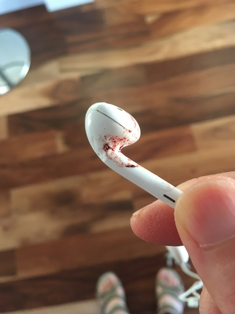
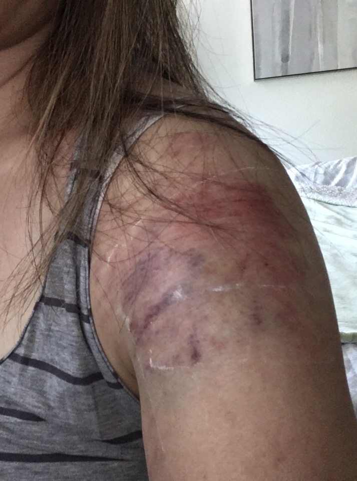
First, about a month and a half ago, I decided to go for a mountain bike ride, as normal. I was happily riding on a trail I’ve ridden dozens of times, when I came upon a little bit of rock (that I’ve ridden over successfully dozens of times) and fell onto my left side. I’m still not sure what happened, but I think my front wheel must have “tripped” and caught a rock. I landed on my left ear, shoulder, and hip. My first thought was that I lost my hearing in my left ear because the podcast I was listening to was only audible in my right ear. Turned out that I broke my left earbud when I crashed. I didn’t incur a concussion, thank goodness, and other than a couple of minor cuts on my left ear and a wicked “tattoo” on my left shoulder, I was fine. My bike escaped unscathed, no scratches at all. I feel like I earned some mountain bike “street cred” with that crash and honestly felt like a bada$$ when I talked about it to some friends who wanted details. 🙂 Still, I took the rest of the week off the bike to recover.
My broken left earbud. RIP. My mountain bike “tattoo.”
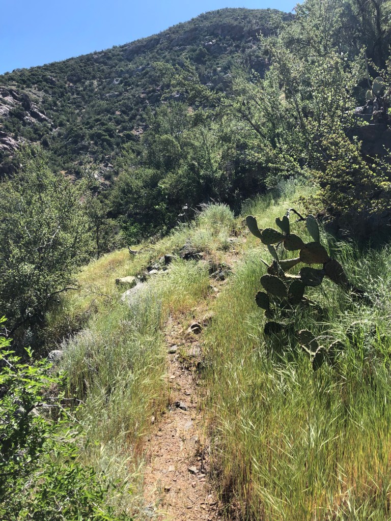
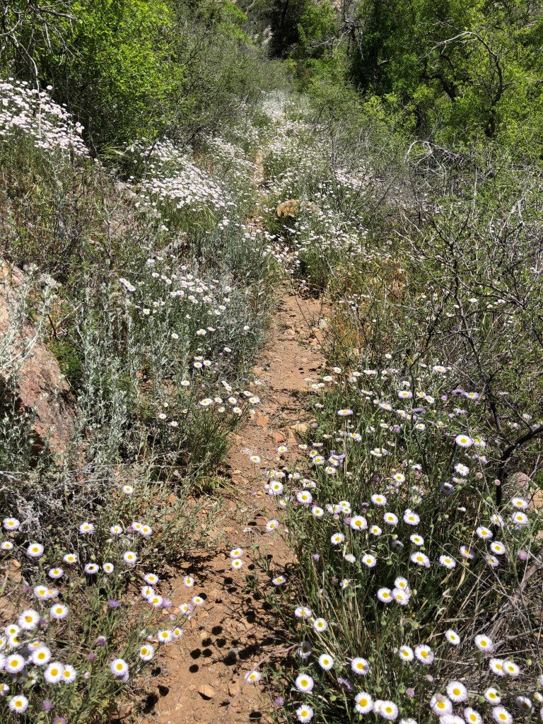
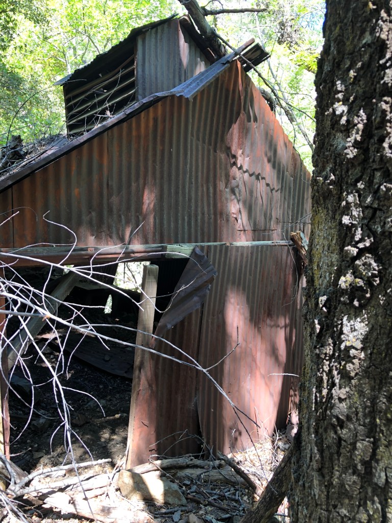
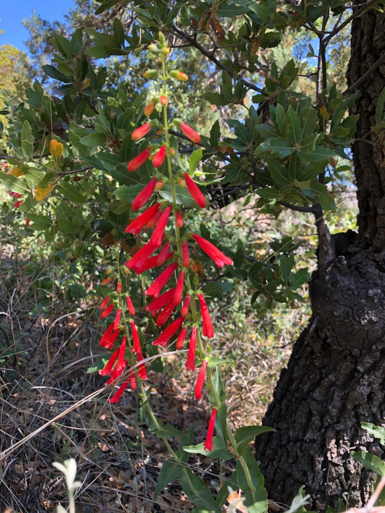
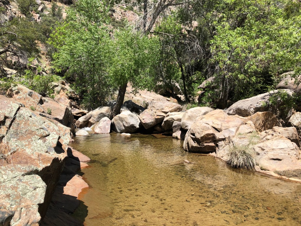
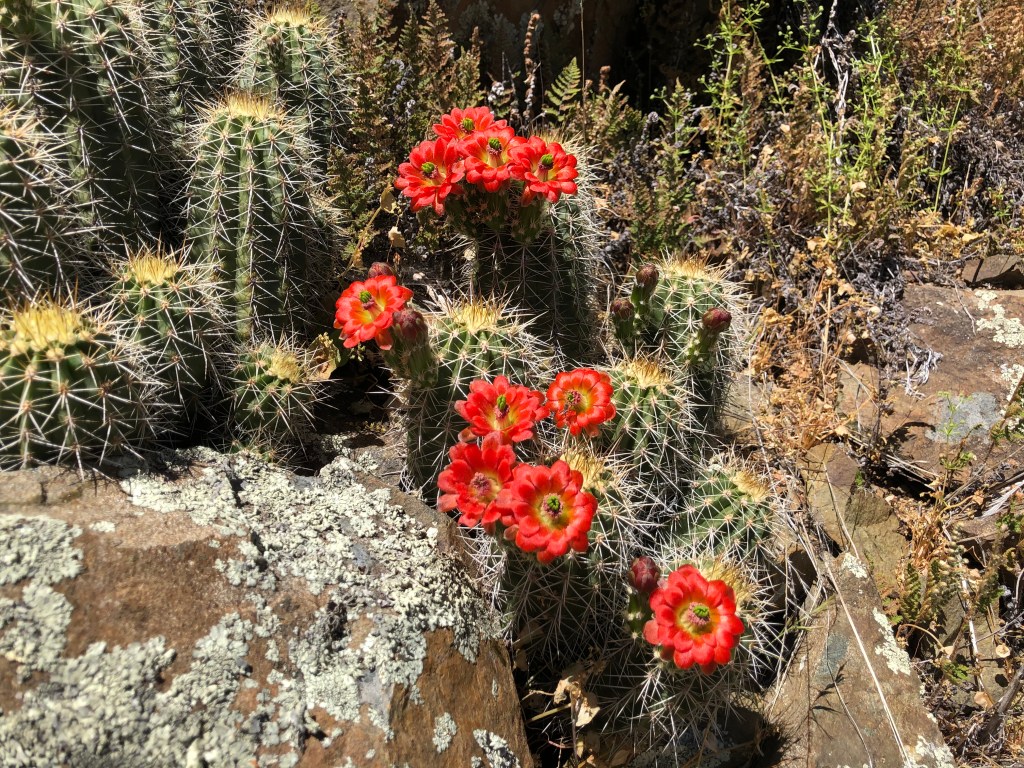
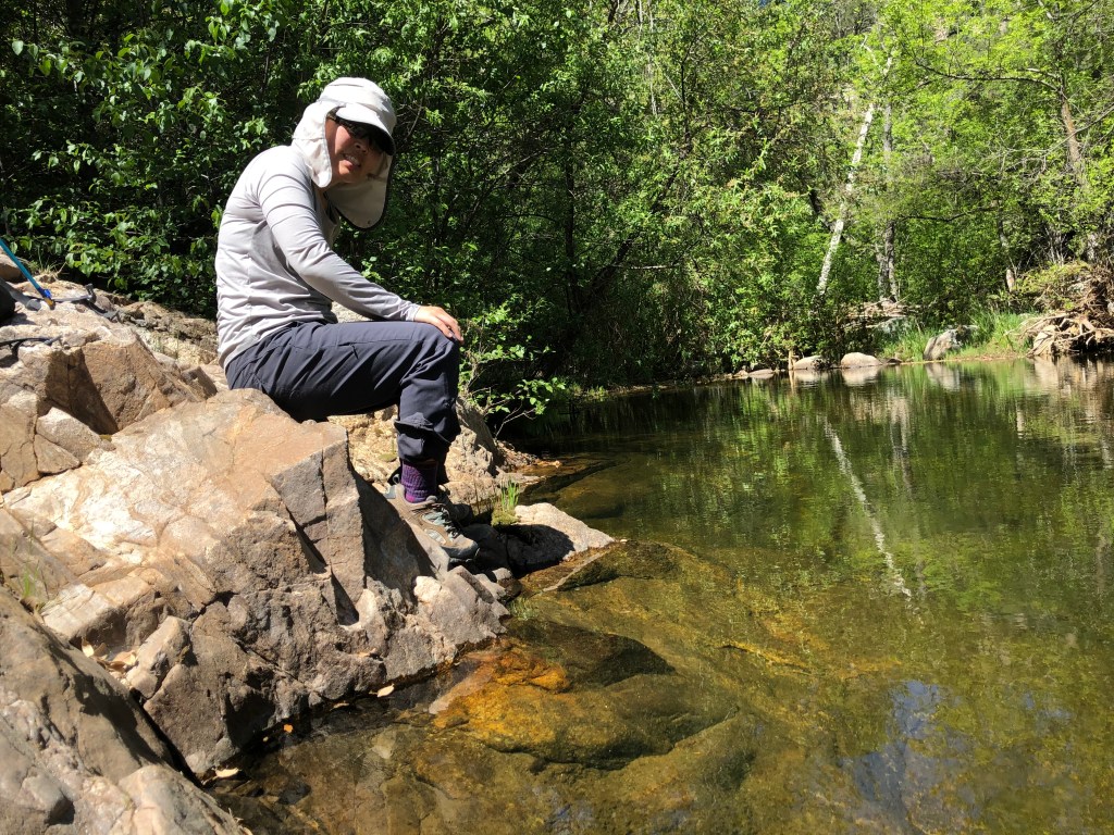
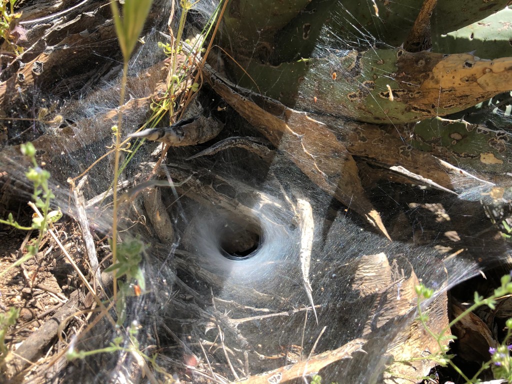
Despite popular opinion, Arizona is not one large desert. There are many different landscapes and microenvironments throughout the state, some of which look like they should belong to Colorado or the Pacific Northwest. Arizona also has a surprisingly large number of creeks and waterfalls. The second “trip” was to a hidden water playground hidden in the eastern side of the Bradshaw Mountain range (closest large city is Prescott, closest little town is Crown King). We decided to do the Big Dipper hike, which required driving on about 25 miles of “washboard-y” road. Once we got to the trailhead (Algonquin trailhead #225), we headed down about 1200 feet to the creek (named Poland Creek), which is only about a mile and a half at most. It was a very pretty hike and we saw lots of wildflowers, an old cabin, great swimming holes, and tunnel webs. I dipped my feet in the water, which felt great. It was super cool to visit a hidden oasis in the mountains.
Such lush, green mountains!
Lovely trail
Carpet of daisies
Old mining cabin
Pretty flowers
One of several swimming holes we saw
More flowers
Water felt great!
Tunnel spider’s web
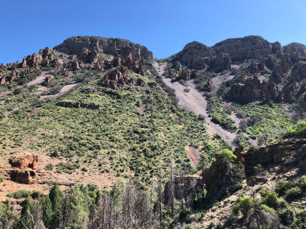
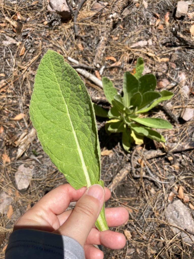
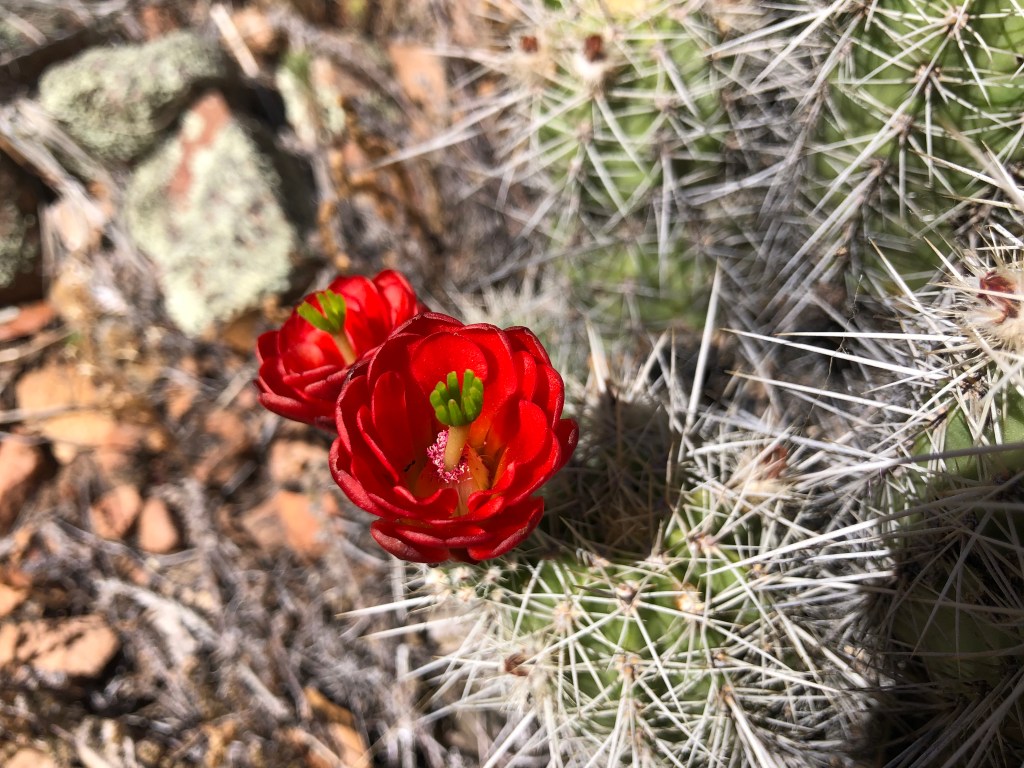
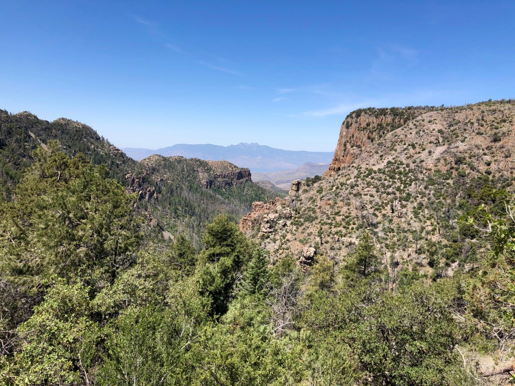
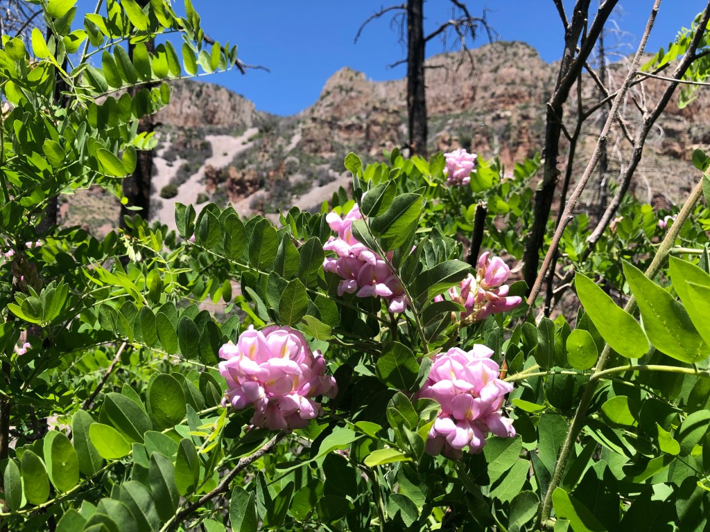
The last little “trip” I wanted to share was one we took to Parker Creek, just outside of Globe. The trailhead (Parker Creek Trail #160) starts at around 5000 feet and I definitely felt the higher altitude right away. Along the way, we got great views of the Four Peaks mountains, Lake Roosevelt, and all the wildflowers. We also passed through a burn area, which contained SO MUCH OVERGROWTH on the trail. We were basically hiking through overgrown branches and some thorny bushes. OK, it wasn’t as bad as the Mazatzal hike, but it was annoying enough that we decided to turn back at around the 4 mile mark. There’s only so much fighting I want to do with bushes and branches.
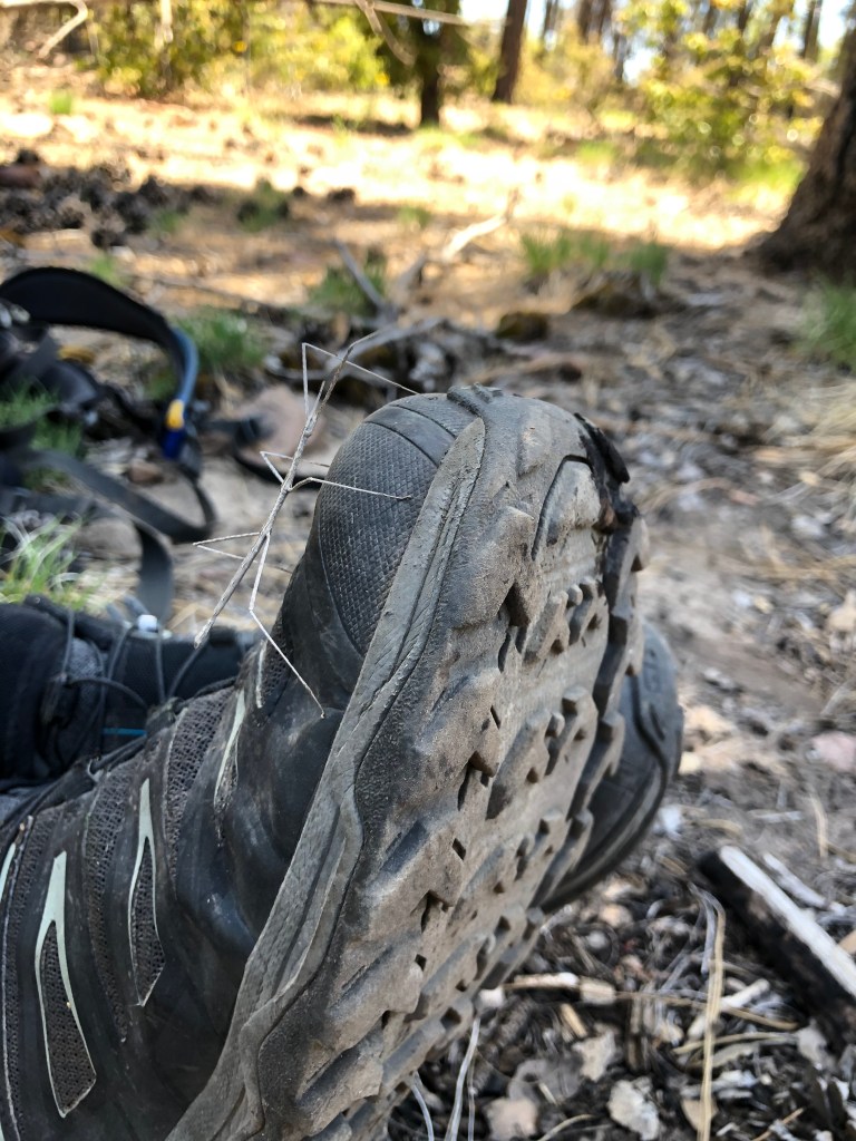
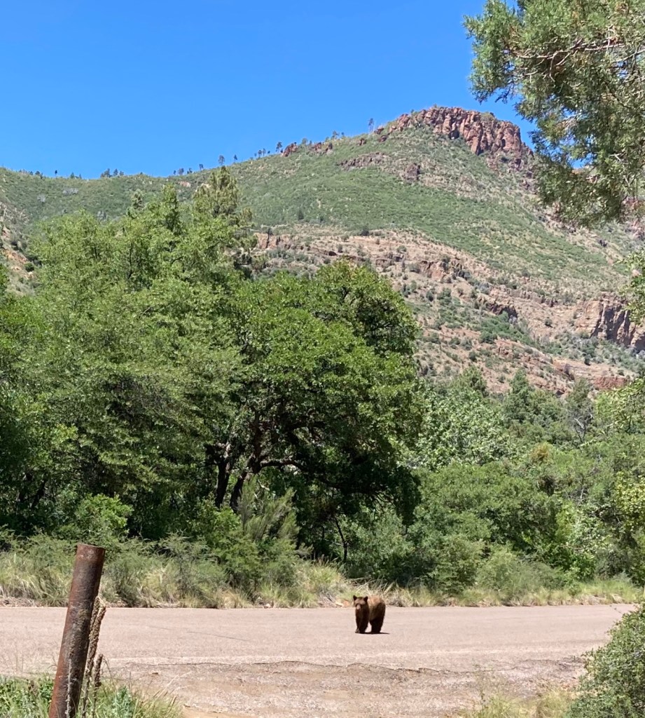
Perhaps the best part of the hike (to me) was seeing a bear at the trailhead! I don’t think that bear was afraid of people because it appeared that it was looking for food. I think my SAT’s best hike moment was seeing a stick bug. Well, each to his/her own. I think the funniest moment occurred during our brief encounter with a military dad and his 4 kids; they were coming up the trail and we were heading back down and they warned us of the bear. After they told us of the bear, my SAT excitedly told them that “we saw a stickbug!” Silence. Well, each to his own.
Start of hike
Good photo opportunity
Don’t know what this is, but the leaves were so soft
Wow, it’s been a month since I last posted on this (poor, neglected) blog! Thanks so much, desert sun and scorching temperatures, for giving me so many excuses to avoid getting outside and get out of shape (thus preventing me from having anything interesting about which to blog). I suppose there have been other distractions taking my attention away from exercise and general fitness; after all, we DID move to a new city, start new jobs (2 different accompanying jobs in my case at this very moment), start house renovations, meet new people….however, today I got an invitation to participate in Sufferfest 2, currently scheduled for October 24, 2015 in Las Vegas, NV. I managed to survive through Sufferfest 1 earlier this year and can claim bragging rights (and memories of sore legs). How challenging/stupid/insane would it be to train for Sufferfest 2? As a reminder to myself, Sufferfest 1 consisted of 2 laps of the Red Rock loop followed by the big climb up Mt. Potosi, followed by one more lap of the Red Rock loop. For voluntary fun. Sufferfest 2, as one may have guessed, is a bit more intense: 2 laps of the Red Rock loop, 1 climb up Mt. Potosi, then TWO laps of the Red Rock loop. Gross. Should I survive SF2 and am drugged or coerced into doing Sufferfest 3, let me state for the record that SF3 is made up of 2 Red Rock loops….TWO climbs up Potosi, then TWO more Red Rock loops. I don’t think there are enough French fries in the world to tempt me to do SF3, but I know that I have done stupid things before (e.g., my double century….).
There are a few factors that may deter me from doing any Sufferfest: 1) the heat. It is not going to get cool — i.e., lower than 35c/95F — until end of September. 2) Lack of hills on which to train. Phoenix is not exactly known for its abundance of hill climbs. I would have to make frequent trips out of town to get my climbing miles in. I would also have to consider doing numerous repeat laps of South Mountain, which is the only hill of significance close to my house. How utterly boring! 3) My music schedule: at the moment, I have 2 nighttime accompanying jobs. I expect to start a daytime accompanying job in the next week or so and add a few more things into my schedule, including private teaching. Fitting in bike training will be a challenge, especially for an event with the word “suffer” in the name.
The other physical challenge on my mind for later in the year is a multi-summit hiking day in and around the Phoenix area. I wanted to register for the Phoenix Summit Challenge, but the likelihood of having a paying “gig” (that’s a paying music job for those of you who are not musicians) on that Saturday is pretty high. I also had a problem with paying a fee to do something that was local. Thus, I am seriously thinking of organizing my own multi-summit day and do that with some friends. This event would also require some training, although it would be easier to do that, given that I live right beside a mountain and like hiking (it’s my outdoor activity of choice). Any of my devoted readers interested in doing this with me? Whatever I choose to do — or not do — I know that I have to find some sort of exercise if I don’t want to acquire “pianist’s butt.” 🙂
I have been thinking about how I want to direct the content of this blog, now that the original purpose for its existence is fulfilled. I believe that I will still be pursuing adventures in my leisure time, ones that include hiking, rock scrambling, rock climbing (hopefully soon), camping, and yes, cycling. Until my next big adventure, I want to share the wonderful day that my SAT planned for me this weekend to celebrate my birthday. Everything about the day was a surprise. The first thing I was told to do on Friday night was to go to bed early, because we “had to meet some people at 6:30am.” My first thought was that we were going to go on a long, difficult hike that required a very early start. Cool! So, we went to bed early and got up just after 5am. (Yes, that hurt a little bit.) As we were driving to the yet-unknown destination, I tried to guess where we were going to hike.
~~~~~~~
Me: “Well, we’re not going to Red Rock, since we’re passing the exit…”
SAT: [smug grin]
A few moments later….
Me: “Maybe we’re doing Black Mountain?”
SAT: [smirk]
Upon spotting the signs directing the way to Boulder City….
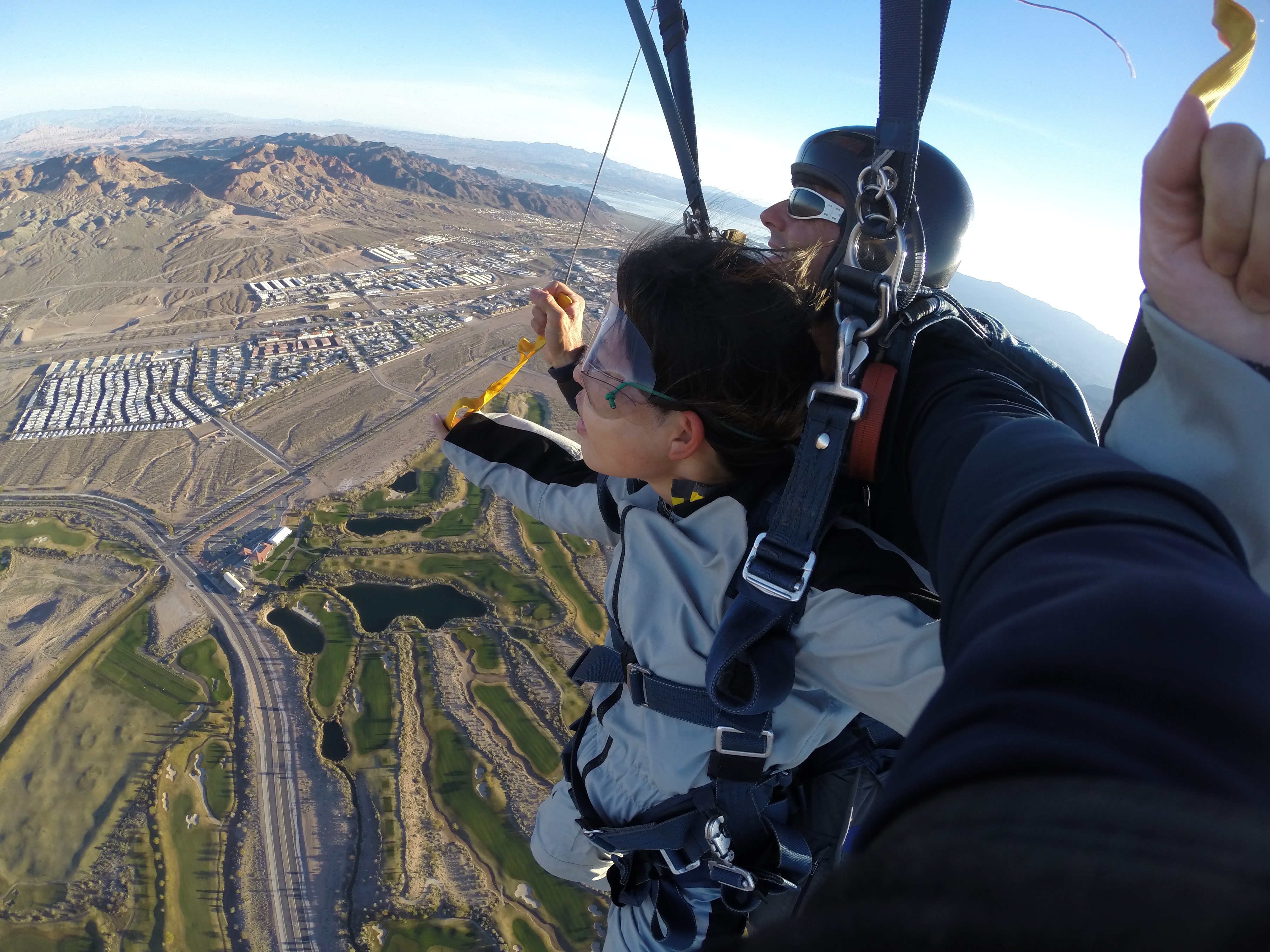
Me: “We’re SKYDIVING??”
SAT: [guffawing with laughter]
~~~~~~~
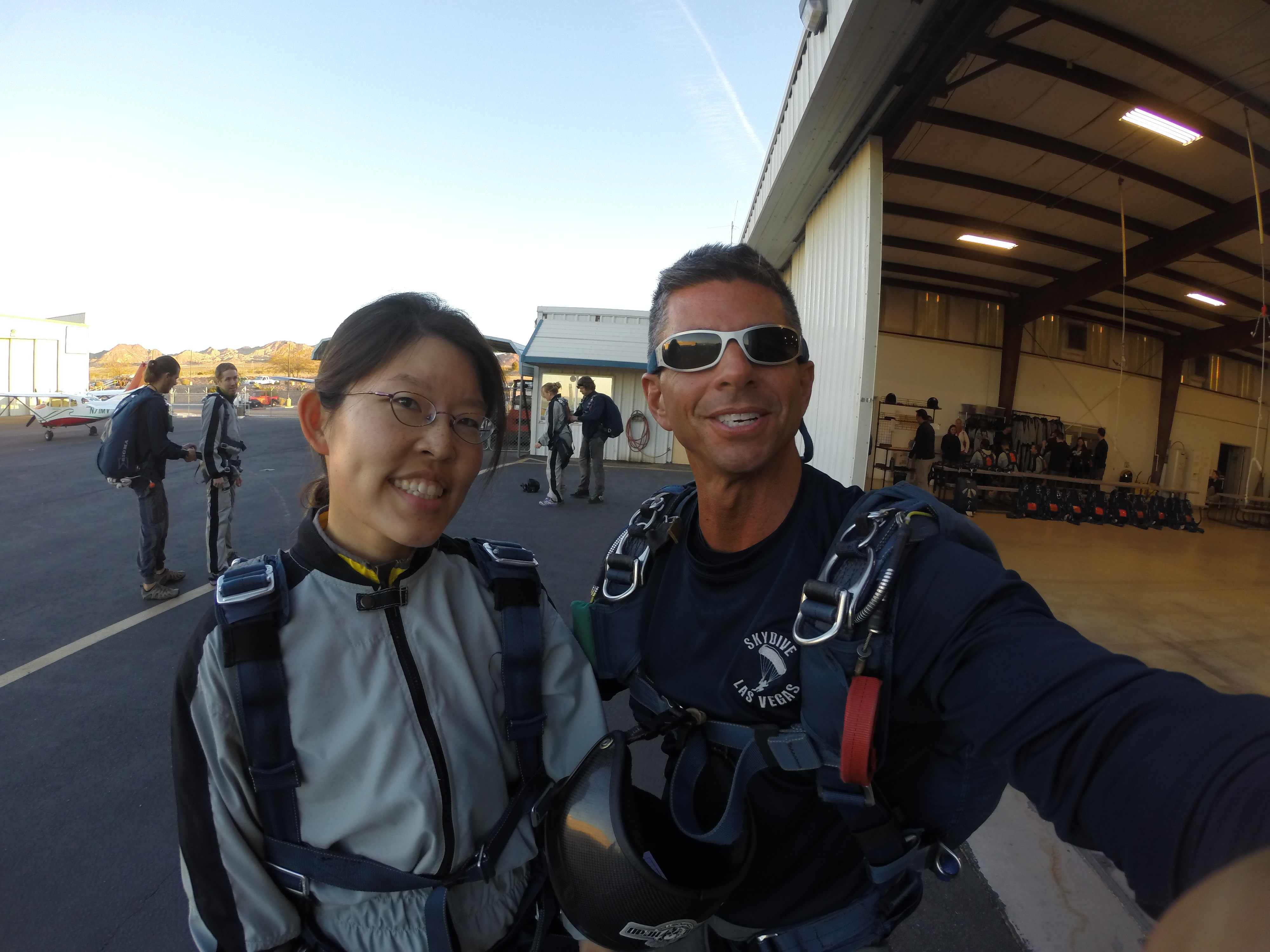
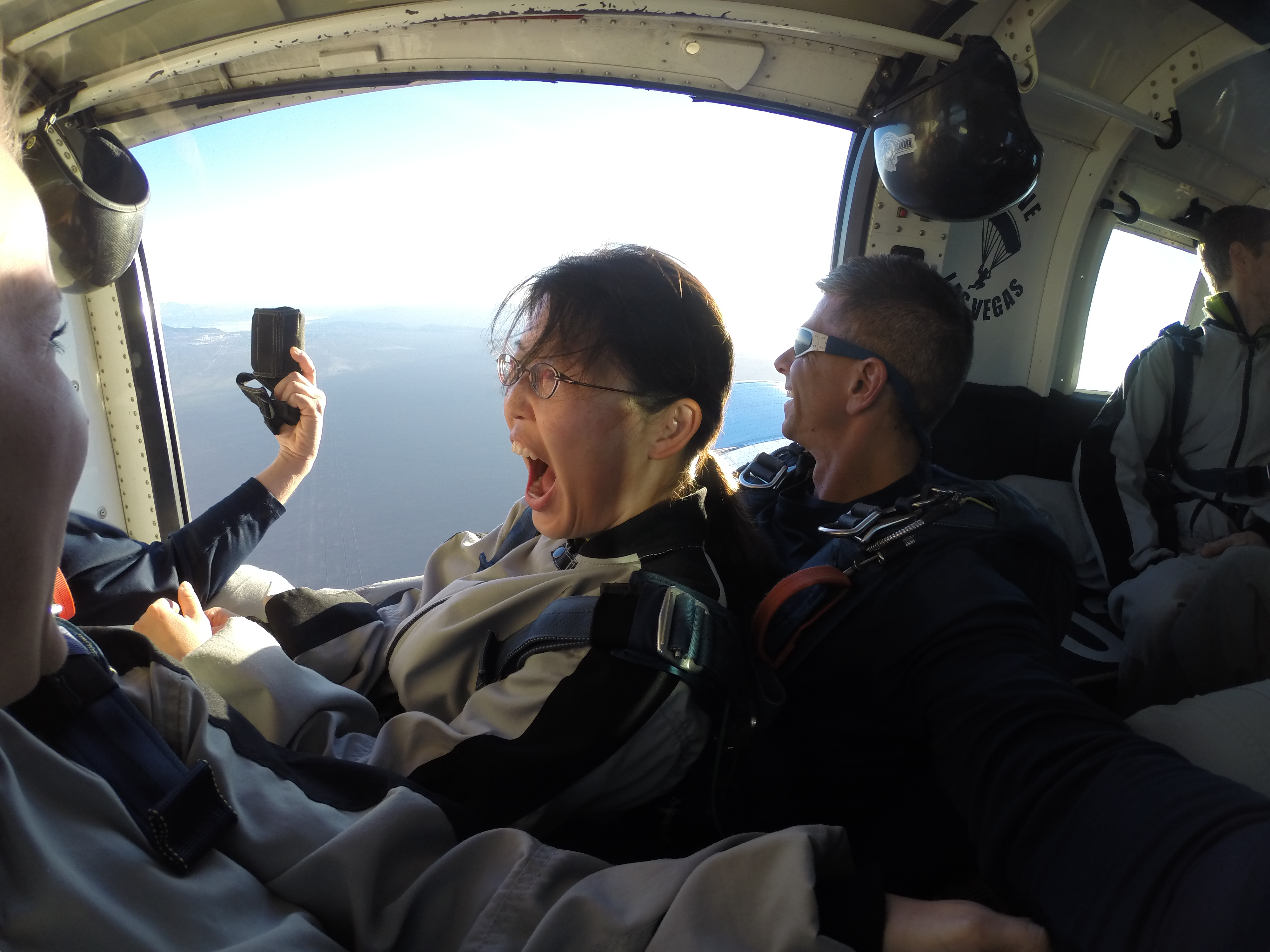
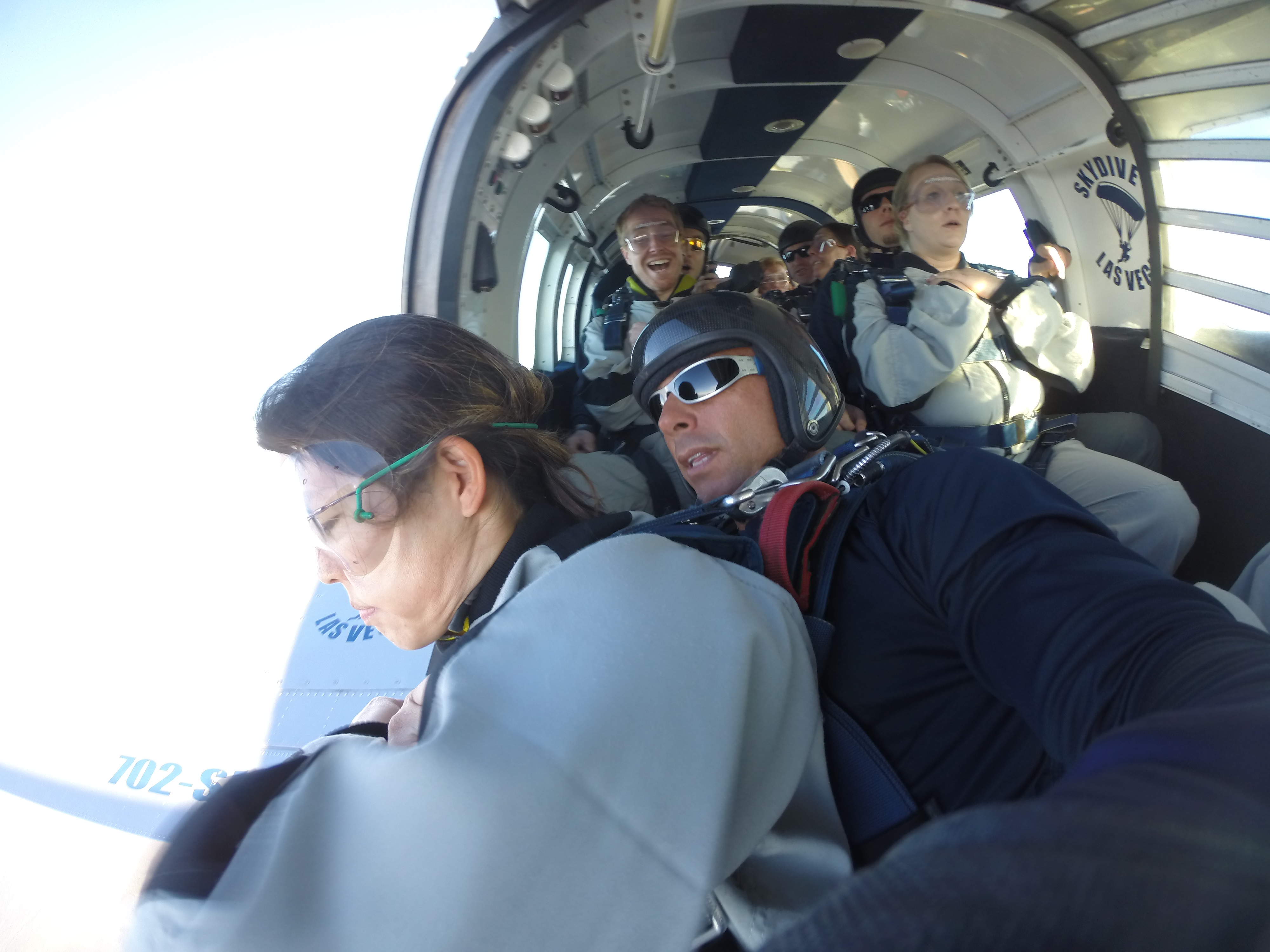
A long time ago, back when we were both barely of legal age, I said that I wanted to skydive and would totally do it with my SAT. He remembered this and filed it away for an opportune moment. That moment had arrived. The whole skydiving experience was excellent and the instructors at Skydiving Las Vegas had everything down to a science. Upon our arrival at 6:30am, we were given paperwork to complete in a small room that also had a short training video playing. After running through some basic body positions (cross arms before jumping, banana position while in the air, etc.), we changed into our jumpsuits and got into the plane. I immediately noticed that I was the last of our group to enter the plane (the lightest person in the group gets on the plane last and is seated at the back, near the wings), which meant that I would be the FIRST to jump. On the bright side, I had the best seat on the plane, as I was right beside the exit door and windows, which gave me great views.
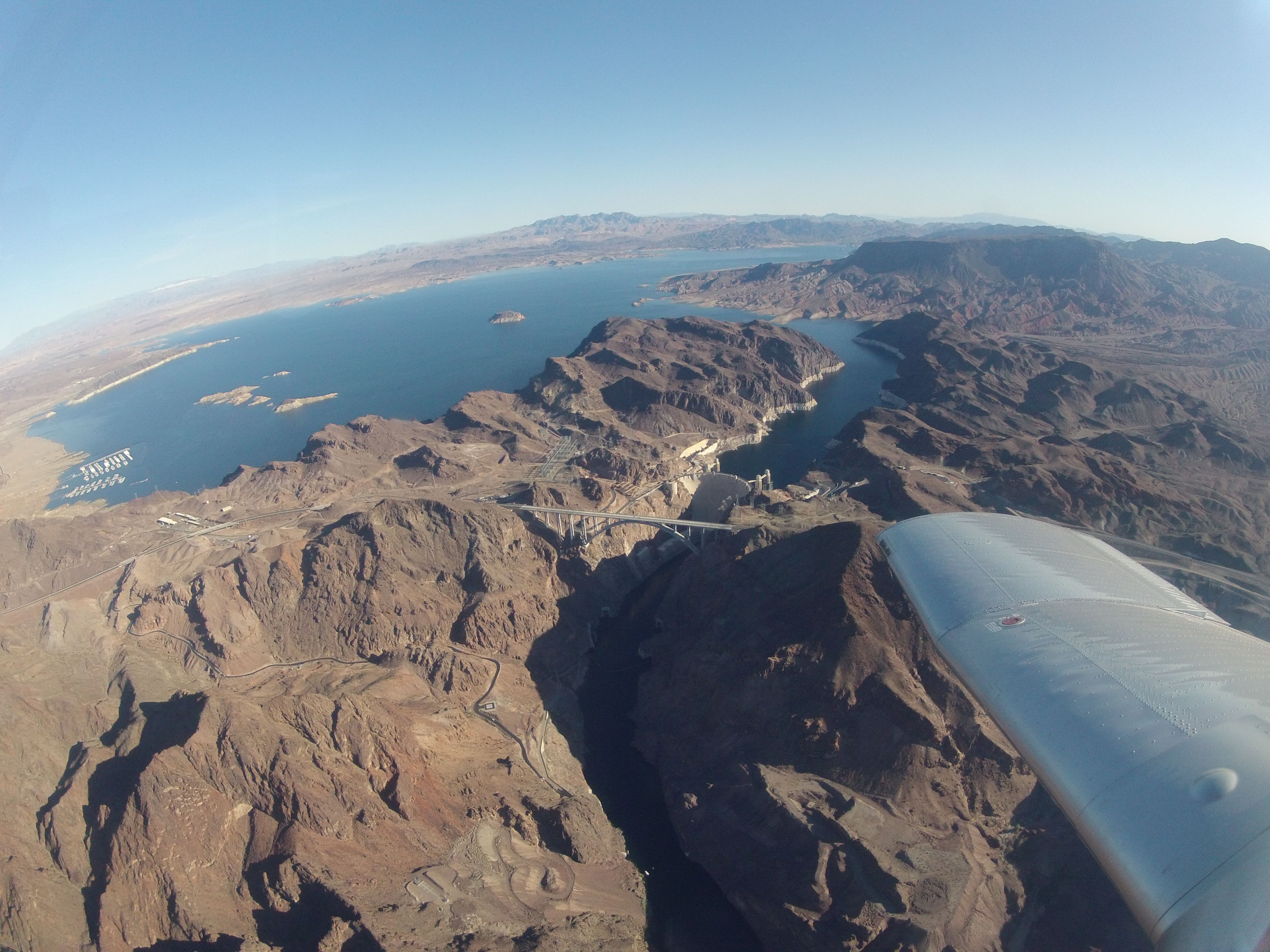
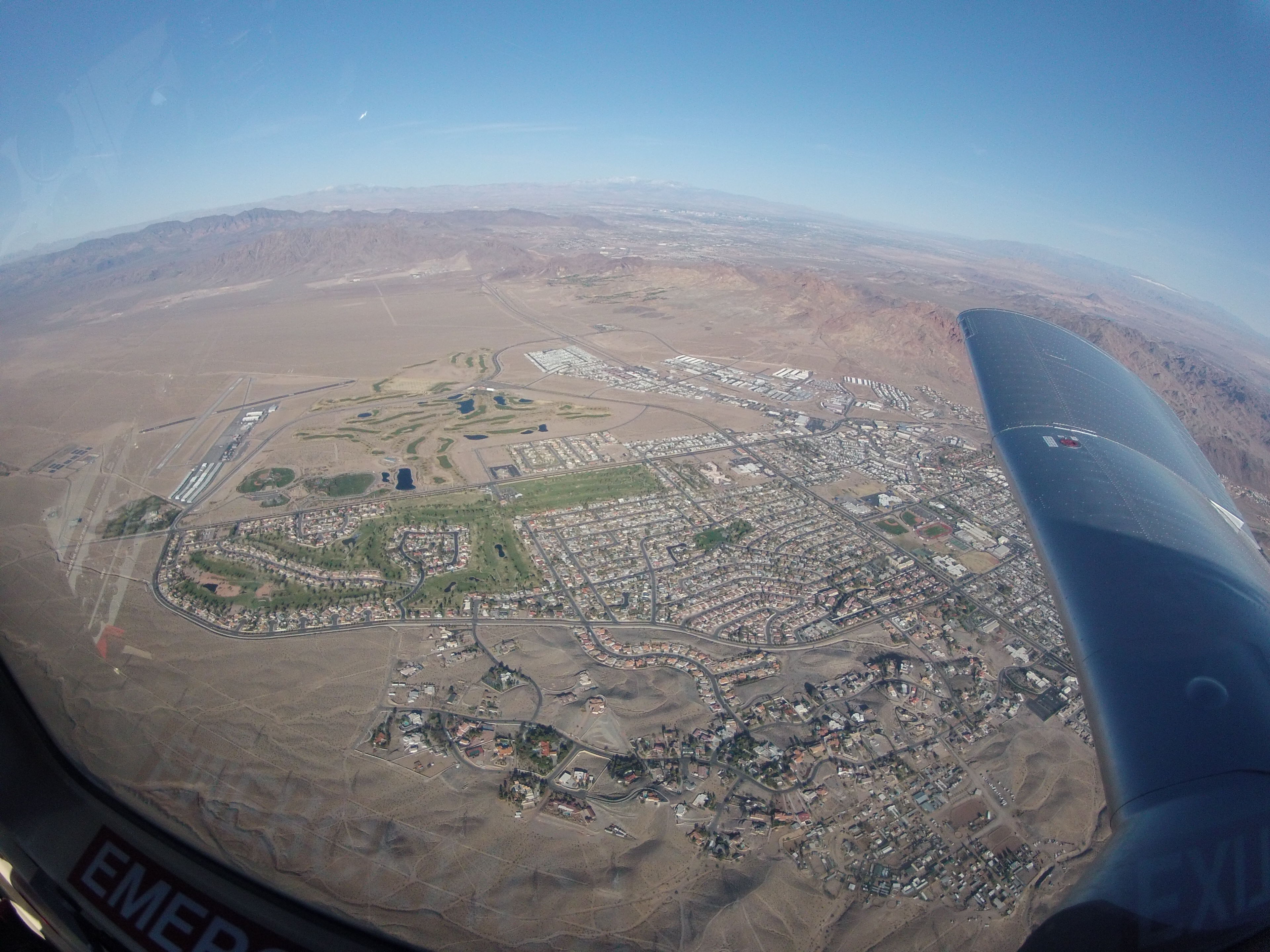
(Photos 1-2: Beautiful views of Lake Mead. Photo 3: With my jump instructor, John.)
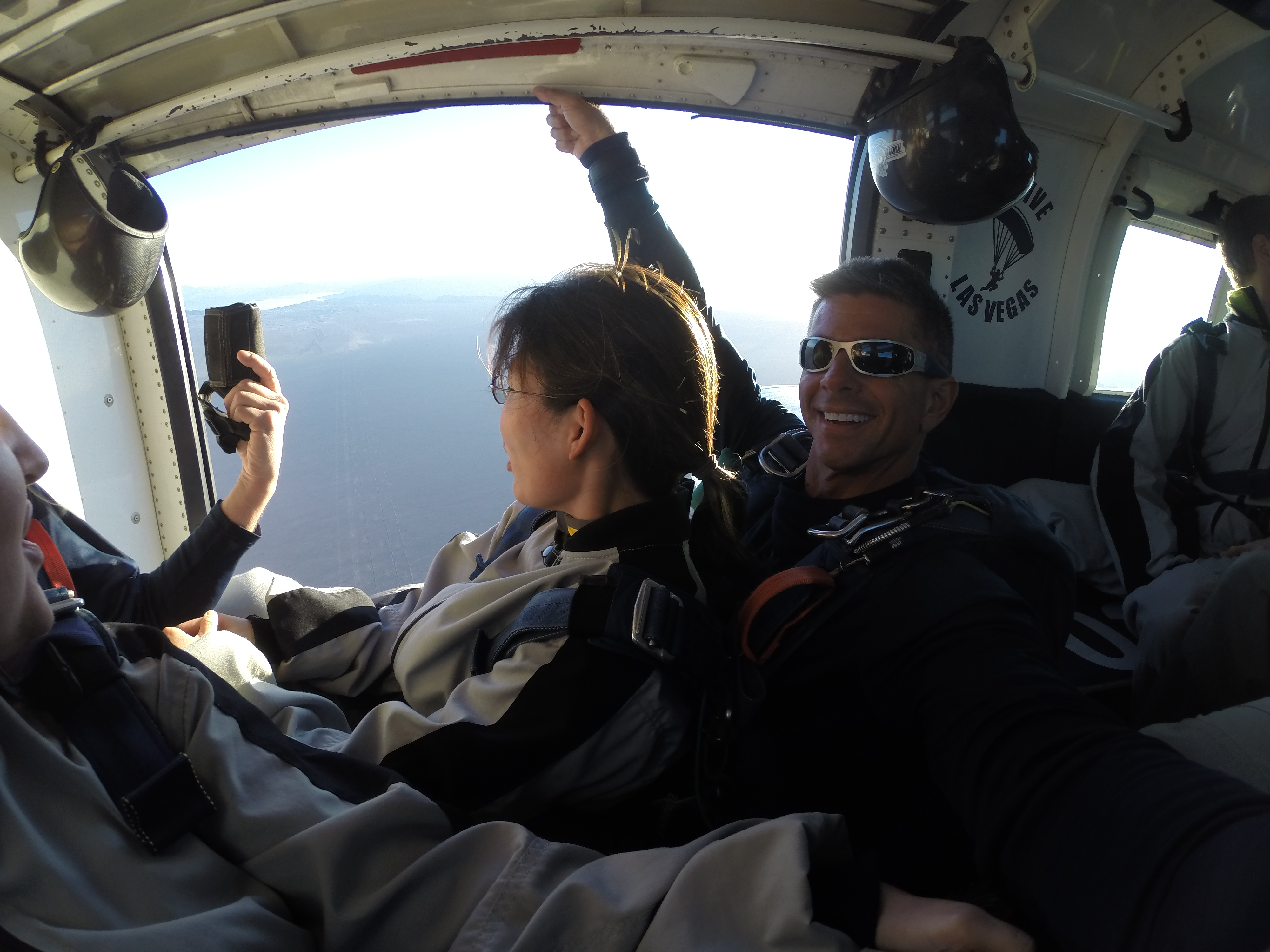
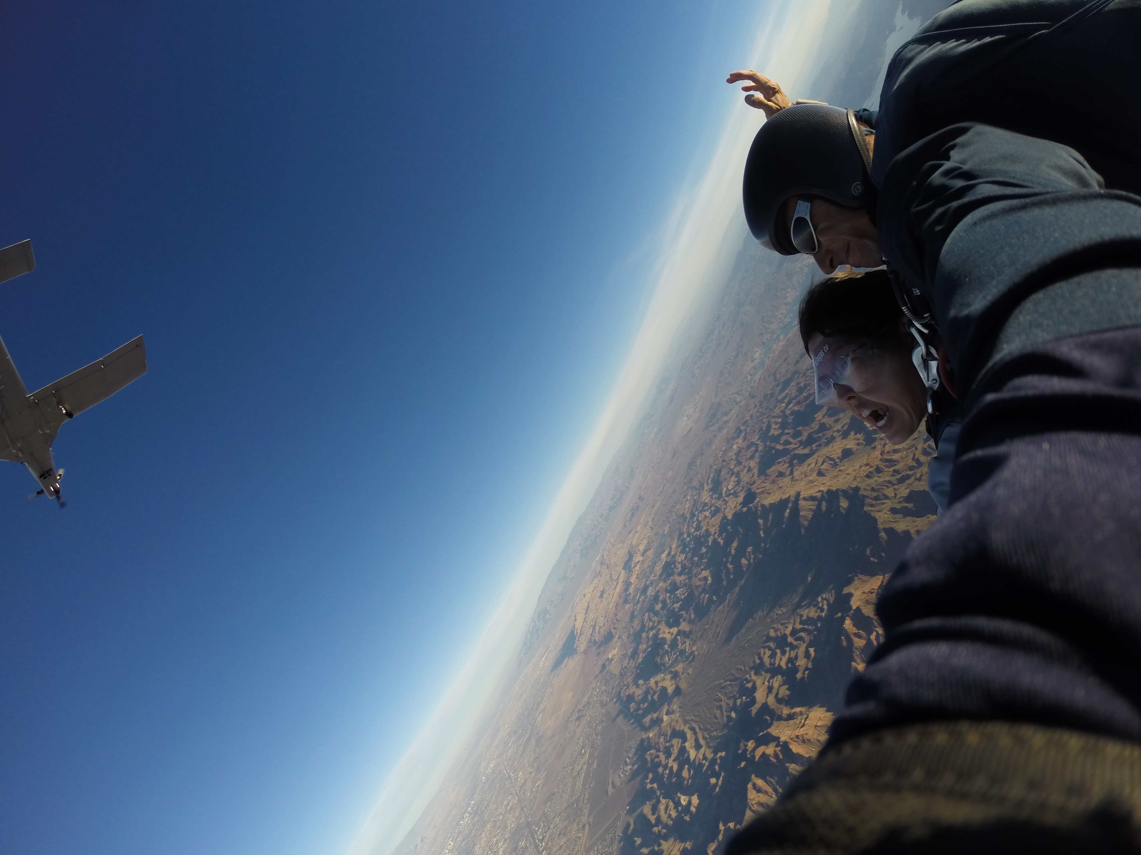
About 10 minutes or so before jumping, John opened the exit door to give me a breath of fresh air:
(This just got real.)
Just about to jump! Note my SAT in the background, grinning like a fool. He was looking forward to seeing me jump:
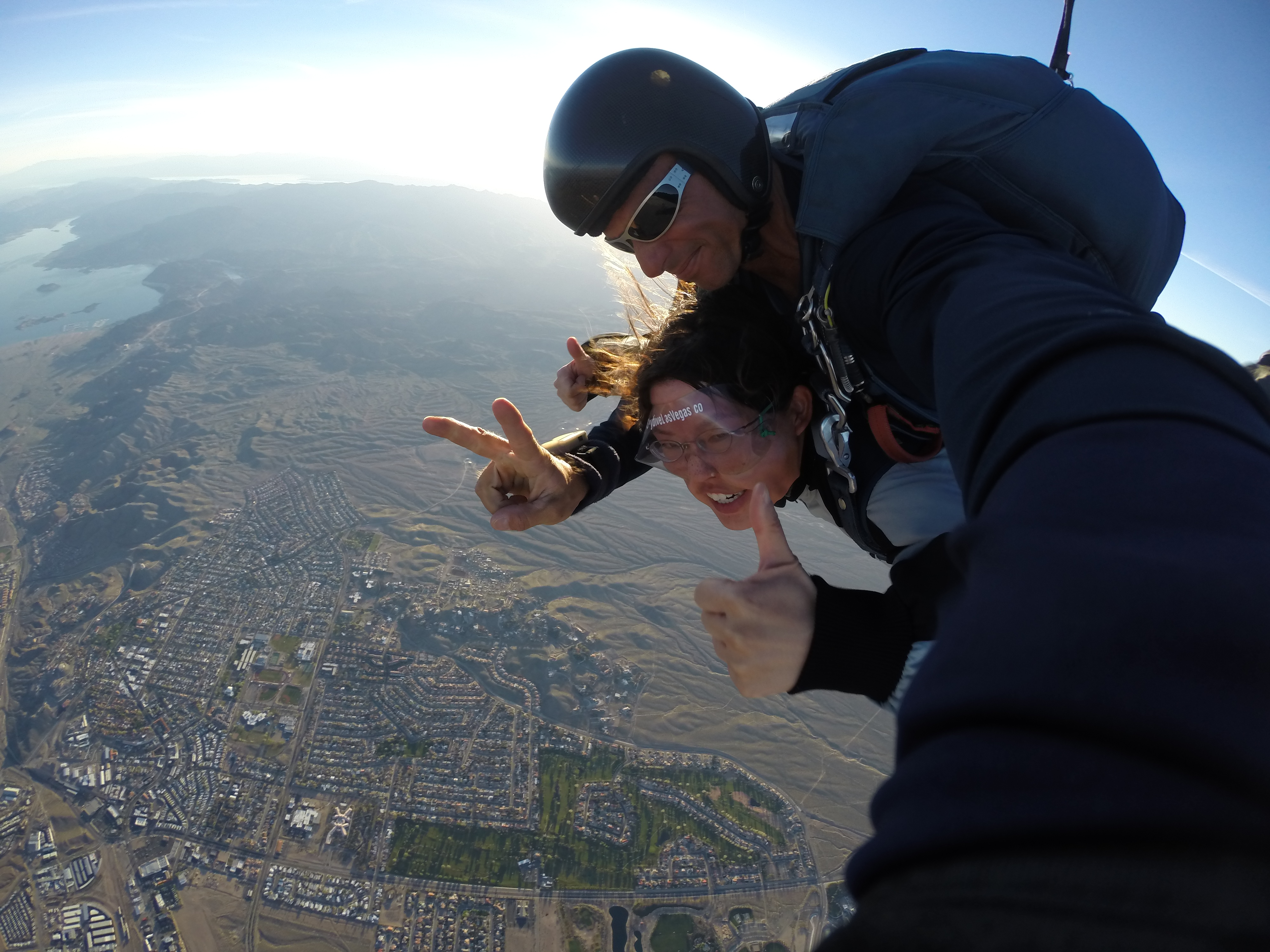
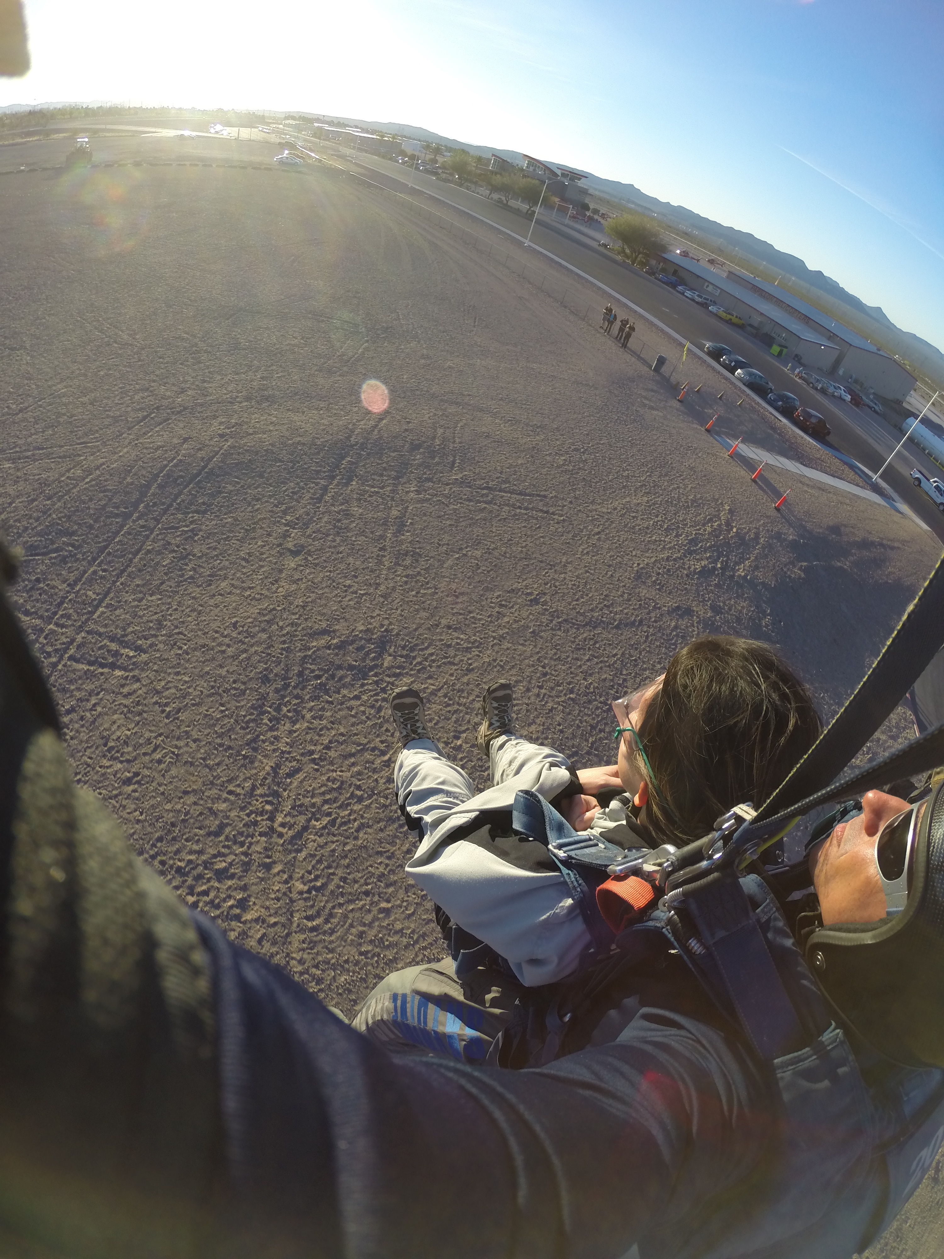
I was NOT ready to jump at all. John told me to cross my arms, bend my legs backward toward the plane, and “…are you READY? LET’S GO!!!!” and he pushed us out of the plane before my brain realized what was happening! The actual falling-out-of-the-plane part wasn’t scary and there wasn’t that weird stomach-in-throat sensation because you’re falling at the same speed as the wind and plane (100+ mph). I found it difficult to breathe because of the wind pushing against my chest and face. The instructors will tell you to scream, as that helps you to breathe! (I didn’t scream, though.) Freefalling lasted about 8 seconds, then John pulled the chute open, which jerked us upwards. After that, everything was quiet because there wasn’t any wind and we were just floating.
(Just after jumping!)
(Yahoo!)
(My SAT is stoked!)
(Checking out the views.)
All too soon, it was time to land. John told me to bring my legs up as we approached the ground:
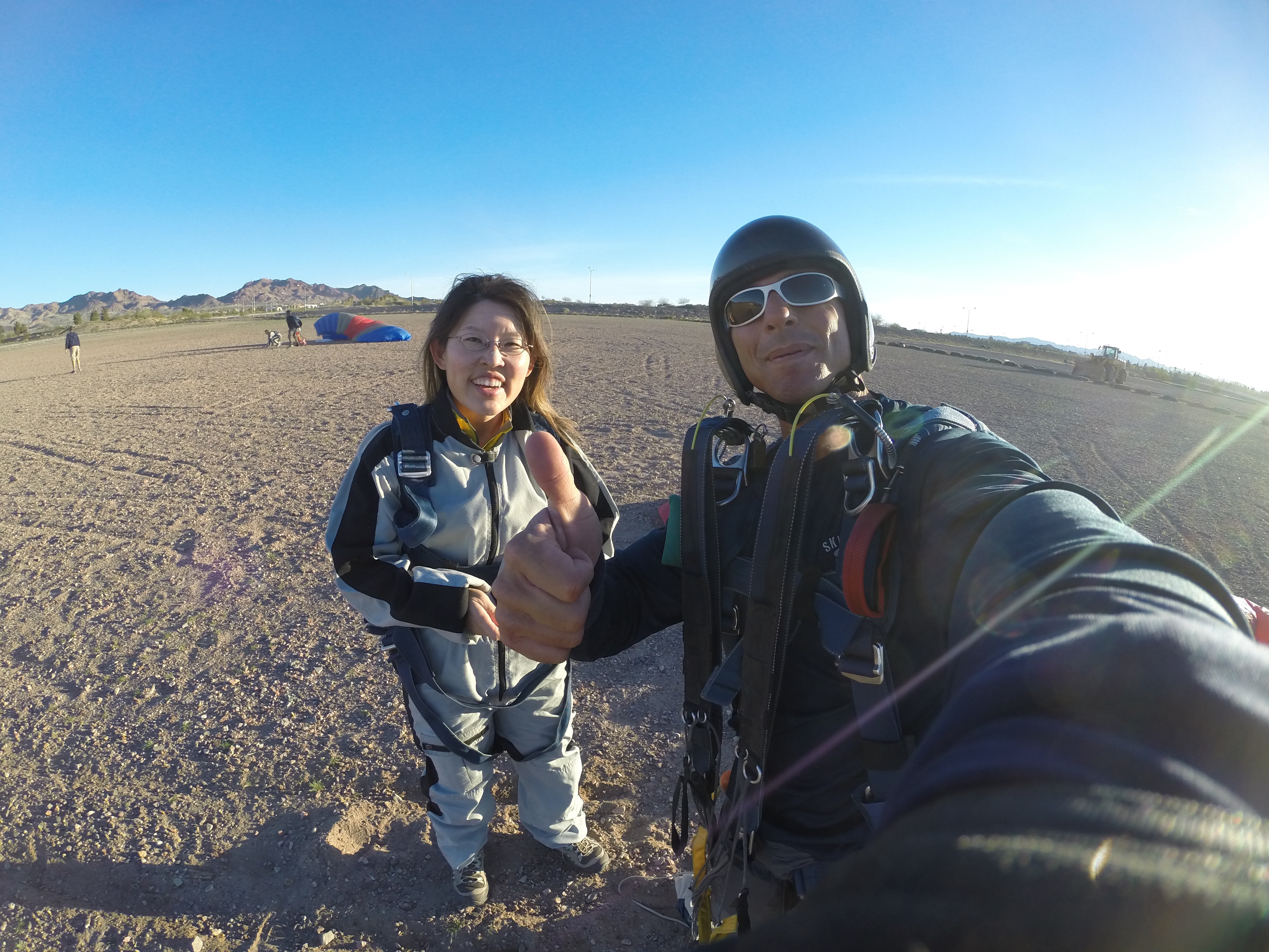
(Photo 1: Touchdown! Photo 2: Back on solid ground.)
I would TOTALLY do that again. Super fun! I can’t describe the sensation of freefalling or floating, but it was definitely the closest I’ll come to being a bird in flight. My SAT did a fabulous job of surprising me!
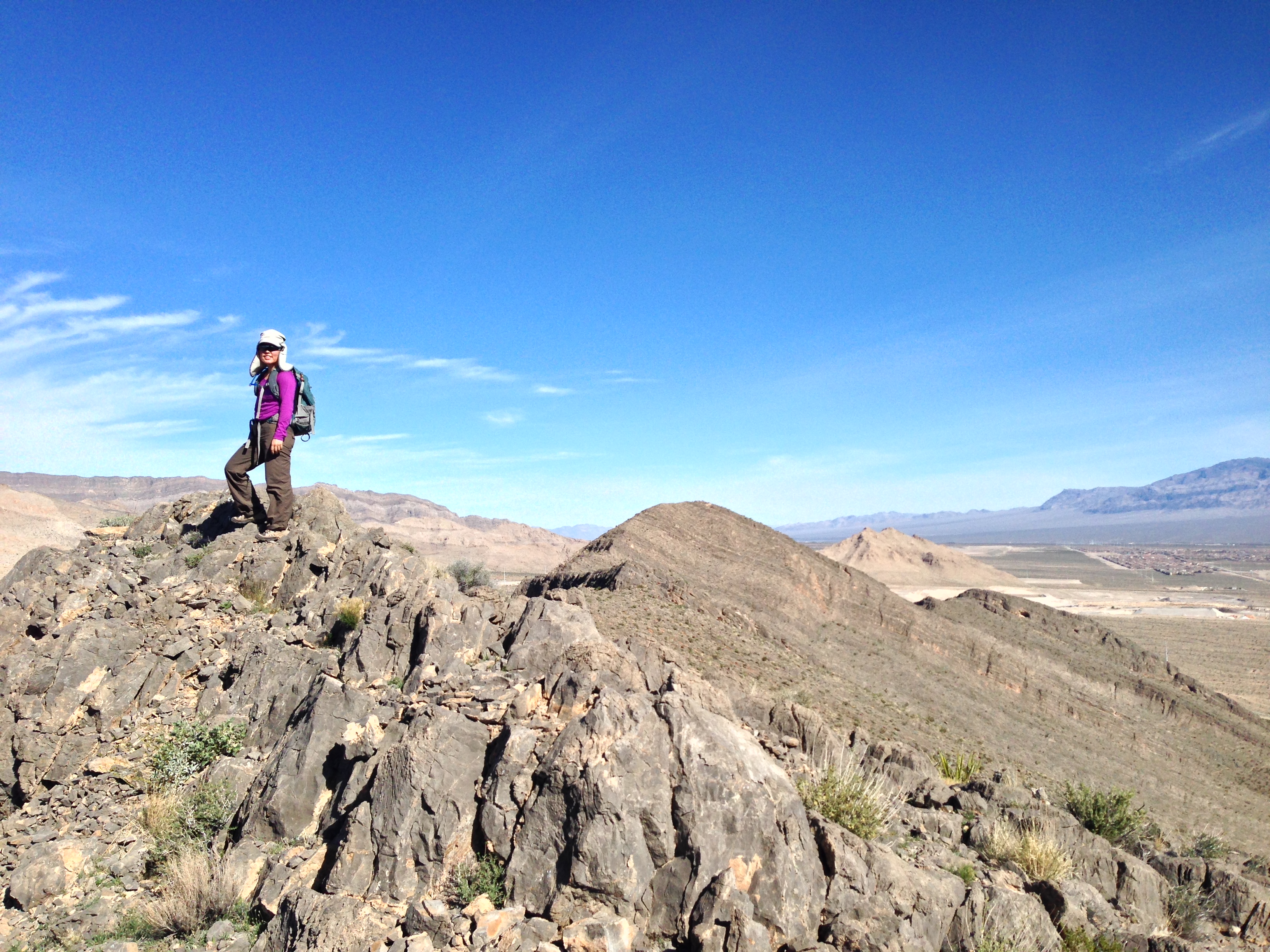
But wait! Since we were finished so early, we decided to head back home and go for a hike for real. I suggested we hike the ridgeline on the mountain across from our place, so that’s what we did. Here are a few pictures from that little adventure:
(Top of first summit!)
(Our hike continued to the next two summits you see in the right half of the photo.)
(Fortunate to enjoy rugged hiking right across the street!)
Finally, to cap off all that fun adventuring, we enjoyed a lovely dinner on the Strip. Perfect day and wonderful memories made that will last a lifetime!
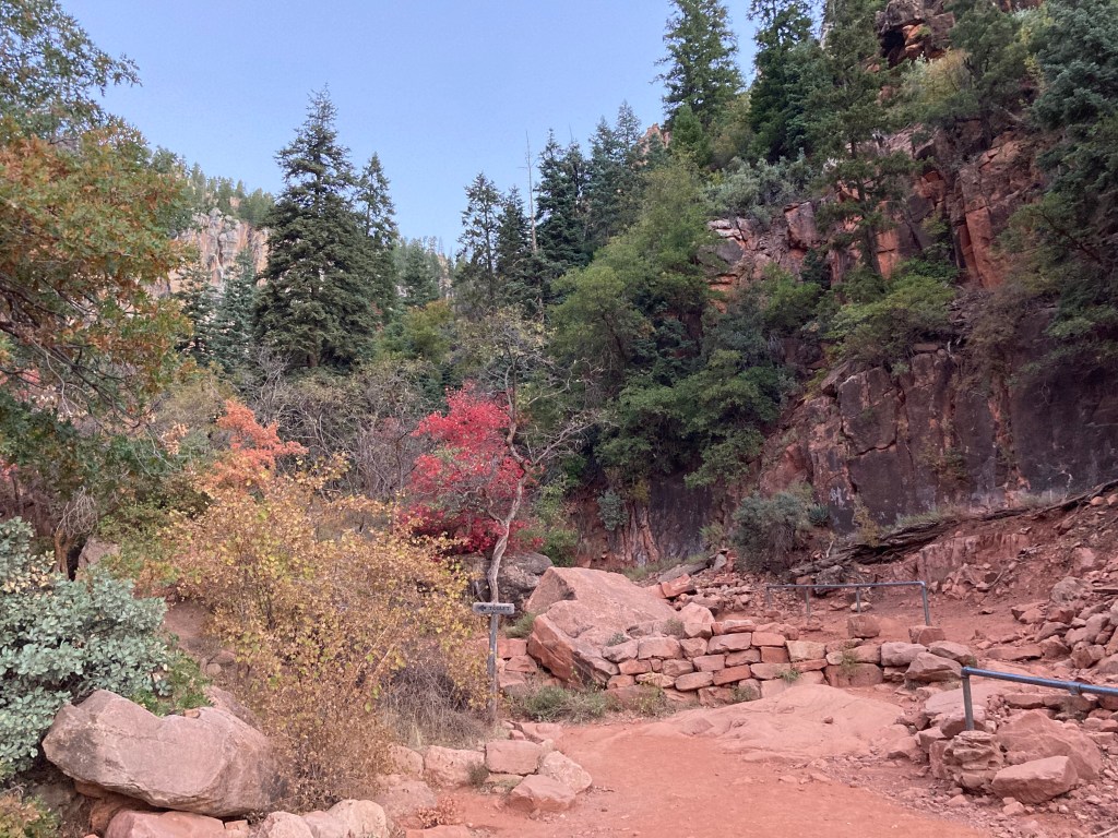
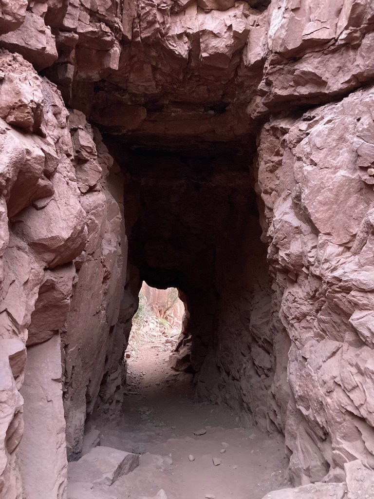
Life after the double century has become easier and harder. Easier because I don’t have to schedule so many (any!) training rides, freeing up time for other pursuits. Harder because several big changes have occurred in the past few weeks and WILL occur in the next few weeks. Despite that inconvenient truth, I still want to get out and enjoy the outdoors when I can and yesterday, I managed to join a small group for a short scramble in Red Rock Canyon. The weather was lovely and it felt really good to use my whole body during the scramble (and by “scramble,” I mean climbing over rocks and squeezing through narrow slots using both hands and feet. I used the term “scramble” once before to a friend who had never heard of that term and she was immediately concerned after hearing it because she imagined “scramble” as in “scrambled eggs” as in “painful and unfortunate early demise”).
Anyways, when we were driving back to the original meeting spot, two of the people in my vehicle were talking about how it was so funny to see road cyclists all decked out in attire that matched their bikes. Wasn’t that weird? How much money do they spend on spandex anyway? And road cycling is SO DANGEROUS. Why would anyone want to do that? (Granted, that was a question I asked myself not that long ago, but I digress.) After a few minutes of hearing my hiking friends make fun of cyclists, I knew I had to say something because like it or not, I was (am!) a cyclist and it was up to me at that point to defend cyclists everywhere (especially the fashion-conscious ones).
Hiker 1: “Yeah, it’s crazy to see them all out there on the road in their matching spandex and coordinating outfits!”
Hiker 2: “I couldn’t imagine doing that! Or wearing that! Too much bother.”
Me: “Uh, dude, MY cycling clothes totally coordinate with my bike.”
*pause*
I went on to say that it was a normal practice. Long road rides can be difficult. May as well LOOK good while suffering all those miles on the bike. Also, I said to my hiking pals, while road cycling is dangerous, it is the cyclist’s responsibility to be as visible and aware as possible. Of course, motorists should watch out for cyclists (and pedestrians) and be courteous enough to give cyclists a bit of extra room on the road when it is possible to do so. Furthermore, the scrambling that we had just enjoyed, I said, also holds inherent dangers, such as rock falling onto heads/bodies and losing one’s balance on a ledge and plummeting many feet to the canyon floor (and resulting in scrambling oneself like scrambled eggs).
I just thought it was funny that I was identifying with THE OTHER SIDE (i.e., cycling!). Will wonders never cease?
This weekend featured 2 new “firsts” for me, plus a return to my “last-resort” method of training: indoor bike. So many words, so little time, so let’s begin!
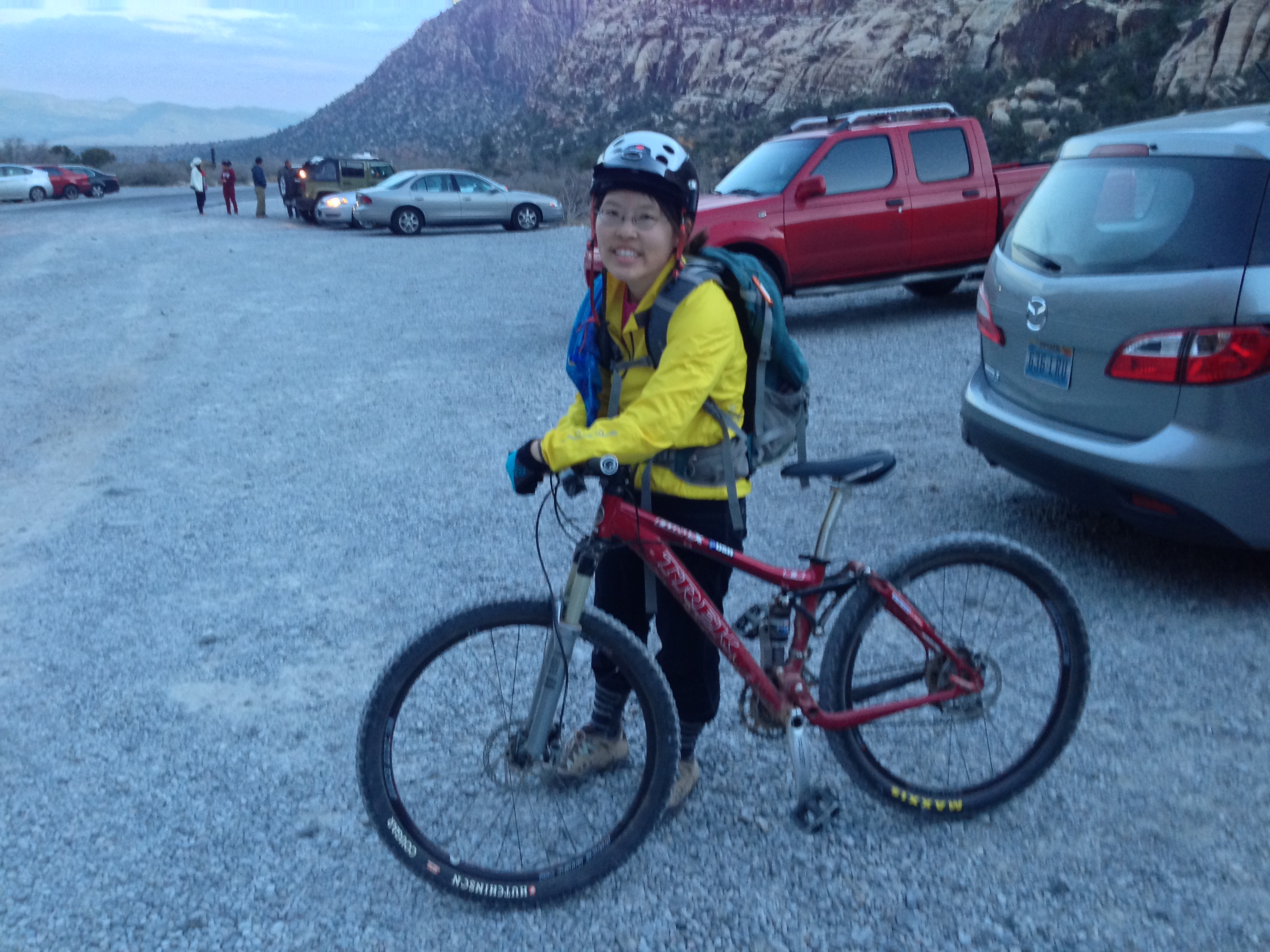
Yesterday, my SAT and I embarked on a new type of adventure: the multi-disciplinary outdoor fest. We decided to hike up Bridge Mountain, which is one of the most popular and beautiful hikes in southern Nevada and is situated in Red Rock Canyon. Most people who climb Bridge Mountain drive their high-clearance vehicle (HCV) up the 5 mile gravel road to the trailhead. That gravel road is appropriately named Rocky Gap Road, for it is indeed VERY rocky. I am not sure which is faster: driving up the road or hiking up the road. There are many sharp twists and turns along the narrow road that necessitate good driving skills, a cool head, and patience (for high speeds are well nigh impossible). I was eager for my SAT to hike Bridge Mountain because I knew from personal experience how fun of a climb it is. Along the way to the summit, one will see the rocks change color from grey (limestone) to red and cream (sandstone). There is also a hidden forest near the summit as well as a beautiful stone bridge or arch (thus, the name “Bridge Mountain”).
Whilst discussing the idea of hiking Bridge Mountain, my SAT smirked and suggested that we do Bridge the “correct” way: (mountain) bike up Rocky Gap Road, hide our bikes at the trailhead, then hike up.
“It’ll be SO much faster going down Rocky Gap on our bikes and besides, we have to do this the proper way,” my SAT declared.
“Proper according to whom?” I inquired.
“To anyone hard-core,” he asserted.
“How long do you think this will take?” I asked.
“Let’s say 2 hours….wait, no, probably more like 1.5 hours for you,” he calculated.
Oh joy. A 5 mile mountain bike climb, which is something I rarely do, for almost 2 hours. To add incentive, my SAT invited a friend (Mike) to join us who knows the route up to Bridge AND who is even less experienced than me on the mountain bike. I reluctantly agreed to this endeavour and yesterday morning, we got on our bikes and started pedaling up the rock and boulder strewn road.
Honestly, that was one of the hardest things I’ve done on the bike. My lack of expertise on the mountain bike was most evident when I had to negotiate my way uphill through rocks and gravel. I was going so slowly that I lost my balance (and patience) several times. All the while I was huffing, puffing, and fearing for my cardiovascular health, my SAT was smiling, laughing, and doling out words of encouragement.
“Pedal HARDER!”….”Why are you just standing there?”….”GET BACK ON YOUR BIKE.”
(Ok, he DID say some nice things too, like how well I was doing and how far I’ve come. Of course, my state of mind during the entire climb was such that I decided that SAT now stood for “Sadistic Apathetic Trainer.” I think the word “sadistic” is apparent enough; the “apathetic” was my adjective to describe his attitude to my pain during the climb).
Mike wasn’t saying much either on the bike ride up the climb and had to admit he did not make HIS wife do things like my SAT was making me do. Take note, my SAT.
We finally got up to the trailhead, heaved in as much oxygen as we could, then stashed our bikes off the trailhead:
The hike up to the top of Bridge Mountain was beautiful. Perfect temperature and gorgeous views.
(Our goal!)
(My SAT and I on top of the bridge.)
The ride down Rocky Gap Road went much faster than the climb (obviously!), but I still had to brake most of the way down, as I kept on gaining speed when I wanted to go slower over the rocks and boulders in my way. However, we all made it down safely and before the sun set.
(SO HAPPY to be DONE.)
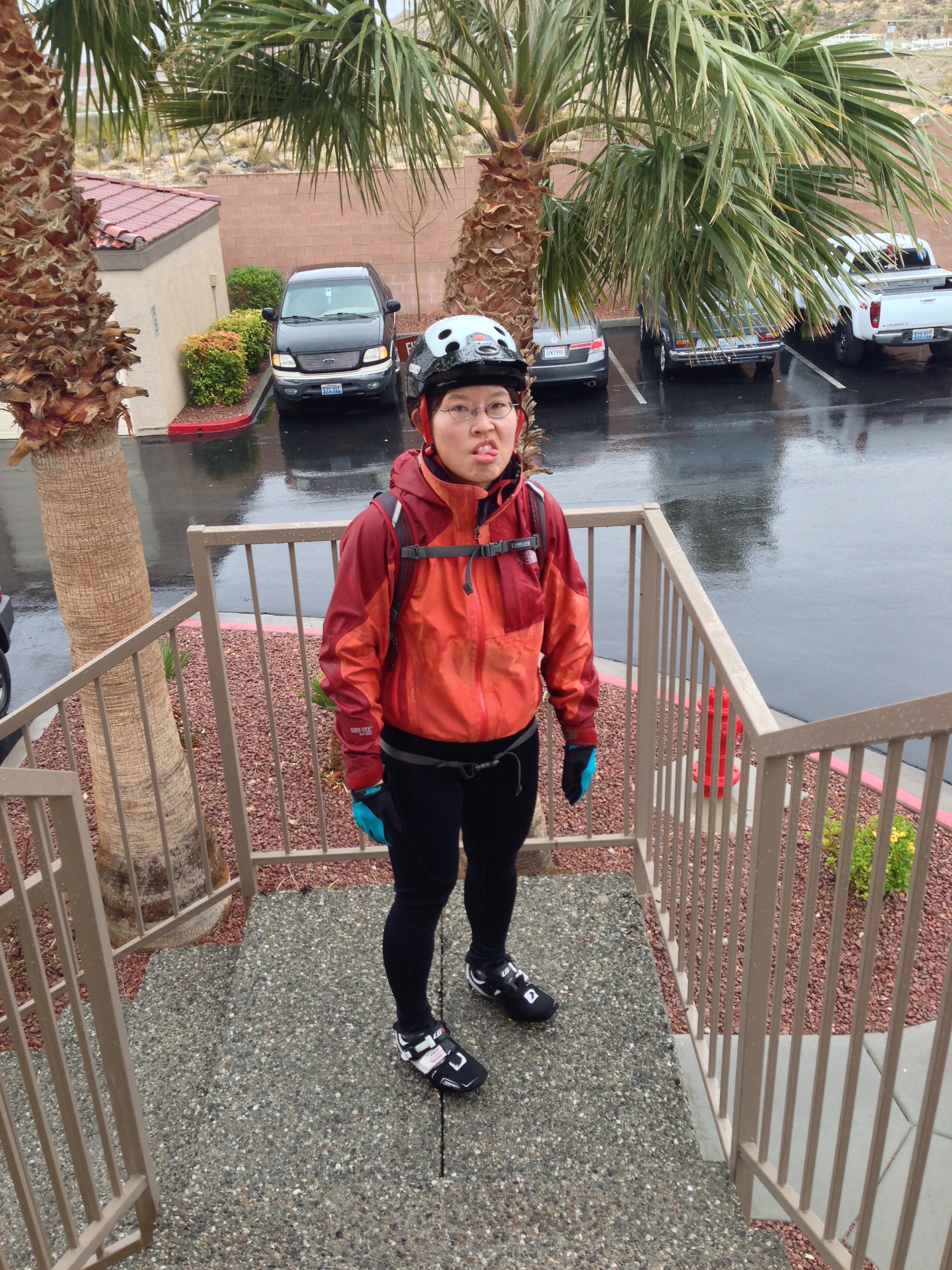
In contrast to yesterday’s beautiful weather, today was quite rainy and cold. I still had a considerable number of miles to ride for the week and it wasn’t looking good for a long ride today. Despite my lack of adequate rainy weather gear, my SAT and I set out for a bike ride anyway. We were only a few miles into the ride when we both decided to turn around and go home for the following reasons: 1) every time we turned a corner, our tires would direct streams of water into our shoes. Cold, wet feet do not a comfortable ride make. 2) My saddle (seat) is one of those fancy cut-out ones to alleviate pressure. While I cycled, water from the wheels would splash up the cut-out and onto my butt area, making my cycling pants feel like a spandex sponge. I could feel myself squeezing water out of my chamois (the padded part of my cycling pants) whilst sitting and rotating my posterior during each pedal stroke. 3) It was just plain cold and miserable.
We arrived home and immediately shed our sodden clothing. I resigned myself to a long session on the indoor bike in the gym. Better than nothing, I suppose. I hope tomorrow is a sunnier, drier day!
(Just arrived home and not impressed with the precipitation.)