In my last post, I shared that I was training for my first “Rim to Rim” (R2R) hike. I gave myself 5 weeks to train and after many miles and logistical planning, I’m happy to report that the R2R hike was a success! Bear with me: this post is a long one because it includes all sorts of information pertaining to the training I did, the gear I took, and the hike itself. I wanted to document all that information for future reference, in case I ever wanted to do this again…
The original idea for doing the R2R came up during a conversation earlier this summer with my friend Jodey. We both had the R2R on our radar, but for various reasons, hadn’t done it yet. When I hiked Humphrey’s Peak with another friend, Crystal, in July, I mentioned that it would be cool to attempt R2R, but I’d need a shuttle driver. Crystal immediately volunteered to be that shuttle driver, and at that moment, R2R became a reality. Jodey, Crystal, and I scheduled our R2R attempt for the October long weekend and I mapped out a hiking training plan.
Training:
I gave myself 5 weeks to focus on hiking and started my training on August 31st. I didn’t want to start my training sooner than that because it was still hot in Phoenix (i.e. temperatures were still hovering around 90F/30C at the coolest part of the day. Yeah. Gross.). My training plan was basically to hike each morning with a rest day once a week. I’d increase my mileage each week and do a big hike on the weekends. This plan went well until my last 2 big training hikes. Jodey, my SAT (self-appointed trainer, i.e. my husband), and I planned a 16 mile loop in South Mountain with just under 4,000 ft of gain. We wanted to use this hike as a “qualifying” hike to see where we were in our training. We started hiking at 4:30am to try and beat the heat, but we were still hiking at 11am, when temperatures hit 100F/38C and my body started shutting down. I was in heat distress and was breathing heavily (while walking on flat trail at that point), walking really slowly, dizzy, and experiencing tunnel vision. We decided that Jodey and I would sit under a tree and wait for my SAT to get the vehicle and pick us up. That experience was a sober reminder that hiking in the Grand Canyon is not a joke. I decided to take the next week to train some more and think about whether I really wanted to do the R2R and if I REALLY felt physically and mentally prepared to commit to the hike. The good thing about this hike is that I didn’t get any leg cramps, which I tend to do on long, difficult hikes. I was trying out some Endurolytes (i.e. electrolyte pills) and they seemed to work.
The next weekend, my SAT and I did another big hike. We planned on doing a 10 mile hike and started hiking at 6:30am. Unfortunately, the hike ended up being 14 miles and we got caught in the heat again. However, I fared a bit better and was able to complete the hike, probably due to my experience the previous weekend. Similar to last week, I didn’t get any leg cramps. Thank you, Endurolytes!
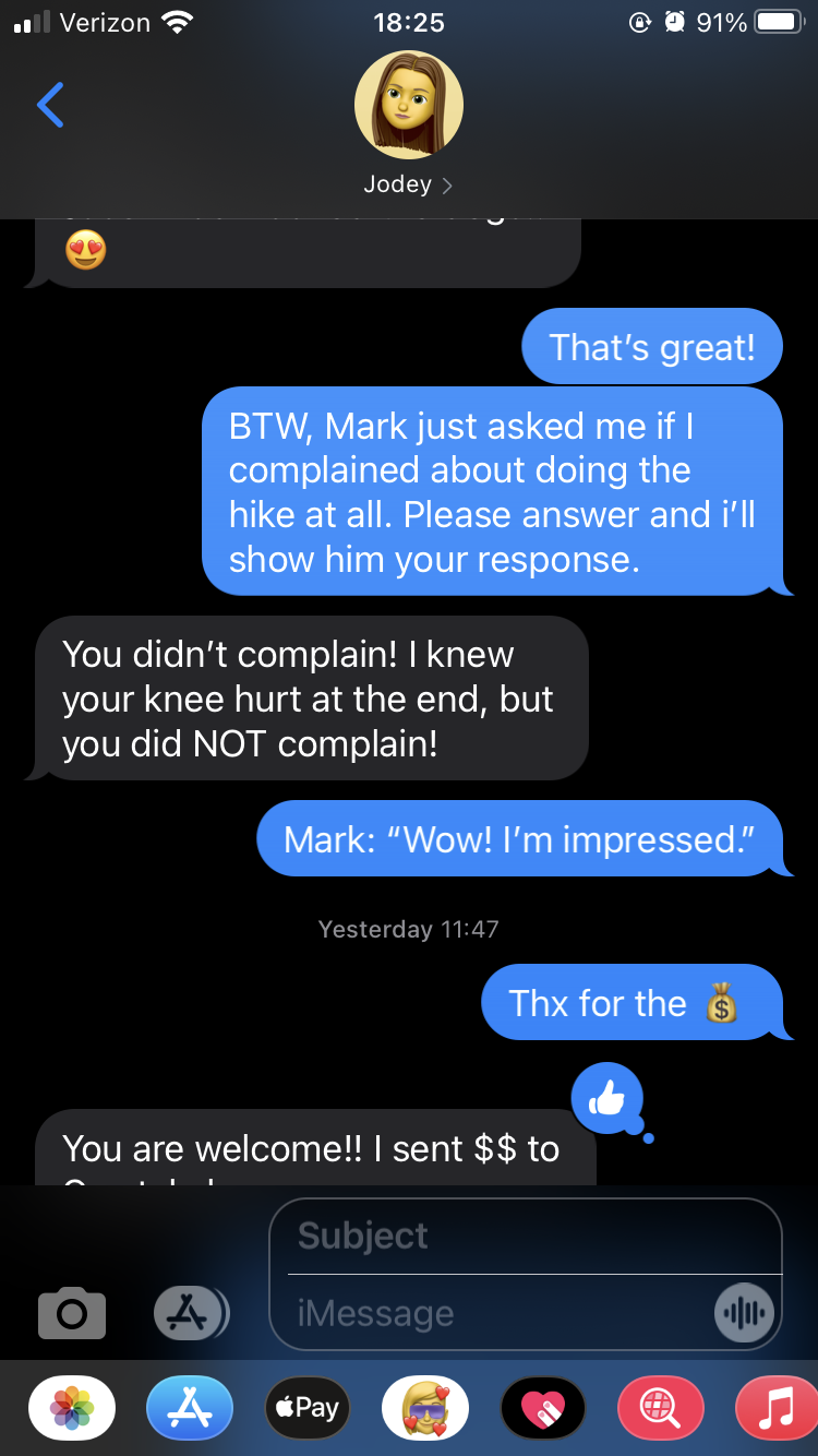
I decided to commit to the R2R and concluded that my goals for the hike were: 1) not to get leg cramps, 2) deal with the heat factor by starting the hike as early as necessary, and 3) not complain. Yes, that last goal was a legitimate goal! (I’m again happy to report that I successfully achieved that goal. Funny story: during the hike, I said to Jodey that my loving SAT would ask if I complained during the hike. Shortly after I got home, he did indeed ask me.
The weekend:
Friday October 9
This day was mainly spent driving. Jodey and I left Phoenix at 6:30am and drove to Prescott to meet up with Crystal (and her adorable dog, Bagheera). We then drove to Flagstaff, stopped at Whole Foods to pick up some food for lunch and dinner, then drove to the North Kaibab trailhead to see where we’d be starting our hike the next morning. We then drove to our campsite (we planned on snagging a dispersed campsite), set up camp, then enjoyed the sunset at the East Rim Viewpoint trailhead. Lights were out by 7:30pm and my alarm was set for 4am. It was really happening!
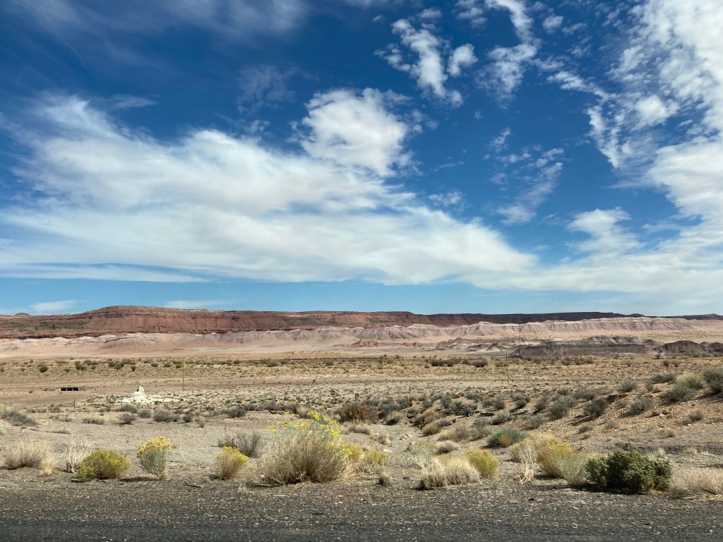
A few pictures of the drive north. 


Jacob Lake cookies! 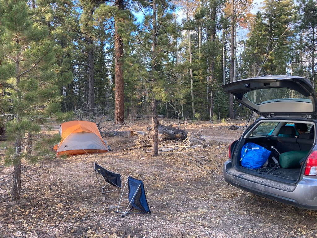
Our dispersed campsite. 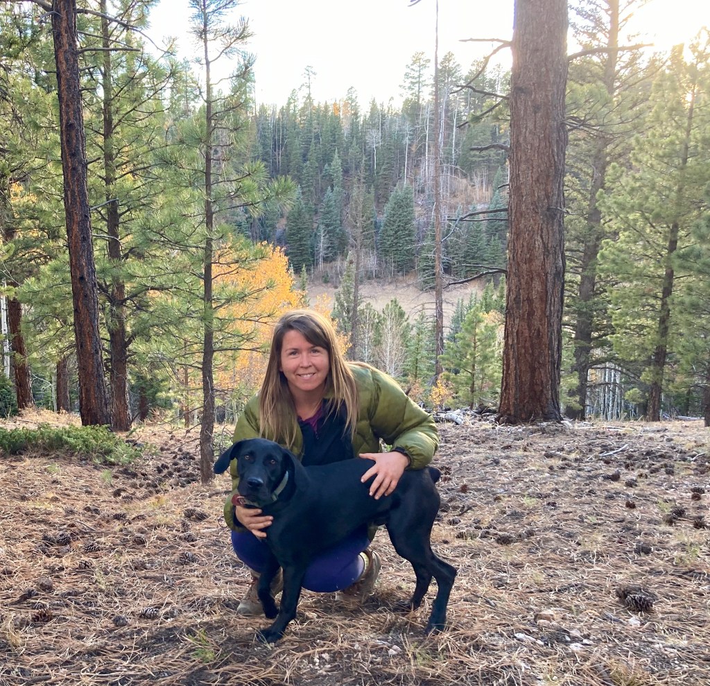
Crystal and Bagheera. 
Some Ensure to ensure our R2R success! Jodey and I had these for breakfast. 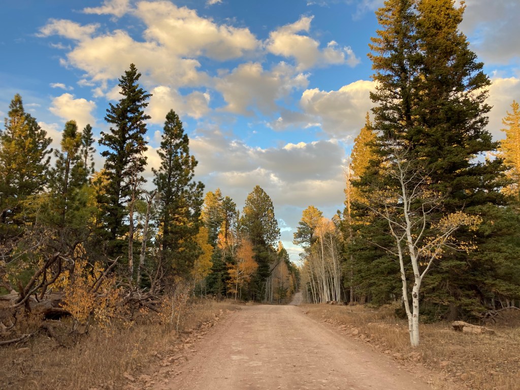
Beautiful golden light. 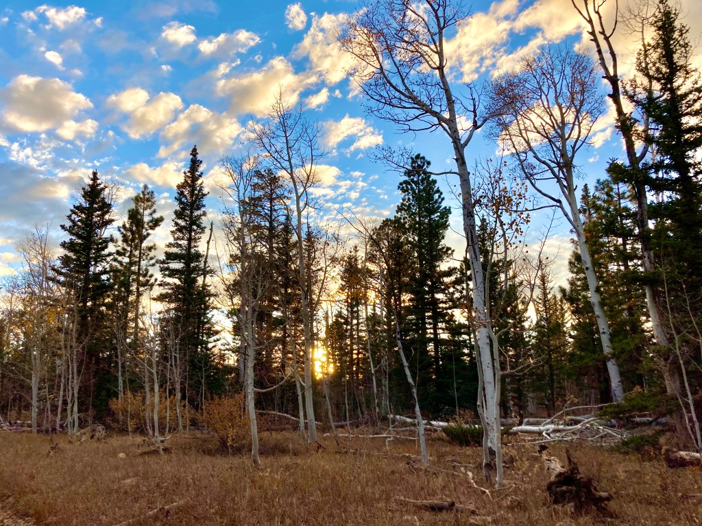

Our campsite was very close to the Arizona Trail. 
Enjoying the sunset. 
Sunset at the East Rim Viewpoint.
Saturday October 10
My alarm went off at 4am and we broke camp, repacked the car, and drove to the North Kaibab trailhead, arriving there just after 5am. Our plan was to start hiking at 5am, but nature called REALLY LOUDLY. Fortunately, there was a restroom at the trailhead. Unfortunately, there was a bit of a queue for the restroom. In any case, we started hiking at 5:26am. It was still pitch black and the temperature was probably just above freezing.
When Jodey and I discussed how to approach R2R mentally, we decided to think of it as doing 2 “shorter” hikes instead of one really long one. So, that’s how I’ll describe our R2R experience!
Hike 1: North Kaibab Trail to Phantom Ranch
- Starting elevation: 8,241 feet / 2,512 m
- Ending elevation: 2,480 feet / 756 m
- Elevation loss: 5,761 feet / 1,756 m
- Distance: 14 miles / 22.5 km
- Length of time: 6.5 hours. We started just before 5:30am and arrived at Phantom Ranch just after 12 noon.
It felt like it was around 40F / 4C when we started the hike. I wore my puffy down jacket, a long sleeve Smartwool shirt, long pants, socks, and hiking shoes. I had to use a headlamp because it was still pitch black. I think the hardest thing about “hike 1” is that it’s mostly downhill. That sounds strange to most people because downhill is considered easier than uphill, which it normally is! But, miles and miles of downhill can wreak havoc on knees, which I will talk about later in this post….
Sunrise occurred about an hour into the hike and wow, the early morning light revealed such pretty scenery!


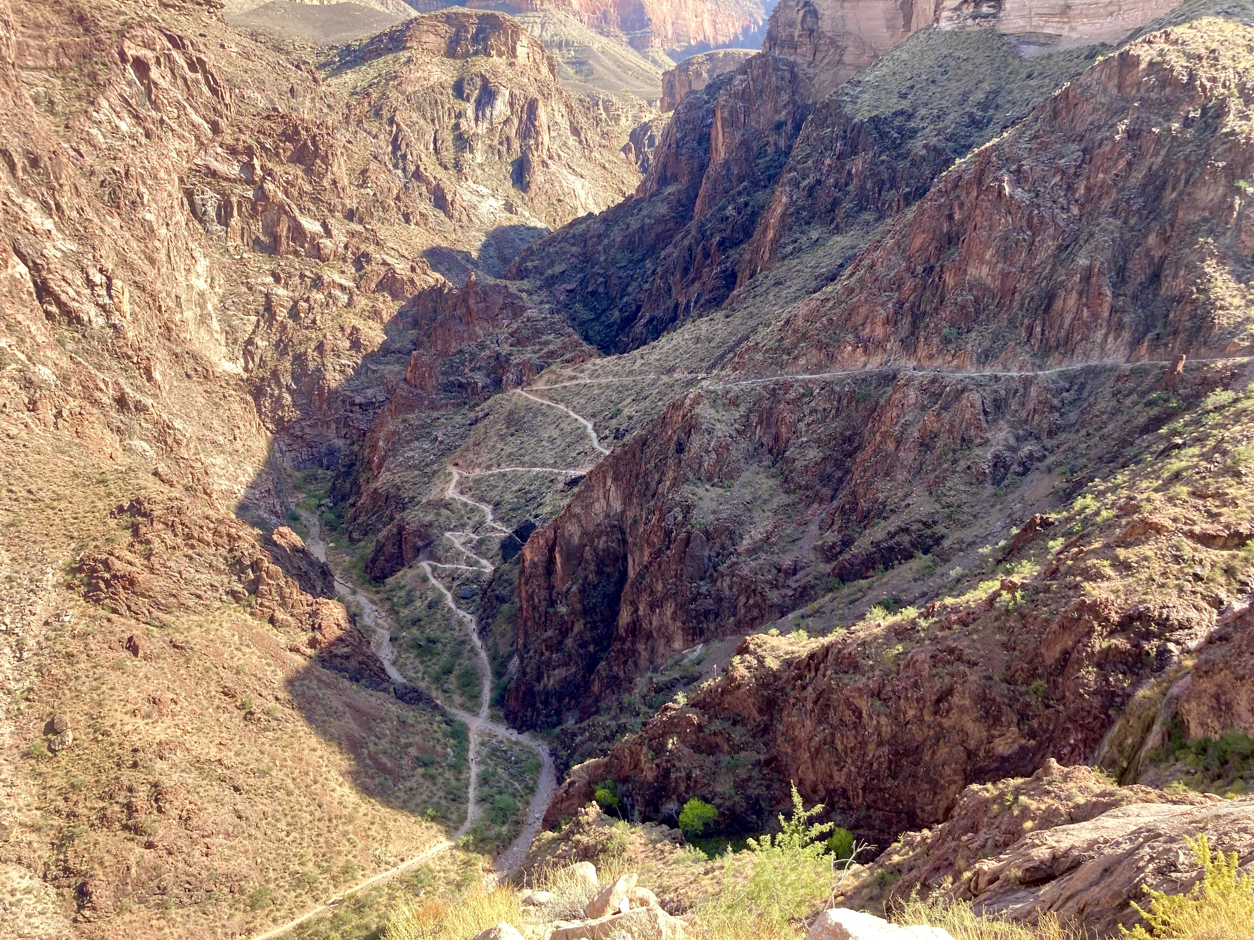
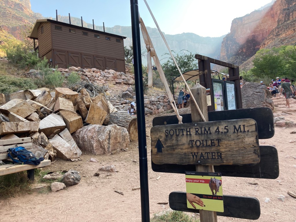
There are several landmarks along the North Kaibab Trail: Supai Tunnel (1.7 miles / 2.7 km), Redwall Bridge (2.3 miles / 3.7 km), Roaring Springs (4.7 miles / 7.6 km), Manzanita rest area (5.4 miles / 8.7 km), Cottonwood Campground (6.8 miles / 10.9 km), Ribbon Falls junction (8.4 miles / 13.5 km), and Phantom Ranch (14 miles / 22.5 km). Most of these landmarks had water spigots for filling up your water bottles and restrooms (i.e. outhouses). Tip: make sure to confirm that the water spigots are working before you hike!
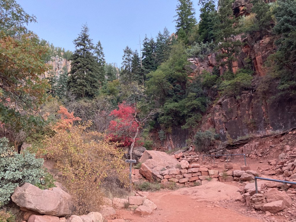
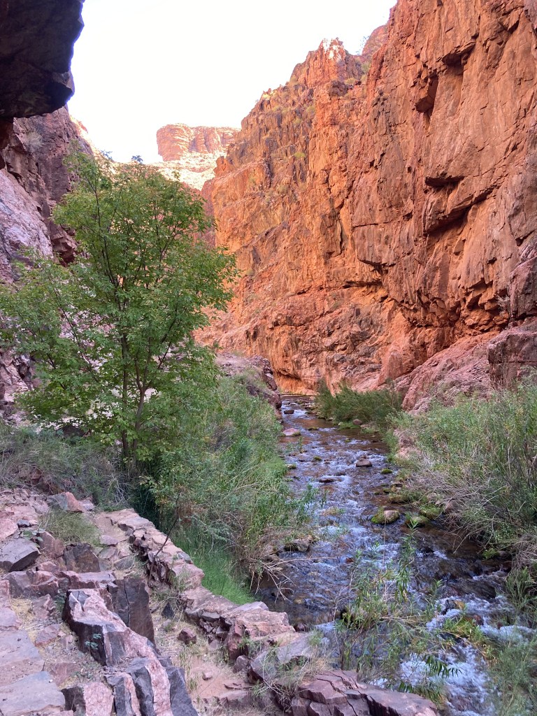
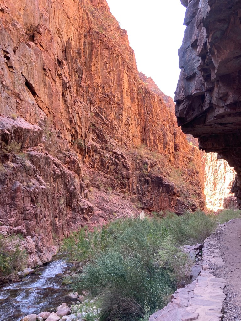
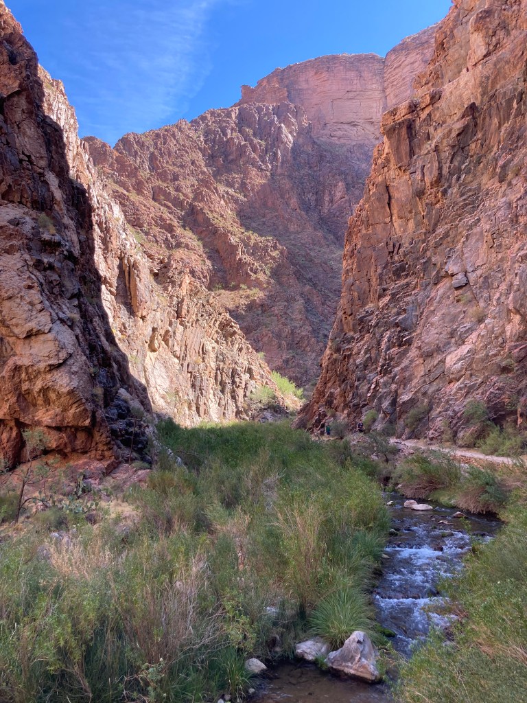
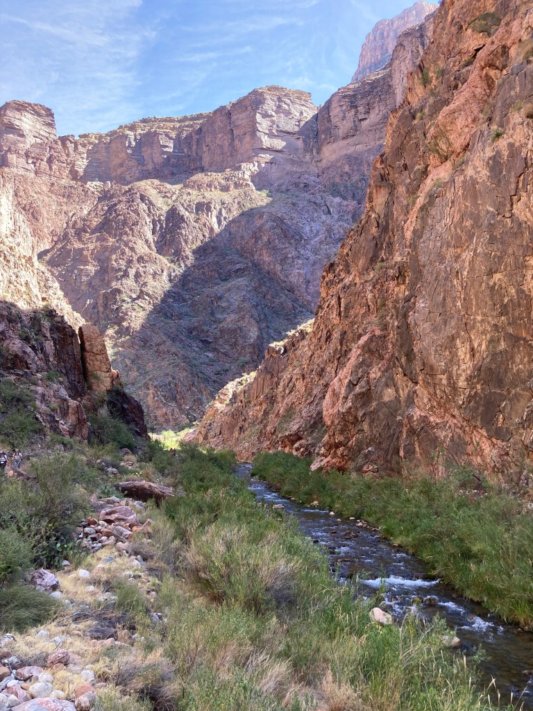
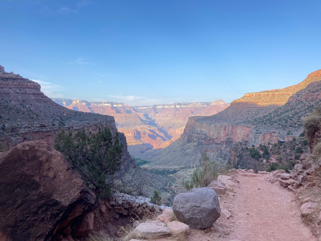
The North Kaibab trail is beautiful and we saw so much red rock, green trees, and fall leaves. Although there were many people on the trail, we were all spaced out enough so that we weren’t crowded. Some parts of the trail were rather exposed (i.e. there was a steep drop on one side), which would probably challenge those who are scared of heights.
At the first rest area 1.5 miles down the trail. 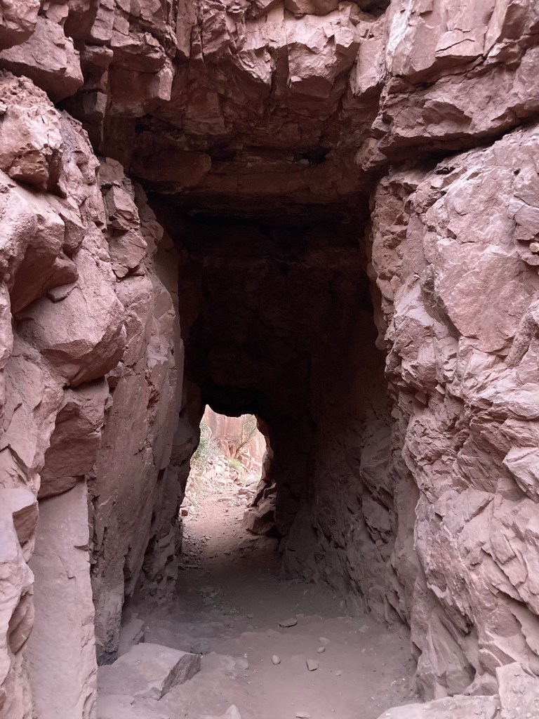
Supai tunnel. 
Check out the view! 
Jodey on the Redwall Bridge. 
Beautiful colours! 
More amazing scenery. 
Note the exposed trail on the right. 
Approaching Roaring Springs. See the waterfall in the bottom center? 
Hanging in there! 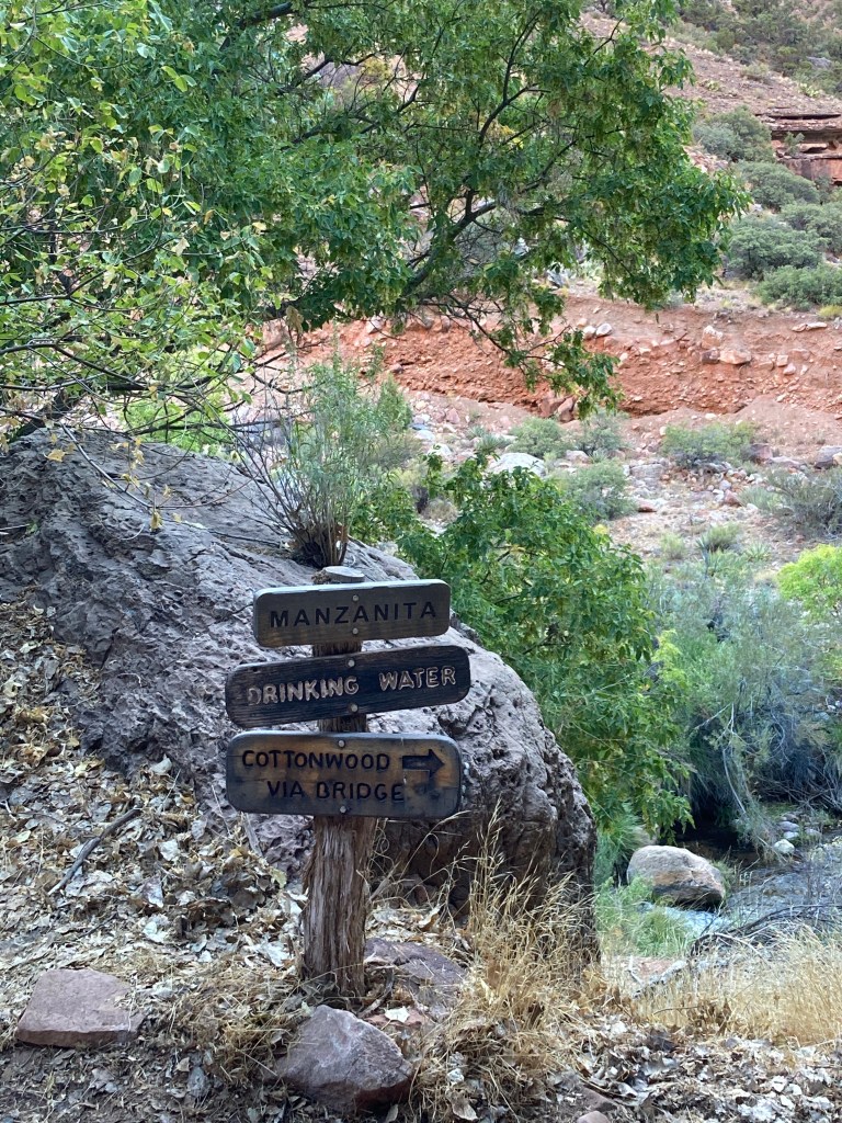
Manzanita rest area. Most of the landmarks were signed. 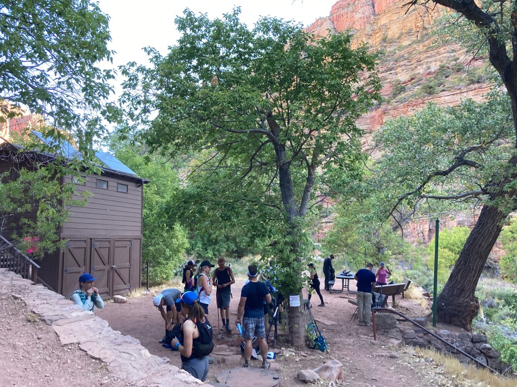
It was busy at the Manzanita rest area when we arrived. 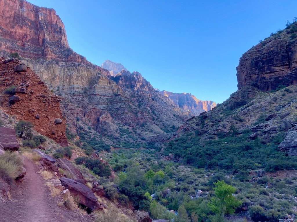
On the way to Cottonwood Campground. 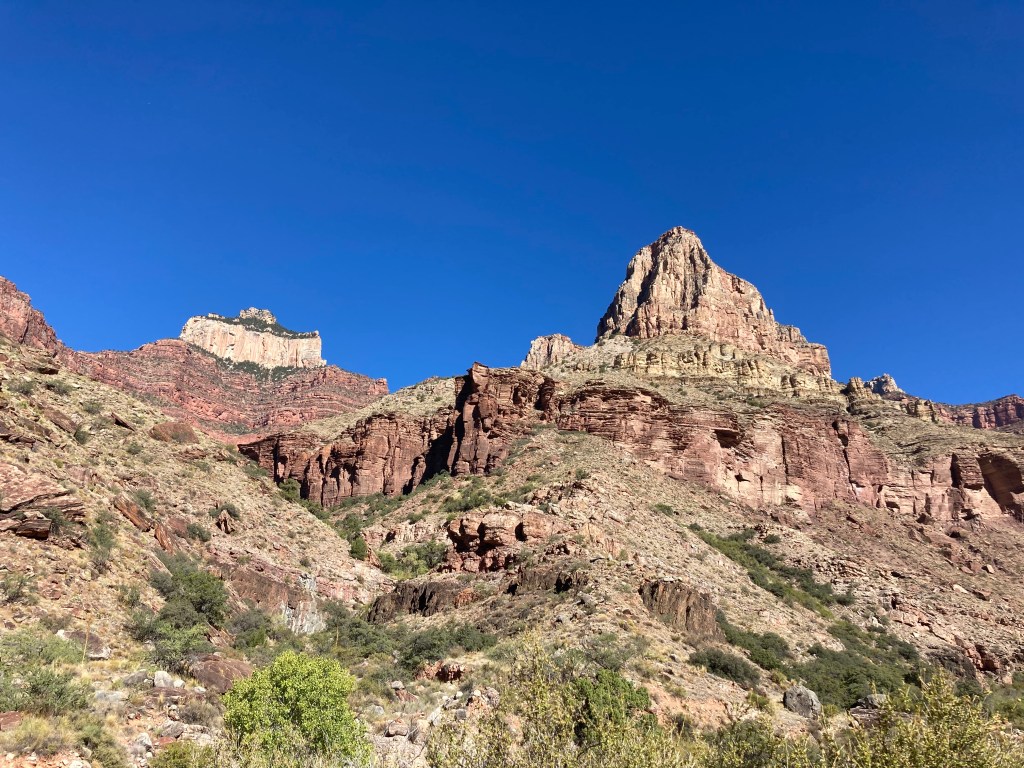
This is one of the few times we were in direct sunlight. We had a lot of shade during our hike. 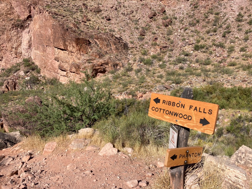
Ribbon Falls junction. Maybe next time!
One of the sections I was concerned about was “The Box.” This section of the North Kaibab trail consists of a few miles of narrow canyon right before Phantom Ranch. Note: “narrow canyon” means “heat trap.” In my R2R research, I read that temperatures in the Box can get as high as 130F (54C). (Reminder: I do NOT do heat well.) In order to stave off the heat, we dipped our shirts in the water right before we entered the Box and wore them through the Box. It was great to feel cold for a few moments! Happily, when we hit the Box during our hike, it was mostly in shade and the temperature was nowhere near 130F (it was probably closer to 85F / 29C).

The last little bridge of “hike #1.”
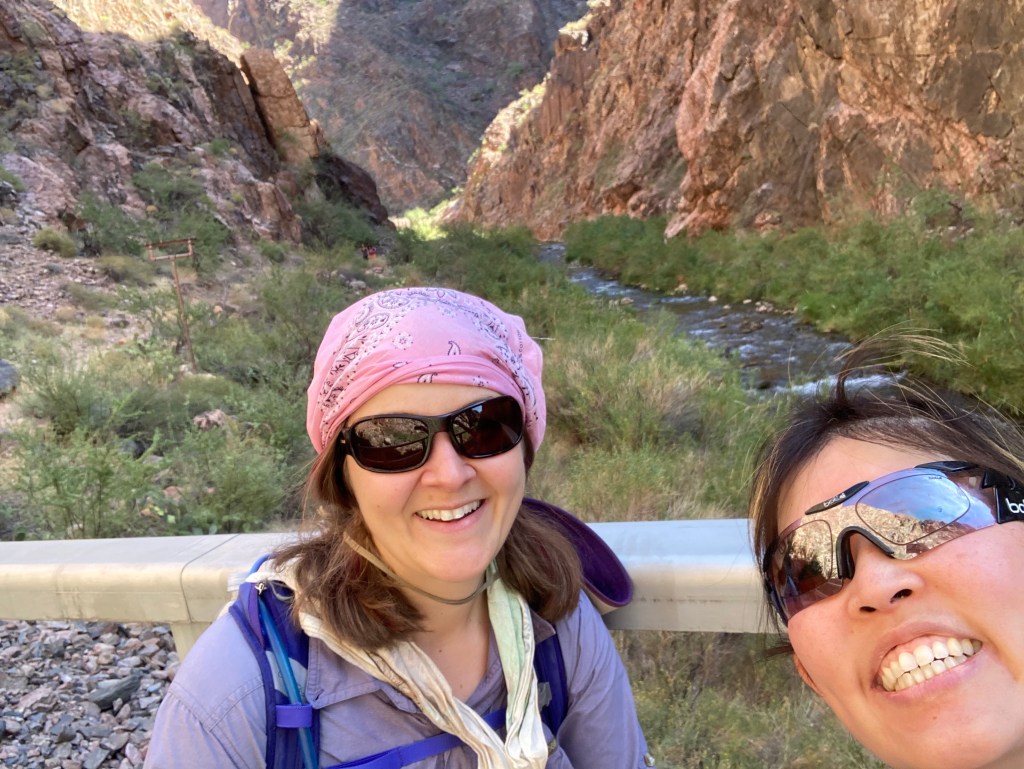
Finally! Phantom Ranch! We finished “hike #1!” I was super happy to reach Phantom Ranch because I REALLY wanted a lemonade. Yes, that overpriced lemonade was probably made from a mix, but it was going to be cold and delicious regardless. I EARNED that drink. In addition to the lemonade, I bought a 4-pack of Oreo cookies and a “sharing size” pack of peanut M&M’s to supplement our respective lunches.
We finished hike #1! 
Masks….sign of the times. 
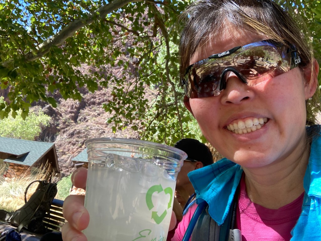
My cold, delicious, overpriced lemonade! 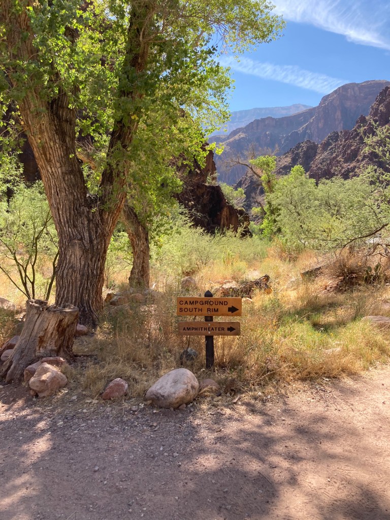
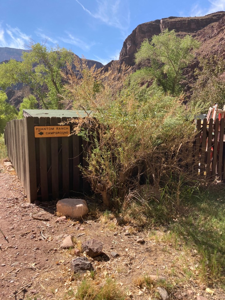
The sign points to Bright Angel campground. 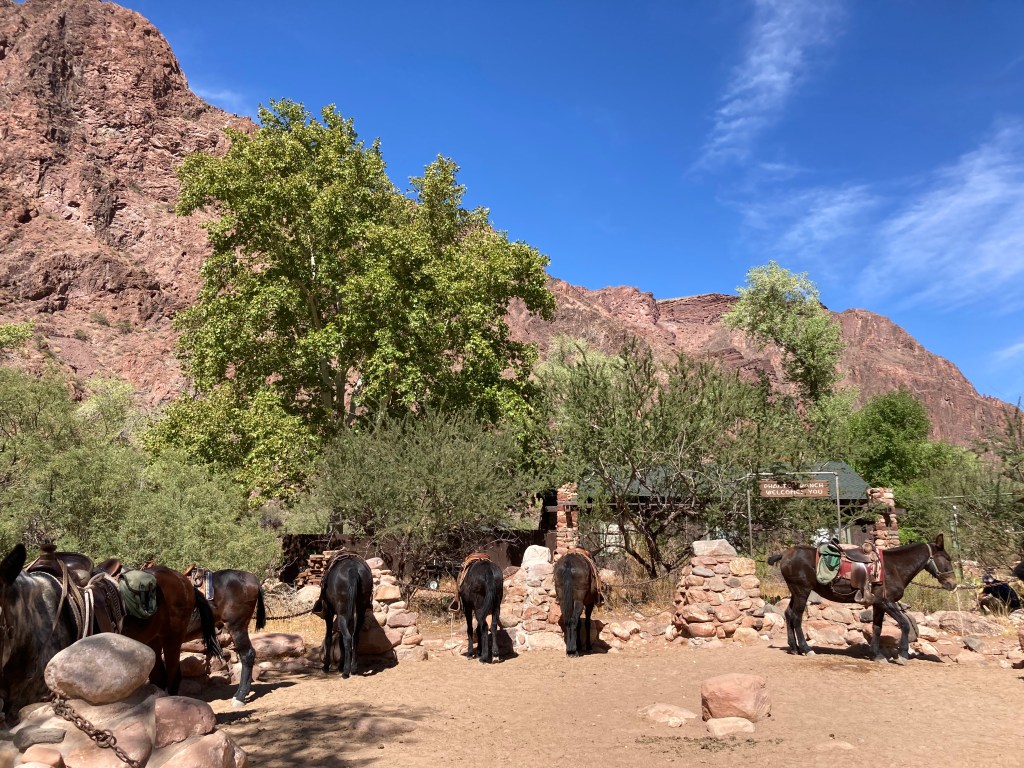
Pack animals.
Hike 2: Bright Angel Trail to the top of the South Rim
- Starting elevation: 2,480 feet / 756 m
- Ending elevation: 6,860 feet / 2,091 m
- Elevation gain: 4,380 feet / 1,335 m
- Distance: 9.5 miles / 15.3 km
- Length of time: 5.5 hours. We started our “second hike” just before 1pm and arrived at the top of the South Rim at 6:30pm.
I’m not sure what the temperature was when we started “hike #2,” but it was probably around 95F (35C). We dipped our shirts again before crossing the Silver Bridge and starting the Bright Angel trail. I’m not going to include any “wet t-shirt pictures” because I am a lady. 😉 I WILL include a few photos of the Silver Bridge that crosses the Colorado River and joins up with the Bright Angel trail. Fun fact: in early September, we learned that the National Park Service (NPS) was closing the Silver Bridge “indefinitely” due to structural concerns. That meant that we’d have to hike an extra 1.5 miles to the Black Bridge. However, a week later, we read that the NPS reopened the Silver Bridge after conducting a formal structural assessment. SUCH great news!
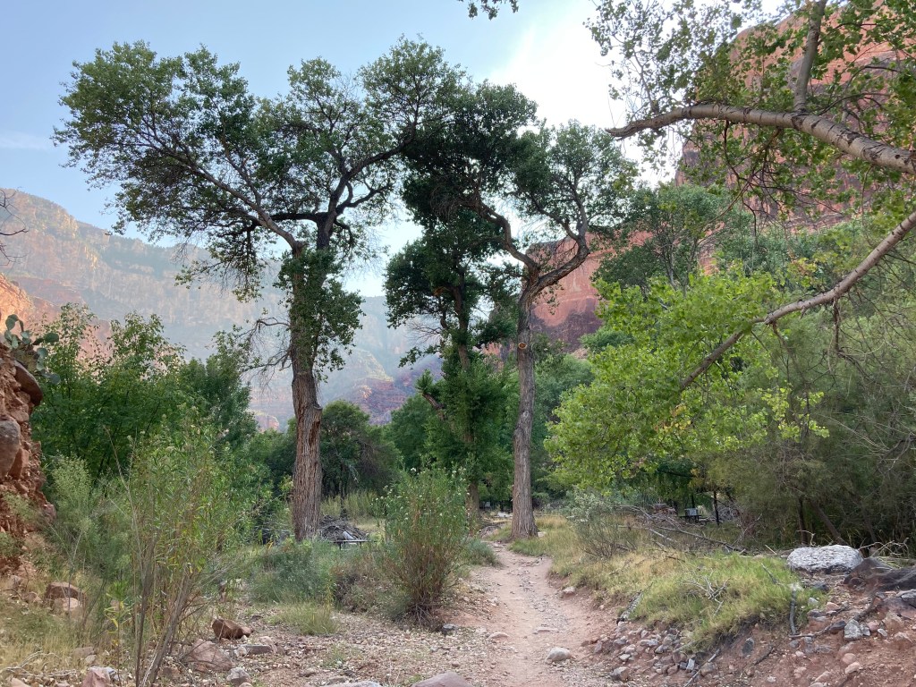
The little bridge at the Bright Angel campground. 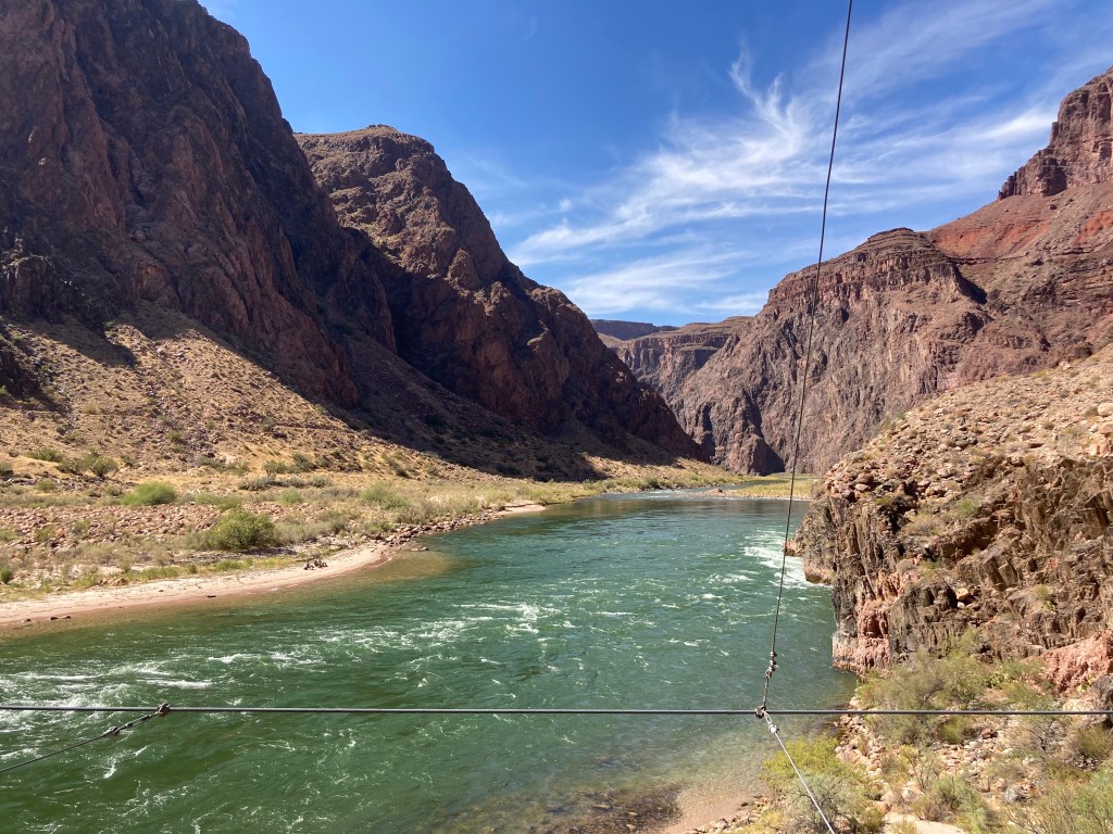
View from the Silver Bridge (west side). 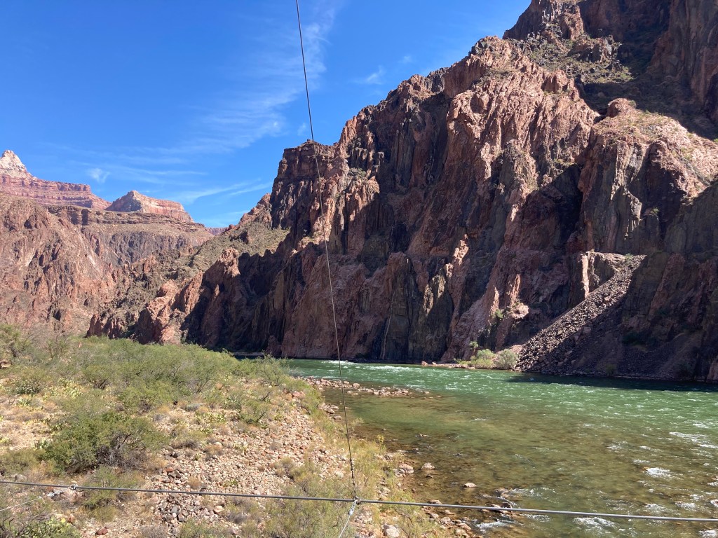
View from the Silver Bridge (east side). 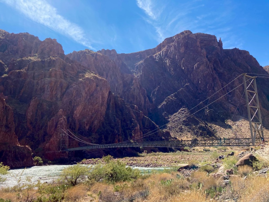
The Silver Bridge, which crosses the Colorado River and leads to the Bright Angel trail. 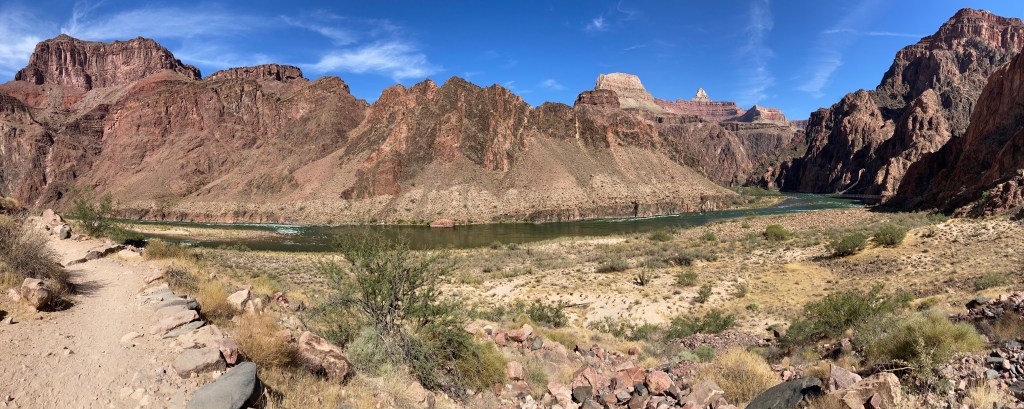
Looking back onto the Colorado River and the Silver Bridge (right side) as we soldier on to the South Rim.
The first major obstacle we had to cross was the “Devil’s Corkscrew.” I’m not sure if that’s the official name of the series of steep switchbacks, or a nickname that suffering hikers bestowed upon them. In any case, we kept on hiking up and up — thankfully, in shade for most of the switchbacks! — until we looked down and saw THIS:
Perhaps the name “Devil’s Corkscrew” was more appropriate than I thought….shortly after leaving that area, my left knee/IT band started complained loudly. I did not, even though my knee was starting to hurt pretty badly.
From this point on, the major landmarks along the trail were well-signed and evenly spaced out. The first goal was hitting the 4.5 mile rest area, otherwise known as “Indian Garden.” We topped off our water, soaked our bandanas, and wearily continued our (absolutely amazing, fantastic, beautiful, fun) hike. [Yes, of COURSE the words in parentheses were the actual words running through my head at that point!] 🙂
Our next goal was the 3 mile rest house. We stopped just before we got there to get a picture taken in the soft, late-afternoon light.


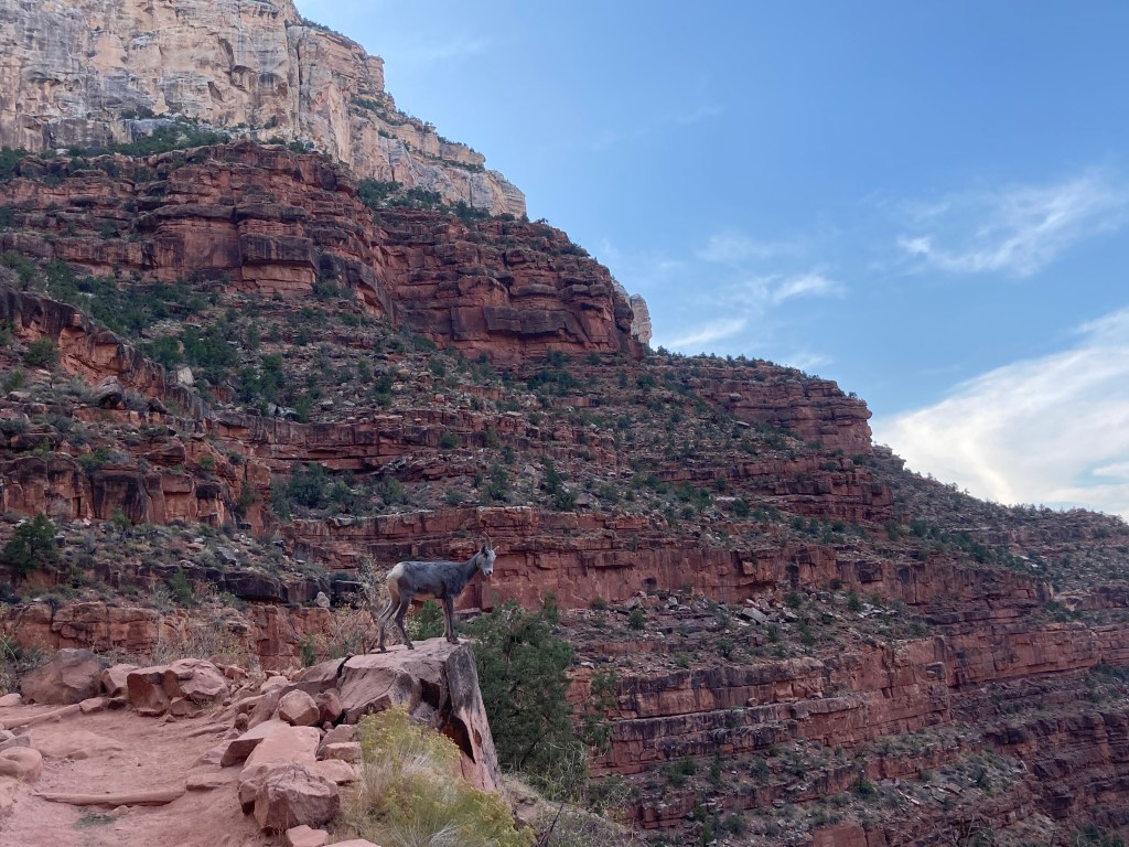
Then, the BEST thing happened. Right in front of us on the trail, maybe 25-30 feet away, was a big-horned sheep! It was definitely a morale booster seeing that sheep.
Next stop was the 1.5 mile rest house. Slowly, but surely, we were making our painful way up to the top.

Only 1.5 miles left. Grrrr….my left knee was REALLY yelling at me (but remember, I was NOT COMPLAINING…out loud…). At this point, I was alternating between 2 walking methods: 1) a weird cowboy two-step that made me look like I just rode a horse for the first time in years, and 2) using my right leg to climb over rocks and tree roots, while limping/dragging my left leg behind me. Truly, I was a picture of hiking grace and beauty. One thing that helped me continue on was looking back to see how far we’d come. The last beautiful view we enjoyed was this one:
The last 2 landmarks were 2 tunnels right before the end, but it was getting too dark to get any good pictures of them. However, one picture I DID get was of the two of us triumphantly posing in front of the Bright Angel Trailhead sign, victorious!

I’m not sure what the temperature was when we finished our hike, but I had to get my puffy jacket from my backpack because I was feeling chilly. After Crystal picked us up, we drove to Tusayan (this little town is only a mile from the South Rim!) and tried to find somewhere to get some food. Unfortunately, nothing much was open, so we ended up grabbing some fries and hamburgers from McDonald’s. What a grand celebratory dinner, right? 😉 I was happy enough because I always want fries after a huge hike!
Sunday October 11
We enjoyed a leisurely morning getting some breakfast and enjoying the canyon views from the South Rim. Before we started our drive back to Phoenix, Jodey and I bought some “swag” to commemorate the occasion.
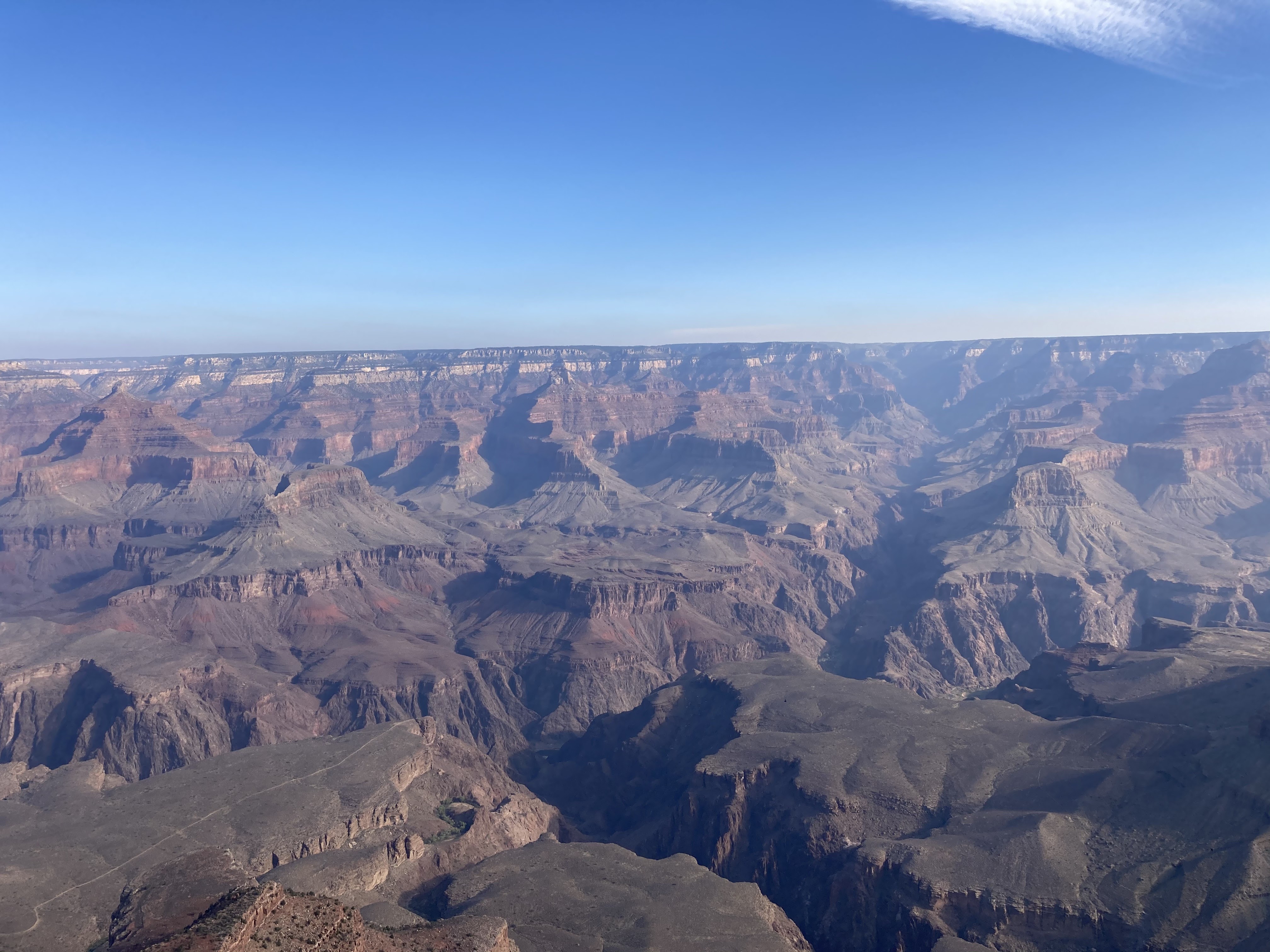
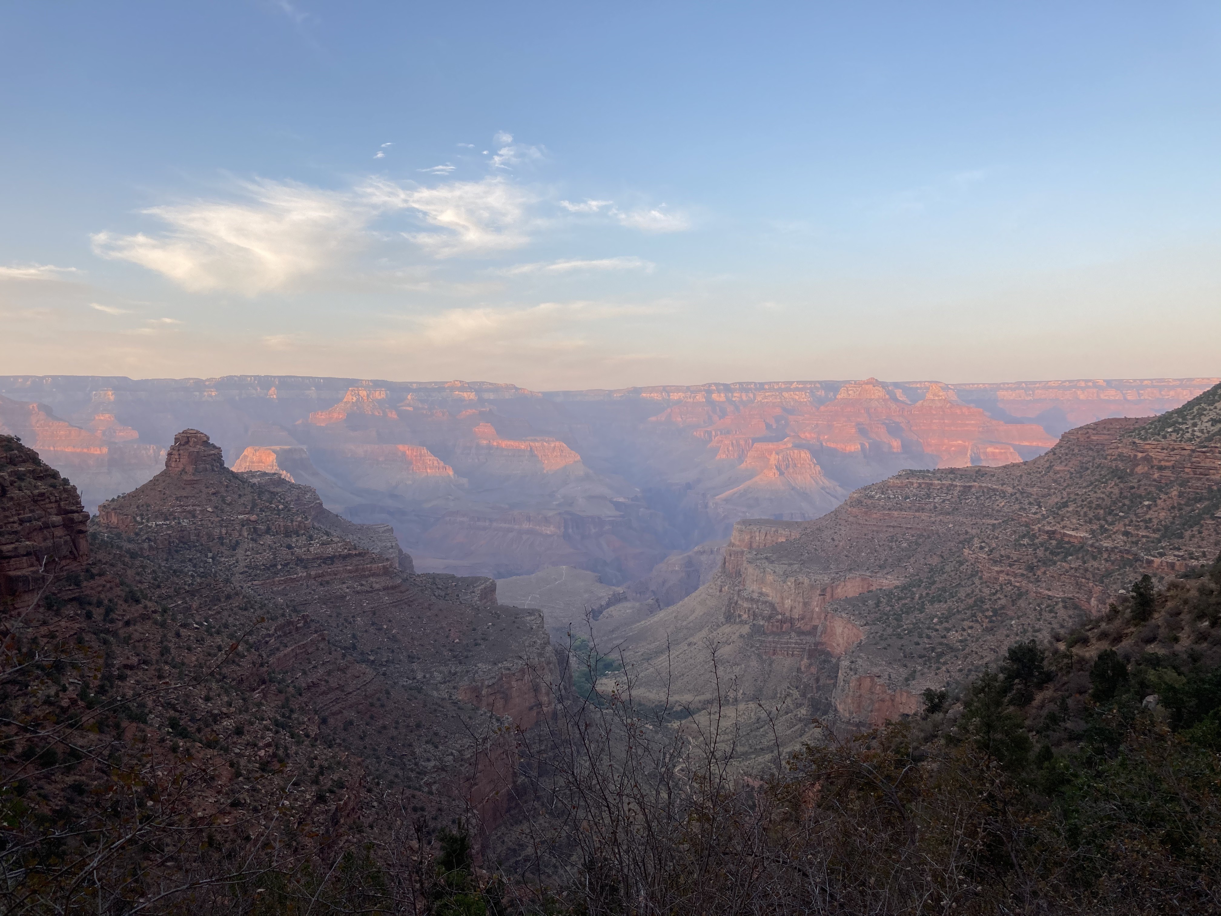
View from the South Rim. 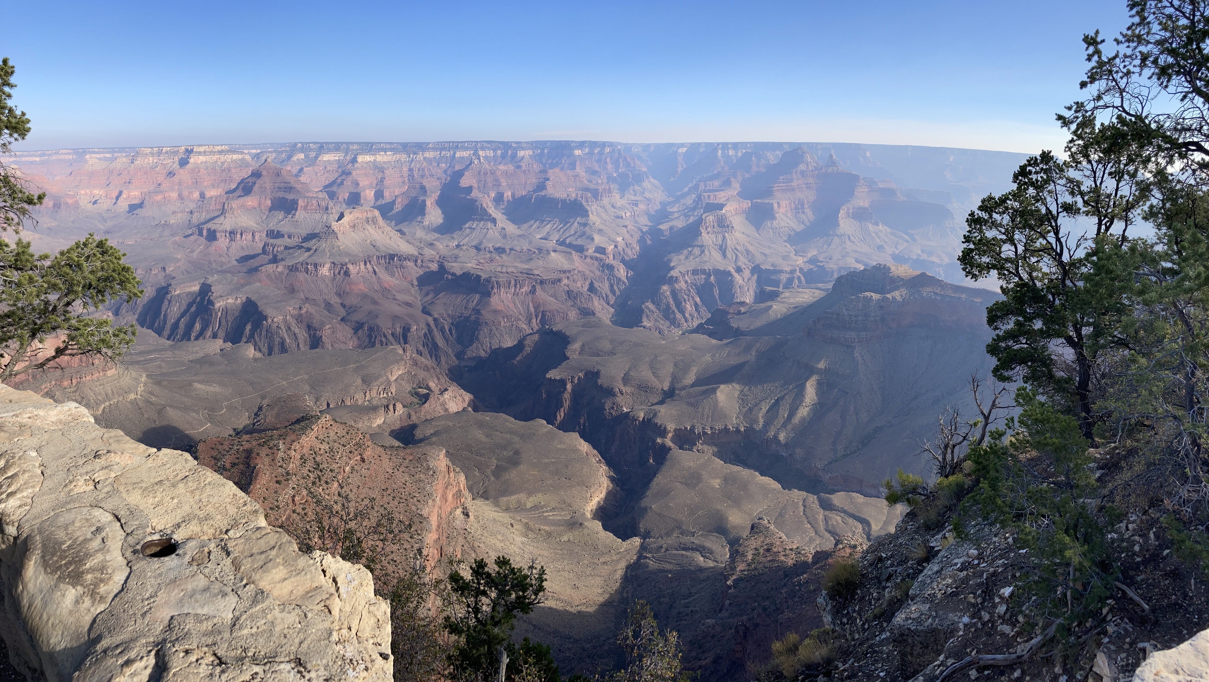
Another view from the South Rim. 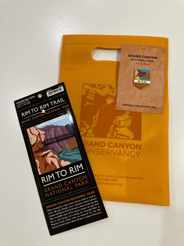
My hard-earned swag: a vinyl R2R sticker and pin.
Overall numbers:
- Distance (according to my Garmin): We hiked 24.87 miles!
- Elevation change: The Grand Canyon National Park website states that there is a 5,761 feet elevation loss (North Kaibab trailhead to Bright Angel Campground) and 4,380 feet elevation gain (Bright Angel Campground to the South Rim on the Bright Angel Trail). As a reference, there are 5,280 feet in one mile. According to my Garmin, we gained 4,696 feet in elevation (my Garmin didn’t record the elevation loss).
- Total time (according to my Garmin): 13 hours, 20 seconds. Of that, 9 hours and 48 minutes were moving time, which means we took just over 3 hours in breaks.
- Temperature: it was just above freezing when we started at the North Rim. The high temperature was 95F / 35C at Phantom Ranch. I’m not sure what the temperature was when we finished the hike at 6:30pm, but it felt like it was 45-50F / 7-10C.
- The Grand Canyon Facebook page said that there were 430 hikers/trail runners who passed through Phantom Ranch between 5:30-9:30am on Saturday!
What worked for me during the hike:
- Training, obviously. Although, I think I’d train more next time. Specifically, I’d train for a longer period of time and increase mileage more slowly.
- Train with a backpack.
- If you think you want to use poles, train with those poles. I have poles and have used them on other long hikes. However, I didn’t use them very much in my R2R training. I decided not to take them at the last minute. Would they have helped my knee by taking a bit of weight off of it? Perhaps. If I do R2R again, I think I’ll try using poles, if only to compare experiences.
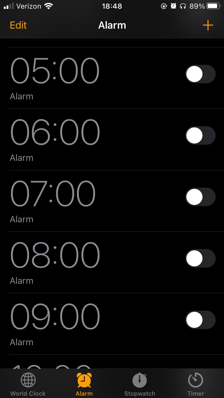
- I set hourly alarms on my phone as reminders to eat. I knew it was important to keep my energy up and I didn’t want to risk not finishing the hike because I didn’t eat enough calories. [My SAT — self-appointed trainer, a.k.a. my husband — told me a few times before I left to eat during the hike. HA! I already had that covered! So there!]
- Dipping my shirt and bandanas in the river to cool off. This really helped a lot. Hooray for evaporative cooling!
- Endurolytes to avoid leg cramps. I took one pill when my hourly alarm went off. I’m never going on a long hike or bike ride without these again!
- Use a checklist (paper or digital) to pack. Compose your list, then check off items as you pack them.
- Remember to look up once in a while when hiking to enjoy the views!
Gear:
- Headlamp (with fresh batteries)
- phone, portable charger, AirPods
- Garmin cycling computer (to record the hike)
- puffy jacket, Smartwool gloves, buff (took all these off a few miles into the hike)
- Smartwool long sleeve shirt, long pants, socks, hiking shoes
- extra pair of wool socks to change into (this felt amazing!)
- 3 bandanas: wet them, pack into ziplock baggies, wear around neck to cool off
- hat
- sunscreen, lip balm
- bandaids, Neosporin, tweezers, mini Swiss army knife
- toilet paper, some wet wipes
- a garbage bag to pack trash
- 2L camelbak bladder and two 1L foldable water bladders
Food:
To figure out how much food to bring, I estimated that the hike would take 12-14 hours. Then, I decided to eat something every hour (remember those hourly alarms?). From there, I gathered a variety of “trail” food and “real” food:
- a tube of Nuun electrolyte tablets (I added one to my 2L Camelbak)
- Endurolytes (GAME CHANGER!)
- a few Huma gels (apple and cinnamon)
- a few packages of Clif Shot Bloks (orange, black cherry, strawberry)
- Louisville vegan jerky, maple bacon flavour (got these at Whole Foods)
- some Trader Joe’s salt and pepper chips (in a ziplock baggie)
- 2 peanut butter and jelly sandwiches
- a quarter of a Whole Foods vegan breakfast burrito (bought this the day before on the way to the Grand Canyon. Ate most of it for dinner and saved the rest for the hike.)
- Nature’s Bakery fig bars (apple cinnamon and original fig)
I had a fig bar, 1 PB+J sandwich, the chips, and some jerky leftover. At Phantom Ranch, I bought a lemonade, peanut M+M’s, and Oreo cookies.
Would I do this again? Or, even better/worse, consider Rim to Rim to Rim (“Rim cubed”)?
It is way too soon to discuss that. 😉
What’s next?
Go away, SAT.

Karen did NOT complain! And she also shared her “share size” M&Ms. Couldn’t ask for more in a hiking companion!
LikeLiked by 1 person
Oooh, a testimonial on how well I behaved! Thanks, Jodey! 😉
LikeLike
What an incredible hike you did, I am really proud and happy for you that you did that. Be careful with your knee pain hope it wouldn’t give you a problem in your later life.
Love, mom
________________________________
LikeLiked by 1 person
My knee is feeling much better after a whole week of inactivity!
LikeLike
Happy Hike-a-versary!
I am grateful to count you as a friend and adventure buddy.
LikeLike
Happy hike-a-versary to you too, Jodey! Thanks for your sweet message. 🙂 Perhaps we should do R2R again…like in the spring?
LikeLike